SoldDarby Emigrants Guide 1818 with large mapHeading: Author: Darby, William Title: The Emigrant's Guide to the Western and Southwestern States and Territories: Comprising a Geographical and Statistical Description of the States of Louisiana, TSee Sold Price
SoldDarby, William, 1818, Kirk & MeceinDarby, William, The Emigrant's Guide to the Western and Southwestern States and Territories..., New York, Kirk & Mercein, 1818, octavo; includes "A Map of the United States Including Louisiana (18 1/4See Sold Price
SoldWilliam Darby, The Emigrant's Guide, and Captain L.William Darby, The Emigrant's Guide (Includes territorial maps), published by Kirk and Mercein, 1818; Captain L. Sitgreaves, Report of an Expedition Down the Zuni and Colorado Rivers, printed by RoberSee Sold Price
SoldDarby Emigrants Guide 1818Title: The Emigrant's Guide to the Western and Southwestern States and Territories: Comprising a Geographical and Statistical Description of the States of Louisiana, Tennessee, Kentucky, and Ohio; theSee Sold Price
Darby Emigrants Guide 1818Title: The Emigrant's Guide to the Western and Southwestern States and Territories: Comprising a Geographical and Statistical Description of the States of Louisiana, Tennessee, Kentucky, and Ohio; theSee Sold Price
Darby Emigrants Guide 1818Title: The Emigrant's Guide to the Western and Southwestern States and Territories: Comprising a Geographical and Statistical Description of the States of Louisiana, Tennessee, Kentucky, and Ohio; theSee Sold Price
SoldCOLTON, J. H.; and SMITH, J. CALVIN. The WesteCOLTON, J. H.; and SMITH, J. CALVIN. The Western Tourist and Emigrant's Guide. Large hand-colored engraved folding map. 12mo, publisher's gilt-lettered cloth, minor wear to extremities; foxing throughSee Sold Price
DARBY, William (1775-1854). The Emigrant's Guide to theDARBY, William (1775-1854). The Emigrant's Guide to the Western and Southwestern States and Territories. New York: Kirk & Mercein, 1818.   8vo (215 x 132 mm). Diagram illustrating land surveying,See Sold Price
DARBY, William (1775-1854). The Emigrant's Guide to theDARBY, William (1775-1854). The Emigrant's Guide to the Western and South-Western States and Territories. New York: Kirk & Mercien, 1818. 8vo (214 x 132 mm). Diagram illustrating land surveying, one fSee Sold Price
DARBY, William (1775-1854). The Emigrant's Guide to theDARBY, William (1775-1854). The Emigrant's Guide to the Western and South-Western States and Territories. New York: Kirk & Mercien, 1818. 8vo (214 x 132 mm). Diagram illustrating land surveying, one fSee Sold Price
The Life of Jim Baker by Mumey 1931 SIGNED LTDThe Life of Jim Baker 1818-1898 Trapper, Scout, Guide by Nolie Mumey. Signed and numbered '202' of 250 copies. 1931 with large fold-out map and extra portrait. The Arthur H. Clark Co., Glendale, CalifSee Sold Price
The Life of Jim Baker by Mumey 1931 SIGNED LTDThe Life of Jim Baker 1818-1898 Trapper, Scout, Guide by Nolie Mumey. Signed and numbered '4' of 250 copies. 1931 with large fold-out map. The World Press, Denver, Colorado. 234 pp. Illustrated. BlueSee Sold Price
SoldCOLTON'S WESTERN TOURIST EMIGRANT'S GUIDE MAP 1853Western Tourist or Emigrant's Guide, circa 1853, location of Cities, Towns, Post Hamlets, Canals and Stage Roads, Ohio, Michigan, Indiana, Illinois, Missouri, Wisconsin, Iowa, plus a wood engraving scSee Sold Price
Western Tourist and Emigrants Guide with map, 1839Published by J. H. Colton. Full color map by J. Calvin Smith. Includes Steam Boat Routes and Explanations of symbols on the map. The map has a larger floral border than the 1845 issue, Iowa is fully fSee Sold Price
SoldGreenwood (C.) Map of the County Palatine of LancaGreenwood (C.) Map of the County Palatine of Lancaster, from an Actual Survey made in the Year 1818,large county map, with decorative title and compass rose above, engraved map with extensiveSee Sold Price
SoldRailway Guide.-Railway Guide.- Appletons' Illustrated Railway and Steam Navigation Guide..., large folding map and maps in the text, advertisements at beginning and end, original printed wrappers, browned, sSee Sold Price
SoldEmigrant's Guide to U.S. 1818 orig. boardsHeading: Author: Holditch, Robert Title: The Emigrant's Guide to the United States of America; Containing the best advice and directions respecting the voyage,--preservation of health,--choice of setSee Sold Price
The Rand McNally Railway Guide Map, 1901Map: The Rand McNally Railway Guide Map. Large, Scarce Railway Pocket Guide Map Publication Date: 1901 ca. Authors: RAND, MCNALLY & CO., RAND, MCNALLY & CO. Publisher: RAND, MCNALLY & CO. Size: FolioSee Sold Price
Sold[CROMWELL (T K)] Excursions in the County of Suffolk, 2[CROMWELL (T K)] Excursions in the County of Suffolk, 2 vols., 1818, large 8vo, folding map and plan, mounted india paper plates, uncut, boards (worn); KIRBY (John) The Suffolk Traveller, 2nd editionSee Sold Price
Bacon's New Shilling Map of LondonBacon (G.W., publisher) Bacon's New Shilling Map of London and Illustrated Guide. (North),large folding map, partly hand-coloured, 2 double-page plain maps, illustrations, advertisements, largSee Sold Price
SoldSmall Collection of 19th century travel guides &Small Collection of 19th century travel guides & photobooks,comprising: Bacon's New Map of London & illustrated guide, large colour folding map, with advertisements, original cloth, rubbed, nSee Sold Price
SoldGreenwood (C.) Map of the County of Middlesex, froGreenwood (C.) Map of the County of Middlesex, from an Actual Survey made in the Years 1818 & 1819,large county map, with decorative title at lower right and vignette view of London from BuckiSee Sold Price
SoldRand McNally Business Atlas 1891Heading: Author: Rand, McNally & Company Title: Rand, McNally & Co.'s Enlarged Business Atlas and Shippers' Guide, Containing Large-Scale Maps of the Dominion of Canada, Old Mexico, Central America,See Sold Price
Rand, McNally & Co Improved Indexed Business Atlas 1888Rand, McNally & Co's Improved Indexed Business Atlas and Shipper's Guide. Containing large scale maps of dominion of Canada, Old Mexico, Central America, Cuba, and the several states and territories oSee Sold Price
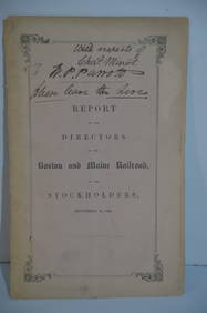
Boston and Maine RR Annual Report-September 12, 1849JM Hobby Supply and Railroad Artifact Auctions4.4(127)See Sold PriceFeb 24, 2024
1937 Holland, Michigan, Tulip Time Map Guide, FramedLakeshore Event Center4.6(106)See Sold PriceMar 02, 2024
1876 The Centennial Exhibition Pennsylvania Railroad Worlds Fair Guide with Map and Trade CardRail & Road Auctions4.6(165)See Sold PriceMar 07, 2024
Pair of Early Railroad Maps - 1862 Pittsburgh, Ft. Wayne & Chicago Railway and 1873 PennsylvaniaRail & Road Auctions4.6(165)See Sold PriceMar 07, 2024
1867 Map of the Railroads of The State of New YorkRail & Road Auctions4.6(165)See Sold PriceMar 08, 2024
Lladro "Road to Mandalay" Elephant Figure.Direct Auction Galleries 4.7(337)See Sold PriceFeb 24, 2024
Pre-colonial Africa. Mountains of Kong/Moon. Caravan routes. THOMSON 1817 mapJasper524.5(9.9k)See Sold PriceFeb 28, 2024
Stanford, Edward 1901 Large Map. Geological Map of the British IslesAlbion Auctions4.6(341)See Sold PriceMar 01, 2024
Perry, Matthew C. 1856 Large Map. Shah Bay, Lew Chew I. JapanAlbion Auctions4.6(341)See Sold PriceMar 01, 2024
Robert de Vaugondy - Map of Canada - Mer de l' Ouest or Sea of the West and a Northwest PassageProverde Auctions4.3(3)See Sold PriceFeb 28, 2024


![[CROMWELL (T K)] Excursions in the County of Suffolk, 2 (1 of 1)](https://p1.liveauctioneers.com/503/133462/67792595_1_x.jpg?height=282&quality=70&version=1545420568)