SoldDaniel Stoopendaal World MapOrbis Terrarum Tabula Recens Emendata et in Lucem Edita Per N. Visscher. Outstanding example of the Dutch Keur bible world map by Daniel Stoopendael in beautiful old hand coloring. The map is based onSee Sold Price
Daniel Stoopendaal World MapOrbis Terrarum Tabula Recens Emendata et in Lucem Edita Per N. Visscher. Outstanding example of the Dutch Keur bible world map by Daniel Stoopendael in beautiful old hand coloring. The map is based onSee Sold Price
Werelt Caert Stoopendaal World MapLater edition of Daniel Stoopendaal's circa 1680s world map, probably from a Dutch Bible, matted and framed, not examined out of frame. Visible image: approx. 17 3/4" x 11 1/4". Frame: approx. 24 3/4"See Sold Price
SoldWorld.- Stoopendaal (Daniel) Werelt Caert, [1688].World.- Stoopendaal (Daniel) Werelt Caert, double-hemisphere world map from a Dutch bible is based on Visscher's similar map of 1663, showing California as an island with a flat northern coastline, anSee Sold Price
SoldVintage Map, Daniel Stoopendaal, Wereit CaertDaniel Stoopendaal (Amsterdam, circa 1680), "Werelt Caert," double-page engraved hand-colored double-hemisphere world map depicting California as an island with corner vignettes depicting allegoricalSee Sold Price
SoldStoopendaal world map California and island 1680Title: Werelt Caert Author: Stoopendaal, Daniel Description: Copper-engraved map, hand-colored (later). 30.5x45.5 cm (12x17¾").Double-hemisphere map of the world, with California an island, surroundeSee Sold Price
SoldSTOOPENDAAL, DANIEL. Werelt Caert. [Amsterdam, c. 1680](MAP) STOOPENDAAL, DANIEL Werelt Caert. (Amsterdam, c. 1680). Double-page engraved hand-colored double-hemisphere world map depicting California as an island. With corner vignettes depicting allegoricSee Sold Price
SoldWorld map from Dutch Bible 18th centuryTitle: Werelt Caert Author: Stoopendaal, Daniel Description: Copper-engraved double-hemisphere map of the world. 31x45.7 cm. (12¼x18").Stoopendahl's world map with California an island, based on theSee Sold Price
Sold1688 Hemisphere Map of the WorldMapsSuperb 1688 Dutch “Werelt Caert” Hemisphere Map! 1688 “WERELT CAERT”, by Daniel Stoopendaal, Very Choice Extremely Fine. This stunning handcolored copper engraved, double hSee Sold Price
SoldMAP - Mediterranean & Middle East. StoopendaalEastern Mediterranean & Middle East. Daniel Stoopendaal, De Beschryvingh van de Reysen Pauli, en van de Andere Apostelen..., 1729 (published). Hand Color. This beautiful map of the eastern MediterraneSee Sold Price
SoldMAP, Holy Land, StoopendaalHoly Land. Daniel Stoopendaal, Het Beloofde Landt Canaan door Wandelt van Onsen Salichmaecker Iesu Christo, Neffens syne Apostelen, 1710 (circa). Black & White. Graphic map of Israel with biblical sceSee Sold Price
MAP, Holy Land, StoopendaalHoly Land. Daniel Stoopendaal, Perigrinatie oste Veertich-Iarige Reyse der Kinderen Israels uyt Egypten door de Roode Zee..., 1748 (circa). Black & White. This map depicts the Exodus from Egypt and thSee Sold Price
MAP, Holy Land, StoopendaalHoly Land. Daniel Stoopendaal, Het Beloofde Landt Canaan door Wandelt van Onsen Salichmaecker Iesu Christo Neffens Syne Apostelen, 1736 (circa). Black & White. Graphic map of Israel with biblical scenSee Sold Price
MAP, Rochester, England, StoopendaalRochester, England. Daniel Stoopendaal, Afbeelding van de Stad en Revier van Rochester, Chattam waar in Vertoont wert de Victorieuse uyt Werckinge van s' Landts..., 1701 (published). Hand Color. LivelSee Sold Price
MAP, Mediterranean & Middle East, StoopendaalEastern Mediterranean & Middle East. Daniel Stoopendaal, De Beschryvingh van de Reysen Pauli, en van de Andere Apostelen..., 1736 (circa). Black & White. This beautiful map of the eastern MediterraneaSee Sold Price
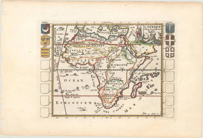
MAP, Algiers, Algeria, StoopendaalAlgiers, Algeria. Daniel Stoopendaal, De Stadt Algiers. La Ville d'Alger, 1701 (published). Hand Color. Striking view of the city from the sea with various types of ships and boats in the foreground.See Sold Price
MAP, Mediterranean & Middle East, StoopendaalEastern Mediterranean & Middle East. Daniel Stoopendaal, De Beschryvingh van de Reysen Pauli, en van de Andere Apostelen..., 1710 (published). Black & White. This beautiful map of the eastern MediterrSee Sold Price
Lufft (Hans) After. [Daniel's Dream world map]Lufft (Hans) After. [Daniel's Dream world map],reduced 2nd version of the apocalyptic vision of four beasts overlaid on an updated Ptolemaic world map, comprising the whole of Africa, Asia witSee Sold Price
SoldLufft (Hans) After. [Daniel's Dream world map]Lufft (Hans) After. [Daniel's Dream world map],reduced 2nd version of the apocalyptic vision of four beasts overlaid on an updated Ptolemaic world map, comprising the whole of Africa, Asia witSee Sold Price
SoldDouble-hemisphere world map StoopendaalFramed handcolored double-hemisphere engraved world map, Orbis Terrarum Tabula Recens Emendata et in Lucem Edita, by D. Stoopendaal, sight: 14.25''H x 18.5''WSee Sold Price
SoldCa.1753 Battle Maps Daniel Stoopendaal (6)Circa 1753 battle maps with three signed in the plate by Daniel Stoopendaal (Amsterdam, 1672- 1726), one signed in plate T. Baptist and six maps total. From Discourse of the Art of War. On laid paper.See Sold Price
SoldCa.1753 Battle Maps Daniel Stoopendaal (6)Circa 1753 battle maps with one signed in the plate by Daniel Stoopendaal (Amsterdam, 1672- 1726) and six maps total. From Discourse of the Art of War. On laid paper. Two separate sheets taped togetheSee Sold Price
Vintage Estate World Maps II Signed & Framed Art PrintMannys Jewelry4.6(331)See Sold PriceMar 03, 2024
17TH C. WORLD MAP BY NICOLAES VISSCHER (NETHERLANDS, 1618-1709)Thomaston Place Auction Galleries4.4(386)See Sold PriceFeb 24, 2024
Vintage Full Color World Map LithographThe Benefit Shop Foundation Inc.4.3(2.9k)See Sold PriceFeb 28, 2024
Nova Totius Full Color Geographical World MapThe Benefit Shop Foundation Inc.4.3(2.9k)See Sold PriceFeb 28, 2024
Arthur Armour (1908-1998) Pair Aluminum Waste BasketsAbsolute Auction Gallery4.5(57)See Sold PriceFeb 28, 2024
An Ebel Voyager automatic wristwatch with world time function, the dial with world map and dateClaydon Auctioneers Ltd4.3(125)See Sold PriceFeb 25, 2024
World map.- Macrobius (Ambrosius Aurelius Theodosius) In somnium Scipionis, Libri II. Saturnaliorum,Forum Auctions4.3(52)See Sold PriceFeb 29, 2024
Laminated Unique Media The World Map 1996 EditionRapid Estate Liquidators and Auction Gallery4.5(1.1k)See Sold PriceMar 02, 2024
1995 Massive World Map Custom-Made Coffee TableGLOBAL NETWORTH AUCTIONS4(38)See Sold PriceMar 03, 2024


![World.- Stoopendaal (Daniel) Werelt Caert, [1688]. (1 of 1)](https://p1.liveauctioneers.com/5458/147572/74578833_1_x.jpg?height=282&quality=70&version=1565275641)


![STOOPENDAAL, DANIEL. Werelt Caert. [Amsterdam, c. 1680] (1 of 1)](https://p1.liveauctioneers.com/197/58374/28679608_1_x.jpg?height=282&quality=70&version=1405541743)


![Lufft (Hans) After. [Daniel's Dream world map] (1 of 1)](https://p1.liveauctioneers.com/410/42305/18443845_1_x.jpg?height=282&quality=70&version=1371828684)
![Lufft (Hans) After. [Daniel's Dream world map] (1 of 1)](https://p1.liveauctioneers.com/410/45481/20462781_1_x.jpg?height=282&quality=70&version=1380191839)