ATLAS of ANTIENT GEOGRAPHY by SAMUEL BUTLER 1843John McInnis Auctioneers,LLC4.5(494)See Sold PriceFeb 24, 2024
18TH C. ANTIQUE MAP: FRENCH & INDIAN WAR, FRAMEDThomaston Place Auction Galleries4.4(386)See Sold PriceFeb 24, 2024
Rand McNally Railroad Map Cabinet w/ 21 Railroad MapsRail & Road Auctions4.6(165)See Sold PriceMar 08, 2024
Keith Haring - Ink on New York Map, Best Buddies, Inscribed, Signed, and DatedSapphire Auction Gallery3.9(67)See Sold PriceMar 02, 2024
LATE 17TH C. FRENCH MAP OF THE NEW WORLD BY ALEXIS-HUBERT JAILLOT (1632-1712)Thomaston Place Auction Galleries4.4(386)See Sold PriceFeb 24, 2024
Central Railroad of New Jersey Map of Sandy Hook Route-ca. 1903JM Hobby Supply and Railroad Artifact Auctions4.4(126)See Sold PriceFeb 24, 2024
Lot of Six Mixed Atlas Box Cars-HO Scale-New in BoxJM Hobby Supply and Railroad Artifact Auctions4.4(126)See Sold PriceFeb 25, 2024
Rand McNally/Santa Fe Railroad Map of Iowa-1912JM Hobby Supply and Railroad Artifact Auctions4.4(126)See Sold PriceFeb 24, 2024
NICOLAES VISSCHER (NETHERLANDS, 1618-1709) MAP OF THE NEW WORLDThomaston Place Auction Galleries4.4(386)See Sold PriceFeb 24, 2024
17TH C. WORLD MAP BY NICOLAES VISSCHER (NETHERLANDS, 1618-1709)Thomaston Place Auction Galleries4.4(386)See Sold PriceFeb 24, 2024
Lot of Six Mixed Atlas Cabooses-HO Scale-New in BoxJM Hobby Supply and Railroad Artifact Auctions4.4(126)See Sold PriceFeb 25, 2024
SoldCornwell & Dower 1849 Lot of 6 European MapsIncl Germany, Austria, Europe, Spain/Portugal, Prussia, and France. Steel Engraved Maps Published 1849, London for "A School Atlas" by James Cornwell. Maps by John Dower. Paper Size: 6.5 x 4 inch (16See Sold Price
SoldCornwell & Dower 1849 Lot of 7 Miniature MapsIncl America Continent, Solar System, Mexico/West Indies, Oceania, Ireland, Scotland, and England/Wales. Steel Engraved Maps Published 1849, London for "A School Atlas" by James Cornwell. Maps by JohnSee Sold Price
SoldCornwell & Dower 1849 Lot of 4 Asian Maps"Chinese Empire and Japan" "Further India, Birman Empire etc" "Hindostan" and "Asia Physical Map" Steel Engraved Map Published 1849, London for "A School Atlas" by James Cornwell. Maps by John Dower.See Sold Price
SoldTurkey & Greece 19th Century Lot of 6 MapsMostly Turkey. Examples by Cornwell/Dower, Becker, and Chambers. Paper Size: Up to 12 x 9.5 inch (30 x 24cm) Some small faults in parts, good overallSee Sold Price
Turkey & Greece 19th Century Lot of 6 MapsMostly Turkey. Examples by Cornwell/Dower, Becker, and Chambers. Paper Size: Up to 12 x 9.5 inch (30 x 24cm) Some small faults in parts, good overallSee Sold Price
SoldCornwell & Dower 1849 World Hemisphere MapSteel Engraved Map Published 1849, London for "A School Atlas" by James Cornwell. Maps by John Dower. Paper Size: 6.5 x 4 inch (16 x 10cm) Very minor toning. Good conditionSee Sold Price
SoldCornwell & Dower 1849 Pair of Miniature Maps of AfricaNorth/South Africa and Africa Physical/Egypt. Steel Engraved Maps Published 1849, London for "A School Atlas" by James Cornwell. Maps by John Dower. Paper Size: 6.5 x 4 inch (16 x 10cm)See Sold Price
Cornwell & Dower 1849 Pair of Miniature Maps of AfricaNorth/South Africa and Africa Physical/Egypt. Steel Engraved Maps Published 1849, London for "A School Atlas" by James Cornwell. Maps by John Dower. Paper Size: 6.5 x 4 inch (16 x 10cm)See Sold Price
SoldRapkin, John 1860 Lot of 6 European MapsIncl Greece, Turkey in Europe, Switzerland, Spain/Portugal, Sweden/Norway, and Russia in Europe. Steel Engraved Map Published 1860 by The London Printing & Published Company, London for "The Royal DicSee Sold Price
Sold2 German Maps and 4 French books, 18th c.Lot of 6 European books & documents. 1ST ITEM: Two German maps, one depicting the Kingdom of Hanover and the other depicting a German village with central school and church. Both retailed by Franz LaFSee Sold Price
SoldRussia 19th Century Lot of 4 MapsExamples by Cornwell/Dower, Weller, Chambers and Philip/Hughes. Paper Size: Up to 13 x 10 inch (34 x 25cm) A couple of minor faults. Good conditionSee Sold Price
SoldMaps 19th Century Mixed Lot of 10Incl Holy Land, South America, West Indies, Scandinavia, Armenia, India and a Mountain Chart. Examples by Weller/Bryce, Hughes, William Collins, Encyclopaedia Britannica and Cornwell/Dower. Paper SizeSee Sold Price
SoldLot of 6 WWI/WWII MapsLot of WWI and WWII German and French maps. Maps are of France and some European areas around France. Maps are believed to be original WWI and WWII era but not guaranteed. Maps are faded and some haveSee Sold Price
SoldPhilip, George C1895 Lot of 6 British County MapsIncl Derbyshire, Shropshire, Warwickshire, Northumberland, Hampshire, and Cumberland. Lithograph Maps Published C1895 by George Philip & Son, London for "Phillips' Atlas of the British Isles" Centre fSee Sold Price
SoldPhilip, George C1895 Lot of 6 British County MapsIncl Northamptonshire, Hertfordshire, Huntingdonshire, Lancashire, Lancashire South and Leicestershire/Rutland. Lithograph Maps Published C1895 by George Philip & Son, London for "Phillips' Atlas of tSee Sold Price
SoldPhilip, George C1895 Lot of 6 British County MapsIncl Surrey, Yorkshire South East, Yorkshire North East, Wiltshire, Norfolk, Bedfordshire. Lithograph Maps Published C1895 by George Philip & Son, London for "Phillips' Atlas of the British Isles" CenSee Sold Price
SoldPhilip, George C1895 Lot of 6 British County MapsIncl Worcestershire, Yorkshire North West, Somersetshire, Cheshire, Sussex, and Westmorland. Lithograph Maps Published C1895 by George Philip & Son, London for "Phillips' Atlas of the British Isles" CSee Sold Price
SoldBartholomew, John 1904 Lot of 6 British MapsIncl Naval & Military Divisions, Parliamentary Boroughs, County Divisions, Ecclesiastical Divisions, Density of Population, and Valuation of Land. Lithograph Maps Published 1904, London for "The SurveSee Sold Price
De La Tour Continents Maps*** START PRICE IS THE RESERVE *** [World] DE LA TOUR, Louis Brion (c. 1743 - 1803). Group lot of 6 maps (1. World and 5 Continents). Engraved maps with original hand color. From Louis C. Desnos' AtlaSee Sold Price
SoldFour Views: Derbenta, Soltanii, Cangoxuma, GoaNicholas Visscher (1649–1702). Amsterdam, [c.1695]. Hand colored engraving. 20 3/4 x 24 3/4 inches sheet, 31 1/2 x 35 1/4 inches framed. Lots 5 & 6: Two brilliantly colored bird’s-eye views of theSee Sold Price
SoldFour Views: Asfahan, Osacco, Kuching, UntitledNicholas Visscher (1649–1702). Amsterdam, [c.1695]. Hand colored engraving. 20 3/4 x 24 3/4 inches sheet, 31 1/2 x 35 1/4 inches framed. Lots 5 & 6: Two brilliantly colored bird’s-eye views of theSee Sold Price
Geological Map of England and Wales, 1843Map: Geological Map of England and Wales, 1843 Maker: Charles Knight / George Cox / S.D.U.K., J. & C. Walker Date: 1852 Size: Quarto, 15.6 x 13.3 inches Please note that this lot has a reserve. When ySee Sold Price
SoldMap of Asia. J. Russell.From The Compendious Geographical Dictionary Maker: Russell, J. Origin: London, 1795. Medium: Engraving with early hand-coloring. Sheet size: 5 x 6 1/2 in. No Reserve: This lot starts at $1 and has noSee Sold Price
SoldWorld Map in Hemispheres 19th CMap: Mapemonde. (World map in hemispheres) Maker: Unknown Origin: French, 19th Century Medium: Original lithograph with hand coloring. Sheet Size: 6 1/4 x 9 inches No Reserve: This lot starts at $1 anSee Sold Price
Lot Of 6 Various European Porcelain Tea Cups And Saucers, 12 Pieces TotalRbfinearts4.4(571)See Sold PriceFeb 24, 2024
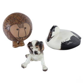
Gustavsberg & Goldscheider Porcelain Figurines LOTHill Auction Gallery 4.7(1000)See Sold PriceFeb 28, 2024
1711 GREEK BIBLE ILLUSTRATED w/ MAPS VELLUM BOUND antique NEW TESTAMENTJasper524.5(9.7k)See Sold PriceFeb 27, 2024
Lot of 10 Jewish items of Soviet and European interestConcept Art Gallery4.7(506)See Sold PriceMar 06, 2024
RENAISSANCE PERIOD EUROPEAN RING, 14TH-16TH CENTURY SIZE 6 ½Jasper524.5(9.7k)See Sold PriceFeb 28, 2024
European Views 1847 Lot of 6 Steel Engravings by PayneAlbion Auctions4.7(335)See Sold PriceMar 07, 2024
European Views 1847 Lot of 6 Steel Engravings by PayneAlbion Auctions4.7(335)See Sold PriceMar 07, 2024
d'Orbigny, Charles 1849 Lot of 4 Antique Bird PrintsAlbion Auctions4.7(335)See Sold PriceMar 07, 2024
d'Orbigny, Charles 1849 Lot of 4 Antique Bird PrintsAlbion Auctions4.7(335)See Sold PriceMar 07, 2024
d'Orbigny, Charles 1849 Lot of 4 Antique Bird PrintsAlbion Auctions4.7(335)See Sold PriceMar 07, 2024
d'Orbigny, Charles 1849 Lot of 4 Antique Bird PrintsAlbion Auctions4.7(335)See Sold PriceMar 07, 2024
d'Orbigny, Charles 1849 Lot of 4 Natural History PrintsAlbion Auctions4.7(335)See Sold PriceMar 07, 2024
Rees & Macpherson 1820 Lot of 6 Ancient Geography MapsAlbion Auctions4.7(335)See Sold PriceMar 01, 2024
1849 Orr & Co. Hand Colored Southern Germany MapMatthew Bullock Auctioneers4.7(1.8k)See Sold PriceMar 02, 2024
6 American & European Majolica Pottery ItemsWorld Auction Gallery LLC4.7(260)See Sold PriceMar 10, 2024
Authentic! Louis Vuitton Monogram 18k Yellow Gold Large RingJasper524.5(9.7k)See Sold PriceMar 02, 2024
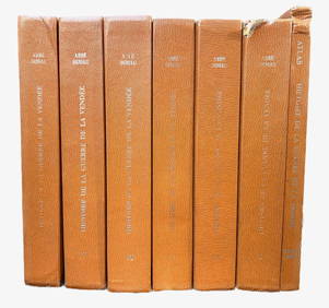
Lot of 6 Guide Books on CollectiblesRapid Estate Liquidators and Auction Gallery4.5(1.1k)See Sold PriceMar 03, 2024