ATLAS of ANTIENT GEOGRAPHY by SAMUEL BUTLER 1843John McInnis Auctioneers,LLC4.5(505)See Sold PriceFeb 24, 2024
18TH C. ANTIQUE MAP: FRENCH & INDIAN WAR, FRAMEDThomaston Place Auction Galleries4.4(393)See Sold PriceFeb 24, 2024
Rand McNally Railroad Map Cabinet w/ 21 Railroad MapsRail & Road Auctions4.6(165)See Sold PriceMar 08, 2024
Keith Haring - Ink on New York Map, Best Buddies, Inscribed, Signed, and DatedSapphire Auction Gallery4(67)See Sold PriceMar 02, 2024
LATE 17TH C. FRENCH MAP OF THE NEW WORLD BY ALEXIS-HUBERT JAILLOT (1632-1712)Thomaston Place Auction Galleries4.4(393)See Sold PriceFeb 24, 2024
Central Railroad of New Jersey Map of Sandy Hook Route-ca. 1903JM Hobby Supply and Railroad Artifact Auctions4.4(127)See Sold PriceFeb 24, 2024
Lot of Six Mixed Atlas Box Cars-HO Scale-New in BoxJM Hobby Supply and Railroad Artifact Auctions4.4(127)See Sold PriceFeb 25, 2024
Rand McNally/Santa Fe Railroad Map of Iowa-1912JM Hobby Supply and Railroad Artifact Auctions4.4(127)See Sold PriceFeb 24, 2024
NICOLAES VISSCHER (NETHERLANDS, 1618-1709) MAP OF THE NEW WORLDThomaston Place Auction Galleries4.4(393)See Sold PriceFeb 24, 2024
17TH C. WORLD MAP BY NICOLAES VISSCHER (NETHERLANDS, 1618-1709)Thomaston Place Auction Galleries4.4(393)See Sold PriceFeb 24, 2024
Lot of Six Mixed Atlas Cabooses-HO Scale-New in BoxJM Hobby Supply and Railroad Artifact Auctions4.4(127)See Sold PriceFeb 25, 2024
SoldColor topographical map of Lake TahoeHeading: (California - Lake Tahoe) Author: Eddy, Gerald A. Title: Lake Tahoe Place Published: Tahoe City Publisher: Date Published: [c.1940's] Description: Color topographiSee Sold Price
A Topographical Map of Parts of Eastern California andA U.S. Geographical Survey Military Issued Topographical Map of Parts of Eastern California and Western Nevada extending from Lake Tahoe, Reno, Carson, Astor Pass, Honey Lake, Horse Lake, Pyramid LakSee Sold Price
SoldColor Wheeler map From Tahoe to Honey LakeHeading: Author: Wheeler, George M. Title: Geographical Surveys West of the 100th Meridian - Parts of Eastern California and Western Nevada - Atlas Sheets 47(B) & 47(D) Place Published: Washington, DSee Sold Price
A Rare Topographical Land Classification Map of PartsA Rare and Original Military Issued Topographical Land Classification Map of Parts of Eastern California and Western Nevada extending from Lake Tahoe, Reno, Carson, Astor Pass, Honey Lake, Horse Lake,See Sold Price
SoldLake Tahoe Maps [135633]Bathymetry and Selected Perspective Views of Lake Tahoe, California, and Nevada. Beautiful colors, ready to frame. Approx. 26 x 39 inches. The bathymetry map shows the surprisingly complex structure oSee Sold Price
SoldLake Tahoe & Vicinity Map, by E. R. Smith, 19472-sided map, one in color, with pictorial relief, & one in B&W with an historical description and the listing, by name and location, of all of the resorts and business[x=#8217/] that surround the lakeSee Sold Price
SoldLake Tahoe (2 Maps) (91352)Approx. 26" x 39".Bathymetry and Selected Perspective Views of Lake Tahoe, California and Nevada. Beautiful colors, ready to frame. Date: c1999 State/Country: City/County:See Sold Price
SoldTwo Rare Lake Tahoe Brochures: Globin's Al Tahoe andLot of 2 different. 1) Globin's Al Tahoe. Color brochure with steamer vignette. Blue and orange print, map, illustrations, and printed photographs. c.1920s. Rare. 2) Emerald Bay Camp & Hotel. ColoredSee Sold Price
MAP - Peru, Brazil. PinkertonPeru, Brazil. John Pinkerton, Peru, 1810 (circa). Hand Color. This interesting map of Peru features nice topographical detail. Political division, place names, rivers, lakes, mountains, and more are sSee Sold Price
SoldUS Geological Survey Map of the United StatesVery large book of US maps, from the whole country. All color topographical maps, featuring quadrant sections. This book measures 28"x19", and has railroads indicated on the maps. These maps are detaiSee Sold Price
KENNETH JAY LANE FUSCHIA "LAKE TAHOE" CLUTCHVintage Kenneth Jay Lane fuschia color "Lake Tahoe" clutch handbag. With magnetic clasp closure, silver tone metal ornament, and zippered slot pocket to interior. Bag measures approx. 6" H x 10-1/2" LSee Sold Price
SoldMichael Collins Signed Lunar Plastic Relief MapMichael Collins Signed Lunar Plastic Relief Map Showing the Apollo 11 Landing Site. ThisSee Sold Price
Buzz Aldrin Signed Lunar Plastic Relief Map ShowBuzz Aldrin Signed Lunar Plastic Relief Map Showing the Apollo 11 Landing Site. This 9.2See Sold Price
SoldNuevo Atlas Nacional de Cubadated 1989; large and impressive green leatherette-bound volume with color topographical maps and charts, gilt lettering on spine, 21 x 25 in.See Sold Price
Sold28 topographical maps of Southern CaliforniaTitle: Topographical Maps (cover title) Author: United States Geological Survey Description: 28 color topographical maps, mounted on linen. Maps measure approx 51x42 cm. (20x16"), sectioned for a singSee Sold Price
SoldPictorial map of Tahoe region, 1950'sHeading: (California - Lake Tahoe) Author: Anderson, J. Title: Fun Map of Lake Tahoe Region Place Published: Berkeley, CA Publisher:California Art & Engraving Co. Date Published: c.1950'sSee Sold Price
SoldThe Sierras, Mt. Tallac Cabinet Photo by R.J. Watersc. Late 19th century. The Sierras, West from Mt. Tallac. Lake Tahoe Series. Front has gorgeous view of Gilmore Lake from Mt. Tallac. Lots of snow. Man with hat lower left. Reverse: Map of Lake Tahoe wSee Sold Price
SoldFramed color photograph of Lake TahoeHeading: (Lake Tahoe) Author: Title: Framed color photograph of Lake Tahoe Place Published: No place Publisher: Date Published: No date Description: Color photograph of LakSee Sold Price
Lake Tahoe Map #5001This maps first edition was 1923 and was revised in 1959. It reflect the sounding in feet of the lakes deepth.30" wide x 45" tallSee Sold Price
Framed color photograph of Lake TahoeHeading: (Lake Tahoe) Author: Title: Framed color photograph of Lake Tahoe Place Published: No place Publisher: Date Published: No date Description: Color photograph of LakSee Sold Price
SoldMAP - Lake Geneva, Switzerland. Mercator/HondiusLake Geneva, Switzerland. Mercator/Hondius, Lacus Lemanus, 1610 (published). Hand Color. Handsome map of Lake Geneva with good detail of surrounding towns and villages. The large compass rose orientsSee Sold Price
SoldTIN SOLDIER CIVIL WAR ERA BATTLEFIELD COLLECTIONTwenty Four pieces Military Tin Soldiers Blue Coats, Red Trousers, (6) soldiers and two horsed seriously wounded in action but perhaps not fatally. Set upon a topographical map of the Lake Miccosuci rSee Sold Price
SoldVirtual business directory of Tahoe region c.1940Heading: (California - Lake Tahoe) Author: Title: 1947-1947: Recreational-Highway Map-Folder, Sacramento-Lake Tahoe Loop... Fishing-Hunting-Boating-Winter Sports Place Published: [Sacramento] PublishSee Sold Price
Lindenkohl Color Map of Rivers and LakesHand-colored (World) Map of Rivers and Lakes by A. von Steinwehr engraved by H. Lindenkohl. Undated. Matt frame sealed. Site size measures 9 in. x 11 in. and frame measures 13 in. x 15 in. If lot is aSee Sold Price
Rand McNally Railroad Map of Arizona-1909JM Hobby Supply and Railroad Artifact Auctions4.4(127)See Sold PriceFeb 24, 2024
New York Central RR The Adirondacks Brochure 1916-1917JM Hobby Supply and Railroad Artifact Auctions4.4(127)See Sold PriceFeb 24, 2024
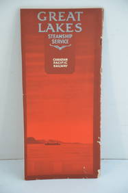
Canadian Pacific RY Great Lakes Steamship 1919 Brochure and TimetableJM Hobby Supply and Railroad Artifact Auctions4.4(127)See Sold PriceFeb 24, 2024
Group of 15 Printed or Lithographed Items, including: litho...Potter & Potter Auctions4.6(545)See Sold PriceMar 07, 2024
GEORGE ANDREW CORLEY (DATES UNKNOWN) U.S. TEAM SKI TRYOUTS / MT. HOOD OREGON. 1939.Swann Auction Galleries4.4(70)See Sold PriceFeb 29, 2024


![Lake Tahoe Maps [135633] (1 of 1)](https://p1.liveauctioneers.com/2699/211842/108080448_1_x.jpg?height=282&quality=70&version=1626741934)