ATLAS of ANTIENT GEOGRAPHY by SAMUEL BUTLER 1843John McInnis Auctioneers,LLC4.6(502)See Sold PriceFeb 24, 2024
18TH C. ANTIQUE MAP: FRENCH & INDIAN WAR, FRAMEDThomaston Place Auction Galleries4.4(386)See Sold PriceFeb 24, 2024
Rand McNally Railroad Map Cabinet w/ 21 Railroad MapsRail & Road Auctions4.6(165)See Sold PriceMar 08, 2024
Keith Haring - Ink on New York Map, Best Buddies, Inscribed, Signed, and DatedSapphire Auction Gallery4(67)See Sold PriceMar 02, 2024
LATE 17TH C. FRENCH MAP OF THE NEW WORLD BY ALEXIS-HUBERT JAILLOT (1632-1712)Thomaston Place Auction Galleries4.4(386)See Sold PriceFeb 24, 2024
Central Railroad of New Jersey Map of Sandy Hook Route-ca. 1903JM Hobby Supply and Railroad Artifact Auctions4.4(126)See Sold PriceFeb 24, 2024
Lot of Six Mixed Atlas Box Cars-HO Scale-New in BoxJM Hobby Supply and Railroad Artifact Auctions4.4(126)See Sold PriceFeb 25, 2024
Rand McNally/Santa Fe Railroad Map of Iowa-1912JM Hobby Supply and Railroad Artifact Auctions4.4(126)See Sold PriceFeb 24, 2024
NICOLAES VISSCHER (NETHERLANDS, 1618-1709) MAP OF THE NEW WORLDThomaston Place Auction Galleries4.4(386)See Sold PriceFeb 24, 2024
17TH C. WORLD MAP BY NICOLAES VISSCHER (NETHERLANDS, 1618-1709)Thomaston Place Auction Galleries4.4(386)See Sold PriceFeb 24, 2024
Lot of Six Mixed Atlas Cabooses-HO Scale-New in BoxJM Hobby Supply and Railroad Artifact Auctions4.4(126)See Sold PriceFeb 25, 2024
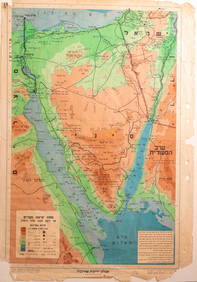
Collection of [19] Maps of the Land of Israel, MandateImpressive collection of maps from the Mandate era and the period of the establishment of the State. Including: Mandatary maps of Gaza, Chevron, the Dead Sea x 2, the Chulah Lake, and Be'er Sheva (a tSee Sold Price
SoldCollection of Interesting Maps of the Land of Israel -The maps: A.The Land of Israel – a large topographic map, 1934, 46x66 cm. B.The Land of Israel, a large map with a list of Jewish settlements, the Jewish national Fund, the British mandate. 66xSee Sold Price
SoldCollection of Eeretz Yisrael Maps - The British MandateA. Map written in English, Palestine, with a special square on the city of Haifa. Hand-painted. B. Map of the Land of Israel from the Mandatory period. Published by Atlas. Hebrew. The Arabic names ofSee Sold Price
SoldCollection of maps of the Land of Israel [30] from theA large collection of approximately 30 ancient geographical maps of the Land of Israel. 17th-18th century. Various maps printed in different countries. Some of the maps show the division of tribSee Sold Price
SoldCollection of Antique Maps of the Land of Israel andCollection of five antique geographic maps of the Land of Israel and the Middle East. Various conditions and sizes. Some are hand-painted. Overall fine condition.See Sold Price
SoldA Collection of Important Maps of the Land of Israel,A collection of some 17 engravings and prints of important and early maps of the biblical Land of Israel including its division between the 12 tribes, some of them hand painted. Europe, 16th-18th centSee Sold Price
SoldA collection [7] of Ancient Maps of the Land of IsraelEarly geographical maps from various publishers. Some of the maps show the division into tribes. Three maps are painted by hand from the time of printing, and four are black and white. Two large maSee Sold Price
SoldMap Collection from the 19th CenturySix maps of the Land of Israel and the surrounding region. 1832-1892. Fine condition. Some are minimally colored.See Sold Price
SoldThe Hebrew Settlement in the Land of Israel - VarietyImportant collection of 19 photographs, a wide variety depicting the history of the Hebrew settlement in the Land of Israel, most from the first half of the 20th century. In the photographs: David BenSee Sold Price
SoldCopper plate—a map of the Land of Israel and the holyEngraving work by an artist. In the middle is a map of the Land of Israel with the borders from the British Mandate. On the four sides of the map are engravings of holy sites in Jerusalem: people praySee Sold Price
SoldCollection of [5] Maps of the Middle East and Environs* Nuova Carta di Irak Arabi, Kurdistan Diarbek Turcomannia Siria, e Palestina, map of Iraq, Arabia, Diarbek, Turkmenistan, Syria and the Land of Israel. 1740, 30x35 cm. * Syria, Cyprus, Palestina, MesSee Sold Price
SoldA Collection [6] of Ancient Geographical Maps of the6 ancient geographical maps of the Land of Israel in varying sizes. Etchings and prints from different publishers, 18-19th century. Writing in Latin letters. All of the maps are painted by hand from tSee Sold Price
SoldLarge Collection [64] of Engravings of the Land ofLarge collection of engravings on the topic of the Land of Israel: 26 engravings with maps of the Land of Israel and environs, and another 38 engravings with depictions of biblical scenes. Highlights:See Sold Price
Collection of [8] JNF Posters from the Period of the* Announcement about the opening of a violin-playing course. Tel Aviv, 1932. *Â Color map of the Land of Israel Nakum U'Vaninu [We will Arise and Build], 1947. * Celebratory poster from the TeachersSee Sold Price
SoldImprovised silver Torah book pointerImprovised silver Torah book pointer, body of old sterling silver-plated Israeli pen with map of the Land of Israel, the Tower of David and the State of Israel symbol, total weight: 19.2 gm, length: 1See Sold Price
Map of the Judah and Israel in biblical times1970. Map of the land of Israel, depicting the kingdoms of Judah and Israel in biblical times. Drawn by a French cartographer. Dated 1790. Hand-coloured etching. Paper, 19.2x18.8 cmSee Sold Price
SoldCollection of [5] Regional Maps, the Middle East, North* IESU CHRISTI SALVATORIS NOSTIR ET APOSTOLORUM PETRI, ET PAULI MANSIONES, map marking the travels of the founders of Christianity in the Land of Israel and Europe, with smaller inset maps on the righSee Sold Price
SoldCollection of Various Regional Maps [10] 17th-18thCollection of [10] antique geographic maps, for the regions of Asia, Albania, Armenia, Saudi Arabia, the Land of Israel and a map of the globe. Various conditions and sizes, overall fine condition.See Sold Price
SoldThe Land of Israel during the British Mandate - A LargeCollection of about 60 booklets on law, economics, demography and statistics in the Land of Israel. Hebrew and English. A. 14 booklets on demography and statistics. B. 6 booklets about economics and sSee Sold Price
SoldCollection of Maps of the Holy Land, Palestine-Israel5 Topographical maps of the Holy Land, some rare, Palestine-Israel, 1930’s-1950’s. *Map of the Holy Land according to its Biblical and historical borders, Dr. Z. Zeitlin, Israel, 1957. ASee Sold Price
SoldIsrael pre 1948 Rare MNH BlocksIsrael - 3 Rare Mint Blocks - Pre 1948,During Mandate Period. A rare opportunity ,to add to your Israel collection - Note -Map shown in these stamps appear to be pre 1948. Stamps are MNH.See Sold Price
SoldCollection of Photographs from the Land of Israel -Collection of 45 photographs taken in the Land of Israel in 1947-1949, some documenting historic events such as street celebrations following the UN proclamation of the end of the British Mandate [29See Sold Price
Collection of leaflets - The General Histadrut of19 leaflets published in the land of israel by the Jewish Workers Union - the Social Movement in Israel. In the midst of the movement struggle in the opposing stream, and in the Zionist leadership. ThSee Sold Price
SoldThe Youth of the Land of Israel - A Collection of BooksThe Youth of the Land of Israel - A Collection of Books Printed in the Mandate Perioda. Jubilee Book of the Talmud Torah School for Girls in Jerusalem (Spitzer). 1918-1943. Published by the Jubilee CoSee Sold Price
Jewish National Fund Collection Box - Great BritainLevy Auction House4.3(11)See Sold PriceFeb 27, 2024
Collection of 10 Maps of Cities in Israel for TouristsLevy Auction House4.3(11)See Sold PriceFeb 27, 2024
Caravan Routes in Palestine Linen Map - Germany, 1881Levy Auction House4.3(11)See Sold PriceFeb 27, 2024
Collection of 3 Bus Tickets - Sheikh Jarrah, JerusalemLevy Auction House4.3(11)See Sold PriceFeb 27, 2024
18 Booklets Collection - War Graves of Palestine - WWILevy Auction House4.3(11)See Sold PriceFeb 27, 2024
Collection of Documents - First Knesset Opening - 1949Levy Auction House4.3(11)See Sold PriceFeb 27, 2024
Illustrated Sabbath Cloth - Holy Sites of Eretz IsraelLevy Auction House4.3(11)See Sold PriceFeb 27, 2024
Antique German Kampen Town Color Copper EtchingHill Auction Gallery 4.7(1k)See Sold PriceFeb 28, 2024
ISRAEL (ISMAEL) ABRAMOFSKY (1888-1975) "LANDSCAPE".Amelia Jeffers, Auctioneers & Appraisers4.6(101)See Sold PriceMar 07, 2024
Alfred Salzman, Etc. JNF Tin Tzedakah Boxes, 3Auctions at Showplace4.5(726)See Sold PriceApr 07, 2024
Churchill & Nieuhof 1744 Folio Map. Cape of Good Hope, South AfricaAlbion Auctions4.6(336)See Sold PriceMar 01, 2024
Churchill & Nieuhof 1744 Folio Map. Batavia Indonesia East IndiesAlbion Auctions4.6(336)See Sold PriceMar 01, 2024
AN IMPORTANT KETUBAH ON VELLUM. Mantua, 1707. Gouache and ink on parchment. Records the wedding ofJ. Greenstein & Co., Inc.4.3(55)See Sold PriceApr 16, 2024