RARE 1930s AUTOGRAPH BOOK FEATURING RUTH & GEHRIGJohn McInnis Auctioneers,LLC4.5(505)See Sold PriceFeb 25, 2024
Group of Ten Books: Art of the Embroiderer, Charles Germain de Saint Aubin; Hand Weaving PatternsNazmiyal Auctions4.4(34)See Sold PriceFeb 26, 2024
Improvisations II 55 original lithographs Artists Equity Assoc 1951Concept Art Gallery4.7(510)See Sold PriceMar 06, 2024
1868 Handwritten diary of Ohio canal boat operator & farmerJasper524.5(9.9k)See Sold PriceFeb 27, 2024
Lot Of 4 Mint Limited Edition Books From The Franklin Library.Rbfinearts4.5(578)See Sold PriceFeb 24, 2024
A Group of Eight Books: Line and Form, Walter Crane (1900); Samplers and Stitches; Designs forNazmiyal Auctions4.4(34)See Sold PriceFeb 26, 2024
First Copy of Gautier's Le Roman de la Momie - 13 Original Watercolors by George Barbier (2 VolumesTrillium Antique Prints & Rare Books4.5(32)See Sold PriceFeb 24, 2024
Group of Nine Books: Handbook of Embroidery; The Book of Stitches, Ellen T. Masters; The Lady'sNazmiyal Auctions4.4(34)See Sold PriceFeb 26, 2024
Outlaws of the Border, rare 1882 Jesse James, Younger brothersJasper524.5(9.9k)See Sold PriceFeb 27, 2024
Scarce 1st ed. “Life Histories of African Game Animals?? – T. Roosevelt, E. HellerJasper524.5(9.9k)See Sold PriceFeb 27, 2024
Large lot of exhibition catalogs on CoBrA artistsConcept Art Gallery4.7(510)See Sold PriceMar 06, 2024
Sold
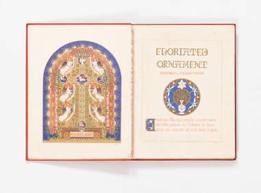
Classical Atlas Ancient Geography Alexander Findlay,MapA Classical Atlas to illustrate Ancient Geography by Alexander Findlay. Includes 25 maps. Marbled leather cover with label for the title. Pencil inscription inside cover dated 1859 Publisher: D. ApplSee Sold Price
SoldFindlay's Classical Atlas 1854Title: A Classical Atlas, To Illustrate Ancient Geography; Comprised in Twenty-Six Maps Author: Findlay, Alexander G. Description: xvi, 44 pp. Folding plate and 25 folding maps, most colored in outlinSee Sold Price
SoldFindlay Classical Atlas Color MapsFindlay, Alexander. A Classical Atlas to Illustrate Ancient Geography, comprised in twenty-five maps… New York, Harper Brothers, no date (c.1854), Hardcover, later 3/4 leather. 25 hand-colored maps.See Sold Price
SoldFINDLAY, ALEXANDER G. A Classical Atlas to IllFINDLAY, ALEXANDER G. A Classical Atlas to Illustrate Ancient Geography. 25 double-page maps; hand-colored in outline. 8vo, publisher's 1/2 roan, needs rebinding; margins partially trimmed along fore-See Sold Price
SoldAntique Atlas of the Ancient World,Antique Atlas of the Ancient World, Findlay, Alexander, "A Classical Atlas to Illustrate Ancient Geography; Comprised in Twenty-Five Maps Showing the Various Divisions of the World as Known to the AncSee Sold Price
SoldFindlay (Alexander G.) - A Classical Atlas,to illustrate Ancient Geography , 25 maps (hand-coloured in outline) and 1 folding plan, some light browning and occasional foxing, original roan-backed boards, upper cover detatched, rubbed and scuffSee Sold Price
SoldLot of 3 Vintage Reference BooksThree vintage references books; Merriam-Webster Pocket Book collectors edition; Leather bound , Atlas of Ancient and Classical Geography including fold out maps, book is separated into two pieces; LeaSee Sold Price
SoldMitchell's Ancient Atlas, Classical & Sacred 1861Very rarely do you come across one Mitchell's original map books, but this is one of them, published by E.H. Butler & Co., 1861. Containing maps illustrating the geography of the ancient world, as desSee Sold Price
SoldMITCHELL'S ANCIENT ATLAS, "Mitchell's Ancient AtMITCHELL'S ANCIENT ATLAS, "Mitchell's Ancient Atlas, Classical and Sacred, Containing Maps Illustrating the Geography of the Ancient World, (etc.)", by S. Augustus Mitchell, Philadelphia: E. H. ButlerSee Sold Price
SoldBooks: '' The Atlas of Ancient and Classical GeographyBooks: '' The Atlas of Ancient and Classical Geography ''. Published by by J.M. Dent, London. 1909 . With a selection of full colour maps. Green cloth bound with gilt detail and lettering to spine. ToSee Sold Price
SoldLong’s Classical Atlas w/hand-colored maps, 1856Reserve Reduced! Atlas with 26 two-page plates in outline hand-color. All maps in fine condition. Maps are all 10 x 13 sheets. Maps include (1) Geography According to the Ancients, (2) The World as KnSee Sold Price
World.- Bankes (Rev. Thomas) A New Royal Authentic andWorld.- Bankes (Rev.Thomas), E.W.Blake and Alexander Cook. A New Royal Authentic and Complete System of Universal Geography Ancient and Modern, engraved allegorical frontispiece and 88 plates (many wiSee Sold Price
SoldMap of Empire of Alexander in 1832. 1835.Print of hand colored steel engraving titled „Empire et marches D‘ Alexandre 1832“.Author C. V. Monin.Engraved by unknown.From the „Atlas Universel de Geography“ by C. V. Monin. Parsi. 1835.See Sold Price
Map of Empire of Alexander in 1832. 1835.Print of hand colored steel engraving titled Empire et marches D‘ Alexandre 1832“.Author C. V. Monin.Engraved by unknown.From the Atlas Universel de Geography“ by C. V. Monin. Parsi. 1835.AlexanSee Sold Price
SoldButler. AN ATLAS OF ANCIENT GEOGRAPHY. 22 Maps.[Atlas] AN ATLAS OF ANCIENT GEOGRAPHY, By Samuel Butler, D. D. London, Published by Longman, Rees, Orme, Brown, Green & Longman. (nd). [C. 1827 to 1840. A previous edition’s engr title had “1827.�See Sold Price
SoldWorld.- ButlerWorld.- Butler (Dr. Samuel) An Atlas of Ancient Geography, 24 engraved maps, most hand-coloured, some spotting, offsetting, later ink inscriptions to endpaper, contemporary half morocco, rubbeSee Sold Price
SoldButler (G.) Atlas of Ancient GeographyButler (Revd. George ) The Public Schools Atlas of Ancient Geography, 27 lithographed maps, with outline colouring, each 240 x 320mm to 310 x 450mm., faint browning, ff disbound, in contemporaSee Sold Price
Atlas of Ancient Geography c.1750Heading: Author: Seale, Richard William & William Henry Toms Title: Atlas of ancient geography with 33 maps engraved by R.W. Seale or W.H. Toms Place Published: No place Publisher: Date PublisheSee Sold Price
SoldAtlas - Butler, Samuel C1835 Ancient Geography, 22 Maps"An Atlas of Ancient Geography" by Samuel Butler. London: Longman et al. nd, C1835. 8vo (220 x 155mm) Original marbled boards. Front board detached and boards rubbed/scuffed. Bookplate on front pastedSee Sold Price
SoldConant family, W. Cornwall, VT books & 1867 DC journalincluding 1841 Atlas of Ancient Geography w/ hand colored maps signed Samuel M Conant Middlebury CollegeSee Sold Price
Sold1831 S Butler "Atlas of Ancient Geography" with han1831 S Butler "Atlas of Ancient Geography" with hand colored mapsSee Sold Price
SoldAtlas of Ancient & Classical Geography , Rhys, ErAtlas of Ancient & Classical Geography , Rhys, Ernest, ed., E.P. Dutton & Co., NY, , Smith's Smaller Classical Dictionary , Rhys, Ernest, ed., E.P. Dutton & Co., NY, , A Shakespeare Glossary , Onions,See Sold Price
Sold1828 ATLAS MAPS Ancient & Modern Geography Asia Africa1828 ATLAS MAPS Ancient & Modern Geography Asia Africa Turkey Greece Delamarche Felix Delamarche was a well-known and important French cartographer from the 18th-century. His best and most widely usedSee Sold Price
SoldOne volume, ' An Atlas of Ancient Geography ' by SamuelOne volume, ' An Atlas of Ancient Geography ' by Samuel Butler including maps engraved by S. Hall, dated 1829, published by Longman, Rees, Orme, Brown ( twenty one maps total )See Sold Price
Blackie (Pub) 1882 Folio Map. West USA - Pacific StatesAlbion Auctions4.6(341)See Sold PriceMar 01, 2024
Blackie (Pub) 1882 Folio Map. Chinese Empire and JapanAlbion Auctions4.6(341)See Sold PriceMar 01, 2024
Blackie (Pub) 1882 Folio Map. East Indies - Indian ArchipelagoAlbion Auctions4.6(341)See Sold PriceMar 01, 2024
Blackie (Pub) 1882 Folio Map. United States of North AmericaAlbion Auctions4.6(341)See Sold PriceMar 01, 2024
Blackie (Pub) 1882 Folio Map. West India Islands & Central AmericaAlbion Auctions4.6(341)See Sold PriceMar 01, 2024
Blackie (Pub) 1882 Folio Map. World on Mercators ProjectionAlbion Auctions4.6(341)See Sold PriceMar 01, 2024
Blackie (Pub) 1882 Pair of Folio Maps. Italy - North & SouthAlbion Auctions4.6(341)See Sold PriceMar 01, 2024
Stanford, Edward 1901 Large Map. Geological Map of the British IslesAlbion Auctions4.6(341)See Sold PriceMar 01, 2024
Stanford, Edward 1901 Large Map. Hydrographical Map of the British IslesAlbion Auctions4.6(341)See Sold PriceMar 01, 2024
Stanford, Edward 1901 Large Map. Stereographical Map of The British IslesAlbion Auctions4.6(341)See Sold PriceMar 01, 2024
Rees & Macpherson 1820 Lot of 6 Ancient Geography MapsAlbion Auctions4.6(341)See Sold PriceMar 01, 2024