Calmet: Antique Map Malta / St. Paul’s Shipwreck, 1728Map: Ancien Plan de l'Isle de Malte, ou S. Paul Aborda apres son Naufrage, Act XXVIII Cartographer: Calmet Place & Date: Paris / 1728 Size: 17" x 12" Condition: b&w; light overall age toning The verySee Sold Price
SoldCalmet: Antique Map of Malta, St Paul’s Shipwreck, 1728Map: Ancien Plan de l'Isle de Malte, ou S. Paul Aborda apres son Naufrage, Act XXVIII Cartographer: Calmet Place & Date: Paris / 1728 Size: 17" x 12" Condition: b&w; light overall age toning The verySee Sold Price
Calmet: Ancien Plan de l'Isle de Malte, 1728Ancien Plan de l'Isle de Malte, ou S. Paul Aborda apres son Naufrage, Act XXVIII. The very scarce "old plan of the island of Malta, where St. Paul landed after his shipwreck" from Calmet's DictionnairSee Sold Price
"Peregrinationis Divi Pauli Typus Corographicus"map depicting the travels of St. Paul throughout the Eastern Mediterranean based on various sources. The title cartouche is flanked by two Biblical views including the shipwreck of the Apostle Paul atSee Sold Price
"Peregrinationis Divi Pauli Typus Corographicus"map depicting the travels of St. Paul throughout the Eastern Mediterranean based on various sources. The title cartouche is flanked by two Biblical views including the shipwreck of the Apostle Paul atSee Sold Price
"Peregrinationis Divi Pauli Typus Corographicus"map depicting the travels of St. Paul throughout the Eastern Mediterranean based on various sources. The title cartouche is flanked by two Biblical views including the shipwreck of the Apostle Paul atSee Sold Price
SoldANTIQUE 17th/18th c MAP ST PAULAntique 17th/18th c. Map showing the travels of The Apostles and St. Paul in the Mediterranean. Professionally framed and matted, measures 23"x26"x1". Weight 7 pds. PROVENANCE: A Private Charleston SCSee Sold Price
SoldOrtelius: Antique Map of Travels of St. Paul, 1624Map: Peregrinationis Divi Pauli Typus Chorographicus. Cartographer: Abraham Ortelius Printing Date: 1624 Medium: Copperplate engraved map. Size: 18.5 x 22 Publisher: Antwerp: Officina Plantiniana, BalSee Sold Price
Stow/Strype: Antique Map of The parish of St Paul'sTITLE/CONTENT OF MAP: 'A mapp of the parish of St Paul's, Covent Garden' The map shows Covent Garden, orientated towards the west. The site of Covent Garden market is in the centre. Drury Lane is at tSee Sold Price
Stow/Strype: Antique Map of Aldersgate Ward & StTITLE/CONTENT OF MAP: 'Aldersgate Ward and St Martins le Grand Liberty' The map covers Goswell Road/Aldersgate Street/St Martin's-le-Grand from the Barbican south to St Paul's. Little Britain is markeSee Sold Price
Soldd'Anville: Antique Map of Brazil, 1758Map: Suite Du Bresil Publication Date: 1758 Authors: DIDOT, ANVILLE, J. B. B. d' Publisher: DIDOT Size: Octavo – 9.25 H x 6.60 W Inches "depuis la Baye de Tous les Saints jusqu'a St. Paul pour serviSee Sold Price
Collection of [3] antique maps - Central Europe and theVarious maps: * Map of travels and voyages of St. Paul. London, published by Mathews and Leigh, 1812. * Map of the wanderings of the Israelites in the desert. Published by J. Murray, London, 1829. * CSee Sold Price
Mallet: Antique Map of Reunion Island, 1683Title/Content of Map: 'Isle Bourbon' REUNION. Ile Bourbon Réunion Ste-Suzanne St-Paul. Indian Ocean. Date Printed: 1683 Image Size: Approx Overall page size 13 x 21cm approximately (5 x 8 inches); imSee Sold Price
SoldMunster (Sebastian) Aphricae Tabula IIMunster (Sebastian) Aphricae Tabula II,map showing part of north Africa, with text box at upper left, and a vignette of St. Paul's shipwreck at upper right, woodcut with hand-colouring, sheetSee Sold Price
SoldBellin: Suite of 3 Antique Brazil Maps, 1756Title/Content of Map: Carte du Bresil Prem. Partie [and] Suite du Bresil Depuis la Baye de Tous les Saints jusqu'a St. Paul [and on the same sheet] Suite du Bresil Cartographer: Bellin Place & Date: PSee Sold Price
Bellin: Suite of 3 Antique Brazil Maps, 1756Map: Carte du Bresil Prem. Partie [and] Suite du Bresil Depuis la Baye de Tous les Saints jusqu'a St. Paul [and on the same sheet] Suite du Bresil Cartographer: Bellin Place & Date: Paris / 1756/1760See Sold Price
Countries embraced within the travels of St Paul. Mediterranean. HUGHES 1856 mapTITLE/CONTENT OF MAP: 'The countries embraced within the travels of St. Paul' DATE PRINTED: 1856 IMAGE SIZE: Approx 20.5 x 30.0cm, 8 x 11.75 inches (Medium) TYPE: Antique atlas map with original handSee Sold Price
Countries embraced within the travels of St Paul. Mediterranean. HUGHES 1856 mapCAPTION PRINTED BELOW PICTURE: 'The countries embraced within the travels of St. Paul' DATE PRINTED: 1856 IMAGE SIZE: Approx 20.5 x 30.0cm, 8 x 11.75 inches (Medium) TYPE: Antique atlas map with origiSee Sold Price
South East London Street Atlas MapBromley & Orpington Hayes Petts Wood Keston St Paul's Mary Cray. Bacon 1903 Map. Size: Approx 34.5 x 51.5cm, 13.5 x 20.25 inches; Please note that this is a folding map. Antique colour atlas map. PleaSee Sold Price
Route of St. Paul through Mediterranean 1722Title: Carte Particuliere des Pais que les Apotres ont Parcourus, et des Lieux les Plus Renommez ou ils ont Preche l'Evangile Author: Calmet, Augustin Description: Copper-engraved map. 32x45 cm. (12½See Sold Price
Route of St. Paul through Mediterranean 1722Title: Carte Particuliere des Pais que les Apotres ont Parcourus, et des Lieux les Plus Renommez ou ils ont Preche l'Evangile Author: Calmet, Augustin Description: Copper-engraved map. 32x45 cm. (12½See Sold Price
SIGNED 1800s GUSTAVE DORE Biblical Woodcut St. Paul Shipwrecked on Malta FRAMEDGustave Dore(Paul Gustave Louis Christophe Dore) (French, 1832-1883). Saint Paul approaching the Island of Malta (from Dore's Bible). Antique woodcut wove paper after the original by a master wood engSee Sold Price
SoldAntique mapPlan of the Town and Harbour of Mahon, St Philip's Castle, and its Fortifications by Paul de Rapin de Thoyras and Nicholas Tindal, 1747.See Sold Price
1701 MAP OF MOSCOVIA RUSSIA ENGLISH copper engraving ANTIQUEMoscovia or Russia. Divided into its general parts &c. by Moll, Herman (Cartographer) London, Printed for Timothy Childe at the White Hart at the West-end of St. Paul's Church-yard; 1701 size 6 1/2 bySee Sold Price
Lake Superior and Mississippi River RR 1869 Seven Percent Bonds Book/Report-1869JM Hobby Supply and Railroad Artifact Auctions4.4(126)See Sold PriceFeb 24, 2024
Chicago Milwaukee and St Paul RY Panama Pacific Exposition Brochure-1915JM Hobby Supply and Railroad Artifact Auctions4.4(126)See Sold PriceFeb 24, 2024
Chicago Milwaukee and St Paul RY To the Lakes of Wisconsin and Minnesota Book-1909JM Hobby Supply and Railroad Artifact Auctions4.4(126)See Sold PriceFeb 24, 2024
Chicago Milwaukee and St Paul RY Why and Wherefore Book-1886JM Hobby Supply and Railroad Artifact Auctions4.4(126)See Sold PriceFeb 24, 2024
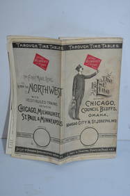
Chicago Milwaukee and St Paul RY March 1, 1889 Public TimetableJM Hobby Supply and Railroad Artifact Auctions4.4(126)See Sold PriceFeb 24, 2024
Illinois Central RR July 24, 1906 Western Lines Public TimetableJM Hobby Supply and Railroad Artifact Auctions4.4(126)See Sold PriceFeb 24, 2024
FRANK MARMINGTON c1910 National Gallery Canada Signed Engraving London St. Pauls 20" x 16"Luis Porretta Fine Arts4.3(10)See Sold PriceMar 02, 2024
D'Oyly (Calcutta, India) - Government House from St. Andrew's LibraryTrillium Antique Prints & Rare Books4.5(30)See Sold PriceFeb 24, 2024
William Simpson's Sketches at the Seat of War - Two Volumes with 81 Hand-colored LithographsTrillium Antique Prints & Rare Books4.5(30)See Sold PriceFeb 24, 2024
Strickler, Rare - San Francisco, CaliforniaTrillium Antique Prints & Rare Books4.5(30)See Sold PriceFeb 24, 2024
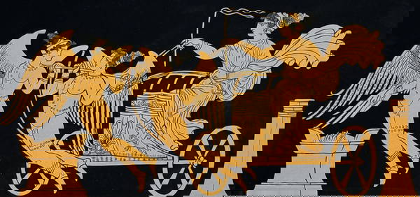
Hamilton - Engraving of a Painting from a Grecian Vase. 32Trillium Antique Prints & Rare Books4.5(30)See Sold PriceFeb 24, 2024
Hamilton - Engraving of a Painting from a Grecian Vase. 114Trillium Antique Prints & Rare Books4.5(30)See Sold PriceFeb 24, 2024
Hamilton - Engraving of a Painting from a Grecian Vase. 5Trillium Antique Prints & Rare Books4.5(30)See Sold PriceFeb 24, 2024
Mivart & Keulemans - Mitchell's LoryTrillium Antique Prints & Rare Books4.5(30)See Sold PriceFeb 24, 2024
Mivart & Keulemans - Verreaux's LoryTrillium Antique Prints & Rare Books4.5(30)See Sold PriceFeb 24, 2024
Mivart & Keulemans - Tahiti Lory, Ultramarine LoryTrillium Antique Prints & Rare Books4.5(30)See Sold PriceFeb 24, 2024
Mivart & Keulemans - Black-capped Lory & Red-breasted LoryTrillium Antique Prints & Rare Books4.5(30)See Sold PriceFeb 24, 2024
WEST AFRICA Explorers' routes Senegal Ashanti. Mountains of Kong. SDUK 1857 mapJasper524.5(9.8k)See Sold PriceFeb 28, 2024
WEST AFRICA explorers' routes. Beaufort Gray Park Dochard Caillie. SDUK 1874 mapJasper524.5(9.8k)See Sold PriceFeb 28, 2024
WEST AFRICA I Explorers' routes Senegal Ashanti Ivory Gold Coast. SDUK 1851 mapJasper524.5(9.8k)See Sold PriceFeb 28, 2024
WEST AFRICA showing early explorers' routes & Mountains of Kong. SDUK 1844 mapJasper524.5(9.8k)See Sold PriceFeb 28, 2024
Theo. Hamm Brewing Co. St. Paul Birds Eye Factory MapMatthew Bullock Auctioneers4.7(1.8k)See Sold PriceMar 02, 2024


![Collection of [3] antique maps - Central Europe and the (1 of 3)](https://p1.liveauctioneers.com/2398/98907/50388426_1_x.jpg?height=282&quality=70&version=1484078795)