Soldc. 1645, Introduction to the Blaeu AtlasMapsINTRODUCTIO AD COSMOGRAPHIAM EIUSQUE PARTES c. 1645, “INTRODUCTIO AD COSMOGRAPHIAM EIUSQUE PARTES,” by Willem & Johannes Blaeu, Amsterdam, Choice Extremely Fine. 19” x 11.25&rdquSee Sold Price
Soldc. 1645, Introduction to the Blaeu AtlasMapsINTRODUCTIO AD COSMOGRAPHIAM EIUSQUE PARTES c. 1645, “INTRODUCTIO AD COSMOGRAPHIAM EIUSQUE PARTES,” by Willem & Johannes Blaeu, Amsterdam, Choice Extremely Fine. 19” x 11.25&rdquSee Sold Price
Soldc. 1645, Introduction to the Blaeu AtlasMapsINTRODUCTIO AD COSMOGRAPHIAM EIUSQUE PARTES c. 1645, “INTRODUCTIO AD COSMOGRAPHIAM EIUSQUE PARTES,” by Willem & Johannes Blaeu, Amsterdam, Choice Extremely Fine. 19” x 11.25&rdquSee Sold Price
Soldc. 1645, Introduction to the Blaeu AtlasMapsINTRODUCTIO AD COSMOGRAPHIAM EIUSQUE PARTES c. 1645, “INTRODUCTIO AD COSMOGRAPHIAM EIUSQUE PARTES,” by Willem & Johannes Blaeu, Amsterdam, Choice Extremely Fine. 19” x 11.25&rdquSee Sold Price
Soldc. 1645, Introduction to the Blaeu Atlas"MapsINTRODUCTIO AD COSMOGRAPHIAM EIUSQUE PARTES c. 1645, “INTRODUCTIO AD COSMOGRAPHIAM EIUSQUE PARTES,” by Willem & Johannes Blaeu, Amsterdam, Choice Extremely Fine. 19” x 11.25&rdqSee Sold Price
Soldc. 1645, Introduction to the Blaeu AtlasMapsINTRODUCTIO AD COSMOGRAPHIAM EIUSQUE PARTES c. 1645, “INTRODUCTIO AD COSMOGRAPHIAM EIUSQUE PARTES,” by Willem & Johannes Blaeu, Amsterdam, Choice Extremely Fine. 19” x 11.25&rdquSee Sold Price
SoldLondon.- Blaeu (Johannes) Middle-Sexia, [c. 1645].London.- Blaeu (Johannes) Middle-Sexia, with London shown in the lower right corner above a decorative title cartouche, engraving with early hand-colouring, platemark 395 x 415 mm (15 1/2 x 16 1/4 in)See Sold Price
Wiltshire county England. By The Blaeu familyTitle: Wiltshire county England. By The Blaeu family Date/Period: c1645-1655 Materials: Copperplate engraved Size: 23x19 inches. Published in Theatrum Orbis Terrarum Sive Atlas Novus, Amsterdam. A beaSee Sold Price
Wiltshire county England. By The Blaeu familyTitle: Wiltshire county England. By The Blaeu family Date/Period: c1645-1655 Materials: Copperplate engraved Size: 23x19 inches. Description: Published in Theatrum Orbis Terrarum Sive Atlas Novus, AmsSee Sold Price
Wiltshire county England. By The Blaeu familyTitle: Wiltshire county England. By The Blaeu family Date/Period: c1645-1655 Materials: Copperplate engraved Size: 23x19 inches. Published in Theatrum Orbis Terrarum Sive Atlas Novus, Amsterdam. A beaSee Sold Price
Wiltshire county England. By The Blaeu familyTitle: Wiltshire county England. By The Blaeu family Date/Period: c1645-1655 Materials: Copperplate engraved Size: 23x19 inches. Published in Theatrum Orbis Terrarum Sive Atlas Novus, Amsterdam. A beaSee Sold Price
Wiltshire county England. By The Blaeu familyTitle: Wiltshire county England. By The Blaeu family Date/Period: c1645-1655 Materials: Copperplate engraved Size: 23x19 inches. Description: Published in Theatrum Orbis Terrarum Sive Atlas Novus, AmsSee Sold Price
Sold1645 c. Map of the Elbe by Hamburg -- CeleberrimiTitle/ Content of Map: 1645 c. Map of the Elbe by Hamburg -- Celeberrimi Fluvii Albis nova delineatio. Auctore Christiano Mollero Cartographer: Blaeu [family] Year/Place: 1645 c., Amsterdam DimensionsSee Sold Price
SoldC.1645 MAP OF ENGLAND& WALES HAND COLORED BY BLAEU 18 1/2" X 22 3/4" OVERALLC.1645 MAP OF ENGLAND& WALES HAND COLORED BY BLAEU 18 1/2" X 22 3/4" OVERALLSee Sold Price
SoldBlaeu Engraved Map of North AmericaAmericae Nova Tabula. Willem Blaeu (1571-1638). Engraved map with original hand color. Amsterdam, c. 1645 or later (state 5). 17 x 22 3/4 inches visible, 27 x 33 inches framed. This is one of the fewSee Sold Price
Blaeu Engraving of Middlesex, Showing LondonBLAEU, Willem Janszoon (1571-1638). MIDDLE-SEXIA. Engraving with original hand color. Amsterdam, c. 1645. 20" x 24 1/8" sheet. Fine example of Blaeu's map of the old Middlesex County, including a marvSee Sold Price
SoldWillem Blaeu map of Cambridge, 1645Willem Janszoon Blaeu (1571-1638) map of Cambridge, hand colored, titled "Cantabrigiensis Comitatus, Cambridge Shire", c 1645. Appx 20 1/4" x 23 1/4", frame appx 30 3/4" x 33 7/8". Very good conditionSee Sold Price
SoldBlaeu map of part of Italian bootHeading: Author: Blaeu, Willem Title: Calabria Citra olim Magna Graecia Place Published: Amsterdam Publisher: Date Published: c.1645 Description: Copper-engraved map, hand-See Sold Price
Blaeu's Britannia, 1645, with pictorial panelsHeading: Author: Blaeu, Willem & Joan Title: Britannia Prout Divisa fuit Temporibus Anglo-Saxonum, Praesertim Durante Illorum Heptarchia Place Published: Amsterdam Publisher: Date Published:See Sold Price
Blaeu's Britannia, 1645, with pictorial panelsHeading: Author: Blaeu, Willem & Joan Title: Britannia Prout Divisa fuit Temporibus Anglo-Saxonum, Praesertim Durante Illorum Heptarchia Place Published: Amsterdam Publisher: Date Published:See Sold Price
Mid 17th Century "India Que Orientalis Dicturet Insvlae Adacentes",c.1645, by Wilem Johannes Blaeu (Dutch), with cartouche Laurens Real,Governor General of the Dutch East Indies from 1615-1619. He is responsible for the introduction of slave labSee Sold Price
SoldBlaeu (Willem) Comitatus Brechiniae BreknokeBlaeu (Willem) Comitatus Brechiniae Breknoke,engraved map, outline colour, 380 x 500mm., c.1645 § Blaeu (J.) Penbrochia Comitatus et Comitatus Caermaridunum, engraved map, outline colour, 400See Sold Price
SoldMap: Helvetia, J. Blaeu, [c. 1645].[SWITZERLAND]. Blaeu after Mercator. Helvetia, Cum Finitimis Regionibus Confoederatis. Ca.1645. 15 1/8 x 19 5/8. Double-page engraving, contemporary hand-coloring, Latin text on verso. Short tear topSee Sold Price
SoldGuiljelmum Blaeu Map of Germany, Copper Engraving[Blaeu Map of Germany] Wirtenberg Ducatus (Duchy of Wurttemburg), c. 1650, from Blaeu's atlas "Theatrum Orbis Terrarum", hand-colored copper engraving, with decorative title cartouche and coat-of-armsSee Sold Price
Chesapeake and Ohio RR 6-pack Atlas Extended Vision Cabooses-HO Scale-New in BoxJM Hobby Supply and Railroad Artifact Auctions4.4(126)See Sold PriceFeb 25, 2024
EARLY 18TH C. DUTCH CHART OF PACIFIC OCEAN BY FREDERIK DE WIT (1629-1706) WITH CALIFORNIA AS ANThomaston Place Auction Galleries4.4(386)See Sold PriceFeb 24, 2024
LARGE EARLY 18TH C. DUTCH CHART OF UPPER NORTH AMERICA, PIERRE MORTIER (1661-1711), FRAMEDThomaston Place Auction Galleries4.4(386)See Sold PriceFeb 24, 2024
LATE 16TH C. MAP OF SCOTLAND BY MERCATOR, FRAMEDThomaston Place Auction Galleries4.4(386)See Sold PriceFeb 24, 2024
17TH C. MAP OF THE BERKSHIRES BY JOHN SPEED, FRAMEDThomaston Place Auction Galleries4.4(386)See Sold PriceFeb 24, 2024
WILLEM JANSZOON BLAEU (NETHERLANDS, 1571-1638) MAP OF UMBRIAThomaston Place Auction Galleries4.4(386)See Sold PriceFeb 24, 2024
WILLEM JANSZOON BLAEU (NETHERLANDS, 1571-1638)Thomaston Place Auction Galleries4.4(386)See Sold PriceFeb 24, 2024
Numismatic Books - Whelan - The Numismatic Atlas of the Roman EmpireTimeLine Auctions Ltd.4.5(183)See Sold PriceMar 09, 2024
SCOT, Reginald (c. 1538 - 1599). The Discoverie of Witchcra...Potter & Potter Auctions4.6(539)See Sold PriceFeb 24, 2024
Willem Blaeu, Etc. 17th C. Antiquarian Maps, 2Auctions at Showplace4.5(726)See Sold PriceMar 17, 2024
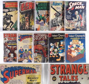
10PC Atlas DC Dell Golden Silver Age Comics GroupBruneau & Co. Auctioneers4.5(491)See Sold PriceFeb 24, 2024
18 Atlas DC Quality Comics Golden Silver Age GroupBruneau & Co. Auctioneers4.5(491)See Sold PriceFeb 24, 2024
Book: A Concise Historical, Biographical & Genealogical Atlas of the Principal Events in theClaydon Auctioneers Ltd4.3(125)See Sold PriceFeb 26, 2024
West Indies Islands. Guadaloupe. | Mariegalante &C. | Antigua.Jasper524.5(9.8k)See Sold PriceFeb 27, 2024
INTRODUCTION OF UNIVERSALIS IN OMNES RESPUBLICAS, 1632, POLITICS OF REPUBLICSNY Elizabeth 4.3(84)See Sold PriceMar 03, 2024
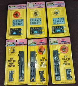
6 Atlas Remote Switch Machines & Control Boxes CRapid Estate Liquidators and Auction Gallery4.5(1.1k)See Sold PriceMar 03, 2024


![London.- Blaeu (Johannes) Middle-Sexia, [c. 1645]. (1 of 1)](https://p1.liveauctioneers.com/5458/180083/90635989_1_x.jpg?height=282&quality=70&version=1600859937)


![Map: Helvetia, J. Blaeu, [c. 1645]. (1 of 1)](https://p1.liveauctioneers.com/179/10971/2682772_1_x.jpg?height=282&quality=70&version=1162265652)