ATLAS of ANTIENT GEOGRAPHY by SAMUEL BUTLER 1843John McInnis Auctioneers,LLC4.6(502)See Sold PriceFeb 24, 2024
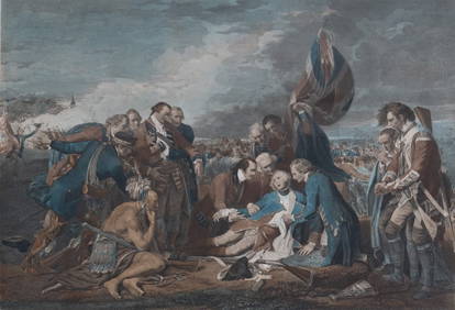
18TH C. ANTIQUE MAP: FRENCH & INDIAN WAR, FRAMEDThomaston Place Auction Galleries4.4(386)See Sold PriceFeb 24, 2024
Rand McNally Railroad Map Cabinet w/ 21 Railroad MapsRail & Road Auctions4.6(165)See Sold PriceMar 08, 2024
Keith Haring - Ink on New York Map, Best Buddies, Inscribed, Signed, and DatedSapphire Auction Gallery4(67)See Sold PriceMar 02, 2024
LATE 17TH C. FRENCH MAP OF THE NEW WORLD BY ALEXIS-HUBERT JAILLOT (1632-1712)Thomaston Place Auction Galleries4.4(386)See Sold PriceFeb 24, 2024
Central Railroad of New Jersey Map of Sandy Hook Route-ca. 1903JM Hobby Supply and Railroad Artifact Auctions4.4(126)See Sold PriceFeb 24, 2024
Lot of Six Mixed Atlas Box Cars-HO Scale-New in BoxJM Hobby Supply and Railroad Artifact Auctions4.4(126)See Sold PriceFeb 25, 2024
Rand McNally/Santa Fe Railroad Map of Iowa-1912JM Hobby Supply and Railroad Artifact Auctions4.4(126)See Sold PriceFeb 24, 2024
NICOLAES VISSCHER (NETHERLANDS, 1618-1709) MAP OF THE NEW WORLDThomaston Place Auction Galleries4.4(386)See Sold PriceFeb 24, 2024
17TH C. WORLD MAP BY NICOLAES VISSCHER (NETHERLANDS, 1618-1709)Thomaston Place Auction Galleries4.4(386)See Sold PriceFeb 24, 2024
Lot of Six Mixed Atlas Cabooses-HO Scale-New in BoxJM Hobby Supply and Railroad Artifact Auctions4.4(126)See Sold PriceFeb 25, 2024
Map of Southeast England & British Channel, 1613Map: Warwicum, Northhamtonia, Huntingdonia, Cantabrigia, Suffolcia, Oxonium, Buckinghamia, Bedfordia, Hartfordia, Effexia Maker: G. Mercator (family) Date: ca. 1613 Origin: Amsterdam Size: 14.4 x 18.3See Sold Price
SoldHay (Lieut. John) Pilotage of the British Channel fromNO RESERVE Hay (Lieut. John) Pilotage of the British Channel from Scilly to the Downs (Channel Islands inclusive), third edition, 17 engraved plates containing 23 sea charts and 4 plates with 10 diagrSee Sold Price
SoldBRITISH CHANNEL & BAY OF BISCAY MAPWilliam Faden (1749-1836) Framed map of British Channel & Bay of Biscay. Measures 41" x 26.5" with frame.See Sold Price
SoldMoore - Chart of the British Channel, 1786John Hamilton Mooreÿ(1738-1807), To His Royal Highness Prince William Henry this Chart of the British Channel, Is most Humbly dedicated by his most Obedient and Dutiful Servant John Hamilton Moore, LSee Sold Price
SoldChart of the British Channel John Moore 1791 MapLarge sea chart published June 27, 1791 by John Hamilton Moore. To his royal highness the Duke of Clarence Chart of the British Channel. Mounted on Canvas. Also, broadside advertising for Navigation SSee Sold Price
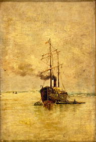
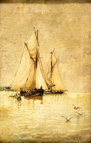
SoldThomas Bush Hardy (1842-1897) British. 'ChannelThomas Bush Hardy (1842-1897) British. 'Channel Shipping', Oil on Canvas, Signed, 16" x 24".See Sold Price
SoldDAVID COX "View of the British Channel, 1859" DAVID COX (British 1809-1885) "View of the British Channel, 1859" Watercolor on paper. 9.25 x 12.75 inches/ 23.5 x 32.4 centimeters. Signed & dated lower left "D. Cox, 1859" Verso: Inscribed & dated "See Sold Price
SoldTHOMAS JEFFERY A CHART OF THE BRITISH CHANNELThomas Jeffery A Chart of the British Channel; Comprehending the Southern Coasts of England and Wales: with the Coast of France hand coloured engraved map published by Robert Sayer 1775 50.5 x 62.5cmSee Sold Price
SoldBritish/Channel Islands Large Stamp Accumulation.British/Channel Islands Large Stamp Accumulation. Including Guersney, Jersey and Isle on Man. Mint, never hinged sets, first day covers, year sets, souvenir items and more. Very fine.See Sold Price
SoldThomas Bush Hardy (1842-1897) British. 'ChannelThomas Bush Hardy (1842-1897) British. 'Channel Shipping', Oil on Canvas, Signed, 16" x 24".See Sold Price
British Channel.Title: British Channel. Publication Date: 1817 Cartographer: THOMSON, JOHN & CO. Publisher: JOHN THOMSON, JUNR. & CO. Dimension: 20Height - 24.75Width No.11 from Thomson's New General Atlas 1817. J &See Sold Price
Thomas Bush Hardy (1842-1897) British. 'ChannelThomas Bush Hardy (1842-1897) British. 'Channel Shipping', Oil on Canvas, Signed, 16" x 24".See Sold Price
SoldFramed Chart of the British Channel, JG MenziesFramed chart of the British Channel by JG Menzies showing the South of England and the North East of France. Circa 1814. On sight 21 x 25. Overall 32 x 36. Condition: very good.See Sold Price
A chart of the British Channel & the Bay of BiscayTITLE/CONTENT OF MAP: 'A chart of the British Channel and the Bay of Biscay with a part of the North Sea, and the entrance of St.George's Channel' The top image on the right hand side shows the entireSee Sold Price
1794 de la Rochette Map of the English Channel and Bay of Biscay -- A Chart of the British ChannelTitle: 1794 de la Rochette Map of the English Channel and Bay of Biscay -- A Chart of the British Channel and the Bay of Biscay, with a Part of the North Sea, and the Entrance of St, George's ChannelSee Sold Price
British ChannelTitle: British Channel Cartographer: ANONYMOUS Publication Date: c1790 Size: 6.6 X 11.75 "including the coasts of England and France." Watermarked laid paper. Reserve: $45.00 Shipping: Domestic: FlaSee Sold Price
A chart of the British Channel & the Bay of BiscayTITLE/CONTENT OF MAP: 'A chart of the British Channel and the Bay of Biscay with a part of the North Sea, and the entrance of St.George's Channel' The top image on the right hand side shows the entireSee Sold Price
1794 de la Rochette Map of the English Channel and Bay of Biscay -- A Chart of the British ChannelTitle: 1794 de la Rochette Map of the English Channel and Bay of Biscay -- A Chart of the British Channel and the Bay of Biscay, with a Part of the North Sea, and the Entrance of St, George's ChannelSee Sold Price
British ChannelTitle: British Channel Publication Date: c1790 Cartographer: ANONYMOUS Size: 6.6Height - 11.75Width Additional Information: including the coasts of England and France." Watermarked laid paper Reserve:See Sold Price
[Maps] La Rochette, British Channel, 1794Louis Stanislas d'Arcy (de) La Rochette, A chart of the British Channel and the Bay of Biscay with a Part of North Sea... 1794. Incisione in rame con coloritura dei confini. mm 510x700. Titolo eSee Sold Price
1794 de la Rochette Map of the English Channel and Bay of Biscay -- A Chart of the British ChannelTitle: 1794 de la Rochette Map of the English Channel and Bay of Biscay -- A Chart of the British Channel and the Bay of Biscay, with a Part of the North Sea, and the Entrance of St, George's ChannelSee Sold Price
Antique early 20C British oil painting signedBroward Auction Gallery4.8(277)See Sold PriceMar 17, 2024
Antique early 20C British oil painting signedBroward Auction Gallery4.8(277)See Sold PriceMar 17, 2024
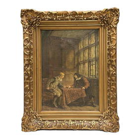
FRANK MOSS BENNETT (British, 1874 - 1953) The Winning Throw 1923Premier Auction Galleries4.3(329)See Sold PriceMar 09, 2024
GROUPING OF (19th c) BRITISH SATIRICAL PRINTS etcJohn McInnis Auctioneers,LLC4.6(502)See Sold PriceFeb 24, 2024
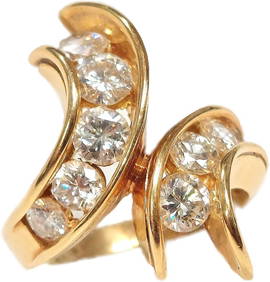
Cartier 3CTW Diamond Channel Set Signed Hand Numbered 18K Gold Bypass Ring 11gHess Fine Auctions4.5(197)See Sold PriceMar 02, 2024
Lucian Freud (British, 1922-2011) - Head of a ChildFreeman's | Hindman4.5(158)See Sold PriceFeb 27, 2024
David Hockney (British, b. 1937) - Gregory + ShinroFreeman's | Hindman4.5(158)See Sold PriceFeb 27, 2024
Elisabeth Frink (British, 1930-1993) - Harbinger Bird IFreeman's | Hindman4.5(158)See Sold PriceFeb 27, 2024
David Hockney (British, B. 1937) - Contre-Jour à ParisFreeman's | Hindman4.5(158)See Sold PriceFeb 28, 2024
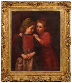
ALOYSIUS C. O'KELLY (BRITISH 1853-1936) OIL ON CANVASSoulis Auctions4.8(953)See Sold PriceFeb 24, 2024
ANTIQUE BRITISH FEMALE PAINTING BY FRED ALBERT SLOCOMBEAntique Arena Inc.4.5(852)See Sold PriceFeb 24, 2024
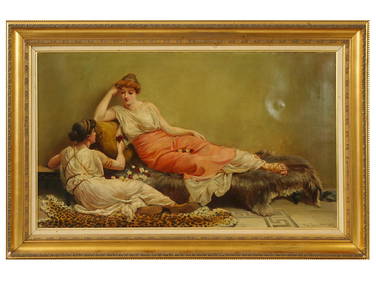
Karen D'Allaird (Pennsylvania, Contemporary) Large Oil on Canvas Painting, British White Cattle in aHoch LTD.4.5(73)See Sold PriceFeb 25, 2024
William WOOLLETT, R.A.A. (1735 - 1785) BritishPridham's Auctions & Appraisals4.7(223)See Sold PriceMar 02, 2024
James Pattison COCKBURN (1779 - 1848) BritishPridham's Auctions & Appraisals4.7(223)See Sold PriceMar 02, 2024


![[Maps] La Rochette, British Channel, 1794 (1 of 2)](https://p1.liveauctioneers.com/1306/149407/75466443_1_x.jpg?height=282&quality=70&version=1567670607)