ATLAS of ANTIENT GEOGRAPHY by SAMUEL BUTLER 1843John McInnis Auctioneers,LLC4.6(502)See Sold PriceFeb 24, 2024
18TH C. ANTIQUE MAP: FRENCH & INDIAN WAR, FRAMEDThomaston Place Auction Galleries4.4(386)See Sold PriceFeb 24, 2024
Rand McNally Railroad Map Cabinet w/ 21 Railroad MapsRail & Road Auctions4.6(165)See Sold PriceMar 08, 2024
Keith Haring - Ink on New York Map, Best Buddies, Inscribed, Signed, and DatedSapphire Auction Gallery4(67)See Sold PriceMar 02, 2024
LATE 17TH C. FRENCH MAP OF THE NEW WORLD BY ALEXIS-HUBERT JAILLOT (1632-1712)Thomaston Place Auction Galleries4.4(386)See Sold PriceFeb 24, 2024
Central Railroad of New Jersey Map of Sandy Hook Route-ca. 1903JM Hobby Supply and Railroad Artifact Auctions4.4(126)See Sold PriceFeb 24, 2024
Lot of Six Mixed Atlas Box Cars-HO Scale-New in BoxJM Hobby Supply and Railroad Artifact Auctions4.4(126)See Sold PriceFeb 25, 2024
Rand McNally/Santa Fe Railroad Map of Iowa-1912JM Hobby Supply and Railroad Artifact Auctions4.4(126)See Sold PriceFeb 24, 2024
NICOLAES VISSCHER (NETHERLANDS, 1618-1709) MAP OF THE NEW WORLDThomaston Place Auction Galleries4.4(386)See Sold PriceFeb 24, 2024
17TH C. WORLD MAP BY NICOLAES VISSCHER (NETHERLANDS, 1618-1709)Thomaston Place Auction Galleries4.4(386)See Sold PriceFeb 24, 2024
Lot of Six Mixed Atlas Cabooses-HO Scale-New in BoxJM Hobby Supply and Railroad Artifact Auctions4.4(126)See Sold PriceFeb 25, 2024
Sold28 c. 1867 book plate maps28 c. 1867 book plate maps including California; Mexico; Chili; Africa; Brazil; India; Palestine; Asia; Texas. Stains; tears; creases. 15 1/4 inches x 12 1/4 inches.See Sold Price
SoldUS Map and Book Plate MapUS Map and Book Plate Map. A New Map of Part of the United States by John Cary; c. 1819; Some foxing and toning; 21" x 23". Small Book Plate Map of North America; London: published by G. Virtue; 13" xSee Sold Price
Sold17 1800's book plate maps17 1800's book plate maps, most Rand McNally including Nova Scotia; Iowa; Wyoming; North America; Ancient Persian Empire; North Carolina; Kentucky; New Mexico. Foxing; creases; tears. Largest measuresSee Sold Price
Soldcollection of 19th c. lithographed bookplate mapscollection of 19th c. lithographed bookplate maps arranged in 6 bindersSee Sold Price
Sold19th Century Colored Map of NH & VT19TH CENTURY ATLAS BOOK PLATE MAP OF NEW HAMPSHIRE AND VERMONT- JOHNSON'S NH AND VT BY JOHNSON AND WARD- 26 1/2" X 17 3/4"- TONING, FOXING, CREASES, SMALL LOSSES TO EDGES AND IMPERFECTIONSSee Sold Price
SoldHerman Moll 1701 Map of PolandThis quality matted and framed hand-colored bookplate map of Poland is from 1701 bt Herman Moll. The map itself measures 12" tall X 8" across.See Sold Price
Sold1832 Hinton Map of Maine, NH, & Vermont1832 Hinton bookplate map of Maine, New Hampshire, & Vermont, creased as issued, framed & matted, image size 15" x 10"See Sold Price
SoldLOT ASSORTED BOOK PLATE COASTAL MAPS OF UNITED STATESLOT ASSORTED BOOK PLATE COASTAL MAPS OF UNITED STATES INCLUDING LONG ISLAND SOUND, BOSTON HARBOR, ETC 19TH CENTURYSee Sold Price
SoldHans Staden. 17th century book plates and map recounting his journey to Brasil in 1547 andHans Staden. 17th century book plates and map recounting his journey to Brasil in 1547 and subsequent capture by cannibalistic peoples. 21 total plates including map. 7.25 x 9.25in. Edge wear and lossSee Sold Price
SoldGroup of 20 antique (late 1800s) Book Plates and mapsLargest is 8.75x11. All are bagged and boarded. Pages from Abbotts Civil War.See Sold Price
SoldFrench Riviera.- Sella (Andreae, ex-libris owner) PlanNO RESERVE French Riviera.- Sella (Andreae, ex-libris owner) Plan de la Rade du Gourjan et des Isles Ste. Marguerite, collector's bookplate with map by Gorvel, showing from Cannes to Antibes, engravinSee Sold Price
SoldBook Plate and other mapsincluding; 17th c. (?) book page with Nubie (Africa) book plate, 1902 Rand McNally Middle East map (folded), Palestine map in Greeting from Israel card. map of South America, older map of Germany andSee Sold Price
SoldFOUR VOLUMES HISTORY OF ROME BY MOMMSEN.Volumes 1,2, 3, 4 by Theodor Mommsen. Published by Charles Scribner’s Sons, translated by Rev. William Dickson. Second volume includes folded map. Bookplate from Orlando Fleming Barnes Library.See Sold Price
SoldHAND COLORED MAP OF IRELAND BOOKPLATE18th century 16.75" X 20.75" Provenance: A New Haven, CT estateSee Sold Price
SoldK. De Vries, Trompe L'oeil paintingK. De Vries, Trompe L'oeil painting, K. De Vries (Dutch, 19th c.), Maps, prints and book plates, Trompe L'oeil, ink and watercolor on paper, signed and dated "K. De Vries - 18 Jaar - 2nd Ondering (181See Sold Price
SoldAfrica.- Churchill (Winston Spencer) My AfricanAfrica.- Churchill (Winston Spencer) My African Journey, first edition in book form, frontispiece and plates, 3 maps with routes in red, booksellers ink stamp to front free endpaper, 16pp. publishers'See Sold Price
Sold[Americana, Maps, Ohio, Lot of 3]Group of 3 books, two containing maps/plates, all printed in America, including" ** 1: Kilbourn. THE OHIO GAZETTEER… Columbus, 1826. 8th edition. 8vo. With folding engraved map of Ohio, hand-coloredSee Sold Price
Sold[Pennant (Thomas)] - Arctic Zoology,first edition , 3 vol. in 2 (including separately-published supplement bound into second vol.), engraved frontispiece, title vignettes, 2 folding maps and 23 plates, bookplate of Michael Tisdale to frSee Sold Price
SoldMexico.- Stephens (John L.) Incidents of Travel inMexico.- Stephens (John L.) Incidents of Travel in Yucatan, 2 vol., 2 folding frontispieces, plates and illustrations, folding map, occasional spotting, bookplate, later calf by G. Bellew, gilt, 1843See Sold Price
Sold1778 "The History of America" Robertson, Complete inWilliam Robertson "The History of America" in Two Volumes (Strahan, London 1778); second edition - 4to, Vol 2 front board is detached, - With 4 folding maps. Both include the bookplate of Abel AnthonySee Sold Price
SoldUring, Nathaniel A History of the Voyages and TravelsLondon W. Wilkins, for J. Peele, 1726. 8vo, 4 folding maps, contemporary panelled calf, bookplate of Lord Sandys, upper cover detached, foxing, folding map of Honduras laid down with repairs, some smaSee Sold Price
Sold2V T E LAWRENCE FIRST EDITIONS Revolt in the Desert2V T E LAWRENCE FIRST EDITIONS Revolt in the Desert 1927 First Printing Seven Pillars of Wisdom A Triumph 1935 First Trade Printing Illustrated Plates Maps Exploration Desert Middle East Book Details:See Sold Price
Land Book of the Borough of Manhattan, New York, 1930Map: Section 3 Plate 47 - Land Book of the Borough of Manhattan, City of New York Maker: GW Bromley & Co Origin: New York Date: 1930 Medium: Original lithograph with hand-coloring Sheet Size: 11.5 x 1See Sold Price
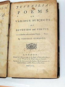
Thomas Gibbons Juvenalia 1750 Very Rare 1st Edition Full CalfLuis Porretta Fine Arts4.3(10)See Sold PriceMar 02, 2024
Autobiography Mark Rutherford Dissenting Minister 1st ed 1881 Scarce CalfLuis Porretta Fine Arts4.3(10)See Sold PriceMar 02, 2024
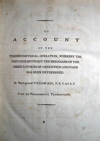
WILLIAM ROY Rare Navigation Book c1797 Trigonometry Between Paris & GreenwichLuis Porretta Fine Arts4.3(10)See Sold PriceMar 02, 2024
Archaeological Books - Morgan - Romano-British Mosaic PavementsTimeLine Auctions Ltd.4.5(183)See Sold PriceMar 06, 2024
Numismatic Books - De La Tour - Atlas de Monnaies GauloisesTimeLine Auctions Ltd.4.5(183)See Sold PriceMar 09, 2024
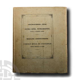
Numismatic Books - Svenska Kongl. Myntkabinettet i AngloSachsiska MyntTimeLine Auctions Ltd.4.5(183)See Sold PriceMar 09, 2024
Large lot of assorted prints. 18th-20th century. To include: North American and other maps, CivilTremont Auctions4.6(293)See Sold PriceFeb 25, 2024
HAMMOND'S READY REFERENCE HISTORICAL ATLAS 1920North American Artifact Auctions4.6(182)See Sold PriceApr 20, 2024
1722 POMPONII MELA De Situ Orbis ARMORIAL VELLUM BINDING antiqueJasper524.5(9.8k)See Sold PriceFeb 27, 2024
1729 GERMANIA SACRA by M. Hansiz BLINDSTAMPED PIGSKIN antique FOLIO w/ MAPJasper524.5(9.8k)See Sold PriceFeb 27, 2024
1704 DESCRIPTION OF ALL THE SEATS OF THE PRESENT WARS OF EUROPE antique w/ MAPSJasper524.5(9.8k)See Sold PriceFeb 27, 2024
LESSING ROSENWALD COLLECTION of ANTIQUE BOOKS CATALOG illustratedJasper524.5(9.8k)See Sold PriceFeb 27, 2024
Bible, English.- Bible (The): that is, the Holy Scriptures contained in the Olde and Newe Testament,Forum Auctions4.3(52)See Sold PriceFeb 29, 2024
Oxfordshire.- P[lot] (R[obert]) The Natural History of Oxford-shire, being an Essay toward theForum Auctions4.3(52)See Sold PriceFeb 29, 2024
Victorian Charity.- Royal Hospital for Incurables My Cottage Clients, 1886; Spence (Lewis) TheForum Auctions4.3(52)See Sold PriceFeb 29, 2024
Kent & Sussex.- Moss (W.G.) The History and Antiquities of the Town and Port of Hastings, 1824; andForum Auctions4.3(52)See Sold PriceFeb 29, 2024
Doughboys The Story of the AEF 1917-1918 HardcoverRapid Estate Liquidators and Auction Gallery4.5(1.1k)See Sold PriceFeb 29, 2024


![[Americana, Maps, Ohio, Lot of 3] (1 of 9)](https://p1.liveauctioneers.com/3532/176090/88636358_1_x.jpg?height=282&quality=70&version=1596942787)
![[Pennant (Thomas)] - Arctic Zoology, (1 of 1)](https://p1.liveauctioneers.com/410/75776/39589580_1_x.jpg?height=282&quality=70&version=1438250490)


![Oxfordshire.- P[lot] (R[obert]) The Natural History of Oxford-shire, being an Essay toward the (1 of 1)](https://p1.liveauctioneers.com/5458/319736/171654562_1_x.jpg?height=282&quality=70&version=1708010439)