ATLAS of ANTIENT GEOGRAPHY by SAMUEL BUTLER 1843John McInnis Auctioneers,LLC4.5(505)See Sold PriceFeb 24, 2024
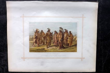
18TH C. ANTIQUE MAP: FRENCH & INDIAN WAR, FRAMEDThomaston Place Auction Galleries4.4(393)See Sold PriceFeb 24, 2024
Rand McNally Railroad Map Cabinet w/ 21 Railroad MapsRail & Road Auctions4.6(165)See Sold PriceMar 08, 2024
Keith Haring - Ink on New York Map, Best Buddies, Inscribed, Signed, and DatedSapphire Auction Gallery4.1(67)See Sold PriceMar 02, 2024
LATE 17TH C. FRENCH MAP OF THE NEW WORLD BY ALEXIS-HUBERT JAILLOT (1632-1712)Thomaston Place Auction Galleries4.4(393)See Sold PriceFeb 24, 2024
Central Railroad of New Jersey Map of Sandy Hook Route-ca. 1903JM Hobby Supply and Railroad Artifact Auctions4.4(127)See Sold PriceFeb 24, 2024
Lot of Six Mixed Atlas Box Cars-HO Scale-New in BoxJM Hobby Supply and Railroad Artifact Auctions4.4(127)See Sold PriceFeb 25, 2024
Rand McNally/Santa Fe Railroad Map of Iowa-1912JM Hobby Supply and Railroad Artifact Auctions4.4(127)See Sold PriceFeb 24, 2024
NICOLAES VISSCHER (NETHERLANDS, 1618-1709) MAP OF THE NEW WORLDThomaston Place Auction Galleries4.4(393)See Sold PriceFeb 24, 2024
17TH C. WORLD MAP BY NICOLAES VISSCHER (NETHERLANDS, 1618-1709)Thomaston Place Auction Galleries4.4(393)See Sold PriceFeb 24, 2024
Lot of Six Mixed Atlas Cabooses-HO Scale-New in BoxJM Hobby Supply and Railroad Artifact Auctions4.4(127)See Sold PriceFeb 25, 2024
WORLD. Mercator's projection. Ocean currents & shipping routes. BLACKIE 1882 mapTITLE/CONTENT OF MAP: 'The World on Mercators projection showing the courses of the chief ocean currents and the navigation tracks between the principal ports' DATE PRINTED: 1882 IMAGE SIZE: Approx 36See Sold Price
1882 Black World Map -- The World on Mercator's ProjectionTitle: 1882 Black World Map -- The World on Mercator's Projection Cartographer: A&C Black Year / Place: 1892, Edinburgh Map Dimension (in.): 16.8 X 22 in. This is an excellent world map, with color coSee Sold Price
Sold1882 World MapTitle: 1882 World Map Author: Blackie Medium: Ink on Paper Dimensions: 22"X15" Description: World map dated 1882. Drawn on Mercator's Projection. Part of the Comprehensive Atlas & Geography of the WorSee Sold Price
Pinkerton: The World on Mercators Projection, 1818Map: The World on Mercators Projection, 2 sheets Maker: John Pinkerton Date: c. 1818 Medium: Copperplate engraving Description: Two large double folio sheets comprising a world map on Mercator's ProjeSee Sold Price
SoldJohnson: Map of the World On Mercator's ProjectionMap Title: Map of the World On Mercator's Projection Publisher: Johnson And Ward, Alvin Jewett Johnson Publishing Date: 1861 Size: Double Folio - 15.25 x 24.00 inches Large, Handsome world map showingSee Sold Price
SoldMap of The World On Mercators Projection, 1848Map: The World On Mercators Projection Size: Folio – 11.00 H x 13.20 W Inches Publisher: Orr & Sons & J. Morrison 1848 London/Glasgow From Edinburgh General Atlas. Shows Texas labeled in the North ASee Sold Price
Colton: Map of the World On Mercator's Projection, 1855Map of the World On Mercator's Projection. JOSEPH HUTCHINS COLTON, 1855, Folio – 16.75 H x 25.50 W Inches, Large double-page world map with leaf of text. Shows major voyage routes of famous explorerSee Sold Price
WORLD IN HEMISPHERES. Equatorial Antarctic London planes. BLACKIE 1882 old mapTITLE/CONTENT OF MAP: 'The World in Hemispheres, on various projections; The world on the plane of the Equator; Southern Circumpolar regions; The world on the plane on the horizon of London' DATE PRINSee Sold Price
SoldIllustrated Van Loon Hand-Colored World Map, 1932Hendrik Willem Van Loon (Dutch-American, 1882-1944). Illustrated World Map, 1932. A hand colored outlined pictorial map of the world on Mercator projections with topographical relief shown pictoriallySee Sold Price
Illustrated Van Loon Hand-Colored World Map, 1932Hendrik Willem Van Loon (Dutch-American, 1882-1944). Illustrated World Map, 1932. A hand colored outlined pictorial map of the world on Mercator projections with topographical relief shown pictoriallySee Sold Price
Illustrated Van Loon Hand-Colored World Map, 1932**First Time At Auction** Hendrik Willem Van Loon (Dutch-American, 1882-1944). Illustrated World Map, 1932. A hand colored outlined pictorial map of the world on Mercator projections with topographicaSee Sold Price
The World on Mercator's Projection. Steamer routesTITLE/CONTENT OF MAP: 'Chart of the World on Mercator's Projection' Date: 1879 IMAGE SIZE: Approx 48.0 x 61.5cm, 19 x 24.25 inches (Large); Please note that this is a folding map. TYPE: Large, folio aSee Sold Price
Sold15 color maps, [Mid 19th C.].[World]. 15 color maps & plates. Folio. ++ Luft und Meeresstromiungen. Color Mercator projection of the world, surrounded by 12 b&w illustrations related to whaling and ocean wildlife. (Leipzig: F. A.See Sold Price
SoldBlackie 1882 Folio Print of Native Americans. USA"Aborginies of North America" Showing Sioux, Pawnee tribes etc. Color Printed Woodblock Published 1882 by Blackie & Son, London for "The Comprehensive Atlas & Geography of the World" by W. G. Blackie.See Sold Price
1796 A General Chart on Mercator’s Projection, toThis fascinating large map, a double folio in black and white is an Exploration Chart of the Eastern Hemisphere which clearly traces the routes of the voyages of the Houghton diplomatic embassy missioSee Sold Price
SoldGuthrie, William 1798 Map World of Mercators ProjectionCopper Engraved Map Published 1798, London for "A New Geographical, Historical and Commercial Grammar..." by William Guthrie. The maps are by John Senex, Thomas Kitchin and others. Folds as issued. PaSee Sold Price
Tallis World Map World on Mercator's Projection 1851Tallis World Map The World on Mercator's Projection 1851. T. Jefferys, 1757 London, 6 X 10.6 In.. This Is an Attractive and Charming Double Hemisphere Map, Colored, and Framed. it Is Set Against a BacSee Sold Price
SoldRapkin, John 1860 Map. World on Mercator's ProjectionSteel Engraved Map Published 1860 by The London Printing & Published Company, London for "The Royal Dictionary-Cyclopedia for Universal Reference" by Thomas Wright. Drawn & Engraved by John Rapkin. FoSee Sold Price
SoldRapkin, John 1860 Map. World on Mercator's ProjectionSteel Engraved Map Published 1860 by The London Printing & Published Company, London for "The Royal Dictionary-Cyclopedia for Universal Reference" by Thomas Wright. Drawn & Engraved by John Rapkin. FoSee Sold Price
SoldMap of World / Mercators Projection, 1868Original engraving from Johnson's Atlas of the World, 1868. Map includes vignette of Long Island & cities, towns and territories. Dimensions: 18" x 26". Shipping Domestic: Shipping rates are determindSee Sold Price
SoldMap World of Mercator's Projection John TallesMap World of Mercator's Projection John Talles - drawn & engraved by J. RapkinSee Sold Price
SoldTallis World Map World on Mercator's Projection 1851Tallis World Map The World on Mercator's Projection 1851 . J. Tallis, 1851 London, 10.5 X 14 In.. This Is a Decorative and Striking Steel Engraved World Map That Was Produced from the Same Plate UsedSee Sold Price
Map of World / Mercators Projection, 1868Original engraving from Johnson's Atlas of the World, 1868. Map includes vignette of Long Island & cities, towns and territories. Dimensions: 18" x 26". No Reserve Buyer pays shipping. This item shipsSee Sold Price
Map of World / Mercators Projection, 1868Original engraving from Johnson's Atlas of the World, 1868. Map includes vignette of Long Island & cities, towns and territories. Dimensions: 18" x 26". No Reserve Buyer pays shipping - ships from OceSee Sold Price
Blackie (Pub) 1882 Folio Print. Aborigines of South America. Brazil Patogonia Tierra del FuegoAlbion Auctions4.7(341)See Sold PriceMar 07, 2024
Blackie (Pub) 1882 Folio Print. Caucasian Race - Kurds, PersiansAlbion Auctions4.7(341)See Sold PriceMar 07, 2024
Blackie (Pub) 1882 Folio Print. Ethopian Race - Negros, KaffirsAlbion Auctions4.7(341)See Sold PriceMar 07, 2024
Blackie (Pub) 1882 Folio Print. Georgian, Circassian & Armenian RacesAlbion Auctions4.7(341)See Sold PriceMar 07, 2024
Blackie (Pub) 1882 Folio Print. Grecian Race - GreeceAlbion Auctions4.7(341)See Sold PriceMar 07, 2024
Blackie (Pub) 1882 Folio Print. Malay Race - Borneo, JavaAlbion Auctions4.7(341)See Sold PriceMar 07, 2024
Blackie (Pub) 1882 Folio Print. Mongol Race - Japanese. Samurai etcAlbion Auctions4.7(341)See Sold PriceMar 07, 2024
Blackie (Pub) 1882 Folio Print. Mongol Race - Lapps and Esquimaux. Canada ScandinaviaAlbion Auctions4.7(341)See Sold PriceMar 07, 2024
Blackie (Pub) 1882 Folio Print. North American Indians, USAAlbion Auctions4.7(341)See Sold PriceMar 07, 2024
Blackie (Pub) 1882 Folio Map. West USA - Pacific StatesAlbion Auctions4.7(341)See Sold PriceMar 01, 2024
Blackie (Pub) 1882 Folio Map. Chinese Empire and JapanAlbion Auctions4.7(341)See Sold PriceMar 01, 2024
Blackie (Pub) 1882 Folio Map. East Indies - Indian ArchipelagoAlbion Auctions4.7(341)See Sold PriceMar 01, 2024
Blackie (Pub) 1882 Folio Map. United States of North AmericaAlbion Auctions4.7(341)See Sold PriceMar 01, 2024
Blackie (Pub) 1882 Folio Map. West India Islands & Central AmericaAlbion Auctions4.7(341)See Sold PriceMar 01, 2024
Blackie (Pub) 1882 Folio Map. World on Mercators ProjectionAlbion Auctions4.7(341)See Sold PriceMar 01, 2024
Blackie (Pub) 1882 Pair of Folio Maps. Italy - North & SouthAlbion Auctions4.7(341)See Sold PriceMar 01, 2024


![15 color maps, [Mid 19th C.]. (1 of 0)](https://p1.liveauctioneers.com/dist/images/placeholder.jpg?height=282&quality=70)