ATLAS of ANTIENT GEOGRAPHY by SAMUEL BUTLER 1843John McInnis Auctioneers,LLC4.6(502)See Sold PriceFeb 24, 2024
18TH C. ANTIQUE MAP: FRENCH & INDIAN WAR, FRAMEDThomaston Place Auction Galleries4.4(386)See Sold PriceFeb 24, 2024
Rand McNally Railroad Map Cabinet w/ 21 Railroad MapsRail & Road Auctions4.6(165)See Sold PriceMar 08, 2024
Keith Haring - Ink on New York Map, Best Buddies, Inscribed, Signed, and DatedSapphire Auction Gallery4(67)See Sold PriceMar 02, 2024
LATE 17TH C. FRENCH MAP OF THE NEW WORLD BY ALEXIS-HUBERT JAILLOT (1632-1712)Thomaston Place Auction Galleries4.4(386)See Sold PriceFeb 24, 2024
Central Railroad of New Jersey Map of Sandy Hook Route-ca. 1903JM Hobby Supply and Railroad Artifact Auctions4.4(126)See Sold PriceFeb 24, 2024
Lot of Six Mixed Atlas Box Cars-HO Scale-New in BoxJM Hobby Supply and Railroad Artifact Auctions4.4(126)See Sold PriceFeb 25, 2024
Rand McNally/Santa Fe Railroad Map of Iowa-1912JM Hobby Supply and Railroad Artifact Auctions4.4(126)See Sold PriceFeb 24, 2024
NICOLAES VISSCHER (NETHERLANDS, 1618-1709) MAP OF THE NEW WORLDThomaston Place Auction Galleries4.4(386)See Sold PriceFeb 24, 2024
17TH C. WORLD MAP BY NICOLAES VISSCHER (NETHERLANDS, 1618-1709)Thomaston Place Auction Galleries4.4(386)See Sold PriceFeb 24, 2024
Lot of Six Mixed Atlas Cabooses-HO Scale-New in BoxJM Hobby Supply and Railroad Artifact Auctions4.4(126)See Sold PriceFeb 25, 2024
SoldBaldwin / Kitchin: Antique Maps Windward Islands, 1782Title/Content of Map: 1782 Baldwin / Kitchin Maps of the Windward Islands -- Island of St. Lucia [on sheet with] Island of St. Vincent [on sheet with] Island of Barbados [on sheet with] Chart of PartSee Sold Price
Baldwin/Kitchin: Antique Map of Windward Islands, 1782Map: 1782 Baldwin / Kitchin Maps of the Windward Islands -- Island of St. Lucia [on sheet with] Island of St. Vincent [on sheet with] Island of Barbados [on sheet with] Chart of Part of the Windward ISee Sold Price
Walker: Antique Map of Cape Verde Islands, 1782Title/Content of Map: 1782 Walker Map of Playa Bay, Cape Verde Islands -- Praya Bay in the Island of St. Iago Date Printed: 1782, London Cartographer: Walker (?) Size: 7.2 x 8.8 in. Condition: Very goSee Sold Price
Kitchin: Antique Map of Gulf of Mexico & Islands, 1821Map: Map of the Gulf of Mexico, the Islands and Countries Adjacent. Publication Date: 1821-08-16 Authors: T. CADELL, CROSS, J. after T. KITCHIN Publisher: T. CADELL Size: Oblong Quarto – 10.60 H x 1See Sold Price
SoldKitchin: Antique Map of Cape de Verde Islands, 1747Title of the Map: 'A Map or Chart of the Cape de Verde Islands' Cape Verde islands - Cabo Verde - Santo Antão - São Vicente - Santa Luzia - São Nicolau - Sal - Boa Vista - Maio - Santiago - Fogo -See Sold Price
SoldHarmsworth: Antique Map of the Caribbean, 1907TITLE/CONTENT OF MAP: 'West Indies and Central America : Industries and Communications; Inset maps of Panama Canal; Bermudas; Kingston; Havana; Windward Islands' DATE PRINTED: 1907 IMAGE SIZE: ApproxSee Sold Price
WEST INDIES 'The Leeward & Windward Islands' BarbadosTITLE/CONTENT OF MAP: 'The Leeward & Windward Islands; Inset Maps of Barbadoes; Trinidad ' DATE PRINTED: 1863 IMAGE SIZE: Approx 43.5 x 31.5cm, 17 x 12.25 inches (Large) TYPE: Antique map with originaSee Sold Price
Antique Map of Islands in the Atlantic by Baldwin andAntique map Islands of the Atlantic. This map was originally published by Baldwin and Cradock and copyrighted and published 1836 Society for the Diffusion of Useful Knowledge or S.D.U.K. map of the IsSee Sold Price
SoldOld map of Venezuela, Janssonius, Amstelodami, circaAntique map of Venezuela, Novae Andalusiae Janssonius, Amstelodami, circa 1650, map shows Venezuela with the Caribbean and Windward Islands, Aruba, Curacao, Bonaire, Los Roques, Isla la Orchila, IslaSee Sold Price
Mallet: Antique Map of the West Indies Caribbean, 1683Map Title: 'Isles Caribes' The map covers the islands between Puerto Rico and Trinidad. WEST INDIES Caribbean Windward Leeward Islands Barbados Pirates Date Printed: 1683 Image Size: Approx Overall paSee Sold Price
Sold William Faden 1795 Antique Map of Jamaica, Hispaniola Artist: Faden, William (British 1749-1836) Geographer to His Majesty and to H R H the Prince of Wales Title: A Chart of the Windward Passage between the Islands of Jamaica, Hispaniola and Cuba with thSee Sold Price
Walker: Antique Map of Playa Bay, Cape Verde IslandsTitle/Content of Map: 1782 Walker Map of Playa Bay, Cape Verde Islands -- Praya Bay in the Island of St. Iago Date Printed: 1782, London Cartographer: Walker (?) Size: 7.2 x 8.8 in. This is a very intSee Sold Price
SoldLOT (5) ENGRAVED MAPS INCLUDING MARTINIQUE, FROM PETITLOT (5) ENGRAVED MAPS INCLUDING MARTINIQUE, FROM PETIT ATLAS NATIONAL, 19TH CENTURY, 10 X 8"; WINDWARD ISLANDS (ST. LUCIA, ST. VINCENT AND BARBADOS), T. KITCHIN, 18TH CENTURY, 10 1/4 X 8"; ANTILLES ORSee Sold Price
SDUK: Antique Map of Nova Scotia & New Brunswick, 1844Title/Content of Map: 'NORTH AMERICA, SHEET I., NOVA SCOTIA WITH PART OF NEW BRUNSWICK AND LOWER CANADA' Quebec Prince Edward's Island. Date Printed: This map was originally published by Baldwin & CraSee Sold Price
SoldWEST INDIES Antilles Caribbean Cuba Bahamas WindwardTITLE/CONTENT OF MAP: 'THE ANTILLES OR WEST INDIA ISLANDS' DATE PRINTED: 1874 IMAGE SIZE: Approx 32.5 x 42.0cm, 12.75 x 16.5 inches (Large) TYPE: Antique steel engraved map with original outline handSee Sold Price
Hungary &c with Turky in Europe. Balkans Greece Ukraine. KITCHIN 1782 old mapTITLE/CONTENT OF MAP: 'Hungary &c with Turky in Europe' DATE PRINTED: 1782 IMAGE SIZE: Approx 18.0 x 23.0cm, 7 x 9 inches (Medium); Please note that this is a folding map. TYPE: Antique engraved coppeSee Sold Price
Hungary &c with Turky in Europe. Balkans Greece Ukraine. KITCHIN 1782 old mapTITLE/CONTENT OF MAP: 'Hungary &c with Turky in Europe' DATE PRINTED: 1782 IMAGE SIZE: Approx 18.0 x 23.0cm, 7 x 9 inches (Medium); Please note that this is a folding map. TYPE: Antique engraved coppeSee Sold Price
SoldKitchin: Antique Map of Mexico and New Spain, 1780Title/Content of Map: 1780 Kitchin Map of Mexico and New Spain in History of America Vol 3 - Carte du Mexique ou de la Nouvelle Espagne ou l'on Peut Suivre les Mouvemens des Costes included in L' HistSee Sold Price
SoldKitchin: Antique Map Gulf of Mexico / West Indies, 1778Map: Kaart van de Golf van Mexico, de Eilanden en de Aangrenzende Landschappen Cartographer: Thomas Kitchin Place & Date: Amsterdam / 1778 Size: 19 1/8" x 12 1/4" Condition: b&w; a beautifully preservSee Sold Price
SoldKitchin: Antique Map of West Indies, 1780Title/Content of Map: West Indes with Florida and Central America Date Printed: 1780-95 Cartographer: T. Kitchin Material/Medium: Paper Size: 19 1/2" x 14" Gulf of Mexico with Florida as an archipelagSee Sold Price
SoldNeele: Antique Map Islands of the Pacific Ocean, 1817Map: Map of the Islands in the Pacific Ocean Publication Date: 1817 Cartographer: NEELE, sc. Publisher: THOMSON'S NEW GENERAL ATLAS Size: Folio – 19.50 H x 23.75 W Inches From a famous Scottish atlaSee Sold Price
SoldKitchin: Antique Map of Africa, 1790Title/Content of Map: Africa from the Best Authorities. Date Printed: 1790 Cartographer: KITCHIN, T. Size (inches): 19x25.3 Illustration map from Guthrie's Geography. Rather detailed. Polar projectionSee Sold Price
SoldKitchin: Antique Map of Panama/Colombia/Ecuador, 1795Map: Map of the Countries on the South Sea, from Panama to Guayaquil Cartographer: Kitchin Place & Date: London / 1795 Size: 9 3/8" x 14 5/8" Condition: outline color; overall age toning; upper rightSee Sold Price
Kitchin: Antique Map of South Sea Countries, 1795Map: Map of the Countries on the South Sea, from Panama to Guayaquil Cartographer: Kitchin Place & Date: London / 1795 Size: 9 3/8" x 14 5/8" Condition: outline color; overall age toning; upper rightSee Sold Price
Vaillant - Hawaii: Stranding in the Sandwich Islands (Echouage aux Iles Sandwich). 43Trillium Antique Prints & Rare Books4.5(30)See Sold PriceFeb 24, 2024
Catesby, Folio - Tumble-Turds (Dung Beetle) with Canada Lily. Sup-11Trillium Antique Prints & Rare Books4.5(30)See Sold PriceFeb 24, 2024
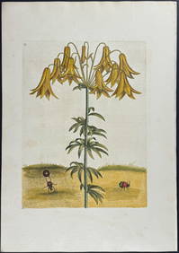
Catesby, Folio - American Goldfinch with Acacia. 1-43Trillium Antique Prints & Rare Books4.5(30)See Sold PriceFeb 24, 2024
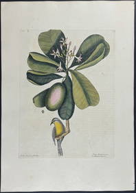
Catesby, Folio - Bahama Titmouse with Seven Years Apple. 1-59Trillium Antique Prints & Rare Books4.5(30)See Sold PriceFeb 24, 2024
Catesby, Folio - American Partridge with Attamusco Lily. Sup-12Trillium Antique Prints & Rare Books4.5(30)See Sold PriceFeb 24, 2024
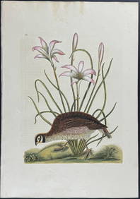
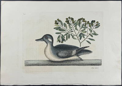
Catesby, Folio - Little Brown Duck with Soap-Wood. 1-98Trillium Antique Prints & Rare Books4.5(30)See Sold PriceFeb 24, 2024
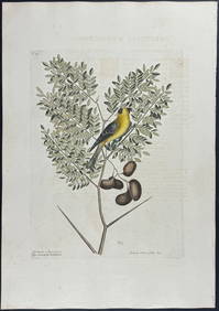
Catesby, Folio - Red Bellied Woodpecker & Hairy Woodpecker with Black Oak. 1-19Trillium Antique Prints & Rare Books4.5(30)See Sold PriceFeb 24, 2024
Geographical Statistical and Historical Map of the Windward IslandsJasper524.5(9.8k)See Sold PriceFeb 27, 2024
Coast & Islands between Cape Roxo. Guinea-Bissau & Bissagos. KITCHIN 1745 mapJasper524.5(9.8k)See Sold PriceFeb 28, 2024
Carte de la Guinée, contenant…'. Guinea & Cape Verde islands. BONNE 1771 mapJasper524.5(9.8k)See Sold PriceFeb 28, 2024
NORTH AFRICA BARBARY. Parts of Tripoli (Libya) & Egypt. Tribes. SDUK 1844 mapJasper524.5(9.8k)See Sold PriceFeb 28, 2024
Plan de la Baye & Isle d'Arguim'. Mauritania. Arguin island. BELLIN 1746 mapJasper524.5(9.8k)See Sold PriceFeb 28, 2024
Partie Occidentale de l’Afrique. West Africa coast Canary islands BONNE 1788 mapJasper524.5(9.8k)See Sold PriceFeb 28, 2024
CENTRAL AFRICA. Tanzania, Kenya, Angola, Zambia, Congo, Mozambique 1903 mapJasper524.5(9.8k)See Sold PriceFeb 28, 2024
NORTH AFRICA BARBARY. Parts of Tripoli (Libya) & Egypt. Tribes. SDUK 1848 mapJasper524.5(9.8k)See Sold PriceFeb 28, 2024
Guinea-Bissau. Kazegut women. Galinhas island, Bissagos archipelago 1746 printJasper524.5(9.8k)See Sold PriceFeb 28, 2024
Churchill & Nieuhof 1744 Map. Batavia Jakarta IndonesiaAlbion Auctions4.6(336)See Sold PriceMar 01, 2024
Blackie (Pub) 1882 Folio Map. West India Islands & Central AmericaAlbion Auctions4.6(336)See Sold PriceMar 01, 2024
Guthrie, William 1812 Antique Map. Spain and PortugalAlbion Auctions4.6(336)See Sold PriceMar 01, 2024
James Cook - Antique map Australia titled 'Gezigt van het Eil. Suffren'. Antique map of SuffrenProverde Auctions4.3(3)See Sold PriceFeb 28, 2024
Jacques Nicolas Bellin - Antique Map - Vue de la Rade de Tiniam, double antique coast view of theProverde Auctions4.3(3)See Sold PriceFeb 28, 2024