ATLAS of ANTIENT GEOGRAPHY by SAMUEL BUTLER 1843John McInnis Auctioneers,LLC4.5(505)See Sold PriceFeb 24, 2024
18TH C. ANTIQUE MAP: FRENCH & INDIAN WAR, FRAMEDThomaston Place Auction Galleries4.4(393)See Sold PriceFeb 24, 2024
Rand McNally Railroad Map Cabinet w/ 21 Railroad MapsRail & Road Auctions4.6(165)See Sold PriceMar 08, 2024
Keith Haring - Ink on New York Map, Best Buddies, Inscribed, Signed, and DatedSapphire Auction Gallery4(67)See Sold PriceMar 02, 2024
LATE 17TH C. FRENCH MAP OF THE NEW WORLD BY ALEXIS-HUBERT JAILLOT (1632-1712)Thomaston Place Auction Galleries4.4(393)See Sold PriceFeb 24, 2024
Central Railroad of New Jersey Map of Sandy Hook Route-ca. 1903JM Hobby Supply and Railroad Artifact Auctions4.4(127)See Sold PriceFeb 24, 2024
Lot of Six Mixed Atlas Box Cars-HO Scale-New in BoxJM Hobby Supply and Railroad Artifact Auctions4.4(127)See Sold PriceFeb 25, 2024
Rand McNally/Santa Fe Railroad Map of Iowa-1912JM Hobby Supply and Railroad Artifact Auctions4.4(127)See Sold PriceFeb 24, 2024
NICOLAES VISSCHER (NETHERLANDS, 1618-1709) MAP OF THE NEW WORLDThomaston Place Auction Galleries4.4(393)See Sold PriceFeb 24, 2024
17TH C. WORLD MAP BY NICOLAES VISSCHER (NETHERLANDS, 1618-1709)Thomaston Place Auction Galleries4.4(393)See Sold PriceFeb 24, 2024
Lot of Six Mixed Atlas Cabooses-HO Scale-New in BoxJM Hobby Supply and Railroad Artifact Auctions4.4(127)See Sold PriceFeb 25, 2024
Austrian Empire, Italian States, Turkey in Europe & Greece. MITCHELL 1869 mapTITLE/CONTENT OF MAP: 'Map of the Austrian Empire, Italian States, Turkey in Europe, and Greece // Maltese Islands' DATE PRINTED: 1869 IMAGE SIZE: Approx 29.0 x 36.0cm, 11.5 x 14.25 inches (Large) TYPSee Sold Price
Austrian Empire, Italian States, Turkey in Europe & Greece. MITCHELL 1869 mapTITLE/CONTENT OF MAP: 'Map of the Austrian Empire, Italian States, Turkey in Europe, and Greece // Maltese Islands' DATE PRINTED: 1869 IMAGE SIZE: Approx 29.0 x 36.0cm, 11.5 x 14.25 inches (Large) TYPSee Sold Price
SoldMitchell: Map of the Austrian Empire, 1879Map of Prussia and the German States. Map of the Austrian Empire, Italian States. Turkey in Europe and Greece. Maltese Islands. Mitchell, Samuel Augustus Jr. 1880. Two maps on either side of the sheetSee Sold Price
SoldTwo French Maps and Augustus MitchellAugustus Mitchell 1867 Map of The Austrian Empire Italian States. Turkey in Europe and Greece, Also This hand colored celestial map of the Stars and Constellations is a steel plate engraving, dating tSee Sold Price
SoldMap of Austrian Empire and ItalyHeading: (Maps) Author: Mitchell, Samuel Augustus Title: Map of the Austrian Empire, Italian States, Turkey in Europe & Greece Place Published: Philadelphia Publisher: Date Published: c.1870<See Sold Price
Map of the Austrian Empire, Italian States. Turkey inMap Title: Map of the Austrian Empire, Italian States. Turkey in Europe, and Greece. Publication Date: c1860Cartographer: MITCHELL, SAMUEL AUGUSTUS (JR.) Publisher: S. AUG. MITCHELL Size: 10.5 X 13.25See Sold Price
SoldSamuel Augustus Mitchell (1790-1868), "Austrian Empire,Samuel Augustus Mitchell (1790-1868), "Austrian Empire, Italian States, Turkey in Europe and Greece," 1860, hand colored, H.-12 1/4 in., W.- 15 3/8 in.See Sold Price
SoldLOT OF 10 MITCHELL WORLD MAPSLOT OF 10 MITCHELL WORLD MAPS. 1. 1860-SPAIN, FRANCE AND PORTUGAL. 2. 1860-AUSTRIAN EMPIRE, ITALIAN STATES, TURKEY AND GREECE. 3. 1874-AUSTRIAN EMPIRE, ITALIAN STATES, TURKEY AND GREECE. 4. 1860-NOVASee Sold Price
Sold1862 Map of the Austrian Empire, Italian States, TurkeyBy: Samuel A. Mitchell Jr. Date: 1862 (published) Philadelphia Dimensions: 10.5 x 13.25 inches (26.7 x 33.7 cm) This authentic, antique lithograph by Samuel Augustus Mitchell Jr. depicts the AustrianSee Sold Price
SoldSix 19th C. Maps of EuropeLot of six 19th C. maps of Central and Eastern Europe, including the Austrian Empire, Turkey, Russia, German State of Franconia, etc. Various dates and publishers.See Sold Price
TURKISH / OTTOMAN EMPIRE in Europe & Asia. Kingdom of Greece. SDUK 1856 mapTITLE/CONTENT OF MAP: 'TURKISH EMPIRE IN EUROPE AND ASIA WITH THE KINGDOM OF GREECE' Coloured in pink are the United States of the Ionian Islands as a separate entity from Greece and Turkey, a state aSee Sold Price
TURKISH / OTTOMAN EMPIRE in Europe & Asia. Kingdom of Greece. SDUK 1856 mapTITLE/CONTENT OF MAP: 'TURKISH EMPIRE IN EUROPE AND ASIA WITH THE KINGDOM OF GREECE' Coloured in pink are the United States of the Ionian Islands as a separate entity from Greece and Turkey, a state aSee Sold Price
OTTOMAN EMPIRE in Europe & Asia. Greece. British Ionian Islands. SDUK 1844 mapTITLE/CONTENT OF MAP: 'TURKISH EMPIRE IN EUROPE AND ASIA WITH THE KINGDOM OF GREECE' Coloured in pink are the United States of the Ionian Islands as a separate entity from Greece and Turkey, a state aSee Sold Price
OTTOMAN EMPIRE in Europe & Asia. Greece. British Ionian Islands. SDUK 1844 mapTITLE/CONTENT OF MAP: 'TURKISH EMPIRE IN EUROPE AND ASIA WITH THE KINGDOM OF GREECE' Coloured in pink are the United States of the Ionian Islands as a separate entity from Greece and Turkey, a state aSee Sold Price
OTTOMAN EMPIRE in Europe & Asia. Greece. British Ionian Islands. SDUK 1844 mapCAPTION PRINTED BELOW PICTURE: 'TURKISH EMPIRE IN EUROPE AND ASIA WITH THE KINGDOM OF GREECE' Coloured in pink are the United States of the Ionian Islands as a separate entity from Greece and Turkey,See Sold Price
SoldTURKISH / OTTOMAN EMPIRE in Europe & Asia. Kingdom ofTITLE/CONTENT OF MAP: 'TURKISH EMPIRE IN EUROPE AND ASIA WITH THE KINGDOM OF GREECE' Coloured in pink are the United States of the Ionian Islands as a separate entity from Greece and Turkey, a state aSee Sold Price
EUROPE. Shows Prussia British Ionian Islands Ottoman Empire. LOWRY 1863 mapTITLE/CONTENT OF MAP: 'Europe' The map shows the United States of the Ionian Islands as a separate entity from Greece and Turkey, a state and amical protectorate of the United Kingdom that existed betSee Sold Price
Sold2) STIELER & MITCHELL MAPS EUROPE, TURKEY & GREECE(lot of 2) Framed maps, including: (1) engraving with hand coloring on paper, German map of Europe, Turkey, Greece, and the Ionian Islands, from "Stielers Schul-Atlas," published by Justus Perthes, GoSee Sold Price
SoldEight Maps of EuropeLot of eight maps of Central Europe and German states, including Switzerland, the Austrian Empire, Prussia, Germany, Westphalia, etc. Various dates and publishers.See Sold Price
SoldGREECE Turkey in Europe British Ionian Islands CycladesTITLE/CONTENT OF MAP: 'Turkey in Europe Greece and the Ionian Islands' The map shows the United States of the Ionian Islands as a separate entity from Greece and Turkey, a state and amical protectoratSee Sold Price
GREECE & BALKANS. Aegean. British Ionian Islands.TITLE/CONTENT OF MAP: 'Turkey in Europe Greece and the Ionian Islands' The map shows the United States of the Ionian Islands as a separate entity from Greece and Turkey, a state and amical protectoratSee Sold Price
GREECE Turkey in Europe British Ionian Islands CycladesTITLE/CONTENT OF MAP: 'Turkey in Europe Greece and the Ionian Islands' The map shows the United States of the Ionian Islands as a separate entity from Greece and Turkey, a state and amical protectoratSee Sold Price
1869 Mitchell Map of Much of Western Europe -- XXXII Prussia the German States Holland & BelgiumTitle: 1869 Mitchell Map of Much of Western Europe -- XXXII Prussia the German States Holland & Belgium [verso] XXXIII France, Spain, Portugal and Belgium Cartographer: S Mithchell Year/Place: 1869, PSee Sold Price
Turchia d'Europa… Turkey in Europe. Balkans Greece Bulgaria &c. ZATTA 1783 mapTITLE/CONTENT OF MAP: 'Turchia d'Europa divisa nelle sue provincie e governi di nuova projezione' "Turkey in Europe divided into its provinces and governments". The Balkan states. Greece, Bulgaria, AlSee Sold Price
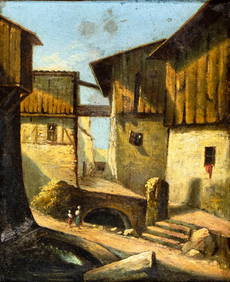
AFTER Hans Zatzka (Austria,Italy,1859-1945) oil painting antiqueBroward Auction Gallery4.7(292)See Sold PriceMar 10, 2024
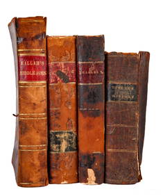
BOOKS on AMERICAN-EUROPEAN HISTORY & KING CHARLESJohn McInnis Auctioneers,LLC4.5(505)See Sold PriceFeb 24, 2024
Peter Todd Mitchell (1924 - 1988) Antique Italian Street Scene Modernist Original Rare Oil PaintingCurated Gallery Auctions4.6(131)See Sold PriceFeb 25, 2024
Large Antique 19th C Ottoman Diamond 14K Gold Drop NecklaceKavanagh Auctions4.6(311)See Sold PriceFeb 24, 2024
Rand McNally Railroad Map Cabinet w/ 21 Railroad MapsRail & Road Auctions4.6(165)See Sold PriceMar 08, 2024
ITALIAN LA RELCO EMPIRE STYLE ALBASTER & GILT METAL TORCHIERE FLOOR LAMPAustin Auction Gallery4.7(1.2k)See Sold PriceFeb 25, 2024
ATTR TO LIBERTY COMPANY ARTS CRAFTS COPPER MIRRORAntique Arena Inc.4.5(878)See Sold PriceFeb 24, 2024
Framed Pastel unsigned Empire State Building, NEW YORKBasel Auction House4.5(47)See Sold PriceFeb 24, 2024
Putnam - First Map of the State of Ohio by Rufus PutnamTrillium Antique Prints & Rare Books4.5(32)See Sold PriceFeb 24, 2024
Carey, pub. 1796 - Map of GeorgiaTrillium Antique Prints & Rare Books4.5(32)See Sold PriceFeb 24, 2024
Carey, pub. 1796 - Map of The State of South CarolinaTrillium Antique Prints & Rare Books4.5(32)See Sold PriceFeb 24, 2024
Carey, pub. 1796 - Map of KentuckyTrillium Antique Prints & Rare Books4.5(32)See Sold PriceFeb 24, 2024
Carey, pub. 1796 - Map of the Tennassee State formerly part of North Carolina (Tennessee)Trillium Antique Prints & Rare Books4.5(32)See Sold PriceFeb 24, 2024
Star Wars ESB Darth Vader's Star Destroyer MISBBruneau & Co. Auctioneers4.5(491)See Sold PriceFeb 24, 2024
Intricately Carved Lidded Chalice, Workshop of Johann RintBrunk Auctions4.6(470)See Sold PriceMar 07, 2024
NAZARIANTZ HRAND: (1886-1962)International Autograph Auctions Europe S.L.4.5(52)See Sold PriceMar 14, 2024