ATLAS of ANTIENT GEOGRAPHY by SAMUEL BUTLER 1843John McInnis Auctioneers,LLC4.5(505)See Sold PriceFeb 24, 2024
18TH C. ANTIQUE MAP: FRENCH & INDIAN WAR, FRAMEDThomaston Place Auction Galleries4.4(393)See Sold PriceFeb 24, 2024
Rand McNally Railroad Map Cabinet w/ 21 Railroad MapsRail & Road Auctions4.6(165)See Sold PriceMar 08, 2024
Keith Haring - Ink on New York Map, Best Buddies, Inscribed, Signed, and DatedSapphire Auction Gallery4.1(67)See Sold PriceMar 02, 2024
LATE 17TH C. FRENCH MAP OF THE NEW WORLD BY ALEXIS-HUBERT JAILLOT (1632-1712)Thomaston Place Auction Galleries4.4(393)See Sold PriceFeb 24, 2024
Central Railroad of New Jersey Map of Sandy Hook Route-ca. 1903JM Hobby Supply and Railroad Artifact Auctions4.4(127)See Sold PriceFeb 24, 2024
Lot of Six Mixed Atlas Box Cars-HO Scale-New in BoxJM Hobby Supply and Railroad Artifact Auctions4.4(127)See Sold PriceFeb 25, 2024
Rand McNally/Santa Fe Railroad Map of Iowa-1912JM Hobby Supply and Railroad Artifact Auctions4.4(127)See Sold PriceFeb 24, 2024
NICOLAES VISSCHER (NETHERLANDS, 1618-1709) MAP OF THE NEW WORLDThomaston Place Auction Galleries4.4(393)See Sold PriceFeb 24, 2024
17TH C. WORLD MAP BY NICOLAES VISSCHER (NETHERLANDS, 1618-1709)Thomaston Place Auction Galleries4.4(393)See Sold PriceFeb 24, 2024
Lot of Six Mixed Atlas Cabooses-HO Scale-New in BoxJM Hobby Supply and Railroad Artifact Auctions4.4(127)See Sold PriceFeb 25, 2024
SoldAttractive old color example of Blaeu’s map of AfricaAfricae nova descriptio. Willem Janszoon Blaeu (1571-1638). Engraved map with original hand color in full. Amsterdam, c. 1642-1663. 19 1/2 x 23 inches sheet, 29 1/2 x 32 1/2 inches framed. Nice old coSee Sold Price
SoldWILLEM JANSZOON BLAEU 1640 MAP OF COLUMBIA ETC."Terra Firma et Novum Regnum Granatense et Popayan" Fine old color example of Blaeu's map of Colombia, part of Ecuador extending south to Esmereldas, and Venezuela extending east nearly to Caracas. InSee Sold Price
1635 Asia Noviter DelineataBy: Willem Janszoon Blaeu Date: 1635 (published) Amsterdam Dimensions: 16 x 22 inches (40.5 x 56 cm) This is a fine old color example of Blaeu's decorative map of Asia. The map is ornamented with 9 viSee Sold Price
SoldHand Colored Map of the World, Willem BlaeuWillem Blaeu, (Dutch, 1571-1638) "Nova Totius Terrarum Orbis Geograhica ac Hydrographica" originally published 1606 Nice old color example of Blaeu's classic world map Approx. 19.5" x 25.5" (unframed)See Sold Price
SoldNova Accurata Japoniae Terrae Esonis Ac InsularumJan Jansson (1588-1664). Amsterdam, c. 1658. Engraved map with original hand color. 21 x 24 3/4 inches sheet, 30 1/2 x 34 1/4 inches framed. An attractive old color first state example of Johannes JanSee Sold Price
SoldAntique Map of the Republic of LuccaDESCRIPTION: An antique map of the Republic of Lucca, from Latin edition of Blaeu's Atlas. Fine old color example, with several cartouches, sea monster, sailing ships. Executed by Joan Blaeu, son of DSee Sold Price
Blaeu Engraving of Middlesex, Showing LondonBLAEU, Willem Janszoon (1571-1638). MIDDLE-SEXIA. Engraving with original hand color. Amsterdam, c. 1645. 20" x 24 1/8" sheet. Fine example of Blaeu's map of the old Middlesex County, including a marvSee Sold Price
MAP - Northwestern Africa. MerianNorthwestern Africa. Matthaus Merian, Fezzae et Marocchi Regna Africae Celeberrima, describebat Abrah: Ortelius, 1646 (circa). Hand Color. This is a small version of Blaeu's decorative map of MoroccoSee Sold Price
MAP, Northern Africa, SansonNorthern Africa. Nicolas Sanson, Partie de Barbarie, ou sont les Royaumes de Tunis, et Tripoli..., from Geographise en Historise Werelt Beschryving, 1683 (published). Hand Color. This attractive map cSee Sold Price
MAP, Western Africa, KeulenWestern Africa. Johannes van Keulen, Nieuwe Paskaert, van de Kust van Genehoa als Mede een Gedeelte van Gambia, Beginnende an C. Blanco tot C. Verde..., 1681 (circa). Hand Color. This attractive sea cSee Sold Price
MAP, Western Africa, SansonWestern Africa. Nicolas Sanson, La Guinee et Pays Circomvoisins; Tires de Mercator de Blommart &c., 1683 (circa). Hand Color. This attractive copper engraved map of the Guinea coast includes Guinea, BSee Sold Price
MAP, Northern Africa, Brion de la TourNorthern Africa. Brion de la Tour/Desnos, Partie de l'Afrique en deca de l'Equateur, Comprenau l'Egypte, la Barbarie, la Nigritie &c, 1766 (dated). Hand Color. An attractive map represents the regionSee Sold Price
MAP - Northwestern Africa. MercatorNorthwestern Africa, Morocco. Mercator/Hondius, Marocchi Regnum, 1613 (published). Hand Color. A very attractive small map of Morocco decorated with mountains, cities and forests filling the land. TheSee Sold Price
MAP - Northwestern Africa, Morocco. MercatorNorthwestern Africa, Morocco. Mercator/Hondius, Marocchi Regnum, 1613 (published). Hand Color. A very attractive small map of Morocco decorated with mountains, cities and forests filling the land. TheSee Sold Price
MAP, Northern Africa, TirionNorthern Africa. Isaac Tirion, Egipte, Libye, Marmarika en Cyrenaika, 1730 (circa). Hand Color. Attractive copper-engraved map with the Nile River prominently depicted with numerous cities along its bSee Sold Price
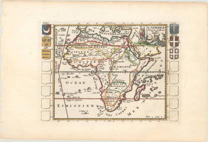
Handsome old color French Map of Africa by ValkL'Afrique divisee suivant l'estendue de ses principales parties... Gerard Valk (1652 - 1726). Engraved map with handcolor in part. Amsterdam, c.1700. 20 1/4 x 23 3/4 inches sheet, 30 1/2 x 34 inches fSee Sold Price
Sold1595 Turcici Imperii Descriptio Middle East MapGorgeous old color example of Ortelius' map of the Middle East, Turkey and the Eastern Mediterranean from Sicily to Cyprus, from the 1595 Latin edition of Ortelius' Theatrum Orbis Terrarum, the firstSee Sold Price
Speed Map of NottinghamSpeed, John (1551-1629). The Countie of Nottingham described... Engraved map with original hand color. London: Humble, 1610. 18 1/4" x 21 3/4" sheet. Attractive full color example of Speed's map of NoSee Sold Price
Sold1794 A New and General Map of the Middle DominionsBy: Lewis Evans published by Laurie & Whittle Date: 1794 (Published) London Dimensions: 18.75 x 25.6 inches (47.6 x 65.02 cm) This is a fine old color example of the Laurie & Whittle edition of LewisSee Sold Price
1794 A New and General Map of the Middle DominionsThis is a fine old color example of the Laurie & Whittle edition of Lewis Evans' landmark map published from the Surveys of Evans, Thomas Walker and Christopher Gist, 1750-51. Evans’ map isSee Sold Price
1794 A New and General Map of the Middle DominionsThis is a fine old color example of the Laurie & Whittle edition of Lewis Evans' landmark map published from the Surveys of Evans, Thomas Walker and Christopher Gist, 1750-51. Evans’ map isSee Sold Price
SoldGuiana Sive Amazonum RegioHendrick Hondius (1573–1650). Amsterdam: Hondius, c. 1636. 15 1/2 x 20 inches. A rare old color example of the English edition of Henricus Hondius’ map of the coast of South America, between the OSee Sold Price
Visscher, Moscow MapMoscoviae Pars Australis. Nicholas Visscher (1649-1702) .From Atlas Minor. Amsterdam, 1662. Engraved Map with Orginal Hand Color in full. 21 x 24 3/4 inches sheet. Fine example of Blaeu’s map of EasSee Sold Price
SoldGorgeous example of Seutter's map of AfricaAfrica Iuxta Navigationes et Observationes Recentissimas Aucta Correcta et in Sua Regna et Status Divisa, in Lucem Edita. Matthaus Seutter (1678-1757). Engraved Map with original hand color in part. ASee Sold Price
SECOND WORLD WAR AFRICA. European colonies & German mandates 1940 old mapJasper524.5(9.9k)See Sold PriceFeb 28, 2024
COLONIAL AFRICA. British East/Central/South Africa. Bechuanaland 1899 old mapJasper524.5(9.9k)See Sold PriceFeb 28, 2024
AFRICA. Pre 'Scramble for Africa'. BARTHOLOMEW 1876 old antique map plan chartJasper524.5(9.9k)See Sold PriceFeb 28, 2024
AFRIQUE. Africa. Decorative antique map/carte by Victor LEVASSEUR 1856 oldJasper524.5(9.9k)See Sold PriceFeb 28, 2024
COLONIAL AFRICA. British East/Central/South Africa. Bechuanaland 1897 old mapJasper524.5(9.9k)See Sold PriceFeb 28, 2024
COLONIAL AFRICA. British East/Central/South Africa. Bechuanaland 1895 old mapJasper524.5(9.9k)See Sold PriceFeb 28, 2024
AFRICA. Africa. Britannica 9th edition 1898 old antique vintage map plan chartJasper524.5(9.9k)See Sold PriceFeb 28, 2024
Pre-SECOND WORLD WAR AFRICA. European colonies & German mandates 1942 old mapJasper524.5(9.9k)See Sold PriceFeb 28, 2024
NORTH EAST AFRICA. Libya Egypt Sudan Ethiopia Ubangi-Shari Chad 1952 old mapJasper524.5(9.9k)See Sold PriceFeb 28, 2024
COLONIAL/TRIBAL AFRICA British East/Central/South Africa JOHNSTON 1892 old mapJasper524.5(9.9k)See Sold PriceFeb 28, 2024
COLONIAL AFRICA. British East/Central/South Africa. Bechuanaland 1900 old mapJasper524.5(9.9k)See Sold PriceFeb 28, 2024