ATLAS of ANTIENT GEOGRAPHY by SAMUEL BUTLER 1843John McInnis Auctioneers,LLC4.6(502)See Sold PriceFeb 24, 2024
18TH C. ANTIQUE MAP: FRENCH & INDIAN WAR, FRAMEDThomaston Place Auction Galleries4.4(386)See Sold PriceFeb 24, 2024
Rand McNally Railroad Map Cabinet w/ 21 Railroad MapsRail & Road Auctions4.6(165)See Sold PriceMar 08, 2024
Keith Haring - Ink on New York Map, Best Buddies, Inscribed, Signed, and DatedSapphire Auction Gallery4(67)See Sold PriceMar 02, 2024
LATE 17TH C. FRENCH MAP OF THE NEW WORLD BY ALEXIS-HUBERT JAILLOT (1632-1712)Thomaston Place Auction Galleries4.4(386)See Sold PriceFeb 24, 2024
Central Railroad of New Jersey Map of Sandy Hook Route-ca. 1903JM Hobby Supply and Railroad Artifact Auctions4.4(126)See Sold PriceFeb 24, 2024
Lot of Six Mixed Atlas Box Cars-HO Scale-New in BoxJM Hobby Supply and Railroad Artifact Auctions4.4(126)See Sold PriceFeb 25, 2024
Rand McNally/Santa Fe Railroad Map of Iowa-1912JM Hobby Supply and Railroad Artifact Auctions4.4(126)See Sold PriceFeb 24, 2024
NICOLAES VISSCHER (NETHERLANDS, 1618-1709) MAP OF THE NEW WORLDThomaston Place Auction Galleries4.4(386)See Sold PriceFeb 24, 2024
17TH C. WORLD MAP BY NICOLAES VISSCHER (NETHERLANDS, 1618-1709)Thomaston Place Auction Galleries4.4(386)See Sold PriceFeb 24, 2024
Lot of Six Mixed Atlas Cabooses-HO Scale-New in BoxJM Hobby Supply and Railroad Artifact Auctions4.4(126)See Sold PriceFeb 25, 2024
SoldAtlases.- British Isles.- Laurie (Richard H.) Laurie'sAtlases.- British Isles.- Laurie (Richard H., publisher) Laurie's New Traveller's Companion and Guide through the Roads of England and Wales, including Great part of Scotland; with a General Map, andSee Sold Price
SoldLaurie, Richard H. A New Elegant General Atlas.Laurie, Richard H. A New Elegant General Atlas. London: Printed for, and Published by, Richard Holmes Laurie. 38 mapas coloreados.See Sold Price
SoldRichard Holmes Laurie, PalaestinaRichard Holmes Laurie (British, 18th-19th c.), Palaestina By. Mons D'Anville of the Royal Academy of Belles Letters and of that of Sciences of Petersburg Secreatry to H.S.H. the Duke of Orleans IN JunSee Sold Price
SoldRichard Holmes Laurie (British, 18th-19th c.),Richard Holmes Laurie (British, 18th-19th c.), "Palaestina" by "Mons. D'Anville of the Royal Academy of Belles Letters and of that of Sciences of Petersburg Secretary to H.S.H. the Duke of Orleans inSee Sold Price
SoldLaurie (Richard H., publisher) The Maritime Flags ofLaurie (Richard H., publisher) The Maritime Flags of All Nations, hand-coloured engraved illustrations of maritime flags, laid on linen in 18 sections, several small tears to folds, housed in contempoSee Sold Price
SoldLondon.- Laurie (Richard H.) A Survey of the Estuary ofLondon.- Laurie (Richard H.) A Survey of the Estuary of the Thames and Medway, with the Coast from Thorpness to Dover, and the Rivers to London and Rochester [with] Survey of the Southern Channels ofSee Sold Price
SoldTWO BLUEBACK CHARTS PUBLISHED BY RICHARD H. LAURIE,TWO BLUEBACK CHARTS PUBLISHED BY RICHARD H. LAURIE, LONDON 1) "A General Chart of the Coasts of Brasil, &c. From the River Para to Buenos Ayres ...". Circa 1842. 38.5" x 77". 2) "The Southern Part ofSee Sold Price
TWO BLUEBACK CHARTS PUBLISHED BY RICHARD H. LAURIE,TWO BLUEBACK CHARTS PUBLISHED BY RICHARD H. LAURIE, LONDON 1) "A General Chart of the Coasts of Brasil, &c. From the River Para to Buenos Ayres ...". Circa 1842. 38.5" x 77". 2) "The Southern Part ofSee Sold Price
TWO BLUEBACK CHARTS PUBLISHED BY RICHARD H. LAURIE,TWO BLUEBACK CHARTS PUBLISHED BY RICHARD H. LAURIE, LONDON 1) "A General Chart of the Coasts of Brasil, &c. From the River Para to Buenos Ayres ...". Circa 1842. 38.5" x 77". 2) "The Southern Part ofSee Sold Price
SoldBLUEBACK CHART OF THE INDIAN AND PACIFIC OCEANS DatedBLUEBACK CHART OF THE INDIAN AND PACIFIC OCEANSDated 1880Made by the Hydrographic Office of the British Admiralty under Adm. Sir. F. Beaufort by Richard H. Laurie.Approx. 39.75" x 89.5".See Sold Price
SoldBritish Isles.- Blome (Richard) A Generall Mapp of theBritish Isles.- Blome (Richard) A Generall Mapp of the Isles of Great Brittaine, Designed by Monsieur Sanson..., engraving with hand-colouring on laid paper with fleur-de-lis watermark, sheet 410 x 52See Sold Price
SoldLAURIE, RICHARD HOLMES. View of the Rock and Town ofLAURIE, RICHARD HOLMES. View of the Rock and Town of Gibraltar. Hand-colored engraved view with British and other vessels in the foreground. "JWhatman/1827" watermarked wove paper, 12x18¾ inchesSee Sold Price
SoldLondon.- Laurie (Richard Holmes) Survey of the CountryNO RESERVE London.- Laurie (Richard Holmes) Survey of the Country Around London to the Distance of Thirty-Two Miles from St. Paul's, from Ware to Reigate and from Chatham to Taplow, title panels aboveSee Sold Price
SoldLaurie (R. H.) publisher. Orbis Veteris NotusLaurie (Richard Holmes) publisher. Orbis Veteris Notus,engraved map of the northern half of the western hemisphere in classical times, with original hand-colouring, 545 x 750mm., central vertSee Sold Price
SoldBritish Isles.- The Channel.- Searle (Richard William)British Isles.- The Channel.- Searle (Richard William) A correct Chart of the English Channel from the No.Foreland to [...] Brest on the coast of France, sea chart of the Channel with four inset mapsSee Sold Price
SoldBritish Isles.- The Channel.- Searle (Richard William)British Isles.- The Channel.- Searle (Richard William) A correct Chart of the English Channel from the No.Foreland to [...] Brest on the coast of France, sea chart of the Channel with four inset mapsSee Sold Price
Laurie Engraved Map of The US (Fredonia)Fredonia, or the United States of North America. Richard Holmes Laurie (c. 1755-1836). Engraved Map. London: 1830 (1833). 26 x 38 inches visible, 43 x 52 inches framed. Rare map of the United States,See Sold Price
SoldMAP, Guadeloupe, LaurieGuadeloupe. Richard Holmes Laurie, Guadaloupe, Done from Actual Surveys and Observations of the English, Whilst the Island Was in Their Possession, with Subsequent Improvements, 1830 (dated). Hand ColSee Sold Price
19th century Laurie and Whittles new map of all the19th century Laurie and Whittles new map of all the coach roads of England and Wales by Nathaniel Coltman, published London 1820 by Richard Holmes Laurie of Fleet Street, 80cm x 65cmSee Sold Price
Gray's New Map of Europe, 1880Gray's New Map of Europe O.w. Gray & Son, Gray, Frank A. 1880 Inset ethnographical map of Europe. British Isles on reverse. Quarto – 13.00 H x 15.25 W Inches Please note that this lot has a confidenSee Sold Price
Sold1796 MAP OF THE BRITISH ISLESItalian map. Caleographia Camerale. Engraving. Dimensions: (Frame) H 22.25"x W 16.75", (Sight) H 21.25" x W 15.75" Condition: Some creases to paper.See Sold Price
Thomson: Map of British Isles, 1815Map: British Isles Publication Date: 1815 Size: Elephant Folio – 23.60 H x 19.80 W Inches Authors: JOHN THOMSON & CO., THOMSON, JOHN Publisher: JOHN THOMSON & CO. Engraved for Thomson's New GeneralSee Sold Price
SoldThomson: Antique Map of British Isles, 1815Map: British Isles Publication Date: 1815 Cartographer: THOMSON, JOHN Publisher: JOHN THOMSON & CO. Size: Elephant Folio – 23.60 H x 19.80 W Inches Engraved for Thomson's New General Atlas. OriginalSee Sold Price
SoldCornell: Antique Map of the British Isles, 1856Title/Content of Map: British Isles Date Printed: 1857 Cartographer: CORNELL, SARAH SOPHIA Publisher: D. APPLETON 1857 NEW YORK Size: Folio – 12.3 H x 10 W Inches "designed to accompany Cornell's HiSee Sold Price
W H Hill (UK,early 20C) oil painting antiqueBroward Auction Gallery4.8(277)See Sold PriceMar 31, 2024
LATE 17TH C. FRENCH MAP OF THE NEW WORLD BY ALEXIS-HUBERT JAILLOT (1632-1712)Thomaston Place Auction Galleries4.4(386)See Sold PriceFeb 24, 2024
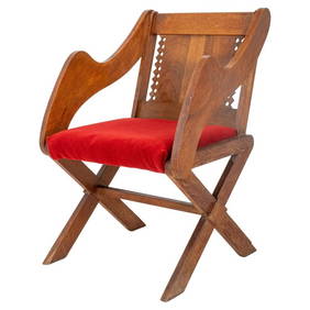
British Arts & Crafts Oak Glastonbury Chair, 19 C.Auctions at Showplace4.5(726)See Sold PriceMar 03, 2024
Portraits of American artists and notables. 20th century. To include: 1) Stow Wengenroth etching byTremont Auctions4.6(293)See Sold PriceFeb 25, 2024
Henry Renzius (1906-1974), Untitled, abstraction, 1956, Oil on canvasboard, 18" H x 24" WJohn Moran Auctioneers, Inc.4.7(453)See Sold PriceFeb 27, 2024
ATTR TO LIBERTY COMPANY ARTS CRAFTS COPPER MIRRORAntique Arena Inc.4.5(852)See Sold PriceFeb 24, 2024
ARTS AND CRAFTS HAMMERED LAMP BY FREDRICK FIFIELDAntique Arena Inc.4.5(852)See Sold PriceFeb 24, 2024
Follower of Arthur David McCormick (British, 1860-1943), "Drake's Drum," 20th c., H.- 20 in., W.- 16Crescent City Auction Gallery4.3(229)See Sold PriceMar 01, 2024
Chatelain - 3 Maps of the British Isles (England, Ireland, Scotland)Trillium Antique Prints & Rare Books4.5(30)See Sold PriceFeb 24, 2024
De Jode, Rare, pub. 1593 - Map of the British Isles [England, Scotland, Ireland] (Angliae Scotiae etTrillium Antique Prints & Rare Books4.5(30)See Sold PriceFeb 24, 2024
Map: A 17thC engraved map of the British Isles titled A Generall Mapp of the Isles of GreatClaydon Auctioneers Ltd4.3(125)See Sold PriceFeb 26, 2024
Collection of design and art books and magazinesToomey & Co. Auctioneers4.7(390)See Sold PriceFeb 29, 2024
Edwardian Flame Mahogany Corner CabinetBroken Arch Auction Gallery NCFL#93994.6(294)See Sold PriceMar 04, 2024
Richard Johnson (American/Louisiana, b. 1942/43), "Untitled," 1988, H.- 4 3/4 in., W.- 6 in.,Crescent City Auction Gallery4.3(229)See Sold PriceMar 08, 2024
Stanford, Edward 1901 Large Map. Geological Map of the British IslesAlbion Auctions4.6(336)See Sold PriceMar 01, 2024
Stanford, Edward 1901 Large Map. Hydrographical Map of the British IslesAlbion Auctions4.6(336)See Sold PriceMar 01, 2024
Stanford, Edward 1901 Large Map. Stereographical Map of The British IslesAlbion Auctions4.6(336)See Sold PriceMar 01, 2024
Henry H. PARKER (1858 - 1930) BritishPridham's Auctions & Appraisals4.7(223)See Sold PriceMar 02, 2024


![De Jode, Rare, pub. 1593 - Map of the British Isles [England, Scotland, Ireland] (Angliae Scotiae et (1 of 2)](https://p1.liveauctioneers.com/6581/319571/171593327_1_x.jpg?height=282&quality=70&version=1707853304)