ATLAS of ANTIENT GEOGRAPHY by SAMUEL BUTLER 1843John McInnis Auctioneers,LLC4.6(502)See Sold PriceFeb 24, 2024
18TH C. ANTIQUE MAP: FRENCH & INDIAN WAR, FRAMEDThomaston Place Auction Galleries4.4(386)See Sold PriceFeb 24, 2024
Rand McNally Railroad Map Cabinet w/ 21 Railroad MapsRail & Road Auctions4.6(165)See Sold PriceMar 08, 2024
Keith Haring - Ink on New York Map, Best Buddies, Inscribed, Signed, and DatedSapphire Auction Gallery4(67)See Sold PriceMar 02, 2024
LATE 17TH C. FRENCH MAP OF THE NEW WORLD BY ALEXIS-HUBERT JAILLOT (1632-1712)Thomaston Place Auction Galleries4.4(386)See Sold PriceFeb 24, 2024
Central Railroad of New Jersey Map of Sandy Hook Route-ca. 1903JM Hobby Supply and Railroad Artifact Auctions4.4(126)See Sold PriceFeb 24, 2024
Lot of Six Mixed Atlas Box Cars-HO Scale-New in BoxJM Hobby Supply and Railroad Artifact Auctions4.4(126)See Sold PriceFeb 25, 2024
Rand McNally/Santa Fe Railroad Map of Iowa-1912JM Hobby Supply and Railroad Artifact Auctions4.4(126)See Sold PriceFeb 24, 2024
NICOLAES VISSCHER (NETHERLANDS, 1618-1709) MAP OF THE NEW WORLDThomaston Place Auction Galleries4.4(386)See Sold PriceFeb 24, 2024
17TH C. WORLD MAP BY NICOLAES VISSCHER (NETHERLANDS, 1618-1709)Thomaston Place Auction Galleries4.4(386)See Sold PriceFeb 24, 2024
Lot of Six Mixed Atlas Cabooses-HO Scale-New in BoxJM Hobby Supply and Railroad Artifact Auctions4.4(126)See Sold PriceFeb 25, 2024
SoldAsher and Adams: Antique Map of North/South CarolinaTitle/Content of Map: 1872 Asher and Adams Map of North Carolina and South Carolina -- Asher & Adams' North Carolina, South Carolina Date Printed: 1872 New York Cartographer: Asher & Adams Size: 15.8See Sold Price
SoldAsher & Adams: Antique Map of Indian Territory, 1874Title/Content of Map: 1874 Asher & Adams Indian Territory Map -- Asher & Adams Indian Territory and Texas North West Portion Date Printed: 1874, New York Cartographer: Asher & Adams Size: 16.3 x 23.2See Sold Price
Asher & Adams: Antique Map of Europe, 1872Map: 1872 Asher & Adams Map of Europe -- Asher and Adams' Europe Cartographer: Asher & Adams Year / Place: 1872, New York Map Dimensions: 16 X 23 Condition: Very good. Very slight toning. A small spliSee Sold Price
Asher & Adams: Antique Map of Europe, 1872Title/Content of Map: 1872 Asher & Adams Map of Europe -- Asher and Adams' Europe Date Printed: 1872, New York Cartographer: Asher & Adams Size: 16 X 23 in. An attractive map of Europe showing rivers,See Sold Price
Asher & Adams: Antique Map of Europe, 1872Title/Content of Map: 1872 Asher & Adams Map of Europe -- Asher and Adams' Europe Date Printed: 1872, New York Cartographer: Asher & Adams Size: 16 X 23 in. An attractive map of Europe showing rivers,See Sold Price
Asher & Adams: Antique Map of Europe, 1872Map: 1872 Asher & Adams Map of Europe -- Asher and Adams' Europe Date Printed: 1872, New York Cartographer: Asher & Adams Size: 16 X 23 in. Condition: Very good. Very slight toning. A small split in lSee Sold Price
SoldBradford: Antique Map of North/South Carolina & GeorgiaTitle/Content of Map: North & South Carolina with Georgia by Bradford Date Printed: 1835 Cartographer: T.G. Bradford Material/Medium: Paper Size: 13" x 9 1/2" A Comprehensive Atlas Geographical, HistoSee Sold Price
Asher and Adams: Antique Map of Florida, 1872Title/Content of Map: 1872 Asher and Adams Map of Florida -- Asher & Adams' Florida Date Printed: 1872 New York Cartographer: Asher & Adams Size: 15.8 x 22.8 in. A very nice, large map of Florida. TheSee Sold Price
Asher and Adams: Antique Map of United States, 1872Title/Content of Map: 1872 Asher and Adams Map of United States -- Asher & Adams' United States and Territories Date Printed: 1872 New York Cartographer: Asher & Adams Size: 15.8 x 22.8 in. A very nicSee Sold Price
Asher and Adams: Antique Map of Virginia, West VirginiaTitle/Content of Map: 1872 Asher and Adams Map of Virginia, West Virginia, Maryland and Delaware -- Asher & Adams' Delaware, Maryland, Virginia, West Virginia Date Printed: 1872 New York Cartographer:See Sold Price
Asher and Adams: Antique Map of Maine, Parts of QuebecTitle/Content of Map: 1872 Asher and Adams Map of Maine and Parts of Quebec, Vermont and New Hampshire -- Asher & Adams Maine and Part of Quebec Date Printed: 1872 New York Cartographer: Asher & AdamsSee Sold Price
1872 Asher and Adams Antique Map of FloridaTitle/Content of Map: 1872 Asher and Adams Map of Florida -- Asher & Adams' Florida Date Printed: 1872 New York Cartographer: Asher & Adams Size: 15.8 x 22.8 in. A very nice, large map of Florida. TheSee Sold Price
Johnson: Antique Map of North & South Carolina, 1864Title/Content of Map: 1864 Johnson Map of North and South Carolina -- Johnson's North and South Carolina Date Printed: 1864, New York Cartographer: Johnson & Ward Size: 17.3 x 24 in. Condition: Very GSee Sold Price
Mitchell: Antique Map of North & South Carolina, 1869Title/Content of Map: North & South Carolina by Mitchell Date Printed: 1869 Cartographer: Augustus S. Mitchell Material/Medium: Paper Size: 15 1/3" x 12 1/2" Hand colored steel engraved Map. PublishedSee Sold Price
SoldAntique Johnson's Map of North & South Carolina.Antique Johnson's Map of North & South Carolina. An engraved, hand-colored map of North and South Carolina, printed by Johnson and Ward. Most likely the 1866 edition, based on the vignettes, the smallSee Sold Price
1872 Asher Adams Map of North and South CarolinaItem: 1872 Asher Adams Map of North and South Carolina Description: Excellent and highly detailed map of the Carolinas, showing the counties color-coded, towns, topography and railroads, which are namSee Sold Price
SoldAN ANTIQUE MAP, "Texas Western Portion," 1874,AN ANTIQUE MAP, "Texas Western Portion," 1874, hand colored engraving on paper, published by Asher & Adams. 22 3/4" x 16 1/2" Provenance: Property from a Fortune 500 Energy Company, Houston, Texas.See Sold Price
Sold1867 NORTH + SOUTH CAROLINA MAPOriginal antique map of North and South Carolina published by S. Augustus Mitchell, Jr. Includes inset maps of Charleston Harbor in the bottom left and a Plan of Charleston in the bottom right. It feaSee Sold Price
SoldNorth & South Carolina Early MapJohnson's North Carolina and South Carolina. Antique Map. A.J. Johnson, New York, c. 1866-70.. 18" x 26 1/2".See Sold Price
SoldHenry Mouzon 1775 1st State Map of North / South Carolina With Indian FrontiersImportant American Revolutionary War era map: AN ACCURATE MAP OF NORTH AND SOUTH CAROLINA WITH THEIR INDIAN FRONTIERS, First State, by Henry Mouzon and Others, published by Robert Sayer and John BenneSee Sold Price
6 assorted folding maps6 assorted folding maps including 1931 road map of Florida; New York to Buffalo turist guide; 1930 road map of North & South Carolina. Used condition; stains; tears; written on.See Sold Price
Sold6 assorted folding maps6 assorted folding maps including 1931 road map of Florida; New York to Buffalo turist guide; 1930 road map of North & South Carolina. Used condition; stains; tears; written on.See Sold Price
SoldAN ANTIQUE AMERICAN RECONSTRUCTION ERA MAP, "IndianAN ANTIQUE AMERICAN RECONSTRUCTION ERA MAP, "Indian Territory and Texas, Northwest Portion," 1874, hand colored engraving on paper, a page fragment, plate 54, published by Asher & Adams. 16 1/2" x 23See Sold Price
NORTH & SOUTH CAROLINA COAST Charleston Cape HatterasTITLE/CONTENT OF MAP: 'NORTH AMERICA, SHEET XI., Parts of North and South Carolina' DATE PRINTED: 1874 IMAGE SIZE: Approx 40.5 x 35.0cm, 15.75 x 13.75 inches (Large) TYPE: Antique steel engraved map wSee Sold Price
17TH C. ANTIQUE MAP SIEGE OF LA ROCHELLE, FRANCE, FRAMEDThomaston Place Auction Galleries4.4(386)See Sold PriceFeb 24, 2024
18TH C. ANTIQUE MAP: FRENCH & INDIAN WAR, FRAMEDThomaston Place Auction Galleries4.4(386)See Sold PriceFeb 24, 2024
Arrowsmith & Lewis - Map of the United StatesTrillium Antique Prints & Rare Books4.5(30)See Sold PriceFeb 24, 2024
Putnam - First Map of the State of Ohio by Rufus PutnamTrillium Antique Prints & Rare Books4.5(30)See Sold PriceFeb 24, 2024
Carey, pub. 1796 - Map of The State of South CarolinaTrillium Antique Prints & Rare Books4.5(30)See Sold PriceFeb 24, 2024
Carey, pub. 1796 - Map of KentuckyTrillium Antique Prints & Rare Books4.5(30)See Sold PriceFeb 24, 2024
Carey, pub. 1796 - Map of the Tennassee State formerly part of North Carolina (Tennessee)Trillium Antique Prints & Rare Books4.5(30)See Sold PriceFeb 24, 2024
De Jode, Rare, pub. 1593 - Map of the Middle East, Eastern Asia (Primae Partis Asiae accurataTrillium Antique Prints & Rare Books4.5(30)See Sold PriceFeb 24, 2024
De Jode, Rare, pub. 1593 - Map of Africa (Africae Vera Forma, et Situs)Trillium Antique Prints & Rare Books4.5(30)See Sold PriceFeb 24, 2024
Wilson - Carolina Parrot & Flycatchers. 26Trillium Antique Prints & Rare Books4.5(30)See Sold PriceFeb 24, 2024
Catesby, Folio - Tumble-Turds (Dung Beetle) with Canada Lily. Sup-11Trillium Antique Prints & Rare Books4.5(30)See Sold PriceFeb 24, 2024
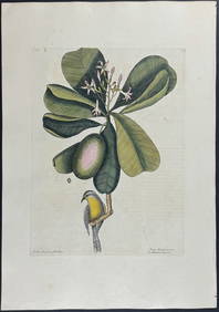
Catesby, Folio - American Goldfinch with Acacia. 1-43Trillium Antique Prints & Rare Books4.5(30)See Sold PriceFeb 24, 2024
Catesby, Folio - Bahama Titmouse with Seven Years Apple. 1-59Trillium Antique Prints & Rare Books4.5(30)See Sold PriceFeb 24, 2024
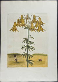
Catesby, Folio - American Partridge with Attamusco Lily. Sup-12Trillium Antique Prints & Rare Books4.5(30)See Sold PriceFeb 24, 2024
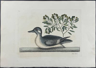
Catesby, Folio - Little Brown Duck with Soap-Wood. 1-98Trillium Antique Prints & Rare Books4.5(30)See Sold PriceFeb 24, 2024
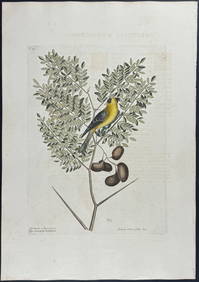
Catesby, Folio - Red Bellied Woodpecker & Hairy Woodpecker with Black Oak. 1-19Trillium Antique Prints & Rare Books4.5(30)See Sold PriceFeb 24, 2024
1822 MAP of NORTH & SOUTH AMERICA GEOGRAPHICAL STATISTICAL HISTORICAL antiqueJasper524.5(9.8k)See Sold PriceFeb 27, 2024
Cooke, George 1801 Antique Map. United States of AmericaAlbion Auctions4.6(336)See Sold PriceMar 01, 2024
Blackie (Pub) 1882 Pair of Folio Maps. Italy - North & SouthAlbion Auctions4.6(336)See Sold PriceMar 01, 2024
Francis McNally - Antique Map of Ohio, Indiana & KentuckyProverde Auctions4.3(3)See Sold PriceFeb 28, 2024
Antique Map of Poland, 1700 by Guillaume De Lisle, ParisAntiques Online Auctions4.6(407)See Sold PriceMar 14, 2024