ATLAS of ANTIENT GEOGRAPHY by SAMUEL BUTLER 1843John McInnis Auctioneers,LLC4.6(502)See Sold PriceFeb 24, 2024
18TH C. ANTIQUE MAP: FRENCH & INDIAN WAR, FRAMEDThomaston Place Auction Galleries4.4(386)See Sold PriceFeb 24, 2024
Rand McNally Railroad Map Cabinet w/ 21 Railroad MapsRail & Road Auctions4.6(165)See Sold PriceMar 08, 2024
Keith Haring - Ink on New York Map, Best Buddies, Inscribed, Signed, and DatedSapphire Auction Gallery4(67)See Sold PriceMar 02, 2024
LATE 17TH C. FRENCH MAP OF THE NEW WORLD BY ALEXIS-HUBERT JAILLOT (1632-1712)Thomaston Place Auction Galleries4.4(386)See Sold PriceFeb 24, 2024
Central Railroad of New Jersey Map of Sandy Hook Route-ca. 1903JM Hobby Supply and Railroad Artifact Auctions4.4(126)See Sold PriceFeb 24, 2024
Lot of Six Mixed Atlas Box Cars-HO Scale-New in BoxJM Hobby Supply and Railroad Artifact Auctions4.4(126)See Sold PriceFeb 25, 2024
Rand McNally/Santa Fe Railroad Map of Iowa-1912JM Hobby Supply and Railroad Artifact Auctions4.4(126)See Sold PriceFeb 24, 2024
NICOLAES VISSCHER (NETHERLANDS, 1618-1709) MAP OF THE NEW WORLDThomaston Place Auction Galleries4.4(386)See Sold PriceFeb 24, 2024
17TH C. WORLD MAP BY NICOLAES VISSCHER (NETHERLANDS, 1618-1709)Thomaston Place Auction Galleries4.4(386)See Sold PriceFeb 24, 2024
Lot of Six Mixed Atlas Cabooses-HO Scale-New in BoxJM Hobby Supply and Railroad Artifact Auctions4.4(126)See Sold PriceFeb 25, 2024
SoldAppleton's handbook with maps 1871Heading: Author: Appleton, D., and Co. Title: Appletons' Hand-book of American Travel. Western Tour. Embracing Eighteen Through Routes to the West and Far West, Tours of the Great Lakes and Rivers, aSee Sold Price
SoldAppleton's Hand-Book of American Travel, Western..''Appleton's Hand-Book of American Travel, Western Tour'', D. Appleton and Company, New York, 1871, 1st edition, all listed 7 maps and fold out map of Section East of Missouri River as frontispiece, xSee Sold Price
Appleton's Hand-Book of American Travel, Western..'Appleton's Hand-Book of American Travel, Western Tour'', D. Appleton and Company, New York, 1871, 1st edition, all listed 7 maps and fold out map of Section East of Missouri River as frontispiece, x,See Sold Price
Section East Of Missouri River MapMap To Accompany Appletons' Hand-book Of American Travel. Western Tour. Section East Of Missouri River. D. Appleton & Co., 1872, Folio – 15.60 H x 27.25 W Inches, Railroad map extending from New EngSee Sold Price
Sold1866 MAPS Atlas Appleton Companion Travel Handbook1866 MAPS Atlas Appleton Companion Travel Handbook Geography United States Color A rare and finely illustrated atlas companion by Richards and Appleton. This Civil War-era work features four enormousSee Sold Price
SoldAppletons' Hand-Book Western Tour 1872Appletons' Hand-Book Western Tour. 1872. D. Appleton and Company, New York. Frontis map only partial remains. Softcover. 7.5" x 5" x .75". Provenance: Estate of Russell Johanson, Ravenna Rare Books, SSee Sold Price
Map of States & Territories, West Of MissouriMap of States & Territories, West Of Missouri, to Accompany Appletons' Hand-Book Of American Travel, Western Tour. D. Appleton & Co., 1872, Folio – 16.00 H x 22.50 W Inches, Railroad map extending fSee Sold Price
Map of the Western States. Engraved to AccompanyTitle: Map of the Western States. Engraved to Accompany Appletons' Hand Book of American Travel Publication Date: 1849 Cartographer: WILLIAMS, W. Publisher: D. APPLETON Size: 12.1Height - 17.1Width EnSee Sold Price
SoldAMERICAN SOUTHERN STATES HISTORICAL TRAVEL VOLUMEAMERICAN SOUTHERN STATES HISTORICAL TRAVEL VOLUME "Appleton's Handbook of American Travel: The Southern Tour", 1866, published by D. Appleton & Co., New York, original cloth boards with impressed giltSee Sold Price
SoldRichards, T. Addison.Appletons' Illustrated Hand-BookRichards, T. Addison.Appletons' Illustrated Hand-Book of American Travel. The Eastern and Middle States, and the British Provinces. Illustrated, including 29 maps on 21 sheets. 8vo, publisher's gilt-lSee Sold Price
Sold(4) BOOKS ABOUT THE SOUTHERN UNITED STATES(1) "Appleton's Hand-Book of American Travel - Southern Tour", compiled and edited by Charles H. Jones; revised for season 1876; New York: D. Appleton and Co. and London: Sampson ad Low, Son and MarstSee Sold Price
SoldJones (Charles H., compiler and editor)Jones (Charles H., compiler and editor) Appleton's Hand-Book of American Travel. Southern Tour, folding lithographed map and 2 folding plans, margins browned, ink signature on front pastedown,See Sold Price
Sold'Appletons'' Illustrated Hand-Book, 1857.[U.S. Travel Guide]. 'Appletons' Illustrated Hand-Book Of American Travel. NY: D. Appleton & Co., 1857. 12mo. 420,(24 ads)pp. Original cloth. 35 maps on 30 folding sheets. Sabin 70960. Sold as is, notSee Sold Price
Appletons' Illustrated Hand Book of American TraveAppletons' Illustrated Hand Book of American Travel, 1857, 5 x 8 5 x 8See Sold Price
SoldLife of General Robert E. Lee NY: Appleton 1871Cooke, John Esten. Life of General Robert E. Lee. NY: Appleton, 1871 with Illustrations, Portraits and Maps.See Sold Price
SoldWestward By Rail (Publication)San Francisco,CA - 1871 - By W. F. Rae. Published by D. Appleton & Company, 549 & 551 Broadway, New York, 1871. Softcover, 391 pages including map. Much of the cover of the spineSee Sold Price
SoldD. Appleton & Co., Publishers (American, 19th Century)D. Appleton & Co., Publishers (American, 19th Century) Railway Map of the United States and Canada. Engraving by Rae Smith with hand-coloring, 1871, unframed 25 1/4" x 28"See Sold Price
Sold2 vols. Darwin. Descent of Man. 1st US ed. 1871.[First Edition] 2 volumes. Darwin, Charles. Descent of Man. Appleton, New York, 1871. First American Edition. 8vo. [4], vi, 409 pp., [2] ; 436 pp., [10]. First issue with errata present in Vol. II. AdSee Sold Price
Descent of Man, and Selection in Relation to Sex. InCharles DARWIN. Descent of Man, and Selection in Relation to Sex. In Two Volumes. New York: D. Appleton and Company, 1871. First American edition. 8vo., v. 409., [2] leaveSee Sold Price
SoldNEW YORK CITY GUIDE MAPS 1871 AND 1879Edsall's 1879 New York City Guide Map for Pocket Use' published by Van Kleeck, Clark & Co., double sided, measures 28 x 21 unfolded, very good with light toning. And 'Map of New York and Vicinity', 18See Sold Price
SoldHardy: Antique New York City Fire Department Map, 1871Title: 1871 Hardy New York City Fire Department Map -- Map of the Boundaries of the Fire Department of the City of New York Made Under the Direction of the Fire Commissioners Cartographer: J Hardy YeaSee Sold Price
Hardy: Antique New York City Fire Department Map, 1871Title/Content of Map: 1871 Hardy New York City Fire Department Map -- Map of the Boundaries of the Fire Department of the City of New York Made Under the Direction of the Fire Commissioners Date PrintSee Sold Price
SoldTexas immigration booklet with map, 1871Heading: Author: Brady, William Title: Glimpses of Texas: Its Divisions, Resources, Development and Prospects Place Published: Houston Publisher:[A. C. Gray, printers] Date Published: 1871See Sold Price
Hardy: New York City Fire Department Map, 1871Map: 1871 Hardy New York City Fire Department Map -- Map of the Boundaries of the Fire Department of the City of New York Made Under the Direction of the Fire Commissioners Cartographer: J Hardy YearSee Sold Price
Crawfordsville and Southwestern RY First Mortgage Bond Prospectus Book-1872JM Hobby Supply and Railroad Artifact Auctions4.4(126)See Sold PriceFeb 24, 2024
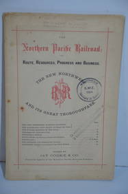
Northern Pacific RR Routes Resources Progress and Business Book-February 1871JM Hobby Supply and Railroad Artifact Auctions4.4(126)See Sold PriceFeb 24, 2024
1885 CIVIL WAR 1ed Famous Memoirs US Grant Sheridan Sherman 6v RARE LOT MapsSchilb Antiquarian Rare Books4.8(421)See Sold PriceMar 10, 2024
1888 Hand Book of the Pennsylvania Lines Containing Maps of Principal Cities - First EditionRail & Road Auctions4.6(165)See Sold PriceMar 07, 2024
Rand McNally Railroad Map Cabinet w/ 21 Railroad MapsRail & Road Auctions4.6(165)See Sold PriceMar 08, 2024
1887 Appletons' General Guide to the United State and Canada Part IIRail & Road Auctions4.6(165)See Sold PriceMar 08, 2024
FORT LARAMIE NATIONAL MONUMENT, WYOMING 1954North American Artifact Auctions4.6(182)See Sold PriceApr 20, 2024
ANDREW RAYMOND JANSON OIL ON BOARD ADIRONDACKSCharleston Estate Services Ltd.4.5(58)See Sold PriceMar 03, 2024
Willem Blaeu, Etc. 17th C. Antiquarian Maps, 2Auctions at Showplace4.5(726)See Sold PriceMar 17, 2024
Putnam - First Map of the State of Ohio by Rufus PutnamTrillium Antique Prints & Rare Books4.5(30)See Sold PriceFeb 24, 2024
Edmund G.M. MORRIS (1871 - 1913) CanadianPridham's Auctions & Appraisals4.7(223)See Sold PriceMar 02, 2024
ANTIQUE ILLUSTRATED HANDBOOK OF GEOGRAPHY AND TRAVEL IN ASIA, VOLUME 2, 1896NY Elizabeth 4.3(84)See Sold PriceMar 03, 2024
Charles Antoine Lemaire (1800 - 1871) - Set of 4 Botanical Prints - Rose - Camellia Duchesse deProverde Auctions4.3(3)See Sold PriceFeb 28, 2024
Charles Antoine Lemaire (1800 - 1871) - Set of 4 Botanical Prints - Brassavola fragias - BerberioProverde Auctions4.3(3)See Sold PriceFeb 28, 2024
Charles Antoine Lemaire (1800 - 1871) - Set of 6 Botanical Prints - Ismene amancaes - Camellia FannyProverde Auctions4.3(3)See Sold PriceFeb 28, 2024
Charles Antoine Lemaire (1800 - 1871) - Set of 6 Botanical Prints - Alocasia - Calathea roseopicta -Proverde Auctions4.3(3)See Sold PriceFeb 28, 2024
Charles Antoine Lemaire (1800 - 1871) - Set of 8 Botanical Prints - Alstraemeria Argento - CayaponiaProverde Auctions4.3(3)See Sold PriceFeb 28, 2024
Charles Antoine Lemaire (1800 - 1871) - Set of 8 Botanical Prints - Embothrium coccineum -Proverde Auctions4.3(3)See Sold PriceFeb 28, 2024
NERVOUS SYSTEM. 7 American imprints on the pathology of the nervous system.Bonhams4.1(305)See Sold PriceJun 18, 2024