ATLAS of ANTIENT GEOGRAPHY by SAMUEL BUTLER 1843John McInnis Auctioneers,LLC4.6(502)See Sold PriceFeb 24, 2024
18TH C. ANTIQUE MAP: FRENCH & INDIAN WAR, FRAMEDThomaston Place Auction Galleries4.4(386)See Sold PriceFeb 24, 2024
Rand McNally Railroad Map Cabinet w/ 21 Railroad MapsRail & Road Auctions4.6(165)See Sold PriceMar 08, 2024
Keith Haring - Ink on New York Map, Best Buddies, Inscribed, Signed, and DatedSapphire Auction Gallery4(67)See Sold PriceMar 02, 2024
LATE 17TH C. FRENCH MAP OF THE NEW WORLD BY ALEXIS-HUBERT JAILLOT (1632-1712)Thomaston Place Auction Galleries4.4(386)See Sold PriceFeb 24, 2024
Central Railroad of New Jersey Map of Sandy Hook Route-ca. 1903JM Hobby Supply and Railroad Artifact Auctions4.4(126)See Sold PriceFeb 24, 2024
Lot of Six Mixed Atlas Box Cars-HO Scale-New in BoxJM Hobby Supply and Railroad Artifact Auctions4.4(126)See Sold PriceFeb 25, 2024
Rand McNally/Santa Fe Railroad Map of Iowa-1912JM Hobby Supply and Railroad Artifact Auctions4.4(126)See Sold PriceFeb 24, 2024
NICOLAES VISSCHER (NETHERLANDS, 1618-1709) MAP OF THE NEW WORLDThomaston Place Auction Galleries4.4(386)See Sold PriceFeb 24, 2024
17TH C. WORLD MAP BY NICOLAES VISSCHER (NETHERLANDS, 1618-1709)Thomaston Place Auction Galleries4.4(386)See Sold PriceFeb 24, 2024
Lot of Six Mixed Atlas Cabooses-HO Scale-New in BoxJM Hobby Supply and Railroad Artifact Auctions4.4(126)See Sold PriceFeb 25, 2024
Antique Map Print - Western Asia - Judea - Holy Land - Dead Sea - VaugondyTitle/Content: Antique Map Print - Western Asia - Judea - Holy Land - Dead Sea - Vaugondy Date: 1806 Material: Paper Dimensions: 12” x 9” inches / 31,5 cm x 24 cm Description: Original 180See Sold Price
Antique Map Print - Western Asia - Judea - Holy Land - Palestine - VaugondyTitle/Artist: Antique Map Print - Western Asia - Judea - Holy Land - Palestine - Vaugondy Date: 1778 Material: Paper Dimensions: 31,5 cm x 24 cm Additional Information: Original 1778 copper-engraved mSee Sold Price
Antique Map Print - Asia - Holy Land - Judea - Palestine - Vaugondy - 1806Title: Antique Map Print - Asia - Holy Land - Judea - Palestine - Vaugondy - 1806 Date: 1806 Material: Paper Dimensions: 12” x 9” inches / 31,5 cm x 24 cm Descritpion: Original 1806 copperSee Sold Price
Soldde Vaugondy: Antique Map of Judea / Holy Land, 1795Title/Content of Map: Judée ou Terre Sainte Cartographer: Robert de Vaugondy/Lamarche Place & Date: Paris / 1795 Size: 8 1/2" x 9 5/8" Condition: outline color; overall age toning, spotting and someSee Sold Price
SoldBrockhaus (Pub) 1890's Mixed Lot of 12 Antique MapsIncl Balkans, Central Asia, Asia Political, Holy Land/Persia, European Railway Development, German Republic Politica, Denmark/Sweden, North France, Historial Map of France, History of the Mapping of tSee Sold Price
Brockhaus (Pub) 1890's Mixed Lot of 12 Antique MapsIncl Balkans, Central Asia, Asia Political, Holy Land/Persia, European Railway Development, German Republic Politica, Denmark/Sweden, North France, Historial Map of France, History of the Mapping of tSee Sold Price
Map of the Holy Land Divided to Judea and Israel, theThe Holy Land divided into the kingdoms of Israel and Judea. Subdivided into six provinces and the twelve tribes. Shoreline from Sidon through Rhinocolura, through the Dead Sea in the south. Nice coppSee Sold Price
Bartholomew, John 1922 Lot of 4 Maps. Holy LandIncl Persia, Palestine, Asia Minor/Syria/Mesopotamia, and South Western Asia. Large Lithograph Maps Published 1922 by The Times, London for "The Times Survey Atlas of the World" Maps by John George BaSee Sold Price
Bartholomew, John 1922 Lot of 4 Maps. Holy LandIncl Persia, Palestine, Asia Minor/Syria/Mesopotamia, and South Western Asia. Large Lithograph Maps Published 1922 by The Times, London for "The Times Survey Atlas of the World" Maps by John George BaSee Sold Price
Bartholomew, John 1922 Lot of 4 Maps. Holy LandIncl Persia, Palestine, Asia Minor/Syria/Mesopotamia, and South Western Asia. Large Lithograph Maps Published 1922 by The Times, London for "The Times Survey Atlas of the World" Maps by John George BaSee Sold Price
SoldJaillot: Antique Map of Judea or the Holy Land, 1709Map: Iudea seu Terra Sancta Cartographer: Jaillot Place & Date: Paris / 1709 Size: 25 1/2" x 18 1/4" Condition: outline color (map), full color (cartouches); light overall age toning, otherwise a beauSee Sold Price
Antique Map Print - Asia - Indostan - India - China - Tartary - Vaugondy - 1806Title/Artist: Antique Map Print - Asia - Indostan - India - China - Tartary - Vaugondy - 1806 Date: 1806 Material: Paper Dimensions: 31,5 cm x 24 cm Additional Information: Original 1778 copper-engravSee Sold Price
SoldLot of three antique maps of the Holy LandLot of three antique maps of the Holy Land and the Mediterranean Sea from the 18th and 19th centuries. Dimensions: 43x34 - 33x48 cm, foxing, minor flaws.See Sold Price
Antique Map Print - Asia - Geography of Asian Turkey and Persia - Vaugondy 1806Title: Antique Map Print - Asia - Geography of Asian Turkey and Persia - Vaugondy 1806 Description: Original 1806 copper-engraved map by Robert de Vaugondy on the Mercator projection. Derived from "NoSee Sold Price
Robert de Vaugondy: Map of Judea, the Holy Land, 1657Carte de la Terre de Canaan ou Terre Promise a Abraham et la Posterite dans Laquelle on a Trace la fortie du people…. By: Robert de Vaugondy Date: 1657 (circa) Paris Dimensions: 18.75 x 23 inches (4See Sold Price
Sold1875 Map "Turkey in Asia The Holy LandTurkey in Asia(Biblical Regions) The Holy Land and its Border" after A.Fullerton & Co Edinburgh 21 x 17. Beautifully colored antique map of Turkey in Asia(Biblical Regions). Circa: 1875. Unframed. ComSee Sold Price
SoldAntique Map of the Holy Land LotLot of 3 antique maps of the Holy Land: (1). "Judea seu Tarra Sancta quae Hebraeorum sive Israelitarum … Geographicis Gulielmi". Latin. Hand-colored copperplate engraving. By Guillaume Sanson. FSee Sold Price
SoldAntique Map of the Holy Land \\\"Terra Sancta quae inAntique Map of the Holy Land \\\"Terra Sancta quae in Sacris Terra Promissionis Olim Palestina\\\", Janszoon Blaeu, 1629Includes large cartouche, two compass roses, sea monsters and other embellishmenSee Sold Price
SoldGeology 1833-64 Lot of 6 Maps and PrintsMaps mosly of Europe and British Isles but one plate showing Asia/Mexico/Holy Land. Copper Engraved Maps Published 1817-45, London for "Encyclopaedia Metropolitana" by Samuel Taylor Coleridge el al anSee Sold Price
SoldJOHANNES JANSSONIUS (DUTCH, 1588-1664) MAP OF THE HOLYJOHANNES JANSSONIUS (DUTCH, 1588-1664) MAP OF THE HOLY LAND, title to top margin "Pars maxima TRIBUS IUDA Versus orientem", depicting the southern end of the Dead Sea, with inset map to upper right coSee Sold Price
Collection of [9] ancient geographic maps. Asia, Holy* Orbis Romani Pars Orientalis. Large map, hand painted during the era of printing, includes Turkey, the Black Sea, the Holy Land and Egypt. 18th century. 55x70 cm. * Yabula Prima Gua Totius OrbSee Sold Price
1875 "Turkey is Asia(Biblical Regions) The Holy Land anTurkey is Asia(Biblical Regions) The Holy Land and its Border" after A.Fullerton & Co Edinburgh 21 x 17. Beautifully colored antique map of Turkey in Asia(Biblical Regions). Circa: 1875. Unframed. ComSee Sold Price
SoldRuscelli (G) Soria Et Terra Santa NuovaRuscelli (Girolamo) Soria Et Terra Santa Nuova Tavola, Cyprus, with the Holy Land from southern Turkey to the Dead Sea, engraved map with hand-colouring, 200 x 260mm., one central vertical folSee Sold Price
Map of Asia and Europe under the Roman Empire.Romani Imperii qua Oriens est Descriptio Geographica. The east of the Roman Empire. Includes the Holy Land and the Near East through Persia in the east, Egypt in the south and the Agean Sea in the wesSee Sold Price
DAVID ROBERTS - Holy Land / Syria / Egypt etc. 3 x Folio Volumes 1849 Very RareLuis Porretta Fine Arts4.3(10)See Sold PriceMar 02, 2024
18 Booklets Collection - War Graves of Palestine - WWILevy Auction House4.3(11)See Sold PriceFeb 27, 2024
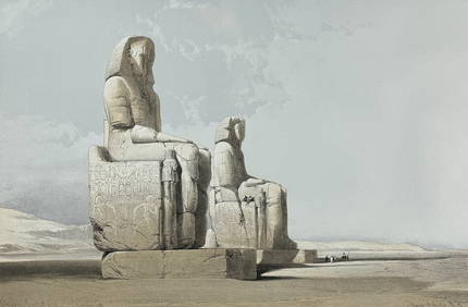
David Roberts - Obelisk of LuxorTrillium Antique Prints & Rare Books4.5(30)See Sold PriceFeb 24, 2024
David Roberts - Approach of the Simoom, Desert of GizehTrillium Antique Prints & Rare Books4.5(30)See Sold PriceFeb 24, 2024
Putnam - First Map of the State of Ohio by Rufus PutnamTrillium Antique Prints & Rare Books4.5(30)See Sold PriceFeb 24, 2024
Carey, pub. 1796 - Map of KentuckyTrillium Antique Prints & Rare Books4.5(30)See Sold PriceFeb 24, 2024
Carey, pub. 1796 - Map of the Tennassee State formerly part of North Carolina (Tennessee)Trillium Antique Prints & Rare Books4.5(30)See Sold PriceFeb 24, 2024
De Jode, Rare, pub. 1593 - Map of Africa (Africae Vera Forma, et Situs)Trillium Antique Prints & Rare Books4.5(30)See Sold PriceFeb 24, 2024
Mckenney & Hall - Two Octavo Volumes of Text with Rare Plate of Billy BowlegsTrillium Antique Prints & Rare Books4.5(30)See Sold PriceFeb 24, 2024
Audubon, NYSE Best Watercolor Ed - Pair: Brown Pelican & Reddish EgretTrillium Antique Prints & Rare Books4.5(30)See Sold PriceFeb 24, 2024
Audubon, Imperial Folio - Canada Lynx. 16Trillium Antique Prints & Rare Books4.5(30)See Sold PriceFeb 24, 2024
La Basse-Guinée… Loango, Congo, AngoIa & Benguela Southern Africa BONNE 1790 mapJasper524.5(9.8k)See Sold PriceFeb 28, 2024
La Nubia ed Abissinia. Red Sea Ethiopia Sudan Eritrea Arabia. ZATTA 1785 mapJasper524.5(9.8k)See Sold PriceFeb 28, 2024
NILE VALLEY. Upper & Lower. Egypt Sinai Nubia Sudan Abyssinia. BLACKIE 1886 mapJasper524.5(9.8k)See Sold PriceFeb 28, 2024
NILE VALLEY. Upper & Lower. Egypt Sinai Nubia Sudan Abyssinia. BLACKIE 1882 mapJasper524.5(9.8k)See Sold PriceFeb 28, 2024
La Basse-Guinée… Loango, Congo, AngoIa & Benguela Southern Africa BONNE 1788 mapJasper524.5(9.8k)See Sold PriceFeb 28, 2024
Georg Bockler Map of Ancient Jerulsaem EtchingAuctions at Showplace4.5(726)See Sold PriceApr 07, 2024
Robert de Vaugondy - Map of Canada - Mer de l' Ouest or Sea of the West and a Northwest PassageProverde Auctions4.3(3)See Sold PriceFeb 28, 2024


![Collection of [9] ancient geographic maps. Asia, Holy (1 of 9)](https://p1.liveauctioneers.com/2398/98907/50388420_1_x.jpg?height=282&quality=70&version=1484078795)