ATLAS of ANTIENT GEOGRAPHY by SAMUEL BUTLER 1843John McInnis Auctioneers,LLC4.6(502)See Sold PriceFeb 24, 2024
18TH C. ANTIQUE MAP: FRENCH & INDIAN WAR, FRAMEDThomaston Place Auction Galleries4.4(386)See Sold PriceFeb 24, 2024
Rand McNally Railroad Map Cabinet w/ 21 Railroad MapsRail & Road Auctions4.6(165)See Sold PriceMar 08, 2024
Keith Haring - Ink on New York Map, Best Buddies, Inscribed, Signed, and DatedSapphire Auction Gallery4(67)See Sold PriceMar 02, 2024
LATE 17TH C. FRENCH MAP OF THE NEW WORLD BY ALEXIS-HUBERT JAILLOT (1632-1712)Thomaston Place Auction Galleries4.4(386)See Sold PriceFeb 24, 2024
Central Railroad of New Jersey Map of Sandy Hook Route-ca. 1903JM Hobby Supply and Railroad Artifact Auctions4.4(126)See Sold PriceFeb 24, 2024
Lot of Six Mixed Atlas Box Cars-HO Scale-New in BoxJM Hobby Supply and Railroad Artifact Auctions4.4(126)See Sold PriceFeb 25, 2024
Rand McNally/Santa Fe Railroad Map of Iowa-1912JM Hobby Supply and Railroad Artifact Auctions4.4(126)See Sold PriceFeb 24, 2024
NICOLAES VISSCHER (NETHERLANDS, 1618-1709) MAP OF THE NEW WORLDThomaston Place Auction Galleries4.4(386)See Sold PriceFeb 24, 2024
17TH C. WORLD MAP BY NICOLAES VISSCHER (NETHERLANDS, 1618-1709)Thomaston Place Auction Galleries4.4(386)See Sold PriceFeb 24, 2024
Lot of Six Mixed Atlas Cabooses-HO Scale-New in BoxJM Hobby Supply and Railroad Artifact Auctions4.4(126)See Sold PriceFeb 25, 2024
SoldAN 1811 UNITED STATES MAP BY JOHN CARYA New Map of Part of the United States of North America Exhibiting the Western Territory, Kentucky, Pennsylvania, Maryland, Virginia & c. also the Lakes Superior Michigan Huron Ontario & Erie with UppSee Sold Price
Sold1811 Map of the United States, John CaryAntique hand colored map of part of the United States, engraved by John Cary, 1811. Sight size is 18" tall.See Sold Price
SoldCary: Map of the United States, 1811An original 1811 framed hand colored engraved map titled "A New Map of the United States of America from the Latest Authorities" created by John Cary for the 2nd edition of his New Universal Atlas oriSee Sold Price
SoldCary: Antique Map of the United States in 1811Map: A New Map of the United States of America Cartographer: John Cary Place & Date: London / 1811 Size: 20" x 17 3/4" Condition: original color; overall age toning and spotting The highly detailed maSee Sold Price
SoldJohn Cary, Map United States, Treaty of Peace 1783John Cary (London, 1754-1835) "An Accurate Map of the United States of America, with Part of the Surrounding Provinces agreeable to the Treaty of Peace of 1783", 1783 (created/published) Hand coloredSee Sold Price
SoldPrint of the USS Constitution, 17'' x 21 1/2'', tPrint of the USS Constitution, 17'' x 21 1/2'', together with a 20th c. map of the United States after the John Cary map of 1825, 16 1/2'' x 18 1/2''.See Sold Price
SoldFour 19th Century United States Mapsincluding The United State of America by John Cary, 1813, hand-colored map of the eastern part of the United States, 12 x 10 in.; Eastern Division of the United States, by J. Archer, 1850, 14-1/See Sold Price
SoldCARY, JOHN. A New Map of the United States of America,CARY, JOHN. A New Map of the United States of America, From the Latest Authorities. Double-page engraved map of the eastern United States. 20¾x22¾ inches sheet size, wide margins; original hSee Sold Price
SoldCARY, JOHN. A New Map of the United States ofCARY, JOHN. A New Map of the United States of America. Double-page engraved map, 470x585 mm, wide margins; hand-colored; some staining in the lower margin (not near the image). London, 1806 All itemsSee Sold Price
SoldJohn Cary, 1805, Map of Part of United States"A New Map of Part of the United States of North America", by John Cary, engraver, 1805, 18 1/2" x 20", sold by Goodspeeds of Boston.See Sold Price
SoldJohn Cary. A New Map of the United States of AmeJohn Cary. A New Map of the United States of America, from the Latest Authorities.<See Sold Price
SoldCary, ''A New Map of the United States...,'' 1806[United States]. John Cary. A New Map Of The United States Of America, From the latest Authorities. Double-page engraved map of the U.S. extending to Mississippi River. Lon: Cary, 1806. 20 x 22 3/8 inSee Sold Price
Sold1812 John Cary Map ofTitled "A New Map of Part of the United States of North America", published by J. Cary, London, 1812. There are a few small pinholes, and one small hole in the bottom center along the center fold.See Sold Price
SoldPair of John Cary Mapsa new map of North America, a new map of part of the United States each 18" x 20" SHIPPING: Buyer is responsible for arranging 3rd party shipping. Also see 3rd party shipper list provided in SHIPPINGSee Sold Price
Sold1 piece. Hand-Colored Engraved Map. Cary, John. A1 piece. Hand-Colored Engraved Map. Cary, John. A New Map of Part of The United States of North America Containing the Carolinas and Georgia, also The Floridas and Part of The Bahama Islands & C." LonSee Sold Price
Sold1 piece. Hand-Colored Engraved Map. Cary, John. A1 piece. Hand-Colored Engraved Map. Cary, John. A New Map of The Part of The United States of North America Containing the Carolinas and Georgia, also The Floridas and Georgia, and Part of the BahamaSee Sold Price
Sold1806 Map of the United States of America, Cary1806 Engraved Map entitled "A New Map of the United States of America, From the Latest Authorities", by John Cary, Engraver, map measures H.22" x W.24"; frame dimensions slightly largerSee Sold Price
SoldJohn Cary U.S. map,"A New Map of Part of the United States of North America, containing the Carolinas and Georgia also the Floridas…", published by John Cary, London, 1819, copper plate engraving, hand colored, centerSee Sold Price
SoldCARY, JOHN. A New Map of Part of the United States ofCARY, JOHN. A New Map of Part of the United States of North America, Exhibiting the Western Territory, Kentucky, Pennsylvania, Maryland, Virginia &c. Double-page engraved map of the Great Lakes and WeSee Sold Price
Cary (John) - A New Map of Part of the United States offrom New Brunswick to North Carolina, engraved map with original hand-colouring in outline, 520 x 580mm., central vertical fold, some faint offsetting, 1806.See Sold Price
SoldCARY, JOHN. A New Map of Part of the United StCARY, JOHN. A New Map of Part of the United States of North America, exhibiting the Western Territory, Kentucky, Pennsylvania, Maryland, Virginia &c. Double-page engraved map, 520x600 mm, wide marginsSee Sold Price
SoldCARY, JOHN. A New Map of Part of the United StCARY, JOHN. A New Map of Part of the United States of North America. Engraved map, 510x575 mm, wide margins; hand-colored; minor scattered soiling. London, 1806 New York, Vermont, New Hampshire, MassaSee Sold Price
SoldCary Map of the Southeast, 1821, inc. AlabamaJohn Cary: A NEW MAP OF PART OF THE UNITED STATES OF NORTH AMERICA, CONTAINING THE CAROLINAS and GEORGIA, ALSO THE FLORIDAS AND PART OF THE BAHAMA ISLANDS & C., 1821. Scarce map, the only edition of CSee Sold Price
SoldJohn Cary, London, Hand-Colored Map of U.S.John Cary, London, Hand-Colored Engraved Map of the United States, 1806, handsomely presented in a gilt-edged gold leaf and watercolor-banded pale blue French mat within a narrow giltwood frame in theSee Sold Price
United States Map with American Flag 3-D Wall Mount PaintingWeatherham Estate Treasures3.9(157)See Sold PriceFeb 29, 2024
1905 20th Century Atlas of Boone County IllinoisMatthew Bullock Auctioneers4.7(1.8k)See Sold PriceFeb 24, 2024
Cooke, George 1801 Antique Map. United States of AmericaAlbion Auctions4.6(336)See Sold PriceMar 01, 2024
Blackie (Pub) 1882 Folio Map. United States of North AmericaAlbion Auctions4.6(336)See Sold PriceMar 01, 2024
MUTUAL LIFE INSURANCE JOHN HANCOCK UNITED STATES HISTORY BOOKLETS 1956Converse Auctions4.5(466)See Sold PriceMar 01, 2024
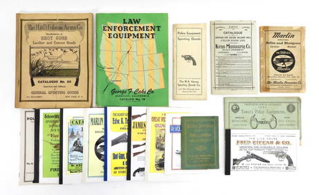
16PC Police Equipment & Sporting Goods CatalogsBruneau & Co. Auctioneers4.5(491)See Sold PriceMar 18, 2024
Map of United States of North America, 1785Antiques Online Auctions4.6(407)See Sold PriceMar 14, 2024
President John Tyler – Authenticated Free Frank Signed Envelope DisplayDalshire International4.6(2.2k)See Sold PriceFeb 29, 2024