ATLAS of ANTIENT GEOGRAPHY by SAMUEL BUTLER 1843John McInnis Auctioneers,LLC4.6(502)See Sold PriceFeb 24, 2024
18TH C. ANTIQUE MAP: FRENCH & INDIAN WAR, FRAMEDThomaston Place Auction Galleries4.4(386)See Sold PriceFeb 24, 2024
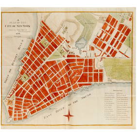
Rand McNally Railroad Map Cabinet w/ 21 Railroad MapsRail & Road Auctions4.6(165)See Sold PriceMar 08, 2024
Keith Haring - Ink on New York Map, Best Buddies, Inscribed, Signed, and DatedSapphire Auction Gallery4(67)See Sold PriceMar 02, 2024
LATE 17TH C. FRENCH MAP OF THE NEW WORLD BY ALEXIS-HUBERT JAILLOT (1632-1712)Thomaston Place Auction Galleries4.4(386)See Sold PriceFeb 24, 2024
Central Railroad of New Jersey Map of Sandy Hook Route-ca. 1903JM Hobby Supply and Railroad Artifact Auctions4.4(126)See Sold PriceFeb 24, 2024
Lot of Six Mixed Atlas Box Cars-HO Scale-New in BoxJM Hobby Supply and Railroad Artifact Auctions4.4(126)See Sold PriceFeb 25, 2024
Rand McNally/Santa Fe Railroad Map of Iowa-1912JM Hobby Supply and Railroad Artifact Auctions4.4(126)See Sold PriceFeb 24, 2024
NICOLAES VISSCHER (NETHERLANDS, 1618-1709) MAP OF THE NEW WORLDThomaston Place Auction Galleries4.4(386)See Sold PriceFeb 24, 2024
17TH C. WORLD MAP BY NICOLAES VISSCHER (NETHERLANDS, 1618-1709)Thomaston Place Auction Galleries4.4(386)See Sold PriceFeb 24, 2024
Lot of Six Mixed Atlas Cabooses-HO Scale-New in BoxJM Hobby Supply and Railroad Artifact Auctions4.4(126)See Sold PriceFeb 25, 2024
Amsterdam. Plan of town/city & fortifications.TITLE/CONTENT OF MAP: 'Amsterdam' Date: 1705 IMAGE SIZE: Approx 20.0 x 30.5cm, 7.75 x 12 inches (Medium) TYPE: Early 18th century copperplate map CONDITION: Good; suitable for framing. VERSO: There isSee Sold Price
de Fer: Amsterdam. Plan of town/city & fortifications.TITLE/CONTENT OF MAP: 'Amsterdam' DATE PRINTED: 1705 IMAGE SIZE: Approx 20.0 x 30.5cm, 7.75 x 12 inches (Medium) TYPE: Early 18th century copperplate map CONDITION: Good; suitable for framing. VERSO:See Sold Price
SoldAntibes. Plan of town/city & fortifications.TITLE/CONTENT OF MAP: 'Antibes' Date: 1705 IMAGE SIZE: Approx 19.0 x 25.5cm, 7.5 x 10 inches (Medium) TYPE: Early 18th century copperplate map CONDITION: Good; suitable for framing. VERSO: There is noSee Sold Price
Ipres'. Ypres. Plan of town/city & fortifications.TITLE/CONTENT OF MAP: 'Ipres [Ypres]' Date: 1705 IMAGE SIZE: Approx 20.5 x 32.5cm, 8 x 12.75 inches (Large) TYPE: Early 18th century copperplate map CONDITION: Good; suitable for framing. VERSO: ThereSee Sold Price
Rouen. Plan of town/city & fortifications.TITLE/CONTENT OF MAP: 'Rouen' Date: 1705 IMAGE SIZE: Approx 21.0 x 32.0cm, 8.25 x 12.75 inches (Large) TYPE: Early 18th century copperplate map CONDITION: Good; suitable for framing. However, please nSee Sold Price
Rouen. Plan of town/city & fortifications.TITLE/CONTENT OF MAP: 'Rouen' Date: 1705 IMAGE SIZE: Approx 21.0 x 32.0cm, 8.25 x 12.75 inches (Large) TYPE: Early 18th century copperplate map CONDITION: Good; suitable for framing. However, please nSee Sold Price
Nice. Plan of town/city & fortifications. AlpesTITLE/CONTENT OF MAP: 'Nice' The top image on the right hand side shows the entire map. To view a close up of the map showing the level of printed detail, please click on the bottom image on the rightSee Sold Price
Liege'. Liège. Plan of town/city & fortifications.TITLE/CONTENT OF MAP: 'Liege [Liège]' Date: 1705 IMAGE SIZE: Approx 20.5 x 28.5cm, 8 x 11.25 inches (Medium) TYPE: Early 18th century copperplate map CONDITION: Good; suitable for framing. VERSO: TheSee Sold Price
Sedan. Plan of town/city & fortifications. Ardennes. DEReserve Reduced! TITLE/CONTENT OF MAP: 'Sedan' DATE PRINTED: 1705 IMAGE SIZE: Approx 19.0 x 31.5cm, 7.5 x 12.25 inches (Medium) TYPE: Early 18th century copperplate map CONDITION: Good; suitable for fSee Sold Price
Ipres'. Ypres. Plan of town/city & fortifications.TITLE/CONTENT OF MAP: 'Ipres [Ypres]' The top image on the right hand side shows the entire map. To view a close up of the map showing the level of printed detail, please click on the bottom image onSee Sold Price
Nice. Plan of town/city & fortifications. AlpesTITLE/CONTENT OF MAP: 'Nice' DATE PRINTED: 1705 IMAGE SIZE: Approx 23.0 x 32.0cm, 9 x 12.5 inches (Large) TYPE: Early 18th century copperplate map CONDITION: Fair-to-Good: The map has been cleaned, whSee Sold Price
Huy. Plan of town/city & fortifications. Belgium. DETITLE/CONTENT OF MAP: 'Huy' The top image on the right hand side shows the entire map. To view a close up of the map showing the level of printed detail, please click on the bottom image on the rightSee Sold Price
Valence'. Valenza. Plan of town/city & fortifications.TITLE/CONTENT OF MAP: 'Valence [Valenza]' The top image on the right hand side shows the entire map. To view a close up of the map showing the level of printed detail, please click on the bottom imageSee Sold Price
Liege'. Liège. Plan of town/city & fortifications.Reserve Reduced! TITLE/CONTENT OF MAP: 'Liege [Liège]' DATE PRINTED: 1705 IMAGE SIZE: Approx 20.5 x 28.5cm, 8 x 11.25 inches (Medium) TYPE: Early 18th century copperplate map CONDITION: Good; suitablSee Sold Price
Liege'. Liège. Plan of town/city & fortifications.TITLE/CONTENT OF MAP: 'Liege [Liège]' Date: 1705 IMAGE SIZE: Approx 20.5 x 28.5cm, 8 x 11.25 inches (Medium) TYPE: Early 18th century copperplate map CONDITION: Good; suitable for framing. VERSO: TheSee Sold Price
Rouen. Plan of town/city & fortifications.TITLE/CONTENT OF MAP: 'Rouen' DATE PRINTED: 1705 IMAGE SIZE: Approx 21.0 x 32.0cm, 8.25 x 12.75 inches (Large) TYPE: Early 18th century copperplate map CONDITION: Good; suitable for framing. However,See Sold Price
de Fer: Dinant. Plan of town/city & fortifications.TITLE/CONTENT OF MAP: 'Dinant' DATE PRINTED: 1705 IMAGE SIZE: Approx 21.5 x 29.5cm, 8.5 x 11.75 inches (Large) TYPE: Early 18th century copperplate map CONDITION: Good; suitable for framing. However,See Sold Price
Valence'. Valenza. Plan of town/city & fortifications.TITLE/CONTENT OF MAP: 'Valence [Valenza]' Date: 1705 IMAGE SIZE: Approx 21.5 x 30.0cm, 8.5 x 11.75 inches (Large) TYPE: Early 18th century copperplate map CONDITION: Good; suitable for framing. VERSO:See Sold Price
de Fer: Nice. Plan of town/city & fortifications. AlpesTITLE/CONTENT OF MAP: 'Nice' DATE PRINTED: 1705 IMAGE SIZE: Approx 23.0 x 32.0cm, 9 x 12.5 inches (Large) TYPE: Early 18th century copperplate map CONDITION: Fair-to-Good: The map has been cleaned, whSee Sold Price
de Fer: Sedan. Plan of town/city & fortifications.TITLE/CONTENT OF MAP: 'Sedan' DATE PRINTED: 1705 IMAGE SIZE: Approx 19.0 x 31.5cm, 7.5 x 12.25 inches (Medium) TYPE: Early 18th century copperplate map CONDITION: Good; suitable for framing. VERSO: ThSee Sold Price
Dinant. Plan of town/city & fortifications. Belgium. DEReserve Reduced! TITLE/CONTENT OF MAP: 'Dinant' DATE PRINTED: 1705 IMAGE SIZE: Approx 21.5 x 29.5cm, 8.5 x 11.75 inches (Large) TYPE: Early 18th century copperplate map CONDITION: Good; suitable for fSee Sold Price
Gand'. Ghent. Plan of town/city & fortifications.TITLE/CONTENT OF MAP: 'Gand [Ghent]' Date: 1705 IMAGE SIZE: Approx 18.5 x 25.0cm, 7.25 x 10 inches (Medium) TYPE: Early 18th century copperplate map CONDITION: Good; suitable for framing. VERSO: ThereSee Sold Price
de Fer: Rouen. Plan of town/city & fortifications.TITLE/CONTENT OF MAP: 'Rouen' DATE PRINTED: 1705 IMAGE SIZE: Approx 21.0 x 32.0cm, 8.25 x 12.75 inches (Large) TYPE: Early 18th century copperplate map CONDITION: Good; suitable for framing. However,See Sold Price
Soldde Fer: Antique Map of Pinerolo, Italy, 1705Title/Content of Map: 'Pignerol [Pinerolo]' Plan of town/city & fortifications. Italy. Date Printed: 1705 Image Size: Approx 21.5 x 31.5cm, 8.5 x 12.25 inches (Large) Type: Early 18th century copperplSee Sold Price
Philadelphia and Reading RR Plan of Financial Reorganization-January 26, 1885JM Hobby Supply and Railroad Artifact Auctions4.4(126)See Sold PriceFeb 24, 2024
M. de BOILEAU Satires & Works First 1st 1737 Edition Amsterdam Printing FrenchLuis Porretta Fine Arts4.3(10)See Sold PriceMar 02, 2024
OFFER VAN ABRAHAM Book Of Genesis in Engravings c1700 Amsterdam Very rare!Luis Porretta Fine Arts4.3(10)See Sold PriceMar 02, 2024
6 Vintage Hand Drawn Mixed Media Floor PlansThe Benefit Shop Foundation Inc.4.3(2.9k)See Sold PriceFeb 28, 2024
Mixed Media Uni Of Edinburg Gallery Floor PlansThe Benefit Shop Foundation Inc.4.3(2.9k)See Sold PriceFeb 28, 2024
Alton Tobey, Keeping New Amsterdam DutchLotus International Auctions, LLC4.6(153)See Sold PriceMar 03, 2024
Hand Colored Map of the city of Amsterdam 1720Global Auctions Company4.3(36)See Sold PriceMar 03, 2024
Follower of Justus van Huysum the Elder (Amsterdam 1659-1716) Flowers Still LifePassion For Antiques3.9(23)See Sold PriceFeb 25, 2024
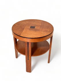
Amsterdam School Arts and Crafts Movement Art Deco Oak and Rosewood Table circa 1920Collective Hudson4.5(54)See Sold PriceMar 01, 2024
HANS DOORNHEIM "STREETS OF AMSTERDAM"Lewis & Maese Antiques & Auction4.4(520)See Sold PriceFeb 25, 2024
1738 BIBLE in DUTCH ILLUSTRATED w/ MAPS antique MASSIVE FOLIO BIBLIAJasper524.5(9.8k)See Sold PriceFeb 27, 2024
1749-59 21 volumes NETHERLANDS HISTORY ILLUSTRATED antique VELLUM BOUNDJasper524.5(9.8k)See Sold PriceFeb 27, 2024
1764 Bellin Map of Port Antonio, Jamaica -- Plan des Havres de Port Antonio et de Saint FrancoisJasper524.5(9.8k)See Sold PriceFeb 27, 2024
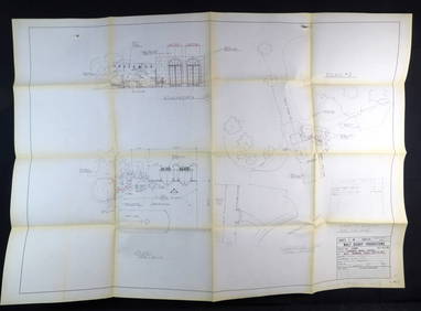
Extremely rare and original location plan for Walt Disney's 1974 movie Herbie Rides AgainEagles Corps International LLC4.6(107)See Sold PriceMar 10, 2024
Dirck Barendsz (1534 Amsterdam - 1592 ibid) (attributed), Standing man with hat, 16th centuryQuittenbaum Kunstauktionen GmbH4.4(63)See Sold PriceMar 20, 2024
Framed Litho Peter Stuyvesant's Army Entering New Amsterdam 8 1/2" X 27 1/2"George Cole Auctions4.5(391)See Sold PriceMar 02, 2024