ATLAS of ANTIENT GEOGRAPHY by SAMUEL BUTLER 1843John McInnis Auctioneers,LLC4.6(502)See Sold PriceFeb 24, 2024
18TH C. ANTIQUE MAP: FRENCH & INDIAN WAR, FRAMEDThomaston Place Auction Galleries4.4(386)See Sold PriceFeb 24, 2024
Rand McNally Railroad Map Cabinet w/ 21 Railroad MapsRail & Road Auctions4.6(165)See Sold PriceMar 08, 2024
Keith Haring - Ink on New York Map, Best Buddies, Inscribed, Signed, and DatedSapphire Auction Gallery4(67)See Sold PriceMar 02, 2024
LATE 17TH C. FRENCH MAP OF THE NEW WORLD BY ALEXIS-HUBERT JAILLOT (1632-1712)Thomaston Place Auction Galleries4.4(386)See Sold PriceFeb 24, 2024
Central Railroad of New Jersey Map of Sandy Hook Route-ca. 1903JM Hobby Supply and Railroad Artifact Auctions4.4(126)See Sold PriceFeb 24, 2024
Lot of Six Mixed Atlas Box Cars-HO Scale-New in BoxJM Hobby Supply and Railroad Artifact Auctions4.4(126)See Sold PriceFeb 25, 2024
Rand McNally/Santa Fe Railroad Map of Iowa-1912JM Hobby Supply and Railroad Artifact Auctions4.4(126)See Sold PriceFeb 24, 2024
NICOLAES VISSCHER (NETHERLANDS, 1618-1709) MAP OF THE NEW WORLDThomaston Place Auction Galleries4.4(386)See Sold PriceFeb 24, 2024
17TH C. WORLD MAP BY NICOLAES VISSCHER (NETHERLANDS, 1618-1709)Thomaston Place Auction Galleries4.4(386)See Sold PriceFeb 24, 2024
Lot of Six Mixed Atlas Cabooses-HO Scale-New in BoxJM Hobby Supply and Railroad Artifact Auctions4.4(126)See Sold PriceFeb 25, 2024
SoldA SUPERB PAIR OF OVAL SILKWORK MAPS, EUROPE AND BRITISHA SUPERB PAIR OF OVAL SILKWORK MAPS, EUROPE AND BRITISH ISLES. 1ft 7ins x 1ft 4ins, both in gilt frames.See Sold Price
Pair of Georgian Antique Silkwork EmbroideriesTitle: Pair of Georgian Antique Silkwork Embroideries Description: Pair of Georgian Antique Silkwork Embroideries Description Pair of oval Georgian silkwork embroideries with hand-drawn detail. FramedSee Sold Price
Sold19th & Early 20thc Maps of EuropePair of original maps of Europe. - a hand-colored, reference Map ( No.14 ) of Central Europe, from THE COMMON-SCHOOL GEOGRAPHY - 1873 - early 20thc fold-out Map of Europe measuring British miles. 9" XSee Sold Price
19th & Early 20thc Maps of EuropePair of original maps of Europe. - a hand-colored, reference Map ( No.14 ) of Central Europe, from THE COMMON-SCHOOL GEOGRAPHY - 1873 - early 20thc fold-out Map of Europe measuring British miles. 9" XSee Sold Price
19th & Early 20thc Maps of EuropePair of original maps of Europe. - a hand-colored, reference Map ( No.14 ) of Central Europe, from THE COMMON-SCHOOL GEOGRAPHY - 1873 - early 20thc Fold-out Map of Europe measuring British miles. 9" XSee Sold Price
19th & Early 20thc Maps of EuropePair of original maps of Europe. - a hand-colored, reference Map ( No.14 ) of Central Europe, from THE COMMON-SCHOOL GEOGRAPHY - 1873 - early 20thc Fold-out Map of Europe measuring British miSee Sold Price
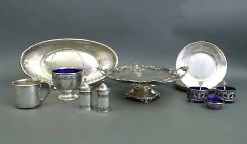
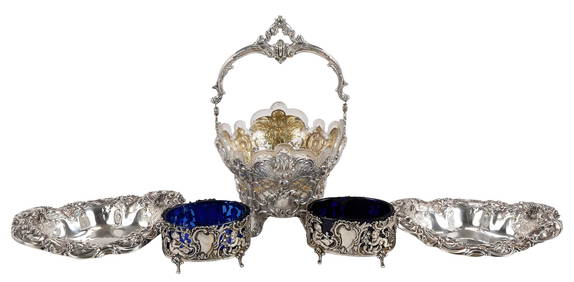
SoldA SUPERB LARGE PAIR OF VICTORIAN BOHEMIAN RUBY GLASSA SUPERB LARGE PAIR OF VICTORIAN BOHEMIAN RUBY GLASS LUSTRES, the domes gilded and painted with enamel oval portraits of THE SHAH OF PERSIA, 3.5ins x 2.5ins, the bases hung with nineteen prism drops.See Sold Price
SoldGuthrie, William 1799 Pair of Maps. Europe, FranceCopper Engraved Maps Published 1799, London for "A New Geographical, Historical and Commercial Grammar..." by William Guthrie. The maps are by D. Ogilby & Son and others. Folds as issued. Paper Size:See Sold Price
SoldGuthrie, William 1799 Pair of Maps. British IslesCopper Engraved Maps Published 1799, London for "A New Geographical, Historical and Commercial Grammar..." by William Guthrie. The maps are by D. Ogilby & Son and others. Folds as issued. Paper Size:See Sold Price
SoldDelamarche, Felix 1829 Pair of Maps. Europe Charlemagne"L'Europe a l'Epoque du demembrement de l'Empire de Charlemagne" and "L'Europe divisee en ses differens Etats sous Charlemagne" Copper Engraved Maps Published 1829, Paris for "Atlas de La Geographie..See Sold Price
SoldA GOOD PAIR OF OVAL SILKWORK PICTURES of LADIES in giltA GOOD PAIR OF OVAL SILKWORK PICTURES of LADIES in gilt frames, glazed. 19ins x 12ins.See Sold Price
Antique Map Print - Europe - British Isles - Great Britain - Ireland - VaugondyTitle/Content: Antique Map Print - Europe - British Isles - Great Britain - Ireland - Vaugondy Date: 1778 Material: Paper Dimensions: 12” x 9” inches / 31,5 cm x 24 cm Description: OriginaSee Sold Price
SoldA pair of oval, silk work picture of a classical riverA pair of oval, silk work picture of a classical river landscape with buildings figures, and boats in knott work, and long and short stitch in gilt frames. 14cm wide. Together with a 19th century silkSee Sold Price
Gray's New Map of Europe, 1880Gray's New Map of Europe O.w. Gray & Son, Gray, Frank A. 1880 Inset ethnographical map of Europe. British Isles on reverse. Quarto – 13.00 H x 15.25 W Inches Please note that this lot has a confidenSee Sold Price
1866 Johnson Map of Europe -- Johnson's EuropeTitle: 1866 Johnson Map of Europe -- Johnson's Europe Cartographer: Johnson & Ward Year / Place: 1866, New York Map Dimension (in.): 17 X 23 in. This is a superb map of Europe. Much detail is shown inSee Sold Price
SoldA pair of Regency oval silkwork pictures, 13.5insA pair of Regency oval silkwork pictures, depicting a maiden playing a triangle and a shepherdess carving a word on a tree trunk, in giltwood oval frames, 13.5insSee Sold Price
SoldA pair of Regency oval silkwork pictures, circa 18A pair of Regency oval silkwork pictures, circa 1815, depicting an archer and companion with painted faces within a landscape setting, within glazed giltwood frames, 30cm high; and another paSee Sold Price
SoldA SUPERB PAIR OF SEVRES OVAL TUREENS AND COVERS, blueA SUPERB PAIR OF SEVRES OVAL TUREENS AND COVERS, blue ground, edged in gilt and painted with panels of flowers. Sevres mark in blue. 6ins wide.See Sold Price
SoldPair of Regency oval silkwork and painted panelsA pair of Regency oval silkwork and painted panels early 19th century In verre eglomise surrounds. 14 3/4 x 12 1/2in (37.5 x 31.5cm) Provenance: Property from the Estate Francis A. Martin III, San FraSee Sold Price
PAIR OF ANTIQUE MAPS Europe, including Breslow, eaPAIR OF ANTIQUE MAPS Europe, including Breslow, each about 15"x19", 18th centurySee Sold Price
SoldA SUPERB PAIR OF SEVRES OVAL STANDS, blue ground, edgedA SUPERB PAIR OF SEVRES OVAL STANDS, blue ground, edged in gilt and painted with an oval of children playing. Sevres mark in blue. 9.25ins wide.See Sold Price
SoldA SUPERB PAIR OF SEVRES OVAL STANDS, blue ground, edgedA SUPERB PAIR OF SEVRES OVAL STANDS, blue ground, edged in gilt and painted with an oval of children playing. Sevres mark in blue. 9.25ins wide.See Sold Price
A SUPERB PAIR OF SEVRES OVAL STANDS, blue ground, edgedA SUPERB PAIR OF SEVRES OVAL STANDS, blue ground, edged in gilt and painted with an oval of children playing. Sevres mark in blue.9.25ins wide. £600-900.See Sold Price
SoldA SUPERB PAIR OF VICTORIAN OVAL PORTRAIT MINIATURES ofA SUPERB PAIR OF VICTORIAN OVAL PORTRAIT MINIATURES of a man in dark coat and cravat, a woman in a lace bonnet, both in gold mounts. 5.5cms x 4.5cms.See Sold Price
Roman Gold Ring with Pair of Birds on Nicolo GemstoneTimeLine Auctions Ltd.4.5(183)See Sold PriceMar 05, 2024
Western Asiatic Bronze Ring with Armed WarriorTimeLine Auctions Ltd.4.5(183)See Sold PriceMar 07, 2024
Arthur Armour (1908-1998) Pair Aluminum Waste BasketsAbsolute Auction Gallery4.5(57)See Sold PriceFeb 28, 2024
Two (2) Antique 18th C. Copper Engraved Framed Maps - America & EuropeMagnusson Art Group4.5(46)See Sold PriceMar 14, 2024
Chatelain - 3 Maps of the British Isles (England, Ireland, Scotland)Trillium Antique Prints & Rare Books4.5(30)See Sold PriceFeb 24, 2024
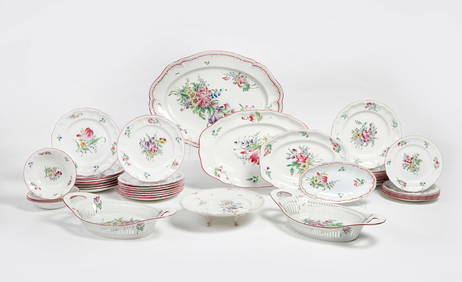
A French (Luneville) faience part dinner serviceAndrew Jones Auctions4.7(206)See Sold PriceFeb 29, 2024
1823 British Bronze Commemorative Medal by FaulknerArtemis Fine Arts4.8(1.4k)See Sold PriceFeb 26, 2024
Paterson & Mogg 1822 Pair of British Road Maps. Isle of Thanet & WightAlbion Auctions4.6(336)See Sold PriceMar 01, 2024
Paterson & Mogg 1822 Pair of British Road Maps. Rye, Eastbourne, SouthamptonAlbion Auctions4.6(336)See Sold PriceMar 01, 2024
Paterson & Mogg 1822 Pair of British Road Maps. Deal, Hythe, Shoreham, ChichesterAlbion Auctions4.6(336)See Sold PriceMar 01, 2024
[BACON FRANCIS]: (1909-1992)International Autograph Auctions Europe S.L.4.5(52)See Sold PriceMar 14, 2024


![[BACON FRANCIS]: (1909-1992) (1 of 1)](https://p1.liveauctioneers.com/1458/320148/172030496_1_x.jpg?height=282&quality=70&version=1708367366)