SoldA set of 7 various maps including: (i) A map of theA set of 7 various maps including: (i) A map of the County of Dublin Divided in Baronys By John Rogue, 43x 64cm (ii) The kingdom of Ireland bu Robt. Morden, 42 x 36cm (iii) Europa, by Guilielmo BlaeuwSee Sold Price
SoldThe King Ranch, Vols. 1 & 2 - Tom Lea - 1957The King Ranch, 838pp, Tom Lea, Little Brown & Company, 1957. An excellent set of this classic work. Maps and illustrations by Tom Lea. Facsimiles. 7 maps, including 2-page, color map in front of VoluSee Sold Price
maps of various states within the USATitle: Sixteen maps of cities, states and counties of the United States of America Author: ** Description: Including: 7 maps from Asher & Adams' publication, all but one are double-paged. Plus table oSee Sold Price
SoldMiniature books, bookshelves, map, globeMiniature Accessories including books, bookshelves, map, globe, art sets, easel, and more. Bookshelf without packaging approximately 7.375 x 3.375 x 1.375 in. Small books 1 x 0.75 x 0.25 in.See Sold Price
(7) SCARCE 1815 WILKINSON MAPS OF VARIOUS NATIONSRobert Wilkinson (active 1768-1825), from his General Atlas of 1815, including a title page in poor condition, the joined sheet maps very good, hand colored engravings, including: "Hindoostan, or IndiSee Sold Price
SoldVintage Patriotic Postcards (18) and 7 Maps (118922)Lot of three plastic wrapped frameable items, including vintage patriotic postcards, set of six old maps of America, and a map of California, c1915-1916. Includes 23 x 22 in. poster board with 18 patrSee Sold Price
SoldBlock puzzle. - A mixed group of puzzle maps,including a boxed block puzzle set of maps by Frémin, with 5 key maps; a similar but smaller block puzzle set of George Philip and Son maps; with 2 other block puzzles and 2 jigsaw maps, various puSee Sold Price
SoldTown Map of Dublin, New HampshireTown Map of Dublin, New Hampshire, Including the part set off to the town of Harrisville, copyright 1907, minor roughage on both top edges, 35 7/8" x 28". Estimate: $100 - $150See Sold Price
Sold50 various maps (including some dups) removed from50 various maps (including some dups) removed from several copies of the 1872 NEW TOPOGRAPHICAL ATLAS OF THE STATE OF PENNSYLVANIA, published by Stedman, Brown, and Lyon of Phila. All hand colored, 12See Sold Price
SoldLot of 7 Hand-Colored Copper Engraved Maps including(Lot of 7) Maps including; "Johnson's Australia," by Johnson and Ward, published in New York c. 1864, hand-colored copper engraved map, North Riding, Yorkshire, published by Henry Teesdale & Co. c. 18See Sold Price
SoldLot of Various MapsLot consisting of four various maps, including a print of John Speed's 1676 map of New York and New England; a map of Texas and Oklahoma from 1929; climatological and geological maps of the United StaSee Sold Price
SoldAntique Maps by Augustus Mitchell (8)Various maps, including North America, South America, Europe, Italy, Spain, Greece, Brazil. Hand-colored engravings. S. Augustus Mitchell, Philadelphia, c. 1850. 17 1/2" x 14 1/4".See Sold Price
SoldMorse on geography c.1790Heading: Author: Morse, Jedidiah Title: Science of Geography Place Published: Massachusetts Publisher: Date Published: c.1790 Description: (iii)-322 pp. Lacking title page.See Sold Price
[BONNE] Lot of 7 maps[BONNE] Rigobert Bonne. Engineer and Cartographer. Lot of 7 maps. Including: CARTE DE LA RIVIERE DE COOK, dans la partie N.O.DE L'AMERIQUE. 23.5 x 34 cm. [1780] ** CARTE DE L'ENTREE DE NORTON ET DU DESee Sold Price
VARIOUS MAPSCOLLECTION OF VARIOUS MAPS INCLUDING CENTRAL WASHINGTON; CANADA; SOUTHWESTERN US. APPROX. 41 PIECES. STAINS; TEARS; CREASES. \CALL 845-457-7550 OR EMAIL STERLINGAUCTION@AOL.COM FOR FULL CONDITION REPOSee Sold Price
SoldHans Staden. 17th century book plates and map recounting his journey to Brasil in 1547 andHans Staden. 17th century book plates and map recounting his journey to Brasil in 1547 and subsequent capture by cannibalistic peoples. 21 total plates including map. 7.25 x 9.25in. Edge wear and lossSee Sold Price
SoldBicycle Map LotLot (18) various bicycle maps including The Cyclist Pocket Touring Maps Of Britain, Bicycle Tour in England and Wales", an important book by A.D. Chandler of Boston Bicycle Club in 1881, The 1897 IowaSee Sold Price
SoldPictorial Map Lot (9)Various pictorial maps including 2 by Ernest Dudley Chase. Various places. 19" x 25".See Sold Price
SoldGulf Tour Guide Service Map Display.Includes various vintage maps including New York, Maine, Arizona & New Mexico, Kentucky & Tennessee, and others. Condition (Very Good). Size 12" x 5".See Sold Price
SoldTurner (Richard) A View of the EarthTurner (Richard) A View of the Earth: Being a short, but comprehensive System of Modern Geography,The Third Edition, 7 engraved maps (including twin-hemisphere world map), plate of a globe, enSee Sold Price
SoldImperial Geological Survey of Japan.- Geological MImperial Geological Survey of Japan.- Geological Map of Japanese Empire,showing Japan and Korea, with 7 inset maps including a general map of the Japanese Empire and Taiwan with the Ryukyu IslSee Sold Price
SoldSinai and Palestine in Connection with their History,Sinai and Palestine in Connection with their History, Arthur Penrhyn Stanley, London, 1862. 7 folding maps including a diagram. Leather binding. 22x14cm.See Sold Price
Sold(WORLD.) Group of 7 engraved maps,(WORLD.) Group of 7 engraved maps, including double-hemispherics and other projections, all margins trimmed to neatlines or within; some color; numerous faults. sold as is. we regret that swann staffSee Sold Price
SoldLot of 7 various maps: 1) The Oldest Map of the NLot of 7 various maps: 1) The Oldest Map of the New World, 2) Venice, published in London by Orr and Smith, drawn and engraved by J. Dower, 3) small map of Washington D.C., 1989, 4) Air France map ofSee Sold Price
LARGE GULF SERVICE STATION MAP COLLECTION WITH DISPLAY STAND.Dan Morphy Auctions4.2(1.3k)See Sold PriceFeb 24, 2024
1977 JRR Tolkien 1st ed Silmarillion Lord of the Rings Middle Earth + MAPSchilb Antiquarian Rare Books4.8(428)See Sold PriceMar 31, 2024
Vintage Elkington and Company English Silver Plated Cruet SetNorthgate Gallery, Inc.4.5(36)See Sold PriceMar 02, 2024
1816 MAP SOUTHERN PART OF RUSSIA or MUSCOVY in EUROPE copper engraving ANTIQUEJasper524.5(9.9k)See Sold PriceFeb 27, 2024
1816 MAP NORTHERN PART OF RUSSIA or MUSCOVY in EUROPE copper engraving ANTIQUEJasper524.5(9.9k)See Sold PriceFeb 27, 2024
Nottingham.- Ordnance Survey Office (publisher) Collection 8 geological maps on the environs ofForum Auctions4.3(53)See Sold PriceFeb 29, 2024
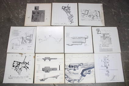
Set of 11 Mid Century Modern Architectural Plans & Site Map RenderingsPUBLIC SALE4.7(226)See Sold PriceMar 02, 2024
Antique "Magic Lantern" Glass Educational SlidesRapid Estate Liquidators and Auction Gallery4.5(1.1k)See Sold PriceFeb 25, 2024
A group of Federico Jimenez stone set jewelryJohn Moran Auctioneers, Inc.4.7(461)See Sold PriceMar 12, 2024
A group of Navajo sterling silver and cluster set jewelryJohn Moran Auctioneers, Inc.4.7(461)See Sold PriceMar 12, 2024
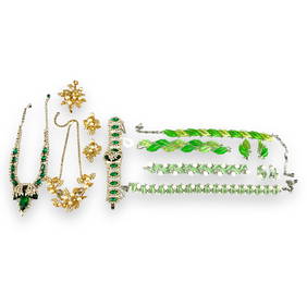
Special Lot of Vintage Costume Jewelry Including Signed "Lisner" and En Tremblant Pieces SignedApple Tree Auction Center4.6(1k)See Sold PriceFeb 27, 2024
ANTIQUE DUTCH STERLING SILVER SERVING CUTLERY SETAntique Arena Inc.4.5(878)See Sold PriceJun 15, 2024
Engraved Stackable Diamond Band Ring 14K Yellow Gold 3.82 Cttw Size 7Bidhaus4.3(762)See Sold PriceMar 06, 2025


![[BONNE] Lot of 7 maps (1 of 1)](https://p1.liveauctioneers.com/1124/187577/94368847_1_x.jpg?height=282&quality=70&version=1607095126)