ATLAS of ANTIENT GEOGRAPHY by SAMUEL BUTLER 1843John McInnis Auctioneers,LLC4.6(502)See Sold PriceFeb 24, 2024
18TH C. ANTIQUE MAP: FRENCH & INDIAN WAR, FRAMEDThomaston Place Auction Galleries4.4(386)See Sold PriceFeb 24, 2024
Rand McNally Railroad Map Cabinet w/ 21 Railroad MapsRail & Road Auctions4.6(165)See Sold PriceMar 08, 2024
Keith Haring - Ink on New York Map, Best Buddies, Inscribed, Signed, and DatedSapphire Auction Gallery4(67)See Sold PriceMar 02, 2024
LATE 17TH C. FRENCH MAP OF THE NEW WORLD BY ALEXIS-HUBERT JAILLOT (1632-1712)Thomaston Place Auction Galleries4.4(386)See Sold PriceFeb 24, 2024
Central Railroad of New Jersey Map of Sandy Hook Route-ca. 1903JM Hobby Supply and Railroad Artifact Auctions4.4(126)See Sold PriceFeb 24, 2024
Lot of Six Mixed Atlas Box Cars-HO Scale-New in BoxJM Hobby Supply and Railroad Artifact Auctions4.4(126)See Sold PriceFeb 25, 2024
Rand McNally/Santa Fe Railroad Map of Iowa-1912JM Hobby Supply and Railroad Artifact Auctions4.4(126)See Sold PriceFeb 24, 2024
NICOLAES VISSCHER (NETHERLANDS, 1618-1709) MAP OF THE NEW WORLDThomaston Place Auction Galleries4.4(386)See Sold PriceFeb 24, 2024
17TH C. WORLD MAP BY NICOLAES VISSCHER (NETHERLANDS, 1618-1709)Thomaston Place Auction Galleries4.4(386)See Sold PriceFeb 24, 2024
Lot of Six Mixed Atlas Cabooses-HO Scale-New in BoxJM Hobby Supply and Railroad Artifact Auctions4.4(126)See Sold PriceFeb 25, 2024
SoldLarge Collection of French & German DinnerwareLarge Collection of French & German antique dinnerware including dinner plates, cups & saucers, creamer and sugar sets, various patternsSee Sold Price
SoldA large collection of antique Dutch Delft and otherThe Delft tiles are approximately 13 x 13 cm.See Sold Price
Jansson: Antique Map of the Island of Corsica, 1657Title/Content of Map: Het Eylandt Corsica ( Corse ) Date Printed: 1657 Cartographer: Jansson, Jan Size (inches): 9 x 7 Antique Dutch map of the French island of Corsica ( Corse ), in the MediterraneanSee Sold Price
SoldLarge Collection of Antique and Vintage FRENCHDetails: This lot consists of a large collection of antique and vintage postcards from the late 19th and early 20th century, most are from France, and depicts many notable French sites and attractionSee Sold Price
Robiquet: Antique Map Gulf of Mexico & Caribbean, 1853Title: Carte Generale des Iles Antilles et du Golfe du Mexique Dressee d'Apres les Travaux Anglais et Espagnols. Large French sea chart of the Gulf of Mexico and Caribbean, centered on Cuba Map maker:See Sold Price
SoldHarrison: Antique Map of Southeast India, 1788Title/Content of Map: Coromandel Coast of SE India Showing British, French, Dutch and Danish Territories Date Printed: 1788 Cartographer: Harrison Material/Medium: Paper Size: 15" x 20" Condition: ExcSee Sold Price
Collection of several antique tiles, Dutch, French andTitle: Collection of several antique tiles, Dutch, French and Spanish Maker: Several Date/Period: 1900's - 1950's Size: Several sizes Some signed Please note that this lot has a confidential reserve.See Sold Price
SoldAntique Map - West Indies - European Settlements - North & South America"The West Indies Exhibiting the English French Spanish Dutch & Danish Settlements with the adjacent Parts of North & South America from the best Authorities 1777". Interesting map of Florida, the CariSee Sold Price
SoldA Large Collection of Old Master Prints Depicting OldA Large Collection of Old Master Prints Depicting Old and New Testament Subjects. Etchings, engravings, and lithographs by Italian, Dutch, and French artists Largest: 26" x 21"See Sold Price
SoldA Large Collection of Old Master Prints (50+)A Large Collection of Old Master Prints (50+) Engravings, Etchings, lithographs & Original drawings by British, Italian, Dutch and French artist Subject: Mythology, Old Testament, Figural, Landscapes,See Sold Price
SoldAntique FRENCH OPERA GLASSES with Green Decoration # 84ANTIQUE FRENCH OPERA GLASSES # 84 Made of Gold Plated & Silvered Brass With GREEN DECORATION VERY RARE ITEM! It is about 4" Wide. VERY RARE! From a Large Private Collection of Rare BinocularsSee Sold Price
1860 LARGE 14" THURY & BELNET FRENCH ANTIQUETitle:1860 LARGE 14" THURY & BELNET FRENCH ANTIQUE TERRESTRIAL GLOBE MAPPEMONDE Additional Information:This 14 inches French globe was published by Thury & Belnet/ Geographers/ Authors Editors/ Dijon]See Sold Price
Antique 1870 Delamarche French large terrestrial globeharles-Francois Delamarche (1740-1817), the founder of the family firm was one of the most important French geographers and mapmakers of the second half of the eighteenth century. Successor to NicolasSee Sold Price
LARGE GROUP ANTIQUE/VINTAGE DUTCH ICE SKATES(lot) Collection of antique/vintage Dutch wood ice skates and a (pair) of roller skates, mismatched groups accompanied by leather straps, approx. 17.5lbs Start Price: $50.00See Sold Price
(5) ANTIQUE FRENCH LEATHER BOUND BOOK VOLUMES(lot of 5) Large leather-bound books, a collection of issues of the French newspaper 'L'Illustration' from the years 1898, 1901, 1902, 1904, 1905, each issue with numerous plates and photographs in boSee Sold Price
Large Collection Of 17th Century Italian and DutchLarge Collection Of 17th Century Italian and Dutch Etching and Engraving Including Engraving by David I TENIERS (1582-1649), Cornelis Van Dalen, Adam Perelle (1640–1695), Johanna Sibylla Krauss andSee Sold Price
Large Louis XV-Style e. 19th Mirror/Picture FrameA large Louis XV-style antique frame, probably French/Belgian/Dutch, early 19th century, giltwood with acanthus arabesques, outer cartouche cornered, diaper ground with dots and center eggs, and two dSee Sold Price
Blaeu: Antique Map of Europe, 1650Title/Content of Map: Europe by Blaeu Date Printed: c1650 Cartographer: W. Blaeu Material/Medium: Paper Size: 19" x 24" Hand colored engraved Map. French text on verso. Magnificent example of Dutch goSee Sold Price
SoldSDUK: Antique Map of Paris Environs, 1847Title/Content of Map: 'THE ENVIRONS OF PARIS' Fortifications Versailles Vincennes St Denis Date Printed: 1847 Image Size: Approx 33.0 x 39.5cm, 12.75 x 15.5 inches (Large) Type: Antique steel engravedSee Sold Price
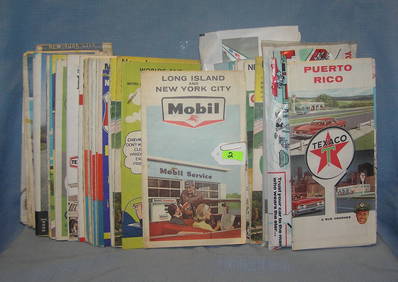
SoldLARGE COLLECTION OF GASOLINE ROAD MAPSAPPROX 100. INCLUDING GULF, TEXACO, STANDARD, MOBILOIL, SHELL, PHILLIPS 66, CHEVRON, STANDARD, FLYING A, & MORESee Sold Price
Sold(7) FRENCH ANTIQUE COPPER PANS, JUG & BED WARMERS(lot of 7) Collection French copperware, 19th/20thc., comprising (2) bed warmers, both pierced, one with floral design, (1) large jug, (1) handled vessel, (1) pan with iron handle, (2) circular pans,See Sold Price
SoldMitchell: Antique Map of Pennsylvania, 1870Title/Content of Map: 1870 Mitchell Map of Pennsylvania -- County Map of the State of Pennsylvania Date Printed: 1870, Philadelphia Cartographer: S Mitchell Size: 14 X 21.5 in. A very nice large, pastSee Sold Price
SoldSUMATRA & JAVA. Dutch East Indies. Singapore.TITLE/CONTENT OF MAP: 'Sumatra; Java' DATE PRINTED: 1863 IMAGE SIZE: Approx 32.0 x 45.5cm, 12.75 x 18 inches (Large) TYPE: Antique map with original outline colour CONDITION: Good; suitable for framinSee Sold Price
SET OF 4 ANTIQUE FRENCH PEWTER SERVING TRAY AND SERVING DISHESAlice Callahan Auction House4.5(56)See Sold PriceMar 02, 2024
Redoute, Rare, Large Folio - Rose - Rosa Gallica flore giganteoTrillium Antique Prints & Rare Books4.5(30)See Sold PriceFeb 24, 2024
Collection of vintage auto related travel mapsBaker's Antiques and Auctions3.3(462)See Sold PriceFeb 25, 2024
CENTRAL EAST AFRICA French Belgian Congo British German Kenya Tanzania 1909 mapJasper524.5(9.8k)See Sold PriceFeb 28, 2024
AFRICA. French West Africa. Rio de Oro Rio Muni Nigeria. BARTHOLOMEW 1952 mapJasper524.5(9.8k)See Sold PriceFeb 28, 2024
Morocco Algeria. French & Spanish West Africa. Sahara sand dunes. TIMES 1956 mapJasper524.5(9.8k)See Sold PriceFeb 28, 2024
FRENCH WEST AFRICA. Afrique Occidentale Française. Saint-Louis, Senegal 1931 mapJasper524.5(9.8k)See Sold PriceFeb 28, 2024
COLONIAL FRENCH NORTH AFRICA. Afrique du Nord. Politique. Political 1929 mapJasper524.5(9.8k)See Sold PriceFeb 28, 2024
Colonial Africa. British German French Spanish Portuguese Italian TIMES 1900 mapJasper524.5(9.8k)See Sold PriceFeb 28, 2024
FRENCH WEST AFRICA. Afrique Occidentale Française. Saint-Louis, Senegal 1938 mapJasper524.5(9.8k)See Sold PriceFeb 28, 2024
FRENCH WEST AFRICA. Afrique Occidentale Française. Saint-Louis, Senegal 1929 mapJasper524.5(9.8k)See Sold PriceFeb 28, 2024
FRENCH COLONIAL GUINEA. Guinee Française. Conakry city town ville plan 1931 mapJasper524.5(9.8k)See Sold PriceFeb 28, 2024
FRENCH WEST AFRICA Nigeria Gold Coast Rio de Oro Portuguese Guinea 1912 mapJasper524.5(9.8k)See Sold PriceFeb 28, 2024
AFRICA. French North Africa and Morocco 1907 old antique map plan chartJasper524.5(9.8k)See Sold PriceFeb 28, 2024
Colonial Africa North-West. British French. Nigeria Sahara. THE TIMES 1900 mapJasper524.5(9.8k)See Sold PriceFeb 28, 2024
L'Afrique Françoise ou du Senegal'. French West Africa. DE L’ISLE 1727 mapJasper524.5(9.8k)See Sold PriceFeb 28, 2024
Henri-Joseph Redouté - Large Folio Botanical Print - Plants in Egypt - Fagonia latifoliaProverde Auctions4.3(3)See Sold PriceFeb 28, 2024
FRANS SWAGERS ANTIQUE DUTCH LANDSCAPE OIL PAINTINGAntique Arena Inc.4.5(852)See Sold PriceMar 09, 2024