Sold[Maps & Atlases] (Adrichom, Christian van), Group of 5[Maps & Atlases] (Adrichom, Christian van) Group of 5 Maps of the Holy Land No place, no date (ca. 1590). Five maps of the territories of the Tribes of Israel, including: Tribus Aser, Tribus Gad, TribSee Sold Price
SoldGroup of six maps of the Holy Lands, four are 14.Group of six maps of the Holy Lands, four are 14.25”x18.5” and two are hand-colored 8”x10”See Sold Price
SoldBartholomew, John 1922 Lot of 5 Maps Egypt & Holy LandIncl Egypt and The Nile, Lower Egypt, Asia Minor/Syria/Mesopotamia, Palestine and Persia. Large Lithograph Maps Published 1922 by The Times, London for "The Times Survey Atlas of the World" Maps by JoSee Sold Price
SoldAntique Map of the Holy Land LotLot of 5 antique maps of the Holy Land, late 18th century - 19th century. Including: Imperium Romanum (London, 1818), A map of antient Egypt, from the best authories (London, 1782), Palestine in the tSee Sold Price
SoldEadie, John 1863 Lot of 5 Holy Land MapsIncl Journeys of Apostle Paul/Asia Minor Apocalyptic Churches, Plan of Jerusalem, Journeys of the Children of Israel/Old & New Canaan, Judah & Israel/Land of Canaan, and The World as peopled by the deSee Sold Price
SoldFuller (Thomas) - A group of 8 maps of the Holy Land,for A Pisgah-Sight of Palestine, engraved maps by Goddard, Marshall, Vaughan and others, all with hand-colouring, each average 290 x 340mm., all with a central vertical fold, occasional slight browninSee Sold Price
Sold(MAP) ORTELIUS, ABRAHAM Size of frame 20 x 26 1/4 i(MAP) ORTELIUS, ABRAHAM A group of two maps of the Holy Land and surrounding Mediterranean. (Antwerp, c. 1580). Hand-colored. Framed and matted. Palestinae sive totius terrae promissionis nova descripSee Sold Price
SoldLot of 5 Holy Land Terracotta Oil Lamps**First Time At Auction** Near East, Holy Land, ca. 3rd to 5th century CE. A wonderful group of five mold-made terracotta oil lamps in varyious styles evocative of the Holy Land. One lamp has a wide bSee Sold Price
SoldDUTCH HAND-COLORED MAP HOLY LAND, STOOPENDAALFramed hand-colored engraving on paper, Map of Canaan (Israel, Palestine, Holy Land), Amsterdam, Daniel Stoopendaal (1672-1726), sight: approx 12"h, 17.5"w, overall: approx 18"h, 23"w, 3.75lbs Start PSee Sold Price
SoldCollection of Maps from the Holy Land. [5]Maps of the Holy Land [5]. 3 colored maps. Map from 1729. One map is a copy.See Sold Price
SoldMaps of the Holy Lands (5)ORTELIUS, Abraham (1527-1598). Terra Sancta, A Petra Laicftain perlus trata, et ab eius ore et fchedis a Chriftiano Schrot in tabulam redacta. 17 3/4 x 21 7/8 inches.; MOXON, Joseph (1627-1691). CanaaSee Sold Price
SoldMap, holy land, Palestine, by Abraham Ortelius, 1612Early map, Palestine, holy land, by Abraham Ortelius, published in Antwerp, 1612, 14.5" by 18.5"See Sold Price
SoldThomas Bowen map, Holy LandMap, Thomas Bowen (1749-1790), An Accurate Map of the Holy Land, with the Adjacent Countries, circa 1770, London, copper plate engraving, with partial color, sight: 12''h x 7.5''w, frame: 16.25''h x 1See Sold Price
SoldNicolaes Berchem 18th Century Holy Land Tinted MapNicolaes Berchem 18th Century Holy Land Tinted Map Engraving 16''x21.5'' Impression. Done after an impression by Elzevier and titled, ''Sortie des Enfans D'Israel hors D'Egypte leur Passage Par la MerSee Sold Price
SoldDaniel Stoopendaal & Jacob Keur 1702 Holy LandDaniel Stoopendaal & Jacob Keur 1702 Holy Land Jerusalem Tinted Map 14''x18.5'' Impression. An 18th century hand tinted map titled ''De Gelegentheyt van 't Paradys ende 't Land Canaan mitsgaders de eeSee Sold Price
SoldHoly Land 1872 Group of 3 Maps by Hughes/BlackieIncl Palestine, The Negreb, and Israel's Wanderings. Lithograph Maps Published 1872, Edinburgh for "The Imperial Bible-Dictionary" Edited by Rev. Patrick Fairbairn. The Maps by W. Hughes. Paper Size:See Sold Price
Sold(Maps) Group of Six 17th, 18th and 19th Century Map(Maps) Group of Six 17th, 18th and 19th Century Maps of the Holy Land, comprising: Palaestina by Mons. D'Anville, London, 1794; Judaea Seu Palaestinia by Johann Baptista Homann, c. 1707; Facies PalaesSee Sold Price
A GROUP OF 5 ANCIENT TERRACOTTA VESSELSA group of five ancient Holy Land pottery vessels. This nice group of vessels consists of:-a wide mouth jug, circa 2nd B.C., measures 3 1/2 in. H. (8.9 cm.)-the flask is 5 1/2 in. H. (14 cm.) and is cSee Sold Price
SoldMap of Holy Land – Woodcut - Basel, 1542Map of the Holy Land and its division into tribes. Woodcut by Claudius Münster Ptolemaeus [Basel, 1542] Hand colored. 25X34.5 cm. Fair –good condition. Stains and creases, damage along the verticalSee Sold Price
Sold3V HOLY LANDS Dan Beersheba Thomson Newman Art"This auction lot includes the following group of titles: - Southern Palestine and Jerusalem by Thomson - Dated 1880 by Harper - library binding. 140 illustrations and maps. - The Holy Land by KelSee Sold Price
SoldPilgrims Holy Land c1961Title/Content of Map: Pilgrims Holy Land c1961 Date Printed: c1961 Cartographer: Japheth Press Material/Medium: glossy paper Size: approx. 25.5x11 inches open, 3.5x6.5 inches folded. c1961. 12-fold. aSee Sold Price
SoldWright, Paul 1782 Holy Land Map. Jerusalem"A Correct Plan of the Antient City of Jerusalem" by Thomas Conder. Folio Copper Plate Published 1782, London for "The Complete British Family Bible…" by Paul Wright. Paper Size: 14.5 x 9.5 inch (37See Sold Price
Soldde Vaugondy: Antique Map of Judea / Holy Land, 1795Title/Content of Map: Judée ou Terre Sainte Cartographer: Robert de Vaugondy/Lamarche Place & Date: Paris / 1795 Size: 8 1/2" x 9 5/8" Condition: outline color; overall age toning, spotting and someSee Sold Price
SoldRollin, Charles 1780 Map of Armenia, Holy Land, Caspian"History of the Assyrians, Babylonians, Medes and Persians" Copper Engraved Map Published 1780, London for "The Ancient History..." by Charles Rollin. Folds as issued. Paper Size: 17.5 x 10.5 inch (25See Sold Price
DAVID ROBERTS - Holy Land / Syria / Egypt etc. 3 x Folio Volumes 1849 Very RareLuis Porretta Fine Arts4.3(10)See Sold PriceMar 02, 2024
1849 Mitchell School ATLAS 24 MAPS America Holy Land France Africa Egypt AsiaSchilb Antiquarian Rare Books4.8(421)See Sold PriceMar 31, 2024
1872 Holy BIBLE & Hitchcock Analysis Gruden Concordance Theology MAPS Holy LandSchilb Antiquarian Rare Books4.8(421)See Sold PriceMar 31, 2024
Group of 5 1934 Sinclair Graphic Road MapsCheck the Oil Promotions, LLC4.6(275)See Sold PriceMar 03, 2024
2.5 gram Gold Bar - Holy Land Mint Dove of Peace (In Assay)Pacific Global Auction3.9(272)See Sold PriceFeb 25, 2024
5 gram Gold Bar - Holy Land Mint Dove of Peace (In Assay)Golden Gate Auctioneer4.1(273)See Sold PriceFeb 24, 2024
Ancient Holy Land Terracotta Handled Jug 5 inch heightGCB Estate Sales4.5(86)See Sold PriceMar 02, 2024
Group of 2 Ancient Holy Land Terracotta Bowl and VesselGCB Estate Sales4.5(86)See Sold PriceMar 02, 2024
2.5 gram Gold Bar - Holy Land Mint Dove of Peace (In Assay)Golden Air Auctions4.4(257)See Sold PriceFeb 28, 2024
TWO ANTIQUE JEWISH NATIONAL FUND CHARITY BOXES. The first one made in Berlin c. 1920J. Greenstein & Co., Inc.4.3(55)See Sold PriceApr 16, 2024
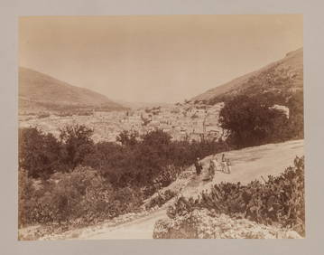
A GROUP OF THREE EARLY HOLY LAND BLACK AND WHITE PHOTOS BY C.N.G. ZANGAKI. C.1870. 11” xJ. Greenstein & Co., Inc.4.3(55)See Sold PriceApr 16, 2024
A GROUP OF TWO EARLY BLACK AND WHITE HOLY LAND PHOTOGRAPHS BY AMERICAN COLONY PHOTOGRAPHERS.J. Greenstein & Co., Inc.4.3(55)See Sold PriceApr 16, 2024
A GROUP OF SEVEN EARLY HOLY LAND BLACK AND WHITE PHOTOS BY FELIX BONFILS. 11” x 8.5”.J. Greenstein & Co., Inc.4.3(55)See Sold PriceApr 16, 2024
5 gram Gold Bar - Holy Land Mint Dove of Peace (In Assay)Golden Air Auctions4.4(257)See Sold PriceFeb 29, 2024

![[Maps & Atlases] (Adrichom, Christian van), Group of 5 (1 of 5)](https://p1.liveauctioneers.com/65/168030/84729854_1_x.jpg?height=282&quality=70&version=1588715715)


![Collection of Maps from the Holy Land. [5] (1 of 5)](https://p1.liveauctioneers.com/2398/71339/36618894_1_x.jpg?height=282&quality=70&version=1430242272)