SoldA group of 17th century and later mapsA group of 17th century and later maps. Comprising a 17th century Scottish map of Galloway, together with maps of Morden's Cheshire, Morden's Warwickshire, Cary's Derbyshire, Cary's Worcestershire, anSee Sold Price
Five assorted maps.Five assorted 17th century and later maps. Comprising Morden's Cheshire, Morden's Warwickshire, Cary's Derbyshire, Cary's Worcestershire, and Bowen's Staffordshire, plus assorted later maps and a bookSee Sold Price
SoldJohn Seller Cartographer (1665-1705) 17th CenturyJohn Seller Cartographer (1665-1705) 17th Century or Later Map of Virginia and Maryland. Engraved and Hand Colored. John Seller The first English publisher of sea-charts. He was hydrographer to CharleSee Sold Price
SoldGrp: 13 Maps of Italy and from Munster's CosmograGroup of 17th-19th century maps. This lot includes four pages from Sebastian Munster's "Cosmographia" including a map of Elba, a map of Italian mainland cities, a map of Sicily, and a map of Africa. TSee Sold Price
SoldEurope.- Mixed group of 17th and 18th century mapsEurope.- Mixed group of 17th and 18th century maps,regions in France and Italy and the counties of Hereford, Hampshire and Berkshire, engraved maps, two with hand-colouring, v.s., average 180See Sold Price
SoldA GROUP OF PASSEMENTERIE TRIMMINGS, 17th CenturyA GROUP OF PASSEMENTERIE TRIMMINGS, 17th Century and later, various types of ribbon and fringing, including an embroidered mirror cover, jute embroidery, pillows and a small embroidered bag.See Sold Price
SoldA GROUP OF PASSEMENTERIE TRIMMINGS, 17th CenturyA GROUP OF PASSEMENTERIE TRIMMINGS, 17th Century and later, various types of ribbon and fringing, including some metal braid.See Sold Price
Sold(Maps) Group of Six 17th, 18th and 19th Century Map(Maps) Group of Six 17th, 18th and 19th Century Maps of the Holy Land, comprising: Palaestina by Mons. D'Anville, London, 1794; Judaea Seu Palaestinia by Johann Baptista Homann, c. 1707; Facies PalaesSee Sold Price
SoldAbraham Ortelius, Acores Insulae map(Dutch, 1527-1598). Hand-colored copper engraved map, 17th century or later, 15 x 22 in., framedSee Sold Price
SoldGroup of French Maps Guillaume de l'Isle SansonGroup of four 17th and 18th century French maps. Guillaume Delisle (1675-1726) hand colored engraved map of Picardie, 1748. Two maps by Nicolas Sanson (1600-1677), "Le Roayaume de France" and "GouvernSee Sold Price
SoldA group of ecclesiastical fragments and chasublesA group of ecclesiastical fragments and chasubles, 17th century and later, including 20th century ivory damask chasuble with 1880s Turkish gold embroidered orphreys; brocaded gold chasuble Italian 186See Sold Price
SoldA group of Continental antique ceramic tiles, 17thA group of Continental antique ceramic tiles, 17th century and later to include terracotta and delft examples, depicting biblical scenes, lions, animals and flora. Each approx. 14cm x 14cm (19)See Sold Price
SoldA Continental boxwood figure group, 17th century,A Continental boxwood figure group, 17th century, depicting the presentation of Christ, on later base, containing a possible reliquary, 16cm highSee Sold Price
SoldA Group of Five Silver Children's ThimblesA Group of Five Silver Children's Thimbles 17th Century and Later comprising English and Continental examples, one example dated 1668. Height of tallest 1/2 inch. Property from the Collection of Ms. ASee Sold Price
SoldSMALL GROUP OF ANTIQUE MAPS17th and 18th Century undated maps include four small 17th Century maps of England and a 17th or 18th Century map of North Africa. Interesting grouping. Largest is 10 1/2" x 11"See Sold Price
SoldA GROUP OF 13 BEAUTIFULLY FRAMED 17TH-19TH CENTUA GROUP OF 13 BEAUTIFULLY FRAMED 17TH-19TH CENTURY HAND-COLORED MAPS including Russia, c. 1750, after M. deL'Isle, 7 inches x 10.25 inches; also from Travels to the Source of the Missouri River and AcSee Sold Price
SoldGROUP OF FLEMISH OR DUTCH GLAZED BRICKS 17TH CENTURYGROUP OF FLEMISH OR DUTCH GLAZED BRICKS 17TH CENTURY AND LATER moulded with stags and rampant lions within a lattice pattern, dated168* (Largest 16cm wide, 10cm high, 5cm deep) Qty: (13)See Sold Price
SoldGroup of Ten Chinese Blue and White DishesGroup of Ten Chinese Blue and White Dishes 17th Century and later With designs of flowers, landscapes, deer and dragons. Diameter of largest 9 inches (22.9 cm).See Sold Price
SoldGroup of Three MapsCollection of three maps, to include one 20th century reprint of a 17th century celestial map, one map of Chesapeake Bay, and one large map of New England, 45" high x 64" wide (frame, largest). ProvenSee Sold Price
A GROUP OF THREE BRONZE BIRD SHAPPED , DECCAN 17THA GROUP OF THREE BRONZE BIRD-SHAPE FINIALS, DECCAN, 17TH CENTURY AND LATER Of various sizes, some with incised decoration - largest 3 7/8in (9.cm) long (7.2) cmSee Sold Price
SoldA GROUP OF CLARET COLORED LARGE FRAGMENTS, CUSHIONA GROUP OF CLARET COLORED LARGE FRAGMENTS, CUSHIONS AND TRIM, 17th Century and later, including curtain tie backs, cording and fragments of 16th Century velvet.See Sold Price
COLLECTION OF EIGHT CITY MAPS I.a. Merian; PetrusCOLLECTION OF EIGHT CITY MAPS I.a. Merian; Petrus Bertius; Braun-Hogenberg; 16th -17th century; partly later prints. Engraving, partly coloured resp. woodcut on different papers. Different sizes. PartSee Sold Price
SoldA group of 12 academic texts and one EthiopicA group of 12 academic texts and one Ethiopic manuscript, Turkey and Ethiopia, 15th century and later, comprising: A compilation text, provincial Iran or Turkey, 17th century or later, 19.5 x 12cm.; KSee Sold Price
SoldA Continental Carved Wood Figural Group Depicting theA Continental Carved Wood Figural Group Depicting the Madonna and Child 17th Century raised on a later wood plinth. Height overall 20 x width 6 inches. Exhibited: Poland, Reginald H. The Bulletin of SSee Sold Price
Medieval and Later 'Wiltshire and Somerset' Lead Farm Token CollectionTimeLine Auctions Ltd.4.5(183)See Sold PriceMar 07, 2024
Tokens - Medieval and Later Copper-Alloy Jetton Group [9]TimeLine Auctions Ltd.4.5(183)See Sold PriceMar 09, 2024
A GRAY AND BLACK JADE 'CAT AND YOUNG' GROUP, CHINA, 17TH-18TH CENTURYGalerie Zacke 4.4(50)See Sold PriceMar 01, 2024
17th Century Hand Colored Engraved Map of GermanyGlobal Auctions Company4.3(36)See Sold PriceMar 03, 2024
Willem Blaeu, Etc. 17th C. Antiquarian Maps, 2Auctions at Showplace4.5(726)See Sold PriceMar 17, 2024
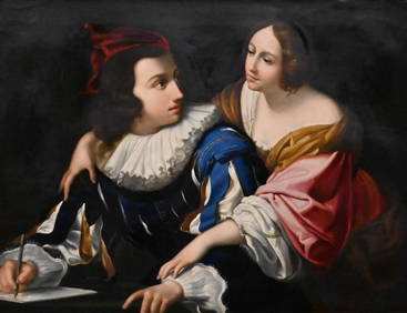
UNKNOWN ARTIST (17TH CENTURY) "PORTRAIT OF A GENTLEMAN".Amelia Jeffers, Auctioneers & Appraisers4.6(101)See Sold PriceMar 07, 2024
WEST AFRICA Niger/Gambia rivers tribes towns. 'Pays des Negres'. MALLET 1683 mapJasper524.5(9.8k)See Sold PriceFeb 28, 2024
WEST AFRICA. Guinea. Nigeria Ghana Benin Togo Sierra Leone. MALLET 1683 mapJasper524.5(9.8k)See Sold PriceFeb 28, 2024
WEST CENTRAL AFRICA. Congo Angola Gabon Cameroon Sao Tome. MALLET 1683 old mapJasper524.5(9.8k)See Sold PriceFeb 28, 2024
WEST AFRICA/MAGHREB Tribes Garamantes Getgulie 'Ancienne Libye'. MALLET 1683 mapJasper524.5(9.8k)See Sold PriceFeb 28, 2024
NORTH AFRICA. Barbary. Morocco Tunisia Libya Egypt. 'Barbarie'. MALLET 1683 mapJasper524.5(9.8k)See Sold PriceFeb 28, 2024
NORTH AFRICA. Morocco Tunisia Libya. 'Mauritanie'. Malta Melita. MALLET 1683 mapJasper524.5(9.8k)See Sold PriceFeb 28, 2024
NUBIA. 'Nubie'. Nile Valley. Sudan Ethiopia Egypt. MALLET 1683 old antique mapJasper524.5(9.8k)See Sold PriceFeb 28, 2024
SUB-SAHARAN AFRICA. 'Ancienne Ethiopie'. Ancient Ethiopia. MALLET 1683 old mapJasper524.5(9.8k)See Sold PriceFeb 28, 2024
16TH AND 17TH CENTURY MEDICAL WORKS. A group of early publications on medicine and surgery.Bonhams4.1(305)See Sold PriceJun 18, 2024


![Tokens - Medieval and Later Copper-Alloy Jetton Group [9] (1 of 1)](https://p1.liveauctioneers.com/1191/317894/170617559_1_x.jpg?height=282&quality=70&version=1706620797)