ATLAS of ANTIENT GEOGRAPHY by SAMUEL BUTLER 1843John McInnis Auctioneers,LLC4.6(504)See Sold PriceFeb 24, 2024
18TH C. ANTIQUE MAP: FRENCH & INDIAN WAR, FRAMEDThomaston Place Auction Galleries4.4(389)See Sold PriceFeb 24, 2024
Rand McNally Railroad Map Cabinet w/ 21 Railroad MapsRail & Road Auctions4.6(165)See Sold PriceMar 08, 2024
Keith Haring - Ink on New York Map, Best Buddies, Inscribed, Signed, and DatedSapphire Auction Gallery4.1(67)See Sold PriceMar 02, 2024
LATE 17TH C. FRENCH MAP OF THE NEW WORLD BY ALEXIS-HUBERT JAILLOT (1632-1712)Thomaston Place Auction Galleries4.4(389)See Sold PriceFeb 24, 2024
Central Railroad of New Jersey Map of Sandy Hook Route-ca. 1903JM Hobby Supply and Railroad Artifact Auctions4.4(126)See Sold PriceFeb 24, 2024
Lot of Six Mixed Atlas Box Cars-HO Scale-New in BoxJM Hobby Supply and Railroad Artifact Auctions4.4(126)See Sold PriceFeb 25, 2024
Rand McNally/Santa Fe Railroad Map of Iowa-1912JM Hobby Supply and Railroad Artifact Auctions4.4(126)See Sold PriceFeb 24, 2024
NICOLAES VISSCHER (NETHERLANDS, 1618-1709) MAP OF THE NEW WORLDThomaston Place Auction Galleries4.4(389)See Sold PriceFeb 24, 2024
17TH C. WORLD MAP BY NICOLAES VISSCHER (NETHERLANDS, 1618-1709)Thomaston Place Auction Galleries4.4(389)See Sold PriceFeb 24, 2024
Lot of Six Mixed Atlas Cabooses-HO Scale-New in BoxJM Hobby Supply and Railroad Artifact Auctions4.4(126)See Sold PriceFeb 25, 2024
Sold7 maps of the Russian Empire southern borderland7 maps of the Russian Empire southern borderland. Edition of the Military Topographic Department of the General Staff. Includes: #2 "Astrakhan, Orenburg", #3 "Tobolsk, Akmolinsk", #4 "Omsk, Tomsk", #5See Sold Price
Sold7 maps oF Russian Empire and Asia, 18th cent.[Russia/Central Asia]. 7 engraved maps, uncolored. Mostly in very good condition. ++ Bellin. Carte Pour Les Voyages De Rubruquis Marco Polo Jenkinson &ca. Left margin lightly soiled. Northern Europe,See Sold Price
Map of Russian Empire, Empire of Japan. 1904Title/Content of Map: Russian Empire, Empire of Japan and The Far East. Cartographer: HAMMOND, C. S. & CO. Size: 7.5X10.6 War Supplement. The Rochester Post. Saturday, February 27, 1904. Oval coloredSee Sold Price
Ottens, J&R. Carte Nouvelle de RussieOttens, Josua & Reinier Carte Nouvelle de tout l'Empire de la Grande Russie C. 1740 Copperplate engraving; area coloured Printed area: 65.5 x 47.2 cm; 25.7 x 18.5 in This map of the Russian Empire strSee Sold Price
Russian Empire, Empire of Japan and The Far East.Title/Content of Map: Russian Empire, Empire of Japan and The Far East. Date Printed: 1904 Cartographer: HAMMOND, C. S. & CO. Size: 7.5x10.6 War Supplement. The Rochester Post. Saturday, February 27,See Sold Price
Weber, F.Ch. «Das Vera?nderte Rußland, In welchem dieFranckfurth; Hannover: Verlegts Nicolaus Fo?rster, 1721. [14], 490, [6] p., 1 frontis. (port.), 7 ill., maps. 21,3x18 cm. Frontispiece with the portrait of Peter I, folding map of the Russian Empire,See Sold Price
SoldA LOT OF 3 ANTIQUE MAPS OF THE RUSSIAN EMPIREThis lot includes a map of Crimea by Huot & Demidoff, a Spanish map of the Russian Empire and Scandinavia, and a British made map of the Central, Southern, and Northern parts of the Russian Empire. DiSee Sold Price
Walker: Map of Turkish Empire in Europe, 1843Map of The Turkish Empire in Europe and Asia With The Kingdom of Greece. Chapman & Hall/SDUK., Walker, J. & C. 1843-10-15. Good view of the Balkans and the southern regions of the Russian Empire as weSee Sold Price
SoldPALLAS (Peter) Travels through the Southern ProvincesPALLAS (Peter) Travels through the Southern Provinces of the Russian Empire..., 2 vols., London 1802-03, 4to, first edition in English, with maps, coloured plates and vignettes as called for, (vol. IISee Sold Price
SoldRussia.- Pallas (Peter Simon) Travels through theRussia.- Pallas (Peter Simon) Travels through the Southern Provinces of the Russian Empire..., 2 vol., second edition, lacking half-title in vol.2 (not called for in vol.1), 52 aquatint or engraved plSee Sold Price
Sold-. Pallas (Peter Simon) Travels through the Southe-. Pallas (Peter Simon) Travels through the Southern Provinces of the Russian Empire,in the Years 1793 and 1794, 2 vol., first edition in English, 4 folding engraved maps, 51 engraved plates aSee Sold Price
SoldPallas. Travels Russian EmpirePallas (Peter Simon) Travels through the Southern Provinces of the Russian Empire,in the Years 1793 and 1794, 2 vol., first edition in English, 55 engraved plates and maps, (49 hand-coloured),See Sold Price
SoldPallas (Peter Simon) Travels through the SouthernPallas (Peter Simon) Travels through the Southern Provinces of the Russian Empire,in the Years 1793 and 1794, [translated by F.W.Blagdon], 2 vol., first edition in English, 4 folding engravedSee Sold Price
SoldJapan, Russia, eastern Asia: 4 maps, [1747]-1829.[Russia/Japan]. 4 engraved maps, uncolored, very good condition overall. ++ Bonne. Tartarie Chinoise, Roy De Coree Et Isles Du Japon. c.1747. 8 7/8 x 13 1/4 in. ++ Thomas Bowen. The Russian Empire, InSee Sold Price
Russian empire in Europe , RARE Swedish issue by A.Title: Russian empire in Europe , RARE Swedish issue by A. Akerman 1768-1774 Date/Period: 1768-1774 Materials: Copperplate engravedSize: 7 1/2 x 6”. The hard to obtain map shows the provinces of EurSee Sold Price
[Asia] the Russian Empire, Empire of Japan and the FarTitle: [Asia] the Russian Empire, Empire of Japan and the Far East Publication Date: 2/21/1904 Cartographer: HAMMOND, C. S. & CO. Publisher:C.S. HAMMOND & CO. | THE NORTH AMERICAN Size: 7.6Height - 10See Sold Price
Robert Johnston Travels Russia 1815Travels Through Part of The Russian Empire and the Country of Poland; along the Southern Shores of the Baltic by Robert Johnston. Illustrated with Maps and Numerous Coloured Plates. 1815. J. J. StockdSee Sold Price
Robert Johnston. Travels through Part of the RusRobert Johnston. Travels through Part of the Russian Empire and the Country of PolaSee Sold Price
SoldJohnston's Travels Through Part of Russia 1815Heading: Author: Johnston, Robert Title: Travels Through Part of the Russian Empire and the Country of Poland; Along the Southern Shores of the Baltic...Illustrated with Maps and Numerous Coloured PlSee Sold Price
SoldJohnston's Travels Through Part of Russia 1815Title: Travels Through Part of the Russian Empire and the Country of Poland; Along the Southern Shores of the Baltic...Illustrated with Maps and Numerous Coloured Plates Author: Johnston, Robert DescrSee Sold Price
Robert Johnston. Travels through Part of the RusRobert Johnston. Travels through Part of the Russian Empire and the Country of PolaSee Sold Price
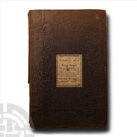
SoldRobert Johnstone book, 1815Johnstone, Robert- ''Travels Through Part of the Russian Empire and the Country of Poland; Along the Southern Shores of the Baltic''. :London, 1815, with illustrations and maps, 456 pages, hardbound,See Sold Price
Sold41 Public Timetables & Maps - lots of WesternA group of 41 timetables and maps. There are 7 Southern Pacific from 1921-1963, 13 GN NP & CB&Q that includes a 1932 Empire Builder equipment list. 1 each from Pere Marquette, Boston & Maine, New HaveSee Sold Price
1809 Arrowsmith Map of European (South) Russia -- South1809 Arrowsmith Map of European (South) Russia -- South Part of Russia in Europe 1809, London A Arrowsmith 9.7 X 15.8 in. Attractive map of the southern half of European portion of Russia. The map covSee Sold Price
Numismatic Books - Whelan - The Numismatic Atlas of the Roman EmpireTimeLine Auctions Ltd.4.6(182)See Sold PriceMar 09, 2024
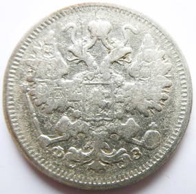
Russian Empire 15 Kopecks - Alexander II / III / Nicholas II 1900 Silver coinBazaar of Persia4.4(24)See Sold PriceFeb 24, 2024
An Empire Russian Tsar & Alexandra Green Marble EggFive Star Auctions4.2(3)See Sold PriceFeb 29, 2024
1816 MAP SOUTHERN PART OF RUSSIA or MUSCOVY in EUROPE copper engraving ANTIQUEJasper524.5(9.8k)See Sold PriceFeb 27, 2024
1816 MAP NORTHERN PART OF RUSSIA or MUSCOVY in EUROPE copper engraving ANTIQUEJasper524.5(9.8k)See Sold PriceFeb 27, 2024
MEDIEVAL EUROPEAN CONVERT’S CROSS NECKLACE, 9th-10th CENTURYJasper524.5(9.8k)See Sold PriceFeb 28, 2024
1764 Bellin Map of Southern Portion of Martinique -- Partie Meridionale de la MartiniqueJasper524.5(9.8k)See Sold PriceFeb 27, 2024
1764 Bellin Chart of Three South Haitian Bays -- Carte des Bayes du Mesle des Flamands et deJasper524.5(9.8k)See Sold PriceFeb 27, 2024
SOUTHERN AFRICA Monomotapa (Mutapa Kingdom) Cafrerie (Kaffraria) MALLET 1683 mapJasper524.5(9.8k)See Sold PriceFeb 28, 2024
ANTIQUE ILLUSTRATED HANDBOOK OF GEOGRAPHY AND TRAVEL IN ASIA, VOLUME 2, 1896NY Elizabeth 4.3(85)See Sold PriceMar 03, 2024
[Russian]. Enameled pendant "Double-headed eagle of Russian Empire", easter egg shaped. - Russia,ARTMAXIMUM4.3(4)See Sold PriceMar 14, 2024


![Japan, Russia, eastern Asia: 4 maps, [1747]-1829. (1 of 4)](https://p1.liveauctioneers.com/179/15522/5074186_1_x.jpg?height=282&quality=70&version=1206672512)

![[Asia] the Russian Empire, Empire of Japan and the Far (1 of 5)](https://p1.liveauctioneers.com/5584/161711/81649481_1_x.jpg?height=282&quality=70&version=1582126150)


![[Russian]. Enameled pendant "Double-headed eagle of Russian Empire", easter egg shaped. - Russia, (1 of 4)](https://p1.liveauctioneers.com/6171/320219/172084112_1_x.jpg?height=282&quality=70&version=1708525949)


