Sold7 19thc School Atlas or Geography map books.A group of 7 American 19th c school atlas or geography books including Mitchell's School Atlas 1839 complete, partial 1829 school atlas, 1854 Smith's Atlas of Modern and ancient geography, 1855 CornelSee Sold Price
Sold19th C. Map of Marblehead, MAMap of Marblehead, MA, lithograph, dated 1850, published by Henry McIntyre, 35 1/2" h x 27 3/4" w (view), 38 5/8" h x 30 7/8" w (frame). Provenance: MA estate.See Sold Price
Sold19th C. Map of Marblehead, MAMap of Marblehead, MA, lithograph, dated 1850, published by Henry McIntyre, 35 1/2" h x 27 3/4" w (view), 38 5/8" h x 30 7/8" w (frame). Provenance: MA estate.See Sold Price
SoldOriginal 19th C. Map of BostonOriginal 19th C. Map of Boston, framed. Image size: 7 x 4 inches.See Sold Price
Sold19thc Map of New Netherland, 17thc Dutch Colony1879 bookplate print, wood engraving, map of New Netherland ( 17thc Dutch Colony ) after an original 1656 map of A. Vanderdonck. 6" X 9 1/2" page size. 4 1/4" X 7" map size. New Netherland was comSee Sold Price
SoldJOSEPH T. SCOTT (AMERICAN, 18TH/19TH C.) MAP OFJOSEPH T. SCOTT (AMERICAN, 18TH/19TH C.) MAP OF VIRGINIA, on laid paper, titled "VIRGINIA" in upper left corner, above scale; printed for "The New and Universal Gazetteer". Late 18th century. 7 1/2" xSee Sold Price
Sold(7 PC) VICTORIAN DRESSER SET(7) Piece Late 19th c. Vanity Set, with carved monogram 'MAP', including: Powder jar with screw lid, 3 1/2" high, 3 3/4" diam.; Rectangular hairpin box with hinged lid and clasp closure, 1" high, 6 5/See Sold Price
SoldThree 19th C English MapsThree 19th c English Maps: Scarborough 6.5 x 4"; Estuary of the Thames 10 x 7.5"; and folding map of Lincolnshire 11 15". Very Good. Reserve: $30.00 Shipping: Domestic: Flat-rate of $5.00 to anywhereSee Sold Price
SoldTexas nach den Besten Quellen Map, 19th CMap: Texas nach den Besten Quellen Cartographer: Bibliographischen Instituts. / Radefeld Place & Date: Hildburghausen / 1849/1857 Size: 13 7/8" x 11 1/2" Condition: original outline color The scarce sSee Sold Price
Sold19th C Linen Manuscript Map Tuckingmill Cornwall19th century manuscript linen map on an area referred to as Tuckingmill in the County of Cornwall. Very Good, Measures 9 x 7”. Please note that this lot has a confidential reserve. When you leave aSee Sold Price
Sold19th c. English steel engraving of map of Ireland19th century English steel engraving with hand-colored embellishments depicting a map of Ireland, London, circa 1843, 10"h x 7.5"w sight of sheet, overall dimensions including frame 21"h x 18.25"w x 1See Sold Price
SoldFramed MapsLot of two framed maps "ASIAE" (sight 18 1/2" x 21"), and "Europe" (sight 18" x 21"), along with 19th c. print "Mount Shasta" (sight 7" x 10").See Sold Price
Sold18TH AND 19TH CENTURY MAPS18th C. map of Wilt Shire measures 7 inches x 4.5 inches sight size through the mat. The 19th century map of Rome measures 8 inches x 11.75 inches sight size through the matSee Sold Price
SoldMAP OF NEW ENGLAND AND NEW YORK BY ROBERTMARDEN, LATE 18TH OR EARLY 19TH C, HAND COLORED, EXCELLENT CONDITION. NEW FRAME, MAT AND UV GLASS. SIGHT SIZE 7" X 6", OVERALL 16 1/2" X 14 3/4".See Sold Price
Sold19th c. Japanese Porcelain VasesPair of blue and white double gourd vases decorated with a map of Japan. 4 character mark dates 1830-44. 7.5"h x 3.5" roundSee Sold Price
SoldMid 19th C. Oil Portrait Of An Older GentlemanMid 19th C. Oil Portrait Of An Older Gentleman Pointing To A Map Location, (Oil On Board) 7 ½” X 9” H. In A Period Gilt Frame 9 ¼” X 10 ¾”. SHIPPING: Shipping HaSee Sold Price
SoldANNA POTTERY PIG (Attr.)ANNA POTTERY PIG (Attr.); Rockingham glaze with partially legible writing and map on both sides, Illinois, late 19th c.; Chip to ear; 3 1/2'' x 7'' x 2 1/2''See Sold Price
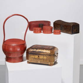
Sold7 19TH C. BRASS WOOD & BRONZE BOXES & BOOKHOLDERSSeven piece lot of nineteenth Century bronze, brass and wood boxes and bookholders, with two featuring Pietra Dura medallions. Ht: 6" Width: 7.25" Depth: 3.75" (Largest)See Sold Price
SoldLOT OF 7 19TH C. VOLUMES INCLUDING LEATHER BOUNDLOT OF 7 19TH C. VOLUMES INCLUDING LEATHER BOUNDSee Sold Price
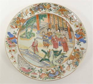
Sold(7) 19th C. Chinese Porcelain Plates with BatsThis is a set of 19th. Century Chinese iron red glazed bat plates. There are sets of five bats surrounding a Shou.The mark in old seal style reads 大清雍正年制 “GSee Sold Price
Sold(4) 19th c. Maps and Guides to New York CityIncluding (2) "'The Great Metropolis or New York in 945" by John Dogget. New York. Hardcover mottled cloth-bound, gilt and blind stamped. (fading, minor wear to covers, toning) 5 1/2 x 3 1/2 inches eaSee Sold Price
Sold(16) 19TH C. MAPS OF THE WEST INDIES IN FOLIO,Including: "L'Isle de Ste. Domingue, et celle de Porto Rico", by Bonne, hand colored engraving,1778, 10" x 14 1/2"; PLUS "West Indies", Smith's Atlas, 1808, hand colored engraving, 1808, 11" x 14"; PLSee Sold Price
Sold7 19TH C. BRASS WOOD & BRONZE BOXES & BOOKHOLDERSSeven piece lot of nineteenth Century bronze, brass and wood boxes and bookholders, with two featuring Pietra Dura medallions. Ht: 6" Width: 7.25" Depth: 3.75" (Largest)See Sold Price
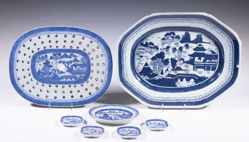
CHINESE EXPORT BLUE & WHITE CANTON DISHESThomaston Place Auction Galleries4.4(393)See Sold PriceFeb 24, 2024
19thc Colton Map, Comparitive Size of Lakes & IslandsConnoisseur Auctions3.9(336)See Sold PriceFeb 24, 2024
Map: A 19thC engraved and hand coloured map of South America. Published by the Society for theClaydon Auctioneers Ltd4.3(125)See Sold PriceFeb 26, 2024
Map: A 19thC engraved and hand coloured map of St. Petersburg / Sanktpeterburga by W. B. Clarke.Claydon Auctioneers Ltd4.3(125)See Sold PriceFeb 26, 2024
Map: A 19thC engraved map titled Gloucestershire from the Best Authorities, after John Cary. Approx.Claydon Auctioneers Ltd4.3(125)See Sold PriceFeb 26, 2024
Map: A 19thC engraved and hand coloured map of Buckingham titled A New Map of BuckinghamshireClaydon Auctioneers Ltd4.3(125)See Sold PriceFeb 26, 2024
Map: A 19thC engraved map of West Riding, titled A Map of the North Part of the West Riding ofClaydon Auctioneers Ltd4.3(125)See Sold PriceFeb 26, 2024
1816 MAP SOUTHERN PART OF RUSSIA or MUSCOVY in EUROPE copper engraving ANTIQUEJasper524.5(9.9k)See Sold PriceFeb 27, 2024
1816 MAP NORTHERN PART OF RUSSIA or MUSCOVY in EUROPE copper engraving ANTIQUEJasper524.5(9.9k)See Sold PriceFeb 27, 2024
1704 DESCRIPTION OF ALL THE SEATS OF THE PRESENT WARS OF EUROPE antique w/ MAPSJasper524.5(9.9k)See Sold PriceFeb 27, 2024
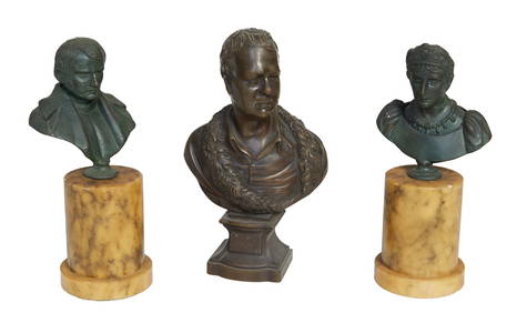
Group of Three Patinated Bronze Cabinet Figures, 19th c., Man- H.- 7 3/4 in., W.- 4 1/2 in., D.- 2Crescent City Auction Gallery4.3(231)See Sold PriceMar 08, 2024
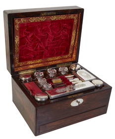
English Carved Rosewood Necessaire de Toilette, 19th c., H.- 7 in., W.- 12 in., D.- 9 1/4 in.Crescent City Auction Gallery4.3(231)See Sold PriceMar 09, 2024
Rare 19thc Colton Map, Argentine Republic, Chile, Uruguay, PataguayConnoisseur Auctions3.9(336)See Sold PriceMar 16, 2024
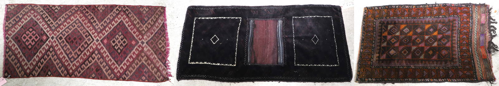
2'4" x 4'7" Late 19th c Turkish Soumak Rug, 2'1" x 4'4" Belouch bag, 3'4" x 2'1" Belouch storage bagWilliam Bunch Auctions & Appraisals4.6(878)See Sold PriceFeb 27, 2024
English Burl Walnut & Brass Lap-Writing Desk, 19Th C., H 7", W 19.5", D 10"DuMouchelles4.6(830)See Sold PriceMar 14, 2024