Sold62 maps bound into composite atlas, [ca. 1700].[Atlas]. Composite Atlas of mostly continental Europe with 59 double-page engraved maps and 3 engraved tables. 24 maps by Nicholas Visscher, 16 by De Wit, 5 by Johann Baptiste Homann, 16 by Pieter SchSee Sold Price
SoldTANNER / BRADFORD / COLTON. Composite atlas wiTANNER / BRADFORD / COLTON. Composite atlas with 62 hand-colored maps of North America or parts thereof. Folio, 415x380 mm, modern 1/4 cloth over old marbled boards; all maps bound in on wide tabs, exSee Sold Price
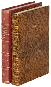
Composite Atlas ca 1850Atlante Geografico composito.Verso il 1850Folio, 355x225 mm; 34 maps, 4 drawings of Sebastopoli and 1 drawing from Rome to Naples and 1 albumina photo by the photographic study of Domenico Muller, smaSee Sold Price
SoldPietre van der Aa Map of India ca. 1700Pietre van der Aa (1659-1733) "Indien Binnen de Ganges Vertoonende de Koninkryken van Golconda, Decan, Bisnaga en Grenzen van Mogol," Leiden, ca. 1700. Hand colored map of India. This map features anSee Sold Price
SoldCovens & Mortier Map of the World ca. 1700 CalifoJohannes Covens (1697-1774) and Cornelius Mortier (1699-1783), "Carte Generale du Monde, ou Description du Monde Terrestre & Aquatique," Amsterdam, ca. 1700. This map of the world shows California asSee Sold Price
SoldHenri Abraham Chatelain Map of Asia ca. 1700Henri Abraham Chatelain (1684-1743), "Carte des Indes, de la Chine & des Iles de Sumatra, Java &c, Dresee sur la Memoires les plus nouveaux & sur les meillures observations, tirees des RelatiSee Sold Price
SoldBroadside, Religious Liberty in England, ca. 1700"A Letter to a Friend." n.p., n.d. [likely London, ca. 1700]. 2 pp. 11.5" x 8. Margins rather chipped with slight loss of text at lower margin, short closed tears, some soiling, Fair. ************* CoSee Sold Price
Sold[SEUTTER] 4 maps sold together. ca. 1700SEUTTER, M. 4 maps sold together. ca. 1700. Including: Africa [Continental], Matthaei Seutteri ** Africa[Northern], Matthaei Seutteri ** Palestina, Matthaei Seutteri ** Opulentissimi Regni Persia, MatSee Sold Price
SoldTwo ca. 1700 Dutch Maps of the Holy LandLot of two antique maps of the holy land: *"Het Beloofde Landt Canaan door wandelt van onsen Salichmaecker Jesu Christo neffens syne Apostelen". Copperplate engraving. From: Biblia..., Dordrecht and ASee Sold Price
SoldAtlas Minor, Sive Geographia Compendiosa Qua Orbis ...Atlas Minor, Sive Geographia Compendiosa Qua Orbis Terrarum Per Paucas Attamen Novissimas Tabulas Ostenditur. Nicolaes II Visscher (1649-1702). Published by Amsterdam: Nicolai Visscher, [ca 1700]. FolSee Sold Price
SoldNicolas Sanson Atlantis Insula Map Hand Colored ENicolas Sanson (1600-1677), "Atlantis Insula," Amsterdam: Mortier, ca. 1700. This wonderful hand colored engraving map of America purportedly shows the Western Hemisphere about 200,000 years ago beforSee Sold Price
Interesting antique map of Spain or CeltiberiaTitle/Content of Map: Interesting antique map of Spain or Celtiberia Date Printed: 1700 Cartographer: Wells, Edward Size (in): 20 x 15 Highly interesting framed intaglio engraved map of Spain ca. 1700See Sold Price
SoldEdward Wells Map of South America ca. 1700-1738Edward Wells (1667–1727), engraved by Benjamin Cole, "A New Map of South America, Shewing it's General Divisions, Chief Cities & Towns; Rivers, Mountains & c," London, ca. 1700-1738. Hand colorSee Sold Price
SoldCornelis Danckerts celestial map of the northernCornelis Danckerts celestial map of the northern hemisphere. Ca. 1700. "Nieuwe Hemels Spiegel…". Hand colored engraving. Prepared by Andreas van Luchtenberg. Engraved by Danckerts. Framed and maSee Sold Price
SoldHONDIUS, Henricus. 2 framed mapsHONDIUS, Henricus. Frisia Occidentalis Auctoribus Adriano Merio et Geraldo Freitag. Amsterdam. ca. 1700 century.38cm x 49.8cm (15" x 19.5") plate mark Sold with: Geldria Dvcatvs et Zvtfania Comitavs 3See Sold Price
18TH CENTURY EUROPEAN SOLDIERS, HAND-TINTED PLATES (11)Fine set of 11 hand-tinted plates of various ca. 1700's European soldiers in uniform, the plates mounted to ca. 6.5 x 8.5 in. mounts. Subjects include Bavarians, Prussians, Hungarians, etc., all disboSee Sold Price
Sold[SEUTTER, M] 52 Maps of Europe sold togetherSEUTTER,M. 52 Maps of Europe sold together. ca. 1700. Includes. Europa ** Flandria ** Hanoniae ** Belgii **Luxemburg ** Dauphine Five Delpinatus ** Parmensis Et Placentinus ** Transylvaniae ** DucatusSee Sold Price
SoldRARE 18TH C. FRENCH MAP OF SCANDINAVIANicolas Sanson, "La Scandinavie, et les Environs, ou sont Les Royaumes de Suede, de Danemark et de Norwege divises en leurs principales Provinces": published by Pierre Schenk, Amsterdam, ca. 1700. CopSee Sold Price
Map of MadridVINCENZO MARIA CORONELLI “MADRID. A.P. CORONELLI”. Venecia, ca. 1700 Plano de Madrid grabado al cobre por el cartógrafo y cosmógrafo veneciano: Coronelli, TÃtulo, clave y escala eSee Sold Price
Sold"L'AFRIQUE, DRESSEE SUR LES OBSERVATIONS DE MRS. DEFine decorative map, titled"L'Afrique, Dressee Sur les Observations de Mrs. De l'Academie Royale des Sciences, et quelques autres; & sur les Memoires les plus recens"Â, ca. 1700, dividing Africa intoSee Sold Price
La Saintonge vers Midy: avec le Brovageais.Sanson, Guillaume. La Saintonge vers Midy: avec le Brovageais. Amsterdam: Valk and Schenk, ca. 1700. A decorative map that shows Saintonge from the southern tip of the island of Oleron to the mouth ofSee Sold Price
Sold[Maps] Berthelot, Côtes de Terre Ferme...François Berthelot, Nouvelle Carte de Partie des Côtes de Terre Ferme et Isles Situées sur l'Ocean. 1700 ca. Incisione in rame. mm 545x780. Titolo e dati editoriali entro cartiglio figurato inSee Sold Price
L'italieTitle/Content of Map: L'italie Date: 1700 ca. Cartographer: ANONYMOUS Size: 9.6X8.25 Please note that this lot has a confidential reserve. When you leave a bid in advance of the auction, submit your mSee Sold Price
Dominio FiorentinoReserve Reduced! Title: Dominio Fiorentino Publication Date: 1690-1700 ca. Cartographer: BLAEU, JOAN ? Material/Medium: G. VALK AND P. SCHENK Size: H15-19.25W From Perugia to the border of Lombardy. DSee Sold Price
DAVID ROBERTS - Holy Land / Syria / Egypt etc. 3 x Folio Volumes 1849 Very RareLuis Porretta Fine Arts4.3(10)See Sold PriceMar 02, 2024
EARLY 18TH C. DUTCH CHART OF PACIFIC OCEAN BY FREDERIK DE WIT (1629-1706) WITH CALIFORNIA AS ANThomaston Place Auction Galleries4.4(393)See Sold PriceFeb 24, 2024
EARLY 18TH C. MAP OF ITALY, FRAMEDThomaston Place Auction Galleries4.4(393)See Sold PriceFeb 24, 2024
LATE 16TH C. MAP OF SCOTLAND BY MERCATOR, FRAMEDThomaston Place Auction Galleries4.4(393)See Sold PriceFeb 24, 2024
[MAPS]. DUFOUR, Auguste-Henri (1795-1865). Bound Volume of ...Potter & Potter Auctions4.6(545)See Sold PriceMar 07, 2024
Four octagonal vials made of gold ruby glassDr. Fischer Fine Art Auctions4.5(110)See Sold PriceMar 09, 2024
Battle of the Nile: Disposition of the English & French Fleets, at the Commencement of the Action,Trillium Antique Prints & Rare Books4.5(32)See Sold PriceFeb 24, 2024
Duval - Pair: Map of Georgia & Map of Moscow, RussiaTrillium Antique Prints & Rare Books4.5(32)See Sold PriceFeb 24, 2024
Duval - Pair: Map of India & Map of MaldivesTrillium Antique Prints & Rare Books4.5(32)See Sold PriceFeb 24, 2024
Putnam - First Map of the State of Ohio by Rufus PutnamTrillium Antique Prints & Rare Books4.5(32)See Sold PriceFeb 24, 2024
![62 maps bound into composite atlas, [ca. 1700]. First Image](https://p1.liveauctioneers.com/179/15522/5074053_1_x.jpg?height=282&quality=95&version=1207090516&width=282)
![62 maps bound into composite atlas, [ca. 1700]. (1 of 5)](https://p1.liveauctioneers.com/179/15522/5074053_1_x.jpg?height=282&quality=70&version=1207090516)
![62 maps bound into composite atlas, [ca. 1700]. First Image](https://p1.liveauctioneers.com/179/15522/5074053_1_x.jpg?height=282&quality=1&version=1207090516&width=282)


![[SEUTTER] 4 maps sold together. ca. 1700 (1 of 2)](https://p1.liveauctioneers.com/1124/187577/94368890_1_x.jpg?height=282&quality=70&version=1607095126)


![[SEUTTER, M] 52 Maps of Europe sold together (1 of 4)](https://p1.liveauctioneers.com/1124/187577/94368891_1_x.jpg?height=282&quality=70&version=1607095126)


![[Maps] Berthelot, Côtes de Terre Ferme... (1 of 2)](https://p1.liveauctioneers.com/1306/149407/75466432_1_x.jpg?height=282&quality=70&version=1567670607)


![[MAPS]. DUFOUR, Auguste-Henri (1795-1865). Bound Volume of ... (1 of 2)](https://p1.liveauctioneers.com/928/318880/171361279_1_x.jpg?height=282&quality=70&version=1707501302)