ATLAS of ANTIENT GEOGRAPHY by SAMUEL BUTLER 1843John McInnis Auctioneers,LLC4.6(502)See Sold PriceFeb 24, 2024
18TH C. ANTIQUE MAP: FRENCH & INDIAN WAR, FRAMEDThomaston Place Auction Galleries4.4(386)See Sold PriceFeb 24, 2024
Rand McNally Railroad Map Cabinet w/ 21 Railroad MapsRail & Road Auctions4.6(165)See Sold PriceMar 08, 2024
Keith Haring - Ink on New York Map, Best Buddies, Inscribed, Signed, and DatedSapphire Auction Gallery4(67)See Sold PriceMar 02, 2024
LATE 17TH C. FRENCH MAP OF THE NEW WORLD BY ALEXIS-HUBERT JAILLOT (1632-1712)Thomaston Place Auction Galleries4.4(386)See Sold PriceFeb 24, 2024
Central Railroad of New Jersey Map of Sandy Hook Route-ca. 1903JM Hobby Supply and Railroad Artifact Auctions4.4(126)See Sold PriceFeb 24, 2024
Lot of Six Mixed Atlas Box Cars-HO Scale-New in BoxJM Hobby Supply and Railroad Artifact Auctions4.4(126)See Sold PriceFeb 25, 2024
Rand McNally/Santa Fe Railroad Map of Iowa-1912JM Hobby Supply and Railroad Artifact Auctions4.4(126)See Sold PriceFeb 24, 2024
NICOLAES VISSCHER (NETHERLANDS, 1618-1709) MAP OF THE NEW WORLDThomaston Place Auction Galleries4.4(386)See Sold PriceFeb 24, 2024
17TH C. WORLD MAP BY NICOLAES VISSCHER (NETHERLANDS, 1618-1709)Thomaston Place Auction Galleries4.4(386)See Sold PriceFeb 24, 2024
Lot of Six Mixed Atlas Cabooses-HO Scale-New in BoxJM Hobby Supply and Railroad Artifact Auctions4.4(126)See Sold PriceFeb 25, 2024
Sold(4) 1838 BRADFORD Maps: KY, IL, MO, WI and Iowa.[United States/West] 4 Maps (maps 21, 27, 34, and 38) from T. G. Bradford, “An Illustrated Atlas, Geographical, Statistical, And Historical, Of The United States, And Adjacent Countries,” Bos: WeeSee Sold Price
1852 OLD ANTIQUE MAP WESTERN UNITED STATES, MITCHELL KY1852 OLD ANTIQUE MAP WESTERN UNITED STATES, MITCHELL KY MI IN OH VA IL IA WI MO 1852 Antique Map by S. Augustus Mitchell of Pennsylvania. ??No. 14 - MAP OF THE CHIEF PART OF THE WESTERN STATES INCLUDISee Sold Price
Soldc 1852 OLD MAP of WESTERN UNITED STATES by MITCHELL IAc 1852 OLD MAP of WESTERN UNITED STATES by MITCHELL IA MI MO IL IN KY OH VA WI Description: Circa 1852 Antique Map ??No. 14 - MAP OF THE CHIEF PART OF THE WESTERN SSTATES INCLUDING WEST VIRGINIA. By SSee Sold Price
Mitchell: Antique Map of Western United States, 1852OLD MAP of WESTERN UNITED STATES by MITCHELL IA MI MO IL IN KY OH VA WI. Circa 1852 Antique Map. No. 14 - MAP OF THE CHIEF PART OF THE WESTERN STATES INCLUDING WEST VIRGINIA. By S. Augustus MitchelSee Sold Price
c 1852 OLD MAP of WESTERN UNITED STATES by MITCHELL IAc 1852 OLD MAP of WESTERN UNITED STATES by MITCHELL IA MI MO IL IN KY OH VA WI Circa 1852 Antique Map ??No. 14 - MAP OF THE CHIEF PART OF THE WESTERN SSTATES INCLUDING WEST VIRGINIA. By S. Augustus MiSee Sold Price
Sold4 19th cent. TN & KY MapsFour (4) 19th century Tennessee and Kentucky maps. 1st item: "Tennessee" by Thomas G. Bradford, engraved by George W. Boynton, published by American Stationer's Co., Boston, 1838. From "A ComprehensivSee Sold Price
4 19th cent. TN & KY Maps1st item: "Tennessee" by Thomas G. Bradford, engraved by George W. Boynton, published by American Stationer's Co., Boston, 1838. From "A Comprehensive Atlas, Geographical, Historical & Commercial" bySee Sold Price
Sold(4) 1838 BRADFORD Maps: OH, IN, MI, TN[United States/Near West] 4 Maps. ++ OHIO. ++ INDIANA. ++ MICHIGAN. [With inset of upper peninsula.] ++ TENNESSEE. ++ Maps 19, 20, 22, 29 from T. G. Bradford, “An Illustrated Atlas, Geographical, StSee Sold Price
Sold(4) 1838 BRADFORD Maps: NC, SC, GA, FL.[United States/South] 4 Maps. ++ NORTH CAROLINA. ++ SOUTH CAROLINA. ++ GEORGIA. ++ FLORIDA. ++ +Maps 28, 30, 31, 32 from T. G. Bradford, “An Illustrated Atlas, Geographical, Statistical, And HistoriSee Sold Price
Sold(4) 1838 Bradford Maps: NY, PA, NYC, Phila.[United States/NY/PA/Phila] 4 Maps. ++ NEW YORK State. ++ NEW YORK City. [Street grid of central & southern Manhattan and northwestern Brooklyn.] ++ PENNSYLVANIA. ++ PHILADELPHIA. ++ Maps 14, 15, 17,See Sold Price
Sold(4) 1838 BRADFORD Maps: AL, MS, LA, AR[United States/Southwest] 4 Maps. ++ ALABAMA. ++ MISSISSIPPI.++ LOUISIANA. ++ ARKANSAS. ++ Maps 33, 34, 35, 36 from T. G. Bradford, “An Illustrated Atlas, Geographical, Statistical, And Historical,See Sold Price
1838 Bradford Map of Iowa and Wisconsin -- Iowa andTitle/Content of Map: 1838 Bradford Map of Iowa and Wisconsin -- Iowa and Wisconsin Date Printed: 1838, New York Cartographer: T Bradford Size: 14.3 x 11.5 in. This is a rather scarce early map of porSee Sold Price
SoldBradford: Antique Map of Iowa and Wisconsin, 1838Title/Content of Map: 1838 Bradford Map of Iowa and Wisconsin -- Iowa and Wisconsin Date Printed: 1838, New York Cartographer: T Bradford Size: 14.3 x 11.5 in. This is a rather scarce early map of porSee Sold Price
Sold4 Maps: Bradford (1838): Mass., CT, NJ, Boston.[United States/Northeast] 4 Maps. ++ MASSACHUSETTS. ++ BOSTON. ++ CONNECTICUT. ++ NEW JERSEY. ++ Maps 10, 11, 13, and 16 from T. G. Bradford, “An Illustrated Atlas, Geographical, Statistical, And HiSee Sold Price
Sold4 Maps: Bradford, (1838). Maine, NH, Vermont, RI.[United States/New England] 4 Maps. ++ MAINE. ++ NEW HAMPSHIRE. ++ VERMONT. ++ RHODE ISLAND. ++ Maps 7, 8, 9, and 12 from T. G. Bradford, “An Illustrated Atlas, Geographical, Statistical, And HistorSee Sold Price
Sold4 TN Maps, Bradford, 1835, 1838, & 18411st item: "Tennessee" Map, by Thomas G. Bradford, engraved by George W. Boynton, published by William D. Ticknor, Boston, 1835. From "A Comprehensive Atlas, Geographical, Historical & Commercial" by TSee Sold Price
COLTON, G.W. and C.B. Colton's New railroad Map of theCOLTON, G.W. and C.B. Colton's New railroad Map of the States of OH, MI, IN, IL, MO, WI & IA. MN, NE & KS. New York, 1870. Engraved folding map hand-colored in wash and outline, sheet 21 6/8 x 29 1/8See Sold Price
SoldBradford: Antique Map of Iowa & Wisconsin, 1838Title/Content of Map: Rare and Important early Iowa and Wisconsin Date Printed: 1838/1841 Cartographer: Thomas G. Bradford Material/Medium: Paper Size: 13" x 16 1/2" Hand colored. A General Atlas of tSee Sold Price
SDUK: Antique Map, MO MS IL IN KY AL Mississippi RiverTitle/Content of Map: 'NORTH AMERICA, SHEET X., Parts of Missouri, Illinois, Kentucky, Tennessee, Alabama, Missouri and Arkansas' Arkansas Tennessee. MO MS IL IN KY AL. Mississippi River. Date PrintedSee Sold Price
Sold3 TN and KY maps inc. Bradford, Greenleaf, IllmanThree (3) Maps, 1 of Tennessee, 2 of Kentucky and Tennessee. 1st item: "Tennessee" Map by Thomas G. Bradford and engraved by George W Boynton, 1838. Colored map of Tennessee divided by county, with ciSee Sold Price
Map of Iowa and Wisconsin, Engraved by G.W. BoyntoMap of Iowa and Wisconsin, Engraved by G.W. Boynton, 1838, hand-colored, 13.5 x 17.25". Entered according to Act of Congress, in the year 1838, by T.G. Bradford, in the Clerks Office of the DistrictSee Sold Price
SoldUSA. Arkansas Tennessee. MO MS IL IN KY AL. MississippiTITLE/CONTENT OF MAP: 'NORTH AMERICA, SHEET X., Parts of Missouri, Illinois, Kentucky, Tennessee, Alabama, Missouri and Arkansas' DATE PRINTED: 1846 IMAGE SIZE: Approx 34.0 x 41.0cm, 13.5 x 16 inchesSee Sold Price
SDUK: Antique Map of Missouri, Illinois, Kentucky, 1846Title/Content of Map: 'NORTH AMERICA, SHEET X., Parts of Missouri, Illinois, Kentucky, Tennessee, Alabama, Missouri and Arkansas' USA. Arkansas Tennessee. MO MS IL IN KY AL. Mississippi River. Date PrSee Sold Price
USA. Arkansas Tennessee. MO MS IL IN KY AL. MississippiTITLE/CONTENT OF MAP: 'NORTH AMERICA, SHEET X., Parts of Missouri, Illinois, Kentucky, Tennessee, Alabama, Missouri and Arkansas' Date: 1846 IMAGE SIZE: Approx 34.0 x 41.0cm, 13.5 x 16 inches (Large)See Sold Price
Rand McNally/Santa Fe Railroad Map of Iowa-1912JM Hobby Supply and Railroad Artifact Auctions4.4(126)See Sold PriceFeb 24, 2024
Western Pacific RR Finned Furred Feathered Brochure-1912JM Hobby Supply and Railroad Artifact Auctions4.4(126)See Sold PriceFeb 24, 2024
Oregon Short Line RR April 1899 Public TimetableJM Hobby Supply and Railroad Artifact Auctions4.4(126)See Sold PriceFeb 24, 2024
Green-Winged Teal Carving by William Schultz (1923-2009)Copley Fine Art Auctions4.5(40)See Sold PriceFeb 24, 2024
4" Etley, Dickey COA, IL / MO, This collection was the property of the Leonard & Vivian NelsonHeartland Artifact Auctions Inc4.7(780)See Sold PriceFeb 25, 2024
Rand McNally Railroad Map Cabinet w/ 21 Railroad MapsRail & Road Auctions4.6(165)See Sold PriceMar 08, 2024
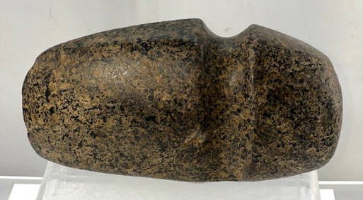
6 5/8" 3/4 Grooved Axe. Pike Co, IL. Pictured. Ex Roy Hathcock and Dale RectorTony Putty Artifacts4.7(404)See Sold PriceMar 09, 2024
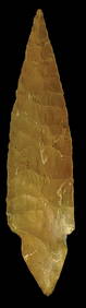
4 11/16”  Dalton Point. Saline Co, MO. Partain and Motley COAsTony Putty Artifacts4.7(404)See Sold PriceMar 09, 2024
4 5/8" 3/4 Grooved Axe. Buchanan Co, MO. Ex Ben ThompsonTony Putty Artifacts4.7(404)See Sold PriceMar 09, 2024
5 3/8" Highly Developed 3/4 Grooved Axe. Ex Thompson, Ritter, BuetellTony Putty Artifacts4.7(404)See Sold PriceMar 09, 2024
4 1/4" Turkeytail (Harrison Variety). KY. Dickey G8 COATony Putty Artifacts4.7(404)See Sold PriceMar 09, 2024
[CIVIL RIGHTS]. Join the March for Freedom! Join the NAACP Now! Midwest Decalomania Co., : Chicago,Freeman's | Hindman4.4(1.6k)See Sold PriceFeb 27, 2024
Group of 4 Whitehall, IL Blue Sawtooth Stoneware ItemsMatthew Bullock Auctioneers4.7(1.8k)See Sold PriceFeb 24, 2024
1738 BIBLE in DUTCH ILLUSTRATED w/ MAPS MASSIVE FOLIO in DUTCH antique BIBLIAJasper524.5(9.8k)See Sold PriceFeb 27, 2024
5.1/4" Sedalia, Adams Co IL, Ex B.W. Stephens S-95, Ex Bill Kacer Family Collection-Majority of hisHeartland Artifact Auctions Inc4.7(780)See Sold PriceMar 10, 2024
Antique Pennsylvania Map Fragment incl Wellersburg and New CentervilleCordier Auctions4.4(1.5k)See Sold PriceMar 02, 2024


![[CIVIL RIGHTS]. Join the March for Freedom! Join the NAACP Now! Midwest Decalomania Co., : Chicago, (1 of 2)](https://p1.liveauctioneers.com/197/319238/171467862_1_x.jpg?height=282&quality=70&version=1707520367)