Sold9 Maps: Africa, 1700's - 1800's.[Africa]. 9 Maps. Various sizes, 18th – 19th century. Condition varies, mostly very good, some light toning, foxing, and dampstain. Few with outline color. ++ H. Liebaux. Carte De L’Afrique PropreSee Sold Price
SoldVarious. 41 maps of Europe. c.19th century.[Europe] 41 maps. Various maps of Europe and the countries therein, mostly 19th century. (1) “The Expedition of Hannibal.” (2) “Delineatio Urbis Nidrosiae vulgo Dronheem.” 1658See Sold Price
Sold24 misc. Maps on Europe/World. 18th-19th century.[Various] 24 maps. Miscellaneous group of 24 18th-19th century maps depicting Europe and the World. Measurements range from approximately 10” x 7 3/4” to 21 1/4” x 15 5/8”. A fSee Sold Price
SoldPair Antique 19th Century Atlases, Bound MapsPair Antique 19th Century Atlases. ‘Mitchell’s New General Atlas Containing Maps of Various Countries of the World, Plans of Cities, Etc.’ published by S. Augustus Mitchell, Jr. c 1860. ‘AtlasSee Sold Price
SoldPair Antique 19th Century Atlases, Bound MapsPair Antique 19th Century Atlases. ‘Mitchell’s New General Atlas Containing Maps of Various Countries of the World, Plans of Cities, Etc.’ published by S. Augustus Mitchell, Jr. c 1860. ‘AtlasSee Sold Price
SoldCollection of approximately thirty hand coloured mapsCollection of approximately thirty hand coloured maps of the United Kingdom by various cartographers including Cary etc., together with fifteen various 19th Century American newspapersSee Sold Price
Sold6 various engravings of maps of Lincolnshire from6 various engravings of maps of Lincolnshire from 18th/19th century - i) Robert Morden (coloured), ii) Reuben Ramble (coloured), iii) London to Boston road map by E.Bowen, iv) Road map featuring KingsSee Sold Price
Sold19 Geography textbooks from the 19th centuryHeading: (Atlases) Author: Title: Nineteen Geography textbooks from the 19th century Place Published: [Various places] Publisher: Date Published: [Mostly 1800's] Description:See Sold Price
SoldGrp: 54 Maps of the World 18th and 19th c.Group of 54 maps of various regions of the world, dating from the 18th and 19th century. Foldable Map of Navarre on paper attached to linen, Tomás López de Vargas Machuca (1730-1802) "Map of theSee Sold Price
SoldLot of Maps of New YorkLot consisting of eight various 19th and 20th century maps of New York, including a copy of a map of Fort Greene, Brooklyn, from 1856; a map of Fishkill on the Hudson from 1876; a map of Queens from 1See Sold Price
SoldMaps of Various United States of AmericaLarge group of 19th and 20th century maps of parts of the United States. F. H. Gerdes (1809-1884) "U. S. Coast Survey Preliminary Chart of Ship Island Shoal Louisiana" U.S. Coast Survey, Washington DCSee Sold Price
SoldEight Maps Depicting the Journeys of the Children ofEight maps depicting the journeys of the Children of Israel, the entrance into the Land and its tribal division - etches. Various etches, 18-19th centuries. *Â The Forty Years of Travels of the ChilSee Sold Price
SoldVARIOUS ARTISTS (19th/20th Century). Three Antique MapsVARIOUS ARTISTS (19th/20th Century). Three Antique Maps (Paris, Ireland and North America). Engravings. 23 x 19 1/2 in.See Sold Price
SoldChina Missions, late 19th century, a small box ofChina Missions, late 19th century, a small box of various China Missionary items and ephemera, including a tissue paper map, passport to Rev. A W Nightingale expiring 1880, signed 'Bullock', printed sSee Sold Price
SoldBox of atlases and other itemsHeading: (Atlases) Author: Title: Group of partial and disbound atlases, atlas maps, pictorial weeklies, etc. Place Published: Various places Publisher: Date Published: 19th century to 1901<See Sold Price
Sold19th Century picture map of the Baltic Sea with various19th Century picture map of the Baltic Sea with various embellishments, unframed and a supplement to the Illustrated London News, 21ins x 31insSee Sold Price
SoldCollection of 19th Century mapsVarious engravers and publishers including Augustus Mitchell A.J. Johnson New York, Taintor Bros & Merrill are a few. See photos for details. Fair to good condition as shown. Also a great 1832 by BaldSee Sold Price
SoldMap and Print AssortmentMap and Print Assortment Approximately (12) pounds of 17th-19th century engravings, etchings and mezzotints, some hand-colored, by various artists including Phillipe de la Rue, Edward Rooker, and AdriSee Sold Price
SoldLarge Collection of 19th Century MapsVarious makers, engravers and publishers. See photos for details. Fair to good condition as shown. George CRAM, Johnsons Georgia and Alabama, Johnsons and Ward NEW YORK, J.H. Colton South Carolina andSee Sold Price
Sold19th Century Map, Putnam County, Cold Spring19th Century Map, Putnam County, Cold Spring & garrison, with various business listings, shows many names of residents throughout Putnam county, circa 1867, map is 17.75" by 19".Map was issued as partSee Sold Price
SoldMAP OF RUSSIA ON LINENLate 19th Century, color printed, on linen, with decorative margin depicting various nationalities, including Jews.Height 28" x Width 27"Provenance: Moriah Galleries, Exhibition of Jewish Folk Art, OcSee Sold Price
Sold19th c. tourist view booksHeading: (Americana) Author: Title: Collection of 19th century maps and tourist souvenir books Place Published: Various places Publisher: Date Published: Various dates Description:See Sold Price
SoldLot of thirty Ojime. Japan. 19th century. VariousLot of thirty Ojime. Japan. 19th century. Various materials and subject matters. All items in session one were collected by William H. Smith (1853-1923)See Sold Price
SoldEarly 19th Century Map of LouisianaEarly 19th Century Map of Louisiana(Baltimore: F. Lucas, 1817), engraving with outline color, depicts adjacent areas in Mississippi, Alabama, Florida, Texas and Arkansas (being labeled "Missouri"). PrSee Sold Price
Illustrated Sabbath Cloth - Holy Sites of Eretz IsraelLevy Auction House4.3(11)See Sold PriceFeb 27, 2024
1849 Mitchell School ATLAS 24 MAPS America Holy Land France Africa Egypt AsiaSchilb Antiquarian Rare Books4.8(428)See Sold PriceMar 31, 2024
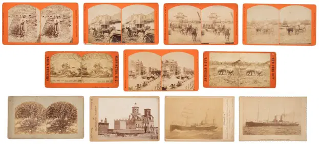
[EPHEMERA]. A Group of Various Ephemera. [V.p., ca. 19th - ...Potter & Potter Auctions4.6(545)See Sold PriceMar 07, 2024
A COLLECTION OF VARIOUS 19TH CENTURY PEARLWARE ITEMSHutchinson Scott Auctioneers4.4(42)See Sold PriceFeb 28, 2024
A 19TH CENTURY HAND COLOURED MAP OF ORKNEY AND SHETLANDHutchinson Scott Auctioneers4.4(42)See Sold PriceFeb 28, 2024
Mitchell - Map of the City of Washington (Washington, DC)Trillium Antique Prints & Rare Books4.5(32)See Sold PriceFeb 24, 2024
Nottingham.- Ordnance Survey Office (publisher) Collection 8 geological maps on the environs ofForum Auctions4.3(53)See Sold PriceFeb 29, 2024
Johnson's Africa. Colonies & tribes. Liberia Nile Delta Cape Colony 1866 mapJasper524.5(9.9k)See Sold PriceFeb 28, 2024
West Africa. Sahara caravan routes. Tribes Kingdoms Empires. LIZARS 1842 mapJasper524.5(9.9k)See Sold PriceFeb 28, 2024
Afrique Ancienne. Ancient North Africa. MALTE-BRUN c1871 old antique map chartJasper524.5(9.9k)See Sold PriceFeb 28, 2024
Two Hand-Colored 19th Century Maps of New Orleans and Louisiana, Larger- H.- 12 1/2 in., W.- 15 1/2Crescent City Auction Gallery4.3(231)See Sold PriceMar 08, 2024
Ernst Ewald (1842-1916) - Set of 12 Prints - Ceiling of a vestibule in a commercial house, Germany -Proverde Auctions4.3(3)See Sold PriceFeb 28, 2024
Joseph Williamson Ludlow (1840 - 1916) - Set of 2 Bird Prints - Aylesbury Ducks - Toulouse GeeseProverde Auctions4.3(3)See Sold PriceFeb 28, 2024
Joseph Williamson Ludlow (1840 - 1916) - Set of 2 Bird Prints - White-faced black Spanish - WhiteProverde Auctions4.3(3)See Sold PriceFeb 28, 2024


![[EPHEMERA]. A Group of Various Ephemera. [V.p., ca. 19th - ... (1 of 1)](https://p1.liveauctioneers.com/928/318880/171361562_1_x.jpg?height=282&quality=70&version=1707501302)