ATLAS of ANTIENT GEOGRAPHY by SAMUEL BUTLER 1843John McInnis Auctioneers,LLC4.5(505)See Sold PriceFeb 24, 2024
18TH C. ANTIQUE MAP: FRENCH & INDIAN WAR, FRAMEDThomaston Place Auction Galleries4.4(394)See Sold PriceFeb 24, 2024
Rand McNally Railroad Map Cabinet w/ 21 Railroad MapsRail & Road Auctions4.6(165)See Sold PriceMar 08, 2024
Keith Haring - Ink on New York Map, Best Buddies, Inscribed, Signed, and DatedSapphire Auction Gallery4.1(67)See Sold PriceMar 02, 2024
LATE 17TH C. FRENCH MAP OF THE NEW WORLD BY ALEXIS-HUBERT JAILLOT (1632-1712)Thomaston Place Auction Galleries4.4(394)See Sold PriceFeb 24, 2024
Central Railroad of New Jersey Map of Sandy Hook Route-ca. 1903JM Hobby Supply and Railroad Artifact Auctions4.4(127)See Sold PriceFeb 24, 2024
Lot of Six Mixed Atlas Box Cars-HO Scale-New in BoxJM Hobby Supply and Railroad Artifact Auctions4.4(127)See Sold PriceFeb 25, 2024
Rand McNally/Santa Fe Railroad Map of Iowa-1912JM Hobby Supply and Railroad Artifact Auctions4.4(127)See Sold PriceFeb 24, 2024
NICOLAES VISSCHER (NETHERLANDS, 1618-1709) MAP OF THE NEW WORLDThomaston Place Auction Galleries4.4(394)See Sold PriceFeb 24, 2024
17TH C. WORLD MAP BY NICOLAES VISSCHER (NETHERLANDS, 1618-1709)Thomaston Place Auction Galleries4.4(394)See Sold PriceFeb 24, 2024
Lot of Six Mixed Atlas Cabooses-HO Scale-New in BoxJM Hobby Supply and Railroad Artifact Auctions4.4(127)See Sold PriceFeb 25, 2024
Sold19th Century Colored Map of NH & VT19TH CENTURY ATLAS BOOK PLATE MAP OF NEW HAMPSHIRE AND VERMONT- JOHNSON'S NH AND VT BY JOHNSON AND WARD- 26 1/2" X 17 3/4"- TONING, FOXING, CREASES, SMALL LOSSES TO EDGES AND IMPERFECTIONSSee Sold Price
Sold19th Century Colored Map of NH & VT19TH CENTURY ATLAS BOOK PLATE MAP OF NEW HAMPSHIRE AND VERMONT- JOHNSON'S NH AND VT BY JOHNSON AND WARD- 26 1/2" X 17 3/4"- TONING, FOXING, CREASES, SMALL LOSSES TO EDGES AND IMPERFECTIONSSee Sold Price
Sold(2) 19th Century Colored Maps of NH & VT19TH CENTURY ATLAS BOOK PLATE OF NH AND VT- AUGUSTUS MITCHELL JR. 1862- 15 1/2" X 12 1/2"- TONING, FOXING AND IMPERFECTIONSSee Sold Price
Sold19th Century Colored Map of Maine, NH & VT19TH CENTURY ATLAS BOOK PLATE OF NH AND VT FRONT MAINE ON REVERSE- GRAYS ATLAS 17 1/4" X 14 1/2"- TONING, SPOTTING, STAIN ON EDGE, AND IMPERFECTIONSSee Sold Price
Lot of Early Maps & PostersMid to late 19th Century roll up wall maps of US, Nh & Vt, 500 miles around Washington DC, war posters, Liberty Loan, Dawn of American Liberty, 861 National Political Chart, and other, estate of HumphSee Sold Price
Sold19th century colored map of Eastern United States19th century colored map of Eastern United States 17" X 19", in antique maple frameSee Sold Price
Sold19th Century Colored Map of New Hampshire19TH CENTURY ATLAS BOOK PLATE MAPS OF NEW HAMPSHIRE- DRAWN EXPRESSLY FOR THE TOWN ATLAS OF THE STATE OF NEW HAMPSHIRE- 20 1/4" X 17 1/2"- TONING, SPOTTING, CENTER CREASES, IMPERFECTIONSSee Sold Price
19th Century Colored Maps, Holland & Spain, (2)Dimension: Holland 9" x 9-1/2"; Spain 12-3/4" x 11-1/2"Condition: GoodProvenance: Original collection of Ricarda GentheSee Sold Price
Sold(2) Late 19th c. maps of Ireland, unframedTwo late 19th century colored maps of Ireland, comprising a map of Ireland printed for The Century Atlas, circa 1897, 16"h x 11"w, unframed, and a map of Ireland printed for The Society for the DiffusSee Sold Price
SoldFramed map of Ireland, circa 1886Late 19th century colored map of Ireland engraved by the People's Publishing Co., Chicago, circa 1886, 16.5"h x 11.25"w sight of sheet, overall dimensions including frame 27.5"h x 21.75"w x 1.75"d.See Sold Price
SoldFramed map of Ireland, circa 1886Late 19th century colored map of Ireland engraved by the People's Publishing Co., Chicago, circa 1886, 16.5"h x 11.25"w sight of sheet, overall dimensions including frame 27.5"h x 21.75"w x 1.75"d.See Sold Price
Framed map of Ireland, circa 1886Late 19th century colored map of Ireland engraved by the People's Publishing Co., Chicago, circa 1886, 16.5"h x 11.25"w sight of sheet, overall dimensions including frame 27.5"h x 21.75"w x 1.75"d.See Sold Price
Framed map of Ireland, circa 1886Late 19th century colored map of Ireland engraved by the People's Publishing Co., Chicago, circa 1886, 16.5"h x 11.25"w sight of sheet, overall dimensions including frame 27.5"h x 21.75"w x 1.75"d.See Sold Price
SoldFramed map of Ireland, circa 1886Late 19th century colored map of Ireland engraved by the People's Publishing Co., Chicago, circa 1886, 16.5"h x 11.25"w sight of sheet, overall dimensions including frame 27.5"h x 21.75"w x 1.75"d.See Sold Price
SoldFramed map of Ireland, circa 1886Late 19th century colored map of Ireland engraved by the People's Publishing Co., Chicago, circa 1886, 16.5"h x 11.25"w sight of sheet, overall dimensions including frame 27.5"h x 21.75"w x 1.75"d.See Sold Price
People's Publishing Co. map of Ireland c. 1886Late 19th century colored map of Ireland engraved by the People's Publishing Co., Chicago, circa 1886, 16.5"h x 11.25"w sight of sheet, overall dimensions including frame 27.5"h x 21.75"w x 1.75"d.See Sold Price
SoldA lot of 18th and 19th century mapsA lot of 18th and 19th century colored maps including a mid 19th century chart of isothermal lines from "Black's General Atlas", four mid 19th century colored maps from "Mitchell's New General Atlas",See Sold Price
Mid 19th century Engraved colored map. "EasternMid 19th century Engraved colored map. "Eastern Hemisphere". Circular View of Asia, Europe, Africa and Australia. Sight size: 18.25" x 20". Overall size: 24.5" x 25.5”See Sold Price
Solddated 1867 Johnson's hand colored map of NH & VT -dated 1867 Johnson's hand colored map of NH & VT - 24 3/4" x17 3/4"See Sold Price
SoldMid 19th century Engraved colored map. "EasternMid 19th century Engraved colored map. "Eastern Hemisphere". Circular View of Asia, Europe, Africva and Australia. Sight size: 18-1/4" x 20". Overall size: 24-1/2" x 25-1/2".See Sold Price
SoldLOT OF EARLY 19TH CENTURY HAND COLORED MAPSEleven hand colored maps published by J. Mawman, May 1819. Includes Africa, Germany, England, India, etc. 10 1/4" x 8 1/2"See Sold Price
SoldAntique Hand Colored Maps of Fairfield County CTAntique Hand Colored Maps of Fairfield County CT. This lot includes three 19th century hand colored maps from the "Atlas of Fairfield County CT" by F.W. Beers. Includes one map of Bethel, one map of DSee Sold Price
SoldAntique Hand Colored Maps of Westchester County NYAntique Hand Colored Maps of Westchester County NY. This lot includes four 19th century hand colored maps from the "Atlas of New York and Vicinity" by F.W. Beers. Includes one map of Mamaroneck/Rye NeSee Sold Price
1849 Mitchell School ATLAS 24 MAPS America Holy Land France Africa Egypt AsiaSchilb Antiquarian Rare Books4.8(431)See Sold PriceMar 31, 2024
Pair of French Champleve Enamel Bronze Candlesticks, 19th CenturyWorld of Antiques, Inc.3.9(74)See Sold PriceFeb 29, 2024
17th Century Hand Colored Engraved Map of GermanyGlobal Auctions Company4.3(36)See Sold PriceMar 03, 2024
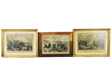
ANTIQUE AMERICAN CIVIL WAR HAND COLORED LITHOGRAPHSAntique Arena Inc.4.5(883)See Sold PriceFeb 24, 2024
A 19TH CENTURY HAND COLOURED MAP OF ORKNEY AND SHETLANDHutchinson Scott Auctioneers4.4(42)See Sold PriceFeb 28, 2024
19th Century Hand colored Lithograph "The Boston Boys"Collective Hudson4.5(60)See Sold PriceMar 01, 2024
Mitchell - Map of the City of Washington (Washington, DC)Trillium Antique Prints & Rare Books4.5(33)See Sold PriceFeb 24, 2024
2 PIECES 19C ENGLISH COLORED ENGRAVINGS SIGNED WITH ORIGINAL HANCARVED FRAMESBidhaus4.3(773)See Sold PriceFeb 28, 2024
Johnson's Africa. Colonies & tribes. Liberia Nile Delta Cape Colony 1866 mapJasper524.5(9.9k)See Sold PriceFeb 28, 2024
West Africa. Sahara caravan routes. Tribes Kingdoms Empires. LIZARS 1842 mapJasper524.5(9.9k)See Sold PriceFeb 28, 2024
Afrique Ancienne. Ancient North Africa. MALTE-BRUN c1871 old antique map chartJasper524.5(9.9k)See Sold PriceFeb 28, 2024
Two Hand-Colored 19th Century Maps of New Orleans and Louisiana, Larger- H.- 12 1/2 in., W.- 15 1/2Crescent City Auction Gallery4.3(233)See Sold PriceMar 08, 2024
Rare 19thc Colton Map, Argentine Republic, Chile, Uruguay, PataguayConnoisseur Auctions3.9(337)See Sold PriceMar 16, 2024
Eight (8) Decoratively Framed Floral Colored LithographsPremier Auction Galleries4.3(338)See Sold PriceMar 29, 2024