Sold1907 Butte, MT Mining Claims MapHeading: (Montana Mining Map) Author: Title: Map of Mining Claims, Butte, Montana and Vicinity Place Published: Butte, MT Publisher:Harper, MacDonald & Co. Date Published: 1907 DescripSee Sold Price
SoldMap of Mining Claims Butte Montana 1901 RAREThis is an exceedingly rare original Butte, Montana mining claim map from circa 1901. The piece is hand tinted and backed on linen with a wood trim piece across the top. Marked on the top left corner,See Sold Price
SoldHARPER. Map of Mining Claims Butte & Vicinity"THE RICHEST HILL ON EARTH" 92. [MAP]. HARPER, Joseph H. & Malcolm L. MacDonald. Map of Mining Claims Butte & Vicinity Montana Compiled and Published by Harper & MacDonald Butte, Silver Bow County MonSee Sold Price
SoldMap of Mining Claims Butte and Vicinity MontanaThis map, printed by Harper, Macdonald, & Co of Butte, Montana, is cleverly folded and hardbound in red cloth. The gold embossed cover is in excellent condition, with only minor fading and wear on theSee Sold Price
SoldJefferson County Montana Mining Map This is a JeffThis is a Jefferson County, Montana mining claim map. The map is marked "Corbin, Wickes & Basin Jefferson County, Montana Harper Macdonald & Co. Butte Montana". The map shows hundreds of mining claimsSee Sold Price
Sold"Map of Goldfield Nevada 1907",published by the Clason Map Co., Denver, Colorado, claims shown for numerous mining companies including "Hardtack Group, Nevada Boy, Doctor Gold, Ready Money Group", imprinted with "Compliments of theSee Sold Price
SoldID, MT U.S. States Mining Stock Certificates (118850)Group of 13 mining stock certificates from U.S. states, including from Idaho and Montana, 1907-1946. Some are blank, some canceled. Wide variety, includes two from North Butte Mining Company, MinnesotSee Sold Price
SoldMining claim map in Colorado 1901Heading: (Colorado) Author: Underhill, James Title: Map of portions of lower Clear Creek and Gilpin Counties showing mining claims in the vicinity of Idaho Springs, Colorado, prepared from official suSee Sold Price
Mining claim map in Colorado 1901Heading: (Colorado) Author: Underhill, James Title: Map of portions of lower Clear Creek and Gilpin Counties showing mining claims in the vicinity of Idaho Springs, Colorado, prepared from official suSee Sold Price
SoldButte, MT. mining Pictures, Stickers, Receipts,Copper City Radio Club, Butte MT. cloth patch. 5 stapled Gordon's Jewelry receipts c. 1938. Stove Catalog from Butte Stove Repair Company, Butte Montana. Approx 20 copies of newspaper ads for JustriteSee Sold Price
Butte, MT. mining Pictures, Stickers, Receipts,Copper City Radio Club, Butte MT. cloth patch. 5 stapled Gordon's Jewelry receipts c. 1938. Stove Catalog from Butte Stove Repair Company, Butte Montana. Approx 20 copies of newspaper ads for JustriteSee Sold Price
Butte, MT. Mining Pictures, Receipts, Stickers and aCopper City Radio Club, Butte MT. cloth patch. 5 stapled Gordon's Jewelry receipts c. 1938. Stove Catalog from Butte Stove Repair Company, Butte Montana. Approx 20 copies of newspaper ads for JustriteSee Sold Price
Butte, MT. mining Pictures, Stickers, Receipts,Copper City Radio Club, Butte MT. cloth patch. 5 stapled Gordon's Jewelry receipts c. 1938. Stove Catalog from Butte Stove Repair Company, Butte Montana. Approx 20 copies of newspaper ads for JustriteSee Sold Price
Sold1928-1961 Elm-Orlu Mine Butte, MT Mining EphemeraFeatured in this lot is this 1928-1961 Elm-Orlu Mine ephemera from Butte, Montana. This lot includes documents such as a mine sample card booklet, production reports, weekly sample reports ledger bookSee Sold Price
SoldCoeur d'Alene Mining Claims Map, 1969 [126905]Full-color, professionally framed map of the Coeur d'Alene Mining District. Frame size is approx. 21-1/2 x 12-3/4 inches. See photo for content and condition.Date: 1969Country (if not USA): State: IdaSee Sold Price
Butte, MT Mining Photos. (50269)Ranging in size from 11.25" x 9" to 11.75" to 16.25". Black and white and 1 color photos of Butte mining headframes. One of the large photos has a large portion of a corner missing. Provenance: CountrSee Sold Price
Butte, MT Mining Photos. #50269Ranging in size from 11.25" x 9" to 11.75" to 16.25". Black and white and 1 color photos of Butte mining headframes. One of the large photos has a large portion of a corner missing. State: montana CitSee Sold Price
Butte, MT Mining Photos. (50269)Ranging in size from 11.25" x 9" to 11.75" to 16.25". Black and white and 1 color photos of Butte mining headframes. One of the large photos has a large portion of a corner missing. Date: Country (ifSee Sold Price
SoldMiscellaneous Gold Mining Claim Maps (4) (122277)1) Plat of the "Great Western Group" Round Mountain, Jefferson M.D. Nye Co., Nevada 1906. 11.5" square blueprint. 2) "Wilhelm Group of Claims" and Adjoining Properties, Secret Pass, Mohave Co, ArizonaSee Sold Price
SoldColorado Mining Claim Maps (5) [152844]Lot of five miscellaneous Colorado mining claim maps. A) Map of Red Mountain and the Mining Region of San Juan, Ouray, San Miguel, and Dolores Counties, Colo. by Emil B. Fischer. 1891. Printed by RandSee Sold Price
SoldMining maps of Washington State by Kroll Map CompanyThis is a collection of blueline mining claims maps of seven mining districts in Washington state printed by the Kroll Map Co. of Seattle: Money Creek District, King County, no scale, no date, 19 in.XSee Sold Price
Miscellaneous Mining Maps (4) (120334)1. Austin Area, Reese River Mining District, Lando Co., Nevada Topographical Map 1937, shows Austin and the many mines in the area. 35" x 35". 2. Jarbridge, Nevada Mining Claims Map, Issued by the TwiSee Sold Price
SoldMap of Last Chance and Great Western Mines This isThis is a mining claim map of the Last Chance and Great Western mines. The map is marked "Map of Last Chance and Great Western Mines Northport, Stevens County, Washington. This is a hand drawn map thaSee Sold Price
Crams Colored Railway Map and Shippers Guide of South Dakota 1908-1909JM Hobby Supply and Railroad Artifact Auctions4.4(127)See Sold PriceFeb 24, 2024
Crams Map of North Dakota-Complete Railroad System and County Map-1907JM Hobby Supply and Railroad Artifact Auctions4.4(127)See Sold PriceFeb 24, 2024
Official Railroad Map of Kansas-1907JM Hobby Supply and Railroad Artifact Auctions4.4(127)See Sold PriceFeb 24, 2024
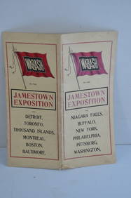
Wabash RR 1907 Jamestown Exposition BrochureJM Hobby Supply and Railroad Artifact Auctions4.4(127)See Sold PriceFeb 24, 2024
GEORGE ANDREW CORLEY (DATES UNKNOWN) U.S. TEAM SKI TRYOUTS / MT. HOOD OREGON. 1939.Swann Auction Galleries4.4(70)See Sold PriceFeb 29, 2024
SOUTH CENTRAL AFRICA. Shows Zambesi river as circular! WELLER 1863 old mapJasper524.5(9.9k)See Sold PriceFeb 28, 2024
AFRICA. European Possessions in Central; map of Zanzibar 1907 old antiqueJasper524.5(9.9k)See Sold PriceFeb 28, 2024
WEST AFRICA. European colonies; Mauritius; Ascension; St Helena 1907 old mapJasper524.5(9.9k)See Sold PriceFeb 28, 2024
AFRICA. Africa. General Map; Inset map of Population map 1907 old antiqueJasper524.5(9.9k)See Sold PriceFeb 28, 2024
NILE VALLEY. Upper & Lower. Egypt Sinai Nubia Sudan Abyssinia. BLACKIE 1886 mapJasper524.5(9.9k)See Sold PriceFeb 28, 2024
CENTRAL AFRICA. Kongo. British & German East Africa. Kenya Tanzania 1907 mapJasper524.5(9.9k)See Sold PriceFeb 28, 2024
NILE VALLEY. Upper & Lower. Egypt Sinai Nubia Sudan Abyssinia. BLACKIE 1882 mapJasper524.5(9.9k)See Sold PriceFeb 28, 2024
EGYPT SUDAN ABYSSINIA. Alexandria; Eastern Continuation; Aden 1907 old mapJasper524.5(9.9k)See Sold PriceFeb 28, 2024
AFRICA. French North Africa and Morocco 1907 old antique map plan chartJasper524.5(9.9k)See Sold PriceFeb 28, 2024


![Coeur d'Alene Mining Claims Map, 1969 [126905] (1 of 1)](https://p1.liveauctioneers.com/2699/193395/97510297_1_x.jpg?height=282&quality=70&version=1612290535)


![Colorado Mining Claim Maps (5) [152844] (1 of 5)](https://p1.liveauctioneers.com/2699/258191/134291009_1_x.jpg?height=282&quality=70&version=1660351799)