1952 ROBERT F. KENNEDY HANDWRITTEN LETTERJohn McInnis Auctioneers,LLC4.6(502)See Sold PriceFeb 25, 2024
CASED PRESENTATION HALF HULL MODEL OF THE BARQUE "HAWTHORNBANK" Last Quarter of the 19th CenturyEldred's4.7(409)See Sold PriceFeb 27, 2024
Lot Of 14 Jack Daniels And Country Club Glass Spirit BottlesRbfinearts4.4(571)See Sold PriceFeb 24, 2024
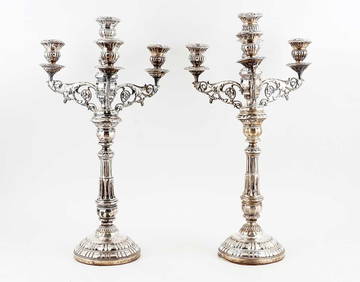
PR OF 17TH C. SPANISH BRASS CANDLESTICKSThomaston Place Auction Galleries4.4(386)See Sold PriceFeb 24, 2024
Lake Shore and Michigan Southern RR Special Excursions Timetable-July 7-13, 1892JM Hobby Supply and Railroad Artifact Auctions4.4(126)See Sold PriceFeb 24, 2024
Tiffany & Co. Sterling Silver Corkscrew Bottle OpenerSJ Auctioneers4.5(165)See Sold PriceMar 03, 2024
Rolls Royce Landau c1950s Gin/ Scotch TantalusPasadena Antique Auctions4.3(6)See Sold PriceMar 10, 2024
Sold18th c Map - Italy Ducato de Urbinofrom an 18th c Atlas possibly Dutch engraved and hand colored framed & glazedSee Sold Price
18th C. Map Italy: Etats du Roy de SardaigneHand colored copper engraving atlas map on laid paper, 1787, by Clouet, J. B. L. (Jean-Baptiste Louis,) entitled "Etats du Roy de Sardaigne. (with) Isle de Sardaigne". A beautiful map, with inset, shoSee Sold Price
Sold18th C. Map of Italy18th C. map of Italy. Carte pour l'expedition D'Annibal et sur laquette son passage en Italie et les principales de ses marches sont traacees; pour intelligence de l'Histoire Romaine de Mr Rollin. ParSee Sold Price
Sold48) 2-18THC. MAPS: VIEW OF PART OF ITALY, 18 X 22 ½" &48) 2-18THC. MAPS: VIEW OF PART OF ITALY, 18 X 22 ½" & OTHER FRANCE, 21 X 17"See Sold Price
18th C. Nicolas Tindal Hand Colored Map of ItalyA map of Italy with it's kingdoms, States and C. From the latest & best observations Condition: Creases, water stains Published in Tindal's Continuation of Rain's History of England, 1750, Rapin/TindaSee Sold Price
Sold1799 Map ITALY JOHN CARY "A New Map of Piedmont" 18th CA beautifully engraved and colored 18th Century map of Italy. This piece is entitled: "A New Map of Piedmon the Duchies of Savoy and Milan; and the Republic of Genoa; with their Subdivisions." EngraveSee Sold Price
1799 Map ITALY JOHN CARY "A New Map of Piedmont" 18th CThis is a beautifully engraved and colored 18th Century map of Italy. This piece is entitled: "A New Map of Piedmon the Duchies of Savoy and Milan; and the Republic of Genoa; with their Subdivisions."See Sold Price
SoldPIETER VAN DER AA 18TH C ENGRAVING: MAP OF VENICEPieter Van Der Aa 18th century engraved map of Venice, Italy. Printed circa 1720, Leiden. Titled lower left " Celeberrima Urbs Venetiae", and below "Lugd. Bat. Excudit Petrus Vander Aa.". Matted and uSee Sold Price
Nine -18th c. Italian map Photogravures circa 1900Nine total color stone engraved maps, some minor edge damage to some, depicting 18th century Italy and EuropeSee Sold Price
SoldHand-colored map of Italy and the Ligorian Sea - 1Hand-colored map of Italy and the Ligorian Sea - 18th c. or earlier - 19" x 15"See Sold Price
SoldFour 18th c. German Maps, European CountriesMAPS. Reilly, Franz Johann Joseph von (Vienna 1766-1820) Group of 4 colored engravings, maps of Europe including Scotland, Frankreich, Ireland, and Italy, possibly from Schauplatz der funf Theile derSee Sold Price
SoldEuropean & British Isles Map 18th C.Germany, France, Italy, Spain & British Isles Map . Mons. D'Anville. 1771. Hand-colored. ; 20" x 18 1/2"See Sold Price
SoldGrp: 6 Maps of Italy 18th-19th c.Group of 18th and 19th century maps of Italy. This group includes one map of Italy, Sardinia, Corsica, and Sicily by Carolo Allard; one map of Sicily by Jan Jansson (1588-1664) with an insert detailinSee Sold Price
SoldGrp: 5 Maps of Sicily Italy 18th/19th c. JaillotGroup of five 18th and 19th century maps of Sicily. Includes Hubert Jaillot , "La Sicile divisee en ses trois Provinces ou Valees, scavoir Valle Demona, Valle Di Noto, et Valle Di Mazara;" and GuillauSee Sold Price
SoldEarly Italian Map: Syracuse, Italy, 18th CenturySiciliae Antiquae quae et Sicania et Trinacria dicta tabula geographica. Auctore Guillelmo del'Isle e Regia Scientiarum Academia. Amstelodami, apud I. Covens et C. Mortier, Geog. Approximate date:See Sold Price
Sold18th century map of Italy by Matthew SeutterHeading: Author: Seutter, Matthaus Title: Nova et Exactissima Totius Italiae Sardiniae et Corsicae Delineatio Opera et Impensis Place Published: Augsburg Publisher: Date Published: c.1725See Sold Price
Sold18th C. Map of LouisianaAn 18th C. hand-colored engraved map by Emanuel Bowen, titled "A New and Accurate Map of Louisiana with Part of Florida and Canada, and the Adjacent Countries", Plate 59. Likely from the "Complete AtlSee Sold Price
Sold18th c. "Map of the Southern States of America,"18th c. "Map of the Southern States of America,"copperplate engraving by John Russell, from THE AMERICAN ATLAS (London: H. D. Symonds, 1795-95), shown are Maryland, Virginia, the Carolinas, Georgia, KSee Sold Price
SoldFRAMED RARE 18TH C. MAP OF CORFU BY HOMANNSPlan de la Place de Corfu avec ses Environs Assiegee Par les Infideles, tranchee ouverte le 25me Juillet jusqu'au 22 me d'Aout, Iour de la Fuite des Ottomans". Homann, J. B. Circa 1740. Hand colored cSee Sold Price
Sold18th C Map Ancient World JerusalemEngraved plate showing maps of ancient world including inset of Judea and Samaria and one of Jerusalem. Early 18th century.Very Good, trimmed to plate lines, measures 7 x 5.5". Reserve: $20.00 ShippinSee Sold Price
Sold18th c. map of North America- H. Popple18th c, map by Henry Popple- ''Nova Mappa Geographica Americae Septentrionalis''- engraving with original hand-coloring, minor vertical printer's wrinkle from Central America to Lake Erie, large margiSee Sold Price
Sold18TH C MAP, NORTH AMERICA, UNITED STATES & MEXICOJohann Baptist Homann (German, 1664-1724). "Regni Mexicani seu Novae Hispaniae" - circa 1725, engraving with hand coloring. Approx. 20.75" x 24" (sheet) Item from the Estate of Forest "Tag" Hunter, AtSee Sold Price
EARLY 18TH C. DUTCH CHART OF PACIFIC OCEAN BY FREDERIK DE WIT (1629-1706) WITH CALIFORNIA AS ANThomaston Place Auction Galleries4.4(386)See Sold PriceFeb 24, 2024
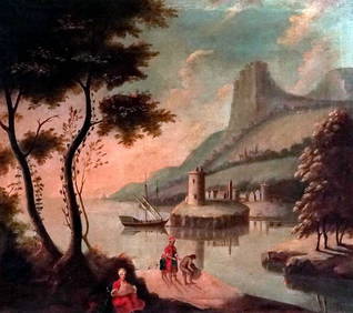
EARLY 18TH C. MAP OF ITALY, FRAMEDThomaston Place Auction Galleries4.4(386)See Sold PriceFeb 24, 2024
18TH C. ANTIQUE MAP: FRENCH & INDIAN WAR, FRAMEDThomaston Place Auction Galleries4.4(386)See Sold PriceFeb 24, 2024
Italian Wood & Silver Bounty Sailing Ship ModelHill Auction Gallery 4.7(1k)See Sold PriceFeb 28, 2024
18th C. Spanish Colonial Four Evangelist CarvingsNapoleon's Fine Art4.4(75)See Sold PriceFeb 25, 2024
Two (2) Antique 18th C. Copper Engraved Framed Maps - America & EuropeMagnusson Art Group4.5(46)See Sold PriceMar 14, 2024
Map: An 18thC engraved and hand coloured map of Buckinghamshire after Robert Morden. Approx. 8 1/4"Claydon Auctioneers Ltd4.3(125)See Sold PriceFeb 26, 2024
Map: An 18thC engraved and hand coloured map of Northamptonshire, with description ofClaydon Auctioneers Ltd4.3(125)See Sold PriceFeb 26, 2024
Map: An 18thC engraved and hand coloured map of North America and South America, titled DeClaydon Auctioneers Ltd4.3(125)See Sold PriceFeb 26, 2024
Map: An 18thC engraved map of Bedfordshire titled An Accurate Map of the County of Bedford DividedClaydon Auctioneers Ltd4.3(125)See Sold PriceFeb 26, 2024
Map: An 18thC engraved map titled A New and Improved Map of Oxfordshire.. after Thomas Kitchin.Claydon Auctioneers Ltd4.3(125)See Sold PriceFeb 26, 2024
18th C. 800 Silver, Sterling Silver, and 18K BraceletGWS Auctions Inc.4.4(265)See Sold PriceMar 02, 2024
18th C. Diamond, Pearl, Silver, 14K/Platinum BroochGWS Auctions Inc.4.4(265)See Sold PriceMar 02, 2024