ATLAS of ANTIENT GEOGRAPHY by SAMUEL BUTLER 1843John McInnis Auctioneers,LLC4.6(502)See Sold PriceFeb 24, 2024
18TH C. ANTIQUE MAP: FRENCH & INDIAN WAR, FRAMEDThomaston Place Auction Galleries4.4(386)See Sold PriceFeb 24, 2024
Rand McNally Railroad Map Cabinet w/ 21 Railroad MapsRail & Road Auctions4.6(165)See Sold PriceMar 08, 2024
Keith Haring - Ink on New York Map, Best Buddies, Inscribed, Signed, and DatedSapphire Auction Gallery4(67)See Sold PriceMar 02, 2024
LATE 17TH C. FRENCH MAP OF THE NEW WORLD BY ALEXIS-HUBERT JAILLOT (1632-1712)Thomaston Place Auction Galleries4.4(386)See Sold PriceFeb 24, 2024
Central Railroad of New Jersey Map of Sandy Hook Route-ca. 1903JM Hobby Supply and Railroad Artifact Auctions4.4(126)See Sold PriceFeb 24, 2024
Lot of Six Mixed Atlas Box Cars-HO Scale-New in BoxJM Hobby Supply and Railroad Artifact Auctions4.4(126)See Sold PriceFeb 25, 2024
Rand McNally/Santa Fe Railroad Map of Iowa-1912JM Hobby Supply and Railroad Artifact Auctions4.4(126)See Sold PriceFeb 24, 2024
NICOLAES VISSCHER (NETHERLANDS, 1618-1709) MAP OF THE NEW WORLDThomaston Place Auction Galleries4.4(386)See Sold PriceFeb 24, 2024
17TH C. WORLD MAP BY NICOLAES VISSCHER (NETHERLANDS, 1618-1709)Thomaston Place Auction Galleries4.4(386)See Sold PriceFeb 24, 2024
Lot of Six Mixed Atlas Cabooses-HO Scale-New in BoxJM Hobby Supply and Railroad Artifact Auctions4.4(126)See Sold PriceFeb 25, 2024
18th c. Map of Christchurch, County of Monmouth 1780Title: 18th c. Map of Christchurch, County of Monmouth 1780 Description: George III provinical map of Monmouth Date/Period: 18th c. Size/Dimensions: 59 x 48 cm / 23 x 19 in Reserve: $85.00 Shipping: DSee Sold Price
18th C. Map Of Christchurch, County Of Monmouth 1780Description Period 18th c. Size 59 x 48 cm / 23 x 19 in Map Merval Farm, lying in the parish of Christ Church in the county of Monmouth Frame Set in sympathetic wood frame Condition Very good conditioSee Sold Price
Sold18TH C. MAP OF "COUNTY OF LIMRICK" IRELANDMARKED SEPTENTRIO TO UPPER EDGE MOUNTED ON BOARD UNDER GLASS 15 X 19 in/ 38 X 48 cmSee Sold Price
Sold18TH C. MAP OF "COUNTY OF LIMRICK" IRELANDMARKED SEPTENTRIO TO UPPER EDGE MOUNTED ON BOARD UNDER GLASS 15 X 19 in/ 38 X 48 cmSee Sold Price
Lot of 18th c. British Maps.MAP LOT. Lot of three 18th c. British maps: County of Kent, 1765, 6 1/2" x 7 3/4" viewed; J. Gibson, 6 1/4" x 8" viewed; Berk Shire 1765, 6 1/2" x 7 3/4" viewed; Oxford Shire 1765, 8 " x 6 1/2" viewedSee Sold Price
Sold18TH C. BRITISH MAP OF SUFFOLK COUNTYA Map of Suffolk County by J. OWEN & E. BOWEN 1753, with "The Road from Ipswich to Norwich" above, hand colored copperplate engraving, in black and gold stick frame, French-lined mat, glazed, OS: 11"See Sold Price
SoldFive 18th C English County MapsBedfordshire, Suffolk, Huntingdonshire, Worcestershire and Warwickshire, each matted for framing with an explanitory sheet of description, all possibly from an early atlas.See Sold Price
Lot of 18th C. MapsMAP LOT. Lot of three 18th C. British maps. Double framed county maps, "Essex" and "Hereford Shire", published Sept 29, 1741, engraved by W.H. Toms, 6" x 5 3/4" viewed; "Survey of the road from ExeterSee Sold Price
SoldHand stitched map : an 18th/19th C map depicting the CoHand stitched map : an 18th/19th C map depicting the Counties of England and Wales, St. Georges Channel, German Ocean etc. 21 1/2 x 23"See Sold Price
SoldAn 18thC framed monochrome map of the county of Surrey,An 18thC framed monochrome map of the county of Surrey, entitled 'A Map of Surry, engraved from an actual survey with improvements' , 'printed for J Harrison, 115 Newgate Street, as the Act directs, MSee Sold Price
SoldGREENWOOD MAP OF MONMOUTHC. and J. Greenwood Map of the County of Monmouth from an Actual Survey made in the years 1829 & 1830 hand-coloured engraved map, inset view of Tintern Abbey, published Jan. 26, 1831 65 x 77cmSee Sold Price
SoldSechs Karten zum Gebiet Franken und Schwaben — 18.Six maps of the Franconia and Swabia region — 18th C. Homannian heirs: ''Comitatus Henneberg...'', map of the Princed County of Henneberg, 1743, by Johann Jakob Zinck and J. G. Küsel; sheetSee Sold Price
SoldA collection of approx. 50 maps of English countiesA collection of approx. 50 maps of English counties 18thC and 19thC by various cartographers, also town plans domestic and overseas and countries, these from atlases AF.See Sold Price
Sold18TH C. FRENCH MAP 'CARTE DES ISLES SANDWICH'From R. Bonne and N. Desmarest's Atlas, circa 1780. Measures approximately 10 x 14inches.See Sold Price
Gloucester Monmouth 19th C. Map by Thomas BowlesThomas Bowles 19th century or earlier "Map of Gloucester & Monmouth Counties". British engraving. 20 5/8" x 27" (Image size). Slight tear in lower center. Good condition. Please check our other listinSee Sold Price
SoldQueen Anne cherry highboy Watertown, CT.Fine 18th C. Litchfield County cherry highboy, a Queen Anne step top form in cherry with unique carved shells and period brass in original holes, on cabriole legs ending in carved QA feet, ca. 1780, pSee Sold Price
SoldEARLY NEW YORK STATE ACTUAL SURVEY MAPEARLY NEW YORK STATE ACTUAL SURVEY MAP FOR COUNTIES ALONG SUSQUAHANNAH RIVER, INCL. CLINTON, CHENANGO, GREEN, ETC. 18TH C. 15 1/2" X 21"See Sold Price
18th C. Chippendale Mahogany Chest on ChestChippendale chest on chest, Worcester County, c. 1760-1780, carved maple, birch, and mahogany, 70 1/4"h x 37"w x 19"d. Provenance: From a Massachusetts collector.See Sold Price
Sold18TH C NEW ENGLAND COUNTY PINE SIX DRAWER TALL CHEST:Ca 1780-1800. Six graduated drawers with knob pulls. Wooden drawer pulls. Measures 51 inches tall x 38 inches wide.See Sold Price
SoldFive unframed engraved maps of Europe, 18th c., tFive unframed engraved maps of Europe, 18th c., together with an unframed later map of Turkey, a map of Steuben County, New York, and a framed map of Gascogne.See Sold Price
Sold18th c. copper engraved map of England and WalesHeading: (England) Author: Kitchin, Tho. Title: A New Map of England and Wales, Divided into Counties Place Published: N.p. Publisher:N.p. Date Published: N.d. Description:See Sold Price
SoldGeographic map / Carte géographique"New map of the County of Monmouth", printed for C. Smith 1808, framed, excellent condition / "New map of the County of Monmouth", imprimée pour C. Smith 1808, encadrée, excellente conditionSee Sold Price
SoldSix Hand-Colored Engraved Maps, 18th/19th c.[18th and 19th c. Maps], a group of six hand-colored, engraved maps from Robert Sayer's @A General Atlas@, 1780, engraved by Thomas Kitchen, and others, including: "The Kingdoms of Spain and Portugal"See Sold Price
Sold18th/19th C. petipoint map of EnglandLate 18th/early 19th C. framed 21" x 18" oval petipoint & embroidered county map of England & Wales, set in original hand carved gesso gilt oval frame, overall size 25" x 22"See Sold Price
LATE 18TH C. VERY LARGE CHART OF NORTHEAST CANADA BY DES BARRES (1721-1824), 1780, FRAMEDThomaston Place Auction Galleries4.4(386)See Sold PriceFeb 24, 2024
EARLY 18TH C. MAP OF ITALY, FRAMEDThomaston Place Auction Galleries4.4(386)See Sold PriceFeb 24, 2024
18TH C. ANTIQUE MAP: FRENCH & INDIAN WAR, FRAMEDThomaston Place Auction Galleries4.4(386)See Sold PriceFeb 24, 2024
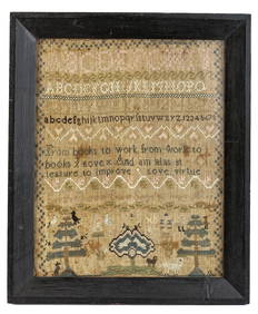
(18th c) SAMPLER by SARAH BROWN born 1780.John McInnis Auctioneers,LLC4.6(502)See Sold PriceFeb 25, 2024
2 Framed 18th C. Parisian Architectural PrintsEpic Auctions and Estate Sales4.6(204)See Sold PriceMar 02, 2024
Two (2) Antique 18th C. Copper Engraved Framed Maps - America & EuropeMagnusson Art Group4.5(46)See Sold PriceMar 14, 2024
Map: An 18thC engraved map of Bedfordshire titled An Accurate Map of the County of Bedford DividedClaydon Auctioneers Ltd4.3(125)See Sold PriceFeb 26, 2024
American Queen Anne Cherry Highboy, Litchfield County, CT, 18th c., H.- 73 in., W.- 41 1/2 in., D.-Crescent City Auction Gallery4.3(229)See Sold PriceMar 09, 2024
18TH C. QUEEN ANNE CONNECTICUT BLANKET CHEST.William Smith Auctions4.6(146)See Sold PriceMar 06, 2024
18TH C. MA. CHIPPENDALE OXBOW MAHOGANY CHEST.William Smith Auctions4.6(146)See Sold PriceMar 06, 2024
18TH C. QUEEN ANNE CHEST ON CHEST, PORTSMOUTH, NH.William Smith Auctions4.6(146)See Sold PriceMar 06, 2024
18TH C. CHIPPENDALE WALNUT CARVED CHEST ON CHEST.William Smith Auctions4.6(146)See Sold PriceMar 06, 2024
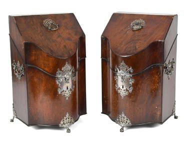
EXCEPTIONAL PR OF 18TH C. GEORGIAN KNIFE BOXES.William Smith Auctions4.6(146)See Sold PriceMar 06, 2024