ATLAS of ANTIENT GEOGRAPHY by SAMUEL BUTLER 1843John McInnis Auctioneers,LLC4.6(502)See Sold PriceFeb 24, 2024
18TH C. ANTIQUE MAP: FRENCH & INDIAN WAR, FRAMEDThomaston Place Auction Galleries4.4(386)See Sold PriceFeb 24, 2024
Rand McNally Railroad Map Cabinet w/ 21 Railroad MapsRail & Road Auctions4.6(165)See Sold PriceMar 08, 2024
Keith Haring - Ink on New York Map, Best Buddies, Inscribed, Signed, and DatedSapphire Auction Gallery4(67)See Sold PriceMar 02, 2024
LATE 17TH C. FRENCH MAP OF THE NEW WORLD BY ALEXIS-HUBERT JAILLOT (1632-1712)Thomaston Place Auction Galleries4.4(386)See Sold PriceFeb 24, 2024
Central Railroad of New Jersey Map of Sandy Hook Route-ca. 1903JM Hobby Supply and Railroad Artifact Auctions4.4(126)See Sold PriceFeb 24, 2024
Lot of Six Mixed Atlas Box Cars-HO Scale-New in BoxJM Hobby Supply and Railroad Artifact Auctions4.4(126)See Sold PriceFeb 25, 2024
Rand McNally/Santa Fe Railroad Map of Iowa-1912JM Hobby Supply and Railroad Artifact Auctions4.4(126)See Sold PriceFeb 24, 2024
NICOLAES VISSCHER (NETHERLANDS, 1618-1709) MAP OF THE NEW WORLDThomaston Place Auction Galleries4.4(386)See Sold PriceFeb 24, 2024
17TH C. WORLD MAP BY NICOLAES VISSCHER (NETHERLANDS, 1618-1709)Thomaston Place Auction Galleries4.4(386)See Sold PriceFeb 24, 2024
Lot of Six Mixed Atlas Cabooses-HO Scale-New in BoxJM Hobby Supply and Railroad Artifact Auctions4.4(126)See Sold PriceFeb 25, 2024
1895 Map of San FranciscoAuthor: McNally Title: 1895 Map of San Francisco Medium: Ink on Paper Dimensions: 11"X14" Map of San Francisco, dated 1895. Engraved and published by Rand McNally in Chicago. Part of Mc Nally World AtSee Sold Price
SoldMap of California, 1895Original map published from Indexed Atlas of the World by Rand McNally, 1895. Map features insets of San Francisco area & San Diego county. Unframed. Dimensions: 32" L x 25.5" WSee Sold Price
Rand McNally: Antique Map of San Francisco, 1895Map: 1895 Rand McNally Map of San Francisco and [verso] California Cartographer: Rand McNally Year / Place: 1895, Chicago Map Dimensions: 11.4 x 9.4 in. Condition: Map very good overall. Colored. VirtSee Sold Price
1895 Rand McNally Map of California & San FranciscoTitle/Content of Map: 1895 Rand McNally Map of California and [verso] San Francisco1895, Chicago Cartographer: Rand McNally Size: 11.4 x 9.4 in. An excellent map of California and on reverse, San FranSee Sold Price
1895 Rand McNally Map of California and San FranciscoTitle/Content of Map: 1895 Rand McNally Map of California and [verso] San Francisco -- California [verso] Map of the Main Portion of San Francisco Date Printed: 1895, Chicago Cartographer: Rand McNallSee Sold Price
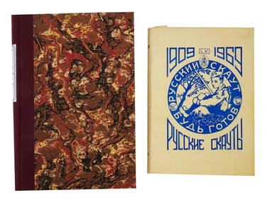
1895 Rand McNally Map of California and [verso] SanTitle/Content of Map: 1895 Rand McNally Map of California and [verso] San Francisco -- California [verso] Map of the Main Portion of San Francisco Date: 1895, Chicago Cartographer: Rand McNally Size:See Sold Price
SoldMap of San Francisco cable Car Lines 1895Heading: (California - San Francisco) Author: Langley, Henry G., Title: Map Showing Transfer System of All Street Car Lines of San Francisco Place Published: [n.p.] Publisher:J.B. Painter Company <See Sold Price
SoldFolding map of Southern California 1895Heading: Author: Willson & Co. Title: Willson & Co.'s Indexed Sectional Map of Southern California Place Published: San Francisco Publisher:Compiled and Published by Willson & Co. Date PublishedSee Sold Price
SoldSutro Heights real estate map c.1895Heading: (San Francisco) Author: Title: Map of Sutro Heights. Lots for Sale by Will E. Fisher & Co., Agents Place Published: San Francisco Publisher: Date Published: c.1895 DescriptionSee Sold Price
Vest Pocket Guide to San Francisco, 1895Heading: (California - San Francisco) Author: Title: Vest Pocket Memoranda & Directory of San Francisco Containing Important Information Place Published: San Francisco Publisher:E.C. Hughes, PrinterSee Sold Price
SoldMaps, San Francisco - The Exposition City, 1912,(lot of 5) Maps of California including "Map of Berkeley," "Map of the City of San Francisco, "San Rafael Quadrangle," "City of San Francisco - Commercial Atlas of America," and "San Francisco - The ESee Sold Price
SoldU.S. Coast Survey Map San Francisco, CAU.S. Coast Survey, "Entrance to San Francisco Bay California From a Trigonometrical Survey under the Direction of A.D. Bache Superintendant of the Survey of the Coast of the United States TriangulatioSee Sold Price
SoldMaps, San Francisco Bay Area, 1800s(Lot of 16) Assorted San Francisco Bay Area maps, including: ''Sacramento, Eel and Russian River Basins, Water Resources,'' 1960, ''Southern California Electrical Supply,'' 1923, and ''Forest Map of TSee Sold Price
[MAP]. [SAN FRANCISCO: ST. FRANCIS WOOD]. ca. 1918365. [MAP]. [SAN FRANCISCO: ST. FRANCIS WOOD]. MASON-McDUFFIE COMPANY. St Francis Wood San Francisco’s Residence Park [above neat line, lower center] Most beautiful of all residential districts.See Sold Price
1853 US Coast Survey Map San Francisco"U.S. Coast Survey A.D. Bache, Superintendent, City Of San Francisco And Its Vicinity California. From a Trigonometrical Survey by R.D. Cutts, Assistant. Topography by A.F. Rodgers Sub-assistant. HydrSee Sold Price
SoldPrints Maps San Francisco Yosemite Covarrubias(lot of 4) Framed offset prints of vintage maps and geographic art: ''San Francisco'' and ''Yosemite National Park'' after John A. Milestone, each signed; two plates from ''Pagent of the Pacific'' bySee Sold Price
SoldMaps San Francisco Bay - Spanish Discovery. Grabhorn,Heading: Author: Harlow, Neal Title: The Maps of San Francisco Bay From the Spanish Discovery Place Published: San Francisco Publisher:Book Club of California Date Published: 1950 DescSee Sold Price
Sold(5) 1894, 1895, & 1896 Morgan silver dollars(5) 1894, 1895, & 1896 Morgan silver dollars, incl. (2) 1894, San Francisco and New Orleans mint, (2) 1895, San Francisco and New Orleans mint, and (1) 1896, San Francisco mint Provenance: From a singSee Sold Price
Sold1895-S MORGAN SILVER DOLLAR MS-63/64 PLTHIS COIN IS AN ABSOLUTE MONSTER! THIS IS, WITHOUT A DOUBT, ABOUT THE FINEST 1895 SAN FRANCISCO I REMEMBER SEEING IN THE LAST TWO DECADES. VERY FRESH AND JUST A TERRIFIC COIN FOR THE DISCRIMINATING COSee Sold Price
SoldKAZUO MATSUBARA SIGNED ROOSTER PRINTKAZUO MATSUBARA SIGNED ROOSTER PRINT: Kazuo Matsubara b. 1895 San Francisco. Dry point etching of roosters titled "Jealousy". Two roosters, hens, and chicks peck in a yard. The roosters tailSee Sold Price
SoldKAZUO MATSUBARA SIGNED ROOSTER PRINTKAZUO MATSUBARA SIGNED ROOSTER PRINT: Kazuo Matsubara b. 1895 San Francisco. Dry point etching of roosters titled "Jealousy". Two roosters, hens, and chicks peck in a yard. The roosters tailSee Sold Price
SoldFourteen framed pieces to include group of six maps toFourteen framed pieces to include group of six maps to include Boston 1877 Augustus Mitchell Johnsons lower Canada, White Plains, Scarsdale, Switzerland, Roman Empire, Geological map San Francisco BaySee Sold Price
SoldSan Francisco 1896Title/Content of Map: San Francisco 1896 Date Printed: 1896 Material/Medium: paper Size: approx. 11x 13.5 inches Rand McNally & Co. Universal Atlas of the World Reserve: $20.00 Shipping: Domestic: FlSee Sold Price
Chicago Milwaukee and St Paul RY Panama Pacific Exposition Brochure-1915JM Hobby Supply and Railroad Artifact Auctions4.4(126)See Sold PriceFeb 24, 2024
1895 PGV Puerto Rico Peso .7234oz. SILV. PGA MS62+Gold Standard Auctions4.5(762)See Sold PriceMar 17, 2024
1895 WORKS OF SKABICHEVSKY AND RUSSIAN SCOUTS BOOKAntique Arena Inc.4.5(852)See Sold PriceJun 15, 2024


![1895 Rand McNally Map of California and [verso] San (1 of 2)](https://p1.liveauctioneers.com/5584/124256/63192766_1_x.jpg?height=282&quality=70&version=1530636078)


![[MAP]. [SAN FRANCISCO: ST. FRANCIS WOOD]. ca. 1918 (1 of 4)](https://p1.liveauctioneers.com/514/38482/16500430_1_x.jpg?height=282&quality=70&version=1363615005)