ATLAS of ANTIENT GEOGRAPHY by SAMUEL BUTLER 1843John McInnis Auctioneers,LLC4.6(502)See Sold PriceFeb 24, 2024
18TH C. ANTIQUE MAP: FRENCH & INDIAN WAR, FRAMEDThomaston Place Auction Galleries4.4(386)See Sold PriceFeb 24, 2024
Rand McNally Railroad Map Cabinet w/ 21 Railroad MapsRail & Road Auctions4.6(165)See Sold PriceMar 08, 2024
Keith Haring - Ink on New York Map, Best Buddies, Inscribed, Signed, and DatedSapphire Auction Gallery4(67)See Sold PriceMar 02, 2024
LATE 17TH C. FRENCH MAP OF THE NEW WORLD BY ALEXIS-HUBERT JAILLOT (1632-1712)Thomaston Place Auction Galleries4.4(386)See Sold PriceFeb 24, 2024
Central Railroad of New Jersey Map of Sandy Hook Route-ca. 1903JM Hobby Supply and Railroad Artifact Auctions4.4(126)See Sold PriceFeb 24, 2024
Lot of Six Mixed Atlas Box Cars-HO Scale-New in BoxJM Hobby Supply and Railroad Artifact Auctions4.4(126)See Sold PriceFeb 25, 2024
Rand McNally/Santa Fe Railroad Map of Iowa-1912JM Hobby Supply and Railroad Artifact Auctions4.4(126)See Sold PriceFeb 24, 2024
NICOLAES VISSCHER (NETHERLANDS, 1618-1709) MAP OF THE NEW WORLDThomaston Place Auction Galleries4.4(386)See Sold PriceFeb 24, 2024
17TH C. WORLD MAP BY NICOLAES VISSCHER (NETHERLANDS, 1618-1709)Thomaston Place Auction Galleries4.4(386)See Sold PriceFeb 24, 2024
Lot of Six Mixed Atlas Cabooses-HO Scale-New in BoxJM Hobby Supply and Railroad Artifact Auctions4.4(126)See Sold PriceFeb 25, 2024
Sold1892 Map of British ColumbiaAuthor: Cram Title: 1892 Map of British Columbia Medium: Ink on paper Dimensions: 22"X14.5" Map of the province of British Columbia dated 1892. Engraved and published by George Cram in Chicago. UpperSee Sold Price
SoldBRITISH COLUMBIA NEW CALEDONIA VANCOUVER ISLAND. SanTITLE/CONTENT OF MAP: 'British Columbia (New Caledonia); Vancouver Island' The San Juan islands are shown on the map as British, although at the time of publication they were disputed territory. The USee Sold Price
BRITISH COLUMBIA & VANCOUVER ISLAND. Canada BritishTITLE/CONTENT OF MAP: 'BRITISH COLUMBIA, VANCOUVER ISLAND &C' The map was published in few years after the Pig War (1859), after which the modern Canadaian/US border was determined through the Juan deSee Sold Price
BRITISH COLUMBIA & VANCOUVER ISLAND. Canada BritishTITLE/CONTENT OF MAP: 'BRITISH COLUMBIA, VANCOUVER ISLAND &C' The map was published in few years after the Pig War (1859), after which the modern Canadaian/US border was determined through the Juan deSee Sold Price
BRITISH COLUMBIA & VANCOUVER ISLAND. Canada BritishTITLE/CONTENT OF MAP: 'BRITISH COLUMBIA, VANCOUVER ISLAND &C' The map was published in few years after the Pig War (1859), after which the modern Canadaian/US border was determined through the Juan deSee Sold Price
BRITISH COLUMBIA NEW CALEDONIA VANCOUVER ISLAND. SanTITLE/CONTENT OF MAP: 'British Columbia (New Caledonia); Vancouver Island' The San Juan islands are shown on the map as British, although at the time of publication they were disputed territory. The USee Sold Price
SoldBritish Columbia 1896Title/Content of Map: British Columbia 1896 Date Printed: 1896 Material/Medium: Paper Size: approx. 14x20.5 inches Additional Info: Rand McNally & Co., Universal Atlas Reserve: $35.00 Shipping: DomestSee Sold Price
BRITISH COLUMBIA NEW CALEDONIA VANCOUVER ISLAND. SanReserve Reduced! TITLE/CONTENT OF MAP: 'British Columbia (New Caledonia); Vancouver Island' The San Juan islands are shown on the map as British, although at the time of publication they were disputedSee Sold Price
SoldBritish Columbia 1899Title/Content of Map: British Columbia 1899 Date Printed: 1899 Material/Medium: Paper Size: approx 11x14 inches Additional Info: Rand McNally & Co. Reserve: $30.00 Shipping: Domestic: Flat-rate of $15See Sold Price
BRITISH COLUMBIA & VANCOUVER ISLAND. Canada BritishTITLE/CONTENT OF MAP: 'BRITISH COLUMBIA, VANCOUVER ISLAND &C' The map was published in few years after the Pig War (1859), after which the modern Canadaian/US border was determined through the Juan deSee Sold Price
BRITISH COLUMBIA & VANCOUVER ISLAND. Canada BritishTITLE/CONTENT OF MAP: 'BRITISH COLUMBIA, VANCOUVER ISLAND &C' The map was published in few years after the Pig War (1859), after which the modern Canadaian/US border was determined through the Juan deSee Sold Price
BRITISH COLUMBIA & VANCOUVER ISLAND. Canada BritishTITLE/CONTENT OF MAP: 'BRITISH COLUMBIA, VANCOUVER ISLAND &C' The map was published in few years after the Pig War (1859), after which the modern Canadaian/US border was determined through the Juan deSee Sold Price
BRITISH COLUMBIA & VANCOUVER ISLAND. Canada BritishTITLE/CONTENT OF MAP: 'BRITISH COLUMBIA, VANCOUVER ISLAND &C' The map was published in few years after the Pig War (1859), after which the modern Canadaian/US border was determined through the Juan deSee Sold Price
BRITISH COLUMBIA & VANCOUVER ISLAND. Canada BritishTITLE/CONTENT OF MAP: 'BRITISH COLUMBIA, VANCOUVER ISLAND &C' The map was published in few years after the Pig War (1859), after which the modern Canadaian/US border was determined through the Juan deSee Sold Price
BRITISH COLUMBIA NEW CALEDONIA VANCOUVER ISLAND. SanReserve Reduced! TITLE/CONTENT OF MAP: 'British Columbia (New Caledonia); Vancouver Island' The San Juan islands are shown on the map as British, although at the time of publication they were disputedSee Sold Price
BRITISH COLUMBIA & VANCOUVER ISLAND. Canada BritishTITLE/CONTENT OF MAP: 'BRITISH COLUMBIA, VANCOUVER ISLAND &C' The map was published in few years after the Pig War (1859), after which the modern Canadaian/US border was determined through the Juan deSee Sold Price
British Columbia & Northwest Territory. ManitobaTITLE/CONTENT OF MAP: 'British Columbia and the Northwest Territory in the Dominion of Canada' Date: 1896 IMAGE SIZE: Approx 53.5 x 70.5cm, 21 x 27.75 inches (Large); Please note that this is a foldinSee Sold Price
BRITISH COLUMBIA & VANCOUVER ISLAND. Canada BritishTITLE/CONTENT OF MAP: 'BRITISH COLUMBIA, VANCOUVER ISLAND &C' The map was published in few years after the Pig War (1859), after which the modern Canadaian/US border was determined through the Juan deSee Sold Price
Rand McNally Map of British Columbia, 19111911 Rand McNally Map of British Columbia -- Rand McNally Indexed Atlas (British Columbia). Detailed with topographical details, settlements, and railroad lines - both existing and planned - highlightSee Sold Price
1911 Rand Mcnally Map Of British ColumbiaRand McNally, 1911, Chicago, 19 X 25.8 in. A nice map of British Columbia, detailed with topographical details, settlements, and railroad lines - both existing and planned - highlighted in red index.See Sold Price
SoldMap of British ColumbiaThe Home Knowledge Atlas, Toronto 1891. George Cram Size: 22 x 13.5 inches No Reserve: This lot starts at $1 and has no reserve as a courtesy so that collectors can determine the true market value onSee Sold Price
Map of British Columbia 1875Map: Map of British Columbia Maker: Walker & Miles, JW Trutch Size: Folio - 16 inches high x 24.3 inches wide Date: 1875 "Compiled from the map of the province with additions from the maps of the PostSee Sold Price
SoldEarly map of British Columbia 1859Heading: Author: Arrowsmith, John Title: The Provinces of British Columbia & Vancouver Island, with Portions of the United States & Hudson's Bay Territories, Compiled from Original Documents Place PuSee Sold Price
SoldRand McNally: Map of British Columbia, 1911Map: 1911 Rand McNally Map of British Columbia -- Rand McNally Indexed Atlas (British Columbia) Cartographer: Rand McNally Year / Place: 1911, Chicago Map Dimensions: 19 X 25.8 in. Condition: ExcellenSee Sold Price
Grand Trunk Railroad Across the Continent Through Canada Book-1917JM Hobby Supply and Railroad Artifact Auctions4.4(126)See Sold PriceFeb 24, 2024
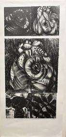
Black Printmaker J.Norman's lush Kafka seriesBert Gallery Studio Sales4.4(18)See Sold PriceFeb 27, 2024
HONEST JOHN OLIVER by James Morton 1st Edition Inscribed by Author ScarceLuis Porretta Fine Arts4.3(10)See Sold PriceMar 02, 2024
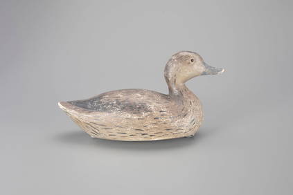
Wigeon Hen Decoy by Amiel Garibaldi (1908-1993)Copley Fine Art Auctions4.5(40)See Sold PriceFeb 24, 2024
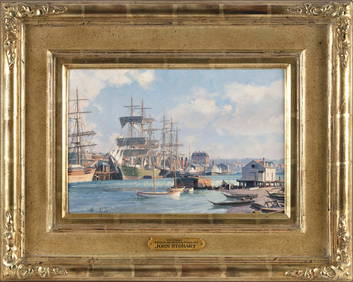
JOHN STOBART (Massachusetts/Florida/England, 1929-2023), "Victoria, View from Songhee Point, 1891".,Eldred's4.7(409)See Sold PriceFeb 27, 2024
Lawrence Rosso (Sisakolas) "Goose" LithographDana J. Tharp Auctions4.7(268)See Sold PriceFeb 24, 2024
Native American Ornamental Basket c. 1890-1910Stefek's Auctioneers & Appraisers4.5(105)See Sold PriceFeb 28, 2024
British Columbia Telephone Co. Trolley SignsMiller & Miller Auctions Ltd.4.7(316)See Sold PriceMar 02, 2024
British Columbia Telephone Co. Trolley SignsMiller & Miller Auctions Ltd.4.7(316)See Sold PriceMar 02, 2024
14" x 14" Eagle And Killer Whales Framed PrintWeatherham Estate Treasures3.9(157)See Sold PriceMar 21, 2024
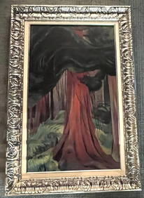
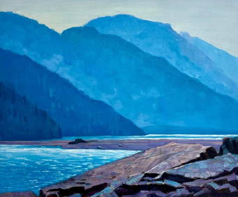
20" x 23 3/4" - Original Acrylic On Canvas Of Bear River At Stewart, British ColumbiaWeatherham Estate Treasures3.9(157)See Sold PriceMar 21, 2024
COLONIAL/TRIBAL AFRICA British East/Central/South Africa JOHNSTON 1892 old mapJasper524.5(9.8k)See Sold PriceFeb 28, 2024
Athern HO Gauge British Columbia Railway two-tone green Diesel/Spirit of 76 Dummy DieselHarris Toy and Train Auctions4.5(122)See Sold PriceMar 01, 2024
1958 Canada Silver Dollar British Columbia Totem Pole BUGolden Air Auctions4.4(257)See Sold PriceFeb 27, 2024
6 pcs Vintage Paper Maps. Vancouver Island, British Columbia. Upper Elk Creek Sheet. See pics.Crawford Family Auctions LLC4.5(112)See Sold PriceMay 25, 2024