ATLAS of ANTIENT GEOGRAPHY by SAMUEL BUTLER 1843John McInnis Auctioneers,LLC4.6(504)See Sold PriceFeb 24, 2024
18TH C. ANTIQUE MAP: FRENCH & INDIAN WAR, FRAMEDThomaston Place Auction Galleries4.4(389)See Sold PriceFeb 24, 2024
Rand McNally Railroad Map Cabinet w/ 21 Railroad MapsRail & Road Auctions4.6(165)See Sold PriceMar 08, 2024
Keith Haring - Ink on New York Map, Best Buddies, Inscribed, Signed, and DatedSapphire Auction Gallery4.1(67)See Sold PriceMar 02, 2024
LATE 17TH C. FRENCH MAP OF THE NEW WORLD BY ALEXIS-HUBERT JAILLOT (1632-1712)Thomaston Place Auction Galleries4.4(389)See Sold PriceFeb 24, 2024
Central Railroad of New Jersey Map of Sandy Hook Route-ca. 1903JM Hobby Supply and Railroad Artifact Auctions4.4(126)See Sold PriceFeb 24, 2024
Lot of Six Mixed Atlas Box Cars-HO Scale-New in BoxJM Hobby Supply and Railroad Artifact Auctions4.4(126)See Sold PriceFeb 25, 2024
Rand McNally/Santa Fe Railroad Map of Iowa-1912JM Hobby Supply and Railroad Artifact Auctions4.4(126)See Sold PriceFeb 24, 2024
NICOLAES VISSCHER (NETHERLANDS, 1618-1709) MAP OF THE NEW WORLDThomaston Place Auction Galleries4.4(389)See Sold PriceFeb 24, 2024
17TH C. WORLD MAP BY NICOLAES VISSCHER (NETHERLANDS, 1618-1709)Thomaston Place Auction Galleries4.4(389)See Sold PriceFeb 24, 2024
Lot of Six Mixed Atlas Cabooses-HO Scale-New in BoxJM Hobby Supply and Railroad Artifact Auctions4.4(126)See Sold PriceFeb 25, 2024
Sold19th c. Map New York City19th c. "Map Of New York And Its Vicinity, New York 1863". Published by S.D. Tildern. 63 1/2" x 63 1/2". Some damage.See Sold Price
Sold[Map] New York City[Map] New York City , 1846, drawn by D.H. Burr, pub. Homans & Ellis, , linen backed and lacquered, 12 5/8 in. x 10 3/8 in Provenance: Property deaccessioned from the Louisiana State Museum, proceeds tSee Sold Price
SoldLarge framed map, "New York City North of 93rd Street",Large framed map, "New York City North of 93rd Street", Colton's New Map of the City and County of New York Including Extensions North of the Harlem River, published by G.W. and C.B. Colton & Co.'s sSee Sold Price
SoldM. Dripps 1860 Map New York City County & Vacinity By M. DrippsM. Dripps 1860 Map New York City County & Vacinity By M. Dripps 22.5" x 30"See Sold Price
SoldOLD MAP NEW YORK CITY, VALENTINE'S MANUAL 1855"A Plan of the City of New York and Environs...1755" 1855 Dimensions: (Paper) H 25.5" x W 20" Condition: Removed from book, folds, edge damages, toning.See Sold Price
SoldMAP NEW YORK CITY VALENTINE'S MANUAL 1860 2 SHEET"Map of the five Cities of New York, Brooklyn Jersey City, Hoboken, & Hudson City, 1860." Printed in two sheets with hand coloring. Dimensions: (Paper, each) H 24.75" x W 28.25" Condition: Removed froSee Sold Price
SoldGoldthwaite MAP NEW YORK CITY 1888 Hyde WelckeTitle: Map of the Steets and Avenues of New York City by: William M. Goldthwaite Publisher: Hyde & Company Printing Year: 1890 Details/Condition: Bound in its original textured cloth boards with gSee Sold Price
SoldTanner: Antique Map of New York City, 1843Title/Content of Map: New York City by Tanner Date Printed: 1843 Cartographer: based on the work of H.C. Tanner Material/Medium: Paper Size: 17" x 14" Hand colored engraved Map. From the first editionSee Sold Price
SoldGray & Son's Map of New York City 1876Map: New York City, Brooklyn, Jersey City, Hoboken, Etc. Maker: O.W. Gray & Son, Ormando W. Gray & Frank H. Gray Size: Double Folio - 23 inches high x 16.3 inches wide Date: 1876 Detailed map of New YSee Sold Price
SoldLarge map, New York City's UWS, 1879Large map, New York City's UWS, 1879, "West End Plateau of New York" by Herman K. Viele, City Surveyor, printed by Johnson & Pratt, New York, 1879, framed under acrylic, with 25-page booklet in pocketSee Sold Price
Sold1865 Colton New York City Map1865 Colton New York City Map -- New York City Brooklyn, Jersey City, Hoboken, Etc. C. B. Colton 1865 New York 24 x 17 in. This nice map of New York City, including Manhattan, Brooklyn, Jersey City anSee Sold Price
SoldMitchell: Antique Map of New York City, 1869Title/Content of Map: New York City by Mitchell Date Printed: 1869 Cartographer: Augustus S. Mitchell Material/Medium: Paper Size: 23" x 15" Condition: Excellent Hand colored engraved Map. Published iSee Sold Price
SoldNew York City Subway Travel1992Title/ Content of Map:New York City Subway Travel1992 Date Printed: 1992 Cartographer: Material/Medium: paper Dimensions: 15-fold. approx. 18.5x 22 inches open, 4x7.5 inches folded. Additional InformaSee Sold Price
Sold(PICTORIAL MAP – NEW YORK CITY.) Hanley, Frank.(PICTORIAL MAP – NEW YORK CITY.) Hanley, Frank. Chart of Greenwich Village For Navigators Who Will Travel on Water or Otherwise. Once the Ninth Ward and Ancient Home of the Celt, Now Simply HoboSee Sold Price
Sold1828 MAP of New York City Suburbs Railroads New Jersey EC Bridgman Color1828 MAP of New York City Suburbs Railroads New Jersey EC Bridgman Color An impressive, 19th-century map of New York City and its surrounding environs. This E.C. Bridgman map is a huge map folded intoSee Sold Price
SDUK: Antique Map of New York City, 1847Title/Content of Map: 'NEW YORK' Antique town city map plan. Manhattan Brooklyn Jersey. Date Printed: 1847 Image Size: Approx 33.0 x 39.0cm, 13 x 15.25 inches (Large) Type: Antique steel engraved mapSee Sold Price
SoldHinton, map of New York City, 1776ANONYMOUS (British, Late 18th Century). [Map] A Plan of the City and Environs of New York in North America. Engraving from the Universal Magazine, November 1776. London: J. Hinton, 1776. 12 1/4" x 15See Sold Price
SDUK: Map of New York City, 1847Title/Content of Map: 'NEW YORK', Antique town city map plan. Manhattan Brooklyn Jersey Date Printed: 1847 Image Size: Approx 33.0 x 39.0cm, 13 x 15.25 inches (Large) Type: Antique steel engraved mapSee Sold Price
SoldAntique 1851 Map of New York CityThis is an antique map of New York City from 1851. This is a fantastic early piece that shows much of what is Lower Manhattan today. In addition to the map, there are several depictions of landmarks tSee Sold Price
SoldGrp: 9 Maps of New York City 18th-Early 20th c.Group of nine maps of New York City, dating from the 18th to early 20th century. By cartographers including John Montresor (1736-1799). Additionally includes a lovely 1704 map of the city featuring thSee Sold Price
SoldHardy: Map of New York City, 1870Map: 1870 Hardy Map of New York City -- Map of the City of New York, Showing its Political Divisions and Subdivisions November 1870 Cartographer: J. Hardy Year / Place: 1870 New York City Map DimensioSee Sold Price
Antique Map Shows New York City in 1776, Marshall, 1807Antique Map Showing New York City in 1776 -- Ile de New-York. Partie de Long-Island ou de l'Ile Longue, et Positions des Armees Americaine et Britannique, apres le Combat Livre sur Hauteurs, le 27 AouSee Sold Price
1870 Hardy Map of New York City1870 Hardy Map of New York City -- Map of the City of New York, Showing its Political Divisions and Subdivisions November 1870. J. Hardy, 1870 New York City, This large colorful map of New York City��See Sold Price
SoldJohnson: Antique Map of New York City, 1866Title/Content of Map: 1866 Johnson Map of New York City -- Johnson's New York and Brooklyn Date Printed: 1866, New York Cartographer: A Johnson Size: 22.8 x 16.3 in Condition: Very good. Age toning noSee Sold Price
Crams Railroad Map of New York-1881JM Hobby Supply and Railroad Artifact Auctions4.4(126)See Sold PriceFeb 24, 2024
Erie Railway Tourist Book/Magazine-1874JM Hobby Supply and Railroad Artifact Auctions4.4(126)See Sold PriceFeb 24, 2024
George Hayward - Map of the City of New York 1854Dane Fine Art Auctions4.4(496)See Sold PriceMar 07, 2024
Pair of The Gateway to a Continent Books - Grand Central Zone and 1939 World's FairRail & Road Auctions4.6(165)See Sold PriceMar 07, 2024
ANDREW RAYMOND JANSON OIL ON BOARD ADIRONDACKSCharleston Estate Services Ltd.4.5(64)See Sold PriceMar 03, 2024
Johann Homann Hand-Colored Map Engraving, c. 1730Auctions at Showplace4.6(731)See Sold PriceMar 17, 2024
Willem Blaeu, Etc. 17th C. Antiquarian Maps, 2Auctions at Showplace4.6(731)See Sold PriceMar 17, 2024
Alfred Salzman, Etc. JNF Tin Tzedakah Boxes, 3Auctions at Showplace4.6(731)See Sold PriceApr 07, 2024
Georg Bockler Map of Ancient Jerulsaem EtchingAuctions at Showplace4.6(731)See Sold PriceApr 07, 2024
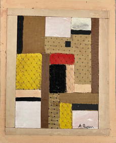
Anne Ryan (Attributed) Collage (Fabric & Mixed Media)Carstens Galleries4.5(130)See Sold PriceMar 01, 2024
Black and white map of part of New York City (mostly Manhattan)Proverde Auctions4.3(3)See Sold PriceFeb 28, 2024
Laminated Unique Media New York City MapRapid Estate Liquidators and Auction Gallery4.5(1.1k)See Sold PriceFeb 29, 2024
Hudson River Map & North American Postcards, 45Auctions at Showplace4.6(731)See Sold PriceFeb 13, 2025


![[Map] New York City (1 of 1)](https://p1.liveauctioneers.com/268/180010/90586232_1_x.jpg?height=282&quality=70&version=1600794544)