ATLAS of ANTIENT GEOGRAPHY by SAMUEL BUTLER 1843John McInnis Auctioneers,LLC4.6(502)See Sold PriceFeb 24, 2024
18TH C. ANTIQUE MAP: FRENCH & INDIAN WAR, FRAMEDThomaston Place Auction Galleries4.4(386)See Sold PriceFeb 24, 2024
Rand McNally Railroad Map Cabinet w/ 21 Railroad MapsRail & Road Auctions4.6(165)See Sold PriceMar 08, 2024
Keith Haring - Ink on New York Map, Best Buddies, Inscribed, Signed, and DatedSapphire Auction Gallery4(67)See Sold PriceMar 02, 2024
LATE 17TH C. FRENCH MAP OF THE NEW WORLD BY ALEXIS-HUBERT JAILLOT (1632-1712)Thomaston Place Auction Galleries4.4(386)See Sold PriceFeb 24, 2024
Central Railroad of New Jersey Map of Sandy Hook Route-ca. 1903JM Hobby Supply and Railroad Artifact Auctions4.4(126)See Sold PriceFeb 24, 2024
Lot of Six Mixed Atlas Box Cars-HO Scale-New in BoxJM Hobby Supply and Railroad Artifact Auctions4.4(126)See Sold PriceFeb 25, 2024
Rand McNally/Santa Fe Railroad Map of Iowa-1912JM Hobby Supply and Railroad Artifact Auctions4.4(126)See Sold PriceFeb 24, 2024
NICOLAES VISSCHER (NETHERLANDS, 1618-1709) MAP OF THE NEW WORLDThomaston Place Auction Galleries4.4(386)See Sold PriceFeb 24, 2024
17TH C. WORLD MAP BY NICOLAES VISSCHER (NETHERLANDS, 1618-1709)Thomaston Place Auction Galleries4.4(386)See Sold PriceFeb 24, 2024
Lot of Six Mixed Atlas Cabooses-HO Scale-New in BoxJM Hobby Supply and Railroad Artifact Auctions4.4(126)See Sold PriceFeb 25, 2024
Sold1884 Map of IrelandAuthor: Cram Title: 1884 Map of Ireland Medium: Ink on Paper Dimensions: 11.5"X13.5" Map of Ireland dated 1884. Printed and published by George Cram in Chicago. Part of The People's Family World AtlasSee Sold Price
SoldOriginal 1884 Map of Cork, IrelandHall's Historic Of Ireland 1884 County of Cork.In excellent condition. Matted and ready for framing. Matted size 11x14See Sold Price
Original 1884 Map of Donegal, IrelandHall's Historic of Ireland 1884 Map of the County of Donegal.In excellent condition. Matted and ready for framing.Matted size 11x14See Sold Price
Sold1884 Cram Maps of Scotland and Ireland1884 Cram Maps of Scotland and Ireland -- Ireland (verso) Scotland. G Cram. 1884, Chicago. 11.7 X 9.5 in. A very nice set of maps with great deal of topographical, county, town, city and railroad lineSee Sold Price
SoldGeogloical mapJ A Knipe - 'Geological & Mineralogical Map of England and Wales with parts of Scotland, Ireland & France...' with forty-nine linen-backed sections, published 1884, 116 x 85 cm overall, with oil-paperSee Sold Price
SoldTallis, John (Pub) 1852 Map. IrelandSteel Engraved Map with Original Outline Hand Color Published 1852-56 by John Tallis, London for "The Universal Pronouncing Dictionary" by Thomas Wright. Drawn & Engraved by John Rapkin. Centre fold aSee Sold Price
SoldGuthrie, William 1790 Antique Map. IrelandCopper Engraved Map Published 1790, London for "A New Geographical, Historical and Commercial Grammar..." by William Guthrie. The maps are by John Senex, Thomas Kitchin and others. Folds as issued. EaSee Sold Price
SoldLochhead (Pub) 1811 Rare Map. IrelandCopper Engraved Map Published 1811 by William Lochhead, Berwick for "Modern Geography: And a Compendious General Gazetteer" Rare. Folds as issued. Paper Size: 10 x 8.5 inch (26 x 22cm) Very minor toniSee Sold Price
Sold1884 map of Georgia & Alabama1884 S. Augustus Mitchell map of Georgia & Alabama. Framed size 23"h x 31"wSee Sold Price
Sold1884 MAP OF THE WORLD BY S.A. MITCHELLMercator projection and shows the routh of Lt. Wilkes in 1840, Cpt Cook 1774-1778 and Cpt Gore in 1780. Matted, 14.75 x 18.25 inches. Not examined outside wrapping, appears excellent.See Sold Price
SoldBarclay, James C1835 Hand Col Map. IrelandHand Colored Copper Engraved Map Published C1835, London for "A Complete and Universal English Dictionary" by the Rev. James Barclay et al. Paper Size: 11 x 8.5 inch (28 x 22cm) Good ConditionSee Sold Price
Sold1884 Map of MontanaAuthor: Cram Title: 1884 Map of Montana Medium: Ink on Paper Dimensions: 21.5"X13.5" Map of Montana dated 1884. Printed and published by George Cram in Chicago. Part of The People's Family World AtlasSee Sold Price
SoldBarclay, James 1809 Antique Map. IrelandOutline Hand Coloured Copper Engraved Map Published 1809, Leeds for "Barclay's Complete and Universal Dictionary of the English Language..." by the Rev. James Barclay. Paper Size: 10 x 8 inch (26 x 20See Sold Price
Sold1884 Map of LouisianaAuthor: Cram Title: 1884 Map of Louisiana Medium: Ink on Paper Dimensions: 13.5"X11.5" Map of Louisiana dated 1884. Printed and published by George Cram in Chicago. Part of The People's Family World ASee Sold Price
Sold1884 Map of Washington DCAuthor: Watson Title: 1884 Map of Washington DC Medium: Ink on Paper Dimensions: 14.5"X11" Map of Washington DC. dated 1884. Engraved and published by Watson in Chicago. Upper right references to histSee Sold Price
Sold1884 Map of West TexasAuthor: Cram Title: 1884 Map of West Texas Medium: Ink on Paper Dimensions: 14.5"X21.5" Map of the West portion of Texas dated 1884. Engraved and published by George Cram in Chicago. Part of his WorldSee Sold Price
Sold1884 Map Of The City Of New Haven Connecticut FramedFramed map of the City Of New Haven Connecticut. Produced by Price, Lee & Company. Survey by S.W. Searle. Folds, creases, paper loss, and toning. Not inspected out of frame.&nbsSee Sold Price
Sold1794 Hydrological Map Ireland Laurie & WhittleDESCRIPTION: A New Hydrographical Survey of the West Coast of Ireland from Sligo Bay to Tory Island and of the North Coast from Tory Island to Raughlan Island; with the Entrance of the North Channel BSee Sold Price
Sold1884 Map of ScotlandAuthor: Cram Title: 1884 Map of Scotland Medium: Ink on Paper Dimensions: 11.5"X13.5" Map of Scotland dated 1884. Printed and published by George Cram in Chicago. Part of The People's Family World AtlSee Sold Price
Sold1884 Map of ItalyAuthor: Cram Title: 1884 Map of Italy Medium: Ink on Paper Dimensions: 11.5"X13.5" Map of Italy dated 1884. Printed and published by George Cram in Chicago. Part of The People's Family World Atlas. KeSee Sold Price
SoldWilkes, John 1811 Map. IrelandCopper Engraved Map Published 1796-1828 London for "Encyclopaedia Londinensis, or universal dictionary of arts, sciences and literature" by John Wilkes et al. Paper Size: 10.5 x 8.5 inch (27 x 22cm) GSee Sold Price
Sold1884 Map of South CarolinaAuthor: Cram Title: 1884 Map of South Carolina Materials: Ink on Paper Size/Dimensions: 13.5"X11" Description: Map of South Carolina dated 1884. Printed and published by George Cram in Chicago. Part oSee Sold Price
Sold1884 Map of CaliforniaAuthor: Cram Title: 1884 Map of California Medium: Ink on Paper Dimensions: 13.5"X21.5" Map of California dated 1884. Printed and published by George Cram in Chicago. Part of The People's Family WorldSee Sold Price
Sold1884 Map of U.S. Western Transportation Lines"The Principal Transportation Lines West of Chicago, St. Louis & New Orleans, To accompany the report on the Internal Commerce of the United States, 1884". Prepared by Joseph Nimmo Jr. Heavy weight paSee Sold Price
Eastern RR Summer Book of Tours-1884JM Hobby Supply and Railroad Artifact Auctions4.4(126)See Sold PriceFeb 24, 2024
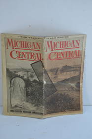
Michigan Central RR May 18, 1884 Public TimetableJM Hobby Supply and Railroad Artifact Auctions4.4(126)See Sold PriceFeb 24, 2024
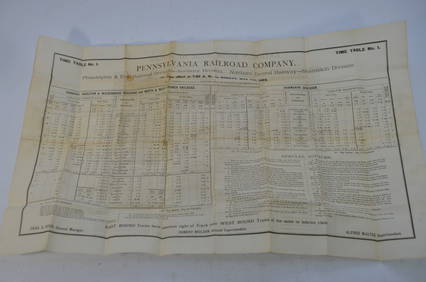
Pennsylvania RR Employee Timetable #1 May 11, 1884JM Hobby Supply and Railroad Artifact Auctions4.4(126)See Sold PriceFeb 24, 2024
1st Class Relic Of Saint Patrick, E.C., Known An The Apostle Of IrelandRbfinearts4.4(571)See Sold PriceFeb 24, 2024
18TH C. ANTIQUE MAP: FRENCH & INDIAN WAR, FRAMEDThomaston Place Auction Galleries4.4(386)See Sold PriceFeb 24, 2024
Richard Burnier (1826 - 1884) Dutch Impressionist Barbizon School Cow Grazing Landscape Oil PaintingCurated Gallery Auctions4.6(120)See Sold PriceFeb 25, 2024
Portfolio of 15 County Maps by Robert Morden (English 1650-1703)Nadeau's Auction Gallery4.7(401)See Sold PriceFeb 24, 2024
Three Delaware & Hudson Canal Company Railroad Annual Passes - 1884, 1885, and 1886Rail & Road Auctions4.6(165)See Sold PriceMar 08, 2024
Rand McNally Railroad Map Cabinet w/ 21 Railroad MapsRail & Road Auctions4.6(165)See Sold PriceMar 08, 2024
[MAP]. NICHOLLS, Sutton (1668-1729). An Epitome of Sr. Will...Potter & Potter Auctions4.6(539)See Sold PriceMar 07, 2024
Chatelain - 3 Maps of the British Isles (England, Ireland, Scotland)Trillium Antique Prints & Rare Books4.5(30)See Sold PriceFeb 24, 2024
De Jode, Rare, pub. 1593 - Map of the British Isles [England, Scotland, Ireland] (Angliae Scotiae etTrillium Antique Prints & Rare Books4.5(30)See Sold PriceFeb 24, 2024
Ireland.- Smedley (Edward) Erin. A Georgraphical and Descriptive Poem, 2 parts in 1, first edition,Forum Auctions4.3(52)See Sold PriceFeb 29, 2024
Goode, George Brown 1884 Lot of 4 Natural History & Meteorology MapsAlbion Auctions4.6(336)See Sold PriceMar 01, 2024


![[MAP]. NICHOLLS, Sutton (1668-1729). An Epitome of Sr. Will... (1 of 1)](https://p1.liveauctioneers.com/928/318880/171361281_1_x.jpg?height=282&quality=70&version=1707501302)


![De Jode, Rare, pub. 1593 - Map of the British Isles [England, Scotland, Ireland] (Angliae Scotiae et (1 of 2)](https://p1.liveauctioneers.com/6581/319571/171593327_1_x.jpg?height=282&quality=70&version=1707853304)


