ATLAS of ANTIENT GEOGRAPHY by SAMUEL BUTLER 1843John McInnis Auctioneers,LLC4.6(504)See Sold PriceFeb 24, 2024
18TH C. ANTIQUE MAP: FRENCH & INDIAN WAR, FRAMEDThomaston Place Auction Galleries4.4(389)See Sold PriceFeb 24, 2024
Rand McNally Railroad Map Cabinet w/ 21 Railroad MapsRail & Road Auctions4.6(165)See Sold PriceMar 08, 2024
Keith Haring - Ink on New York Map, Best Buddies, Inscribed, Signed, and DatedSapphire Auction Gallery4.1(67)See Sold PriceMar 02, 2024
LATE 17TH C. FRENCH MAP OF THE NEW WORLD BY ALEXIS-HUBERT JAILLOT (1632-1712)Thomaston Place Auction Galleries4.4(389)See Sold PriceFeb 24, 2024
Central Railroad of New Jersey Map of Sandy Hook Route-ca. 1903JM Hobby Supply and Railroad Artifact Auctions4.4(126)See Sold PriceFeb 24, 2024
Lot of Six Mixed Atlas Box Cars-HO Scale-New in BoxJM Hobby Supply and Railroad Artifact Auctions4.4(126)See Sold PriceFeb 25, 2024
Rand McNally/Santa Fe Railroad Map of Iowa-1912JM Hobby Supply and Railroad Artifact Auctions4.4(126)See Sold PriceFeb 24, 2024
NICOLAES VISSCHER (NETHERLANDS, 1618-1709) MAP OF THE NEW WORLDThomaston Place Auction Galleries4.4(389)See Sold PriceFeb 24, 2024
17TH C. WORLD MAP BY NICOLAES VISSCHER (NETHERLANDS, 1618-1709)Thomaston Place Auction Galleries4.4(389)See Sold PriceFeb 24, 2024
Lot of Six Mixed Atlas Cabooses-HO Scale-New in BoxJM Hobby Supply and Railroad Artifact Auctions4.4(126)See Sold PriceFeb 25, 2024
1872 Map of Penn. Flora – Walling, GrayMap of Pennsylvania colored to Illustrate the Distribution of its Flora,” by Thos. C. Porter. Hand colored engraving. Unusual early map, colored to show the distribution of plants in the state. FromSee Sold Price
1872 Geological map of Penn. – Walling, Gray1872 Topographical Map of Pennsylvania, Colored for the Principal Geological Formations,” by J. Peters. Lovely, colorful presentation with period hand coloring. Unusual early map, colored to show thSee Sold Price
1872 Map of Penn. Mineral Deposits – Walling, GrayMap of Pennsylvania Showing the Principal Deposits of Iron, Anthracite, Coal, Petroleum and Zinc.” Unusual early map, colored to show distribution of mineral deposits. Shows area in northwest part oSee Sold Price
Sold2 vols. American Atlases: Walling, Henry F.; Gray2 vols. American Atlases: Walling, Henry F.; Gray, O.W. New Topographical Atlas of the State of Pennsylvania. Philadelphia: Stedman, Brown & Lyon, 1872. Folio, orig. bds., gilt-lettered morocco coverSee Sold Price
Sold2 framed PA mapsca. 1872-1900; handcolored PA railway map drawn by F.A. Gray and professionally matted and framed, 30 ¾”x 22 1/8” frame; handcolored map of Pennsylvania flora engraved by W.S. Barnard and professSee Sold Price
SoldNew Topographical Atlas... Pennsylvania... 1872.[Atlas]. Henry F. Walling and O. W. Gray. NEW TOPOGRAPHICAL ATLAS OF THE STATE OF PENNSYLVANIA With Descriptions Historical, Scientific, and Statistical, Together with a Map of the United States and TSee Sold Price
SoldATLAS OF PENNSYLVANIA - WALLING, 1872Atlas of Pennsylvania with descriptions, by Professor Henry F. Walling (Lafayete College) and O. W. Gray-Civil & Top'l Engineer, Phila.; published by stedman, Brown & Lyon; Philadelphia, 1872; both coSee Sold Price
Sold1872 Pennsylvania AtlasNew Topographical atlas of the state of Pennsylvania w/descriptions, 1872 by Walling & Gray, published by Stedman, Brown & LyonSee Sold Price
Sold1871 WALLING & GRAY MAP OF NEW ENGLANDMAP OF NEW ENGLAND WITH ADJACENT PORTIONS OF NEW YORK & CANADA: By H.F. Walling & O.W. Gray Boston 1871, sight size 23 1/2'' x 16 1/2'', matted and framed, 28 5/8'' x 22''. Horizontal crease to centerSee Sold Price
Cape Cod, Nantucket & Martha's Vineyard. Barnstable Dukes. WALLING GRAY 1871 mapTitle: Cape Cod, Nantucket & Martha's Vineyard. Barnstable Dukes. WALLING GRAY 1871 map Description: Barnstable, Dukes, Nantucket counties' by Henry Francis Walling & Ormando Willis Gray (1871). AntiqSee Sold Price
SoldFOUR MAPS OF INDIAN TERRITORY AND SOUTH WEST, 19TH CEN.Includes an 1872 Gray's Atlas map of Indian Territory, by G.W. & C.B. Colton, 13.75 x 17 inches. An A.A. Grant 'Railroad and County Map of Indian Terr.,' 17.25 x 23.5 inches. Two similar Wells, FargoSee Sold Price
SoldC1875 Lithograph Map of Massachusetts, BostonCirca 1875 lithograph, "Railway & Township Map of Massachusetts, Boston, 1875", attributed to Walling & Gray, 16 1/4" x 25 1/2", unframed. Some toning.See Sold Price
Franklin County, Massachusetts MapBoston, Walling & Gray, 1871, Pocket – 11.00 H x 16.50 W Inches, "Scale of 2 1/2 miles to an inch: or 1/158400" Rare india paper reprinting of Page 43 from their state atlas, the 'Official topographSee Sold Price
SoldAntique Map of Philadelphia and Camden, Walling, 18721872 Map of the Compact Portions of Philadelphia and Camden, Walling. Very nice example with good margins and very clean. Hand-colored map was originally published in the 1872 "New Topographical AtlasSee Sold Price
Walling & Gray. The Compact Portions of PhiladelphiaArt Print on Canvas - Walling & Gray. The Compact Portions of Philadelphia and Camden, 1872See Sold Price
SoldATLAS OF THE STATE OF MASSACHUSETTS 1871Atlas of the State of Massachusetts; compiled by Walling & Gray, Boston; published by Stedman, Brown and Lyon, 1871; cover edges rough; interior pages toned; a few have some rough edges; minor creasesSee Sold Price
Hampshire [and] Hampden CountiesPublication Date: 1871 Title: Hampshire [and] Hampden Counties Cartographer: GRAY, ORMANDO W. Publisher: STEDMAN, BROWN & LYON Height: 14.8 Width: 23 46-47 from Walling & Gray's "Official topographicaSee Sold Price
Worcester CountyPublication Date: 1871 Title: Worcester County Cartographer: GRAY, ORMANDO W. Publisher: STEDMAN, BROWN & LYON Height: 23 Width: 16.5 50-51 from Walling & Gray's "Official topographical atlas of MassaSee Sold Price
Middlesex CountyPublication Date: 1871 Title: Middlesex County Cartographer: GRAY, ORMANDO W. Publisher: STEDMAN, BROWN & LYON Height: 16.5 Width: 23.25 54-55 from Walling & Gray's "Official topographical atlas of MaSee Sold Price
Plymouth CountyTitle: Plymouth County Date: 1871 Cartographer: GRAY, ORMANDO W. Publisher: STEDMAN, BROWN & LYON Size: 23Height - 15Width 66-67 from Walling & Gray's "Official topographical atlas of Massachusetts, fSee Sold Price
Map of the Compact Portions of Philadelphia, 18721872 Map of the Compact Portions of Philadelphia and Camden, Walling. 16 x 24. Very nice example with good margins and very clean. Hand-colored map was originally published in the 1872 "New TopographiSee Sold Price
Sold1872 Colton's map of the Indian Territory1872 Colton's map of the Indian Territory, facing page is map of Dakota, reverse is 2 page map of Kansas, from Gray's Atlas, overall size open is 28" x 17 1/4"See Sold Price
SoldBentham (George) - Flora Hongkongensis:first edition , without the supplement by Hance published in the Linnean Society Journal in 1872, lithographed map, some spotting, ex-library copy with stamp on title, hinges weak, 1861 § JarrettSee Sold Price
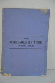
Chicago Danville and Vincennes RR Gold Bond Prospectus Book-1872JM Hobby Supply and Railroad Artifact Auctions4.4(126)See Sold PriceFeb 24, 2024
Crawfordsville and Southwestern RY First Mortgage Bond Prospectus Book-1872JM Hobby Supply and Railroad Artifact Auctions4.4(126)See Sold PriceFeb 24, 2024
Map UNITED COUNTIES LEEDS & GRENVILLE by Walling 1861 Rare Canada Map 5ft x 5ftLuis Porretta Fine Arts4.3(10)See Sold PriceMar 02, 2024
Vintage County Map Of NY State Plate EngravingThe Benefit Shop Foundation Inc.4.3(2.9k)See Sold PriceFeb 28, 2024
1872 Holy BIBLE & Hitchcock Analysis Gruden Concordance Theology MAPS Holy LandSchilb Antiquarian Rare Books4.8(422)See Sold PriceMar 31, 2024
Pair of Catasauqua & Fogelsville Railroad Annual Passes - 1867 and 1872Rail & Road Auctions4.6(165)See Sold PriceMar 08, 2024
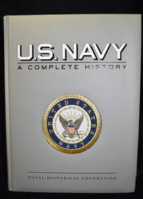
U.S. NAVY - A Complete History by Goodspeed, M. Hill 2003 MintNorth American Artifact Auctions4.6(184)See Sold PriceApr 20, 2024
Strickler, Rare - San Francisco, CaliforniaTrillium Antique Prints & Rare Books4.5(30)See Sold PriceFeb 24, 2024
WEST AFRICA Explorers' routes Senegal Ashanti. Mountains of Kong. SDUK 1857 mapJasper524.5(9.8k)See Sold PriceFeb 28, 2024
Fifteen American Fiddleback Coin Silver Spoons by Various MakersGray's Auctioneers4.5(187)See Sold PriceMar 06, 2024
JOYCE WIELAND: TRUE PATRIOT LOVE. 1971, 1st. ED.Toronto Book Auctions4.3(13)See Sold PriceMar 07, 2024
Carl Axel Magnus Lindman (1856 - 1928) - Set of 10 Botanical Prints - Caraway, Carum carvi -Proverde Auctions4.3(3)See Sold PriceFeb 28, 2024
Carl Axel Magnus Lindman (1856 - 1928) - Set of 10 Botanical Prints - Orchis militaris - TragopogonProverde Auctions4.3(3)See Sold PriceFeb 28, 2024
Carl Axel Magnus Lindman (1856 - 1928) - Set of 10 Botanical Prints - Viburnum opulus - SileneProverde Auctions4.3(3)See Sold PriceFeb 28, 2024
Carl Axel Magnus Lindman (1856 - 1928) - Set of 10 Botanical Prints - Consolida regalis - CampanulaProverde Auctions4.3(3)See Sold PriceFeb 28, 2024


![Hampshire [and] Hampden Counties (1 of 1)](https://p1.liveauctioneers.com/5584/289753/153469559_1_x.jpg?height=282&quality=70&version=1684878062)