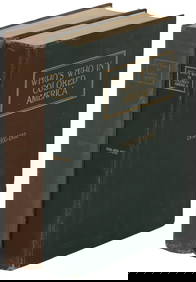
ATLAS of ANTIENT GEOGRAPHY by SAMUEL BUTLER 1843John McInnis Auctioneers,LLC4.5(505)See Sold PriceFeb 24, 2024
18TH C. ANTIQUE MAP: FRENCH & INDIAN WAR, FRAMEDThomaston Place Auction Galleries4.4(393)See Sold PriceFeb 24, 2024
Rand McNally Railroad Map Cabinet w/ 21 Railroad MapsRail & Road Auctions4.6(165)See Sold PriceMar 08, 2024
Keith Haring - Ink on New York Map, Best Buddies, Inscribed, Signed, and DatedSapphire Auction Gallery4.1(67)See Sold PriceMar 02, 2024
LATE 17TH C. FRENCH MAP OF THE NEW WORLD BY ALEXIS-HUBERT JAILLOT (1632-1712)Thomaston Place Auction Galleries4.4(393)See Sold PriceFeb 24, 2024
Central Railroad of New Jersey Map of Sandy Hook Route-ca. 1903JM Hobby Supply and Railroad Artifact Auctions4.4(127)See Sold PriceFeb 24, 2024
Lot of Six Mixed Atlas Box Cars-HO Scale-New in BoxJM Hobby Supply and Railroad Artifact Auctions4.4(127)See Sold PriceFeb 25, 2024
Rand McNally/Santa Fe Railroad Map of Iowa-1912JM Hobby Supply and Railroad Artifact Auctions4.4(127)See Sold PriceFeb 24, 2024
NICOLAES VISSCHER (NETHERLANDS, 1618-1709) MAP OF THE NEW WORLDThomaston Place Auction Galleries4.4(393)See Sold PriceFeb 24, 2024
17TH C. WORLD MAP BY NICOLAES VISSCHER (NETHERLANDS, 1618-1709)Thomaston Place Auction Galleries4.4(393)See Sold PriceFeb 24, 2024
Lot of Six Mixed Atlas Cabooses-HO Scale-New in BoxJM Hobby Supply and Railroad Artifact Auctions4.4(127)See Sold PriceFeb 25, 2024
SoldMitchell: Antique Map of New York State w/ city insetsCounty Map of the State of New York The beautifully detailed and colored county map of New York State from the 1870 edition of Mitchell's popular New General Atlas of the world. Framed by the vine motSee Sold Price
Mitchell: County Map of the State of New YorkDetailed and colored county map of New York State from the 1870 edition of Mitchell's popular New General Atlas of the world. Framed by the vine motif border typical of Mitchell maps of the mid-1860sSee Sold Price
SoldAntique Hand Colored Engraved Map NEW YORK STATE SmithDetails: This nicely hand-colored engraved map of New York State was designed by J. Calvin Smith and published by J. Disturnell circa 1852. Featuring insets of New York City and the St. Lawrence RiveSee Sold Price
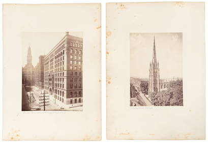
SoldJohnson's New York Maps [New York State, NYC]Two Johnson's New York Maps, one of New York City and Brooklyn, the other of New York State. Alvin Jewett Johnson Cartographer. Published by A. J. Johnson, New York. Stamped 'Entered according to ActSee Sold Price
Gathering BasketTitle: Gathering Basket Dimension: 13” x 13” Provenance:An oak splint flower gathering basket. Featuring a kick up bottom and single wrapped rim. C. 1870. New York State origin. Shipping: DomesticSee Sold Price
SoldAntique Map of New York StateAntique map of New York State backed on linen. [42 1/2" x 49 1/2" W]. In poor condition.See Sold Price
Williams: Antique Pocket Map on New York State, 1828Title: 1828 Williams Pocket Map on New York State -- The Tourist's Map of the State of New York Compiled from the Latest Authorities in the Surveyor General's Office Cartographer: W. Williams Year / PSee Sold Price
Sold497) WALL MAP OF NEW YORK STATE, FRENCH, PEARSALL SMITHThe State of New York from New and Original Surveys Under the direction of J. H. French, Robert Pearsall Smith, Publisher 1861 - Syracuse, NY On linen with losses towards top, 67" x 74"See Sold Price
SoldMassive Map of New York State Dated 1850Item measures approx. 68"h x 70"w. It was printed under the direction of J.E. French C.E. and by Robert Yearsal Smith. Item shows significant wear consistent with age.See Sold Price
SoldWilliams: Antique Pocket Map on New York State, 1828Map: 1828 Williams Pocket Map on New York State -- The Tourist's Map of the State of New York Compiled from the Latest Authorities in the Surveyor General's Office Cartographer: W. Williams Year / PlaSee Sold Price
SoldD. H. BURR HAND COLORED MAP OF NEW YORK STATE C1838D. H. BURR, HAND COLORED MAP OF NEW YORK STATE, C1838, H 12", W 15":D. H. Burr hand colored folding pocket map of New York State. Map folds into a leaf that is attached at the side of the map. InscripSee Sold Price
SoldHoratio Gates Spafford, I (1778-1832) Hand Drawn Map ofHoratio Gates Spafford, I (1778-1832) Hand Drawn Map of New York State & Letter Map dated 1821. Map: 11 1/2 x 14 in. The estate of Dr. Seymour Ira Schwartz, Rochester, New York.See Sold Price
SoldThree Hand Colored Pocket MapsComprising Pennsylvania and New Jersey by H.S Tanner Philadelphia 1827, Tourist Map of New York State by William Williams 1828 and Township Map of the State of New York published by JH Colton New YorkSee Sold Price
SoldPOWDER HORNPowder horn with scrimshaw etching,POWDER HORNPowder horn with scrimshaw etching, masterfully executed, depicting a Revolutionary War era map of New York State, with minor wear, 12" l.See Sold Price
H. Tanner: New York, 1847Map: New York Cartographer: Henry Tanner Publishing: Philadelphia, 1847 Size: 21 x 25 folded out inches A lovely pocket map of New York state with colored counties and details on towns, villages and cSee Sold Price
SoldJohnson: New York State Map, 1866Map: 1866 Johnson's New York State Map -- Johnson's New York Cartographer: A Johnson & Co. Year/Place: 1866 New York Dimensions: 17 x 24 in. This is a large double page map of New York state with muchSee Sold Price
SoldThomas, Cowpwerthwait: Antique Map of New York, 1854Title/Content of Map: 1854 Thomas, Cowpwerthwait Map of New York State -- Map of the State of New York Compiled from the Latest Authorities Date Printed: 1854 Philadelphia Cartographer: Thomas, CowperSee Sold Price
Johnson's New York, 1856Map: Johnson's New York Cartographer: A Johnson & Co. Publishing: New York, 1856 Size: 16.8 x 25 inches This is an oversized double page map of New York state with much town and topographic detail. ThSee Sold Price
SoldScott Hanson, mixed mediaScott Hanson, mixed media, Scott Hansen (American, 20th/21st c.), "New York State of Arts", 2003, map of New York State composted out of NY State license plates mounted onto steel plaque, signed, dateSee Sold Price
Sold1846 MAP OF NEW YORK ENGRAVED BY G.W. BOYNTONSHOWING A FRAMED MAP OF NEW YORK STATE ENGRAVED BY G.W. BOYNTON - CORRECTED TO 1846. EXCELLENT AS FOUND ESTATE CONDITION.See Sold Price
Buchon: Map of New York, 1825Map: 1825 Buchon Map of New York -- Carte Geographique, Statistique et Historique Du New-York Maker: J A Buchon Published In: 1825, Paris Size: 16 x 24 in. This quite attractive map of New York stateSee Sold Price
Buchon Map of New York, 1825Map: Buchon Map of New York - Carte Geographique, Statistique et Historique Du New-York Cartographer: J A Buchon Date: 1825 Origin: Paris Size: 16 x 24 inches This quite attractive map of New York staSee Sold Price
SoldSix 19th C. Maps of New YorkLot of six 19th C. maps of New York state, including Niagara Falls, New York City, Long Island, etc. Various dates and publishers.See Sold Price
1892 Adams and Bowles New Road Map of the State of New YorkJM Hobby Supply and Railroad Artifact Auctions4.4(127)See Sold PriceFeb 24, 2024
American Express/New York Central Railroad Map of the United States-1934JM Hobby Supply and Railroad Artifact Auctions4.4(127)See Sold PriceFeb 24, 2024
Crams Railroad Map of New York-1881JM Hobby Supply and Railroad Artifact Auctions4.4(127)See Sold PriceFeb 24, 2024
Crams Township and Railroad Map of New York-1890JM Hobby Supply and Railroad Artifact Auctions4.4(127)See Sold PriceFeb 24, 2024
Vintage County Map Of NY State Plate EngravingThe Benefit Shop Foundation Inc.4.3(2.9k)See Sold PriceFeb 28, 2024
1867 Map of the Railroads of The State of New YorkRail & Road Auctions4.6(165)See Sold PriceMar 08, 2024
M.E. Johns NYS&W Railroad and Chief Justice Charles Evan Hughes Correspondence with SignaturesRail & Road Auctions4.6(165)See Sold PriceMar 08, 2024
1870 East Greenwich RI USA Advertising Cover To Westerly Boston UniversityMynt Auctions4.6(697)See Sold PriceFeb 24, 2024
ANDREW RAYMOND JANSON OIL ON BOARD ADIRONDACKSCharleston Estate Services Ltd.4.5(69)See Sold PriceMar 03, 2024
Famed Black women Lorraine Hansberry and Charlotta BassPBA Galleries4.7(385)See Sold PriceMar 07, 2024


![Johnson's New York Maps [New York State, NYC] (1 of 3)](https://p1.liveauctioneers.com/5755/154409/77936949_1_x.jpg?height=282&quality=70&version=1573094011)