ATLAS of ANTIENT GEOGRAPHY by SAMUEL BUTLER 1843John McInnis Auctioneers,LLC4.6(502)See Sold PriceFeb 24, 2024
18TH C. ANTIQUE MAP: FRENCH & INDIAN WAR, FRAMEDThomaston Place Auction Galleries4.4(386)See Sold PriceFeb 24, 2024
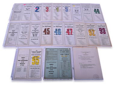
Rand McNally Railroad Map Cabinet w/ 21 Railroad MapsRail & Road Auctions4.6(165)See Sold PriceMar 08, 2024
Keith Haring - Ink on New York Map, Best Buddies, Inscribed, Signed, and DatedSapphire Auction Gallery4(67)See Sold PriceMar 02, 2024
LATE 17TH C. FRENCH MAP OF THE NEW WORLD BY ALEXIS-HUBERT JAILLOT (1632-1712)Thomaston Place Auction Galleries4.4(386)See Sold PriceFeb 24, 2024
Central Railroad of New Jersey Map of Sandy Hook Route-ca. 1903JM Hobby Supply and Railroad Artifact Auctions4.4(126)See Sold PriceFeb 24, 2024
Lot of Six Mixed Atlas Box Cars-HO Scale-New in BoxJM Hobby Supply and Railroad Artifact Auctions4.4(126)See Sold PriceFeb 25, 2024
Rand McNally/Santa Fe Railroad Map of Iowa-1912JM Hobby Supply and Railroad Artifact Auctions4.4(126)See Sold PriceFeb 24, 2024
NICOLAES VISSCHER (NETHERLANDS, 1618-1709) MAP OF THE NEW WORLDThomaston Place Auction Galleries4.4(386)See Sold PriceFeb 24, 2024
17TH C. WORLD MAP BY NICOLAES VISSCHER (NETHERLANDS, 1618-1709)Thomaston Place Auction Galleries4.4(386)See Sold PriceFeb 24, 2024
Lot of Six Mixed Atlas Cabooses-HO Scale-New in BoxJM Hobby Supply and Railroad Artifact Auctions4.4(126)See Sold PriceFeb 25, 2024
1867 Mitchell Map of Louisiana, Arkansas andTitle/Content of Map: 1867 Mitchell Map of Louisiana, Arkansas and Mississippi -- County Map of Louisiana, Mississippi and Arkansas Date: 1867 Philadelphia Cartographer: S Mitchell Size: 21 x 13.6 in.See Sold Price
1867 Mitchell Map of Louisiana, Arkansas andTitle/Content of Map: 1867 Mitchell Map of Louisiana, Arkansas and Mississippi -- County Map of Louisiana, Mississippi and Arkansas Date: 1867 Philadelphia Cartographer: S Mitchell Size: 21 x 13.6 in.See Sold Price
Mitchell: Antique Map of Louisiana Arkansas MississippiTitle/Content of Map: 1867 Mitchell Map of Louisiana, Arkansas and Mississippi -- County Map of Louisiana, Mississippi and Arkansas Date Printed: 1867 Philadelphia Cartographer: S Mitchell Size: 21 xSee Sold Price
Mitchell: Antique Map of Louisiana, Arkansas, 1867Title/Content of Map: 1867 Mitchell Map of Louisiana, Arkansas and Mississippi -- County Map of Louisiana, Mississippi and Arkansas Date Printed: 1867 Philadelphia Cartographer: S Mitchell Size: 21 xSee Sold Price
Mitchell: Map of Louisiana, Arkansas, Mississippi, 1867Map: 1867 Mitchell Map of Louisiana, Arkansas and Mississippi -- County Map of Louisiana, Mississippi and Arkansas Cartographer: S Mitchell Year / Place: 1867 Philadelphia Map Dimensions: 21 x 13.6 inSee Sold Price
Mitchell: Antique Map of Louisiana, Arkansas, 1867Title/Content of Map: 1867 Mitchell Map of Louisiana, Arkansas and Mississippi -- County Map of Louisiana, Mississippi and Arkansas Date Printed: 1867 Philadelphia Cartographer: S Mitchell Size: 21 xSee Sold Price
Samuel Augustus Mitchell (1790-1868), "County Map ofSamuel Augustus Mitchell (1790-1868), "County Map of the States of Arkansas, Mississippi, and Louisiana," 1867, H.- 23 1/2 in., W.- 15 1/2 in.See Sold Price
Samuel Augustus Mitchell (1790-1868), "County Map ofSamuel Augustus Mitchell (1790-1868), "County Map of the States of Arkansas, Mississippi, and Louisiana," 1867, H.- 23 1/2 in., W.- 15 1/4 in.See Sold Price
SoldTwo Hand Colored Maps, consisting of "County Map of theTwo Hand Colored Maps, consisting of "County Map of the States of Arkansas, Mississippi and Louisiana," 1867 by W.H. Gamble, Philadelphia; and "Plan of New Orleans," 1867 by S. Augustus Mitchell, bothSee Sold Price
Sold1880 Mitchell Map of Texas, Louisiana and Arkansas -- Map of Louisiana, Texas, ArkansasTitle: 1880 Mitchell Map of Texas, Louisiana and Arkansas -- Map of Louisiana, Texas, Arkansas Cartographer: S Mitchell Year / Place: 1880, Philadelphia Map Dimension (in.): 8.1 X 10.6 in. This is anSee Sold Price
SoldAugustus Mitchell, "Map of Louisiana, Mississippi, andAugustus Mitchell, "Map of Louisiana, Mississippi, and Arkansas," c. 1860, hand-colored, framed, H.- 13 3/4 in., W.- 11 1/8 in.See Sold Price
1860 Mitchell Map of Mississippi, Louisiana andTitle: 1860 Mitchell Map of Mississippi, Louisiana and Arkansas -- Map of Louisiana, Mississippi, Arkansas Cartographer: S Mitchell Year / Place: 1860, Philadelphia Map Dimension (in.): 13.5 X 10.7 inSee Sold Price
SoldThree Maps by Samuel Augustus Mitchell (1790-1868), "Three Maps by Samuel Augustus Mitchell (1790-1868), " County Maps of Arkansas, Louisiana and Mississippi, Verso with Florida, and a Plan of New Orleans" 1882, hand colored, on two pages, H.-24 in., W.See Sold Price
SoldMitchell: Arkansas, Mississippi, Louisiana County MapMap: County Map of the States of Arkansas, Mississippi, and Louisiana Cartographer: S. A. Mitchell Place/Date: Philadelphia / 1870 Size: 13 5/8" x 21" Condition: full color; overall age toning The beaSee Sold Price
Sold1860 MAP LOUISIANA, MISSISSIPPI, ARKANSASFramed hand colored 1860 map, 'Map of Louisiana, Mississippi and Arkansas" by Augustus Mitchell (American, 1790-1868), sight: 14"h, 11.25"w, overall: 21.5"h, 18.75"w, 4.25lbs Start Price: $100.00See Sold Price
SoldArkansas, Mississippi & Louisiana, 1872A beautiful example of the legendary American map publisher Samuel Augustus Mitchell Jr.'s 1872 map of the states of Louisiana, Mississippi and Arkansas. Covers the states of Mississippi, Louisiana anSee Sold Price
Arkansas, Mississippi & Louisiana, 1872A beautiful example of the legendary American map publisher Samuel Augustus Mitchell Jr.'s 1872 map of the states of Louisiana, Mississippi and Arkansas. Covers the states of Mississippi, Louisiana anSee Sold Price
SoldMitchell: Antique Map of Mississippi Louisiana, 1869Title/Content of Map: Arkansas, Mississippi & Louisiana by Mitchell Date Printed: 1869 Cartographer: Augustus S. Mitchell Material/Medium: Paper Size: 23 1/2" x 15" Hand colored engraved Map. From 'MiSee Sold Price
Sold1860 Map of Louisiana, Mississippi and Arkansas, in1860 Map of Louisiana, Mississippi and Arkansas, in Full Color. Page #32. Published In: Mitchell's New General Atlas, Containing Maps Of The Various Countries Of The World, Plans Of Cities, Etc. EmbraSee Sold Price
SoldTwo Copies of Samuel Augustus Mitchell (1790-1868), "Two Copies of Samuel Augustus Mitchell (1790-1868), " County Map of Arkansas, Mississippi, and Louisiana," 1870, hand colored, H.-15 1/8 in., W.- 23 1/8 in. (2 Pcs.)See Sold Price
SoldTwo Fine Civil War Era MapsTwo Fine Civil War Era Maps by Samuel Augustus Mitchell, Jr., including "Plan of New Orleans" and "County Map of Louisiana, Mississippi and Arkansas", each hand-colored engraving published PhiladelphiSee Sold Price
SoldMAPS, MITCHELL "PLAN OF NEW ORLEANS", ARKANSASUnframed map by Samuel Augustus Mitchell, Jr., copyright 1882, depicting "Plan of New Orleans, "Country Map of Florida" on one side, "County Map of the States of Arkansas, Mississippi and Louisiana" oSee Sold Price
SoldMAPS: MITCHELL NEW ORLEANS, FLORIDA, ARKANSASUnframed map, Samuel Augustus Mitchell, Jr., copyright 1882, depicting "Plan of New Orleans, "Country Map of Florida" on one side, "County Map of the States of Arkansas, Mississippi and Louisiana" onSee Sold Price
SoldMAPS, MITCHELL "PLAN OF NEW ORLEANS", ARKANSASUnframed map by Samuel Augustus Mitchell, Jr., copyright 1882, depicting "Plan of New Orleans, "Country Map of Florida" on one side, "County Map of the States of Arkansas, Mississippi and Louisiana" oSee Sold Price
Union Pacific RR Across The Continent West From Omaha, NE Book-April 2, 1868JM Hobby Supply and Railroad Artifact Auctions4.4(126)See Sold PriceFeb 24, 2024
1849 Mitchell School ATLAS 24 MAPS America Holy Land France Africa Egypt AsiaSchilb Antiquarian Rare Books4.8(421)See Sold PriceMar 31, 2024
Twenty-Three Kansas City Southern Lines Railway Employee Timetables and General Orders - 1960 toRail & Road Auctions4.6(165)See Sold PriceMar 08, 2024
1867 Map of the Railroads of The State of New YorkRail & Road Auctions4.6(165)See Sold PriceMar 08, 2024
Kansas City Southern and Louisiana & Arkansas Railway Ticket Dater Die Shreveport 105CRail & Road Auctions4.6(165)See Sold PriceMar 08, 2024
Kansas City Southern Lines Cram's Universal Terrestrial Globe 10 1/2"Rail & Road Auctions4.6(165)See Sold PriceMar 08, 2024
Arrowsmith & Lewis - Map of PolynesiaTrillium Antique Prints & Rare Books4.5(30)See Sold PriceFeb 24, 2024
Arrowsmith & Lewis - Map of North AmericaTrillium Antique Prints & Rare Books4.5(30)See Sold PriceFeb 24, 2024
Arrowsmith & Lewis - Map of the World on Mercator's ProjectionTrillium Antique Prints & Rare Books4.5(30)See Sold PriceFeb 24, 2024
Arrowsmith & Lewis - Map of LouisianaTrillium Antique Prints & Rare Books4.5(30)See Sold PriceFeb 24, 2024
Arrowsmith & Lewis - Map of the United StatesTrillium Antique Prints & Rare Books4.5(30)See Sold PriceFeb 24, 2024
Mitchell - Map of the City of Washington (Washington, DC)Trillium Antique Prints & Rare Books4.5(30)See Sold PriceFeb 24, 2024
Two Hand-Colored 19th Century Maps of New Orleans and Louisiana, Larger- H.- 12 1/2 in., W.- 15 1/2Crescent City Auction Gallery4.3(229)See Sold PriceMar 08, 2024
Six Views of Louisiana, 19th/20th c., Smallest- H.- 10 1/4 in., W.- 10 3/4 in., Largest- H.- 11 3/4Crescent City Auction Gallery4.3(229)See Sold PriceMar 08, 2024
"Map of the Parishes of Iberville Most of West Baton Rouge and Including Parts of the Parishes ofCrescent City Auction Gallery4.3(229)See Sold PriceMar 09, 2024
Herman Moll A New Map of Ye North Parts of AmericaWillow Auction House4.5(283)See Sold PriceMar 14, 2024
John Senex Map of Louisiana & Mississippi RiverWillow Auction House4.5(283)See Sold PriceMar 14, 2024