ATLAS of ANTIENT GEOGRAPHY by SAMUEL BUTLER 1843John McInnis Auctioneers,LLC4.6(502)See Sold PriceFeb 24, 2024
18TH C. ANTIQUE MAP: FRENCH & INDIAN WAR, FRAMEDThomaston Place Auction Galleries4.4(386)See Sold PriceFeb 24, 2024
Rand McNally Railroad Map Cabinet w/ 21 Railroad MapsRail & Road Auctions4.6(165)See Sold PriceMar 08, 2024
Keith Haring - Ink on New York Map, Best Buddies, Inscribed, Signed, and DatedSapphire Auction Gallery4(67)See Sold PriceMar 02, 2024
LATE 17TH C. FRENCH MAP OF THE NEW WORLD BY ALEXIS-HUBERT JAILLOT (1632-1712)Thomaston Place Auction Galleries4.4(386)See Sold PriceFeb 24, 2024
Central Railroad of New Jersey Map of Sandy Hook Route-ca. 1903JM Hobby Supply and Railroad Artifact Auctions4.4(126)See Sold PriceFeb 24, 2024
Lot of Six Mixed Atlas Box Cars-HO Scale-New in BoxJM Hobby Supply and Railroad Artifact Auctions4.4(126)See Sold PriceFeb 25, 2024
Rand McNally/Santa Fe Railroad Map of Iowa-1912JM Hobby Supply and Railroad Artifact Auctions4.4(126)See Sold PriceFeb 24, 2024
NICOLAES VISSCHER (NETHERLANDS, 1618-1709) MAP OF THE NEW WORLDThomaston Place Auction Galleries4.4(386)See Sold PriceFeb 24, 2024
17TH C. WORLD MAP BY NICOLAES VISSCHER (NETHERLANDS, 1618-1709)Thomaston Place Auction Galleries4.4(386)See Sold PriceFeb 24, 2024
Lot of Six Mixed Atlas Cabooses-HO Scale-New in BoxJM Hobby Supply and Railroad Artifact Auctions4.4(126)See Sold PriceFeb 25, 2024
1865 Johnson's Map of France, Spain, and Portugal, Johnson & Ward NY19th century. A hand-colored United States published map of France, Spain, and Portugal. Published by Johnson and Ward, New York USA. Marked as page 80/81. Overall good condition; some toning throughSee Sold Price
Johnson's France, Spain and Portugal. Corsica Gibraltar Iberia 1865 old mapTITLE/CONTENT OF MAP: 'Johnson's France, Spain, and Portugal // Corsica - Gibraltar Rock' DATE PRINTED: 1865 IMAGE SIZE: Approx 60.0 x 45.5cm, 23.75 x 17.75 inches (Large); Please note that this is aSee Sold Price
SoldJohnson and Ward, New York, Hand-Colored MapsTwo Johnson and Ward, New York, Hand-Colored Engraved Maps, one of France, Spain and Portugal, 1863, the other a Johnson and Ward similarly colored engraved map of England and Wales, also third quarteSee Sold Price
SoldJohnson and Ward, New York, Hand-Colored MapsTwo Johnson and Ward, New York, Hand-Colored Engraved Maps, one of France, Spain and Portugal, 1863, the other a Johnson and Ward similarly colored engraved map of England and Wales, also third quarteSee Sold Price
SoldA.J. Johnson antique maps(lot of 2) Unframed antique maps by A.J. Johnson "England and Wales" (circa 1865) image: approx. 26.75"H x 18"W and "France, Spain & Portugal" (circa 1864), image: approx. 26.75"H x 18"WSee Sold Price
1865 Johnson's Map of Germany, Johnson & Ward NY19th century. A hand-colored United States published map of Germany. Published by Johnson and Ward, New York USA. Marked as page 85. Overall good condition; some toning throughout and dark spot in boSee Sold Price
Johnson's Map of France, Spain & Portugal, 1864Original engraving Map of France, Spain & Portugal from World Atlas by Johnson, New York, 1864. Map includes significant vignettes of Corsica and Gibraltar. Displayed in a wood frame and UV protectantSee Sold Price
ANCIENT ROMAN BALKANS. Illyricum Dacia Moesia Macedonia. ARROWSMITH 1828 mapTITLE/CONTENT OF MAP: 'Johnson's France, Spain, and Portugal // Corsica - Gibraltar Rock' DATE PRINTED: 1865 IMAGE SIZE: Approx 60.0 x 45.5cm, 23.75 x 17.75 inches (Large); Please note that this is aSee Sold Price
Johnson's France Spain and PortugalTitle/Content of Map: Johnson's France Spain and Portugal Date: 1865 Cartographer: JOHNSON, ALVIN JEWETT Size: 23.25x17 Scarce new Johnson regional map showing all of southwestern Europe. WaterstainedSee Sold Price
Johnson's France Spain and PortugalPublication Date: 1865 Title: Johnson's France Spain and Portugal Cartographer: JOHNSON, ALVIN JEWETT Publisher: JOHNSON AND WARD Height: 23.25 Width: 17 Scarce new Johnson regional map showing all ofSee Sold Price
SoldJohnson’s New Illustrated Family Atlas. 1865.[Atlas] Johnson’s New Illustrated (Steel Plate) Family Atlas... NY: Johnson and Ward, 1865. 104 maps/illustrations, with 103-104 being insets on map 101-102. Maps are hand colored, and include stateSee Sold Price
1858 Map of Spain and PortugalTitle: 1858 Map of Spain and Portugal Author: Johnson Medium: Ink on Paper Dimension: Description: Map of Spain and Portugal dated 1858. Engraved by A.J. Johnson. Published by Johnson and Ward in NewSee Sold Price
Spain & PortugalTitle/Content of Map: Spain & Portugal Date: 1863 Cartographer: By Johnson & Ward. From, Johnson’s New Illustrated Family Atlas Size: 18x14” Provenance: New York Additional Info: Hand colored. TexSee Sold Price
SoldFrance, Spain & Portugal. Inserts of Corsica and rockFrance, Spain & Portugal. Inserts of Corsica and rock of Gibraltar 1868 A.J. Johnson 18" x 26 1/3" Hand colored engraved Map. Published in New York in Johnson's New Illustrated Family Atlas of the WorSee Sold Price
SoldJohnson's New Illustrated Family Atlas, 1865.[Atlas]. Johnson's New Illustrated Family Atlas. Geographical Index and chronology of the Civil War by Richard Swainson Fisher. Maps by J. H. Colton and A. J. Johnson. NY: Johnson and Ward, 1865. FoliSee Sold Price
SoldA.J. Johnson Map of France, Spain, and PortugalWith inset map of Gibraltar Rock. 23" X 17" (31.5" X 25")See Sold Price
A.J. Johnson Map of France, Spain, and PortugalWith inset map of Gibraltar Rock. 23" X 17" (31.5" X 25")See Sold Price
Map of France & Spain, 1862Map: France & Spain, 1862 Original engraving by Johnson and Ward. Includes the Balearic Islands of Majorca, Minorca and Ibiza. Lower right hand quadrant contains inset maps of the Island of Corsica anSee Sold Price
SoldMap of Minnesota by Johnson & Ward, 1865Original engraving by Johnson & Ward, 1865. Towns, railroads, topography and more are all clearly presented on this detailed map. Counties shown in contrasting pastel shades. Inset shows Lake SuperiorSee Sold Price
Sold1865 JOHNSON'S AFRICA MAPMap by Johnson and Ward of Africa with much of the interior still unmapped. Sight size 24.5 x 17.5, overall 34.5 x 25.5 inches.See Sold Price
Map of Minnesota by Johnson & Ward, 1865Original engraving by Johnson & Ward, 1865. Towns, railroads, topography and more are all clearly presented on this detailed map. Counties shown in contrasting pastel shades. Inset shows Lake SuperiorSee Sold Price
Map of Empire of France, Spain & Portugal, 1868Original engraving from Johnson's Atlas of the World, 1868. Map includes vignette of Malta and details cities, towns and territories. Dimensions: 18" x 26". No Reserve This item ships from Ocean View,See Sold Price
Map of Empire of France, Spain & Portugal, 1868Original engraving from Johnson's Atlas of the World, 1868. Map includes vignette of Malta and details cities, towns and territories. Dimensions: 18" x 26". This item ships from Ocean View, DE.See Sold Price
The Johnson Johnson Yellowlegs Decoy by J. Taylor Johnson (1853-1929)Copley Fine Art Auctions4.5(40)See Sold PriceFeb 24, 2024
Elfi Schuselka "#50" Mixed Media Wall SculptureAuctions at Showplace4.5(726)See Sold PriceMar 03, 2024
Elfi Schuselka Abstract Mixed Media Wall SculptureAuctions at Showplace4.5(726)See Sold PriceMar 03, 2024
Original Milo Modern Art Bull Bronze Statue Figure Abstract Mid CenturyHouse of Treasure4.4(50)See Sold PriceFeb 29, 2024
Vintage County Map Of NY State Plate EngravingThe Benefit Shop Foundation Inc.4.3(2.9k)See Sold PriceFeb 28, 2024
Salvador Dali Monochromatic Engraving Titled LA DaliHeritage Gallery Auctions4.4(56)See Sold PriceMar 10, 2024
Joan Miro "Unesco - Droits de l'homme" LithographNapoleon's Fine Art4.4(75)See Sold PriceFeb 25, 2024
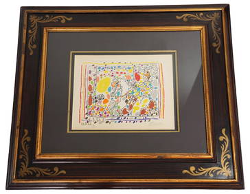
Pablo Picasso "Taureau aile contemple par Quatre Enfants"Napoleon's Fine Art4.4(75)See Sold PriceFeb 25, 2024
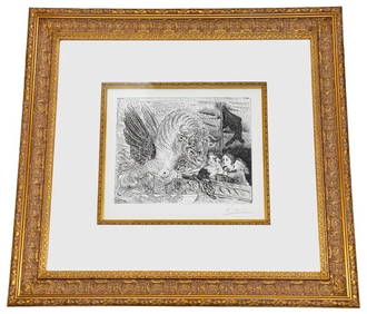
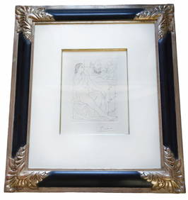
Pablo Picasso "Sculpteur, Model et Buste" EtchingNapoleon's Fine Art4.4(75)See Sold PriceFeb 25, 2024
Salvador Dali "Judgement" Color Etching & AquatintNapoleon's Fine Art4.4(75)See Sold PriceFeb 25, 2024
Salvador Dali "The Age of Anxiety" Color LithographNapoleon's Fine Art4.4(75)See Sold PriceFeb 25, 2024
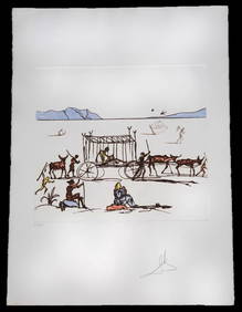
Salvador Dali Arise, Barak and lead Original Lithograph Pencil SignedJasper524.5(9.8k)See Sold PriceFeb 24, 2024
[ADVERTISING]. Red Cross Cotton, From Start to Finish. New Brunswick, NJ: Johnson & Johnson, 1894.Freeman's | Hindman4.4(1.6k)See Sold PriceFeb 27, 2024
R. Crumb (American, b. 1943) Robert Johnson, 1988Freeman's | Hindman4.4(1.6k)See Sold PriceMar 07, 2024
Herman Moll A New Map of Ye North Parts of AmericaWillow Auction House4.5(283)See Sold PriceMar 14, 2024


![[ADVERTISING]. Red Cross Cotton, From Start to Finish. New Brunswick, NJ: Johnson & Johnson, 1894. (1 of 2)](https://p1.liveauctioneers.com/197/319238/171468146_1_x.jpg?height=282&quality=70&version=1707520367)