Sold1855 ENGRAVED PRINT LONG ISLAND SOUND SURVEY MAPA very detailed, large engraved print map of Long Island Sound, published in 1855. The drawing is by Fairfax, Wampler & Gluck. The engraving is by Siebert, Knight, Rolle, & McCoy. Measurements: EngravSee Sold Price
Massive Long Island Sound Coast ChartHassler, Ferdinand R. (1770-1843), & U.S. Coast Survery. Eastern Part of Long Island Sound | Middle Part of Long Island Sound | Western Long Island Sound Three engraved maps. GPO, 1855. 105" wide if aSee Sold Price
SoldMap of Eastern Part of Long Island Sound, 1855,Map of Eastern Part of Long Island Sound, 1855, Second edition of 1880 to 1883,Under the direction of F. H. Hassler and published by the United States Coast and Geodetic Survey.Framed dimensions: H: 2See Sold Price
Long Island Sound (Western Sheet)Title/Content of Map: Long Island Sound (Western Sheet) Cartographer: U.S. COAST SURVEY/F. R. HASSLER Date: 1866 Publisher: GPO Size: 24.5Height - 35Width "Published in 1855" New York and ConnecticutSee Sold Price
Long Island Sound (Western Sheet)Title/Content of Map: Long Island Sound (Western Sheet) Date: 1866 Cartographer: U.S. COAST SURVEY/F. R. HASSLER Publisher: GPO Size: 24.5Height - 35Width Published in 1855 New York and Connecticut coSee Sold Price
Sea Chart Mid-Part Long Island SoundU.S. Coast Survey. 115. Middle Part of Long Island Sound from a Trigonometrical Survey... Lithographed map. U.S. Coast and Geodetic Survey, 1889. 24 ½" x 34 ½" sheet. the Connecticut coast and tSee Sold Price
SoldUSGS Map Connecticut - Long IslandUS Coast & Geodetic Survey map of New York Long Island Sound - Eastern Part, Mercator Projection Scale 1:80,000 at Latitude 41.07, North American 1927 Datum, soundings in feet at Mean Low Water, colorSee Sold Price
3-sheet chart of Lonng Island Sound 1855Heading: Author: U.S. Coast Survey Title: Long Island Sound... From a Trignometrical survey under the direction of F. R. Hassler and A. D. Bache Superintendents of the Survey Of The Coast Of The UnitSee Sold Price
Sold3-sheet chart of Long Island Sound 1855Title: Long Island Sound. Western Sheet [in set with] Middle Part of Long Island Sound [and] Eastern Part of Long Island Sound Author: U.S. Coast Survey Description: Together, 3 sheet forming one largSee Sold Price
Sold3-sheet chart of Lonng Island Sound 1855Heading: Author: United States Coast Survey Title: Long Island Sound... From a Trignometrical survey under the direction of F. R. Hassler and A. D. Bache Superintendents of the Survey Of The Coast OfSee Sold Price
115. Middle Part of Long Island Sound from a Trigonometrical Survey...Publication Date: 1889-10-19 Title: 115. Middle Part of Long Island Sound from a Trigonometrical Survey... Cartographer: U.S. COAST & GEODETIC SURVEY Publisher: U.S.C. & G.S. Height: 24.5 Width: 34.5See Sold Price
115. Middle Part of Long Island Sound from aTitle/Content of Map: 115. Middle Part of Long Island Sound from a Trigonometrical Survey... Cartographer: U.S. COAST & GEODETIC SURVEY Date: 1889-10-19 Publisher: U.S.C. & G.S. Size: 24.5Height - 34.See Sold Price
Sold3 Coast Chart of Long Island SoundLong Island Sound... From a Trignometrical survey under the direction of F. R. Hassler and A. D. Bache Superintendents of the Survey Of The Coast Of The United States. U.S. Coast Survey. Washington, 1See Sold Price
115. Middle Part of Long Island Sound from aTitle/Content of Map: 115. Middle Part of Long Island Sound from a Trigonometrical Survey... Cartographer: U.S. COAST & GEODETIC SURVEY Date: 1889-10-19 Publisher: U.S.C. & G.S. Size: 24.5Height - 34.See Sold Price
1859 SURVEY MAP OF HEMPSTEAD HARBOR, LONG ISLAND, NEWScarce and detailed engraved map of Hempstead Harbor Long Island published in 1859 by the "Survey of the Coast of the United States" 1:20 000 scale. The plate measures approx. 16.25 x 18 in.See Sold Price
1859 SURVEY MAP OF HEMPSTEAD HARBOR, LONG ISLAND, NEWScarce and detailed engraved map of Hempstead Harbor, Long Island, published in 1859 by the 'Survey of the Coast of the United States', 1:20,000 scale. The plate measures approx. 16.25 x 18 in., withSee Sold Price
S.W. Long Island Captain's Sea ChartBache, Alexander D. (1806-1867) & Hassler, Ferdinand R. (1770-1843). Western Part of the Southern Coast of Long Island. Engraved map. U. S. Coast Survey, 1851. 24 ½" x 35" sheet. Rare. Details fromSee Sold Price
Eastern Part of Long Island Sound | Middle Part of LongTitle/Content of Map: Eastern Part of Long Island Sound | Middle Part of Long Island Sound | Long Island Sound (Western Sheet) Cartographer: U.S. COAST SURVEY/F. R. HASSLER Date: 1855 Publisher: GPO SSee Sold Price
Scarce Captain's Chart of W. Long Island & NYCHassler, Ferdinand R. (1770-1843), Blunt, E., Ferguson, J. & Eakin, C. M. et al. Long Island Sound (Western Sheet)/ Continuation to New York. Lithographed map. U.S. Coast and Geodetic Survey, 1889. 24See Sold Price
German Map of Long Island c.1750Title: Untitled map of Long Island, the Sound, New York, etc., with place names in German Author: ** Description: Copper-engraved map. 21x43.5 cm. (8¼x17").Map of Long Island, the sound and the ConneSee Sold Price
SoldConnecticut Map Engraved Powder Horn by Hiel HallConnecticut Map Engraved Powder Horn by Hiel Hall (1736-1807), 2nd Cavalry, Jan. 1803with a detailed map of the Connecticut River Valley from Long Island Sound to the Massachusetts line, including towSee Sold Price
SoldMap of Connecticut & Rhode Island 1776Title: A Map of Connecticut and Rhode Island, with Long Island Sound, &c. Author: Gentleman's Magazine Description: Copper-engraved map. 17x22.5 cm. (6¾x9"). Rhode Island and Connecticut at the beginSee Sold Price
SoldAntique Chart of Long Island SoundChart of Long Island SoundShowing Light Stations from Block Island to New YorkAdapted for use in the New England Almanac from US Coast Survey Charts by L.E. Daboll Undated, but believed to have come fSee Sold Price
Connecticut and Rhode Island, 1776Title: A Map of Connecticut and Rhode Island, with Long Island Sound, &c. Author: Gentleman's Magazine Description: Copper-engraved map. 17x22.5 cm. (6¾x9").Rhode Island and Connecticut at the beginnSee Sold Price
CHART "LONG ISLAND SOUND FROM NEW YORK TO MONTOCK POINT ..." New York, 1830 21" x 77" sight. FramedEldred's4.7(423)See Sold PriceFeb 27, 2024
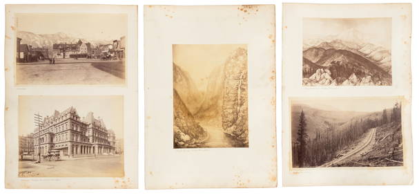
Group of Ten Railroad Photographs, Maps, and Prints - New Jersey, Long Island, and New YorkRail & Road Auctions4.6(165)See Sold PriceMar 07, 2024
Sixteen Framed Railroad Locomotive Photographs and Prints - Nickel Plate Road, Reading, Erie, andRail & Road Auctions4.6(165)See Sold PriceMar 07, 2024
Harry Barton, Mother and daughter with ParasollLotus International Auctions, LLC4.6(153)See Sold PriceMar 03, 2024
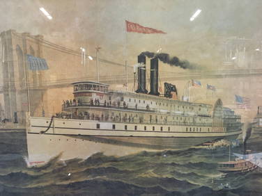
Iron Mountain Of Long Island Sound Litho J GleasonThe Benefit Shop Foundation Inc.4.3(3k)See Sold PriceMar 06, 2024
Oyster Bay Long Island NY Vintage Color Reproduction Map 12 x 18Mynt Auctions4.6(711)See Sold PriceFeb 23, 2024
Wilson - Wood Thrush, Red-breasted Thrush or Robin, & Nuthatches. 2Trillium Antique Prints & Rare Books4.5(33)See Sold PriceFeb 24, 2024
Wilson - Grosbeak, Warbler, Siskin, & Flycatcher. 17Trillium Antique Prints & Rare Books4.5(33)See Sold PriceFeb 24, 2024
Wilson - Woodpeckers - Red-headed, Yellow-bellied, Hairy, & Downy. 9Trillium Antique Prints & Rare Books4.5(33)See Sold PriceFeb 24, 2024
Wilson - Cardinal Grosbeak & Red Tanager. 11Trillium Antique Prints & Rare Books4.5(33)See Sold PriceFeb 24, 2024
Wilson - Mottled Owl, Lark, Creeper, & Warbler. 19Trillium Antique Prints & Rare Books4.5(33)See Sold PriceFeb 24, 2024
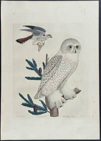
Wilson - Snow Owl (Snowy Owl) & Sparrow Hawk. 32Trillium Antique Prints & Rare Books4.5(33)See Sold PriceFeb 24, 2024
Wilson - Ivory-billed Woodpecker, Red-headed & Pileated Woodpeckers. 29Trillium Antique Prints & Rare Books4.5(33)See Sold PriceFeb 24, 2024
Wilson - Carolina Parrot & Flycatchers. 26Trillium Antique Prints & Rare Books4.5(33)See Sold PriceFeb 24, 2024
Partie Occidentale de l'Ancien Continent… W Africa Macaronesia. BONNE 1780 mapJasper524.5(9.9k)See Sold PriceFeb 28, 2024