ATLAS of ANTIENT GEOGRAPHY by SAMUEL BUTLER 1843John McInnis Auctioneers,LLC4.6(502)See Sold PriceFeb 24, 2024
18TH C. ANTIQUE MAP: FRENCH & INDIAN WAR, FRAMEDThomaston Place Auction Galleries4.4(386)See Sold PriceFeb 24, 2024
Rand McNally Railroad Map Cabinet w/ 21 Railroad MapsRail & Road Auctions4.6(165)See Sold PriceMar 08, 2024
Keith Haring - Ink on New York Map, Best Buddies, Inscribed, Signed, and DatedSapphire Auction Gallery4(67)See Sold PriceMar 02, 2024
LATE 17TH C. FRENCH MAP OF THE NEW WORLD BY ALEXIS-HUBERT JAILLOT (1632-1712)Thomaston Place Auction Galleries4.4(386)See Sold PriceFeb 24, 2024
Central Railroad of New Jersey Map of Sandy Hook Route-ca. 1903JM Hobby Supply and Railroad Artifact Auctions4.4(126)See Sold PriceFeb 24, 2024
Lot of Six Mixed Atlas Box Cars-HO Scale-New in BoxJM Hobby Supply and Railroad Artifact Auctions4.4(126)See Sold PriceFeb 25, 2024
Rand McNally/Santa Fe Railroad Map of Iowa-1912JM Hobby Supply and Railroad Artifact Auctions4.4(126)See Sold PriceFeb 24, 2024
NICOLAES VISSCHER (NETHERLANDS, 1618-1709) MAP OF THE NEW WORLDThomaston Place Auction Galleries4.4(386)See Sold PriceFeb 24, 2024
17TH C. WORLD MAP BY NICOLAES VISSCHER (NETHERLANDS, 1618-1709)Thomaston Place Auction Galleries4.4(386)See Sold PriceFeb 24, 2024
Lot of Six Mixed Atlas Cabooses-HO Scale-New in BoxJM Hobby Supply and Railroad Artifact Auctions4.4(126)See Sold PriceFeb 25, 2024
Sold1838 Carey & Lea Map of Northern Italy -- ItaliaeTitle/Content of Map: 1838 Carey & Lea Map of Northern Italy -- Italiae Antiquae Pars Septemtrionalis. Cartographer: Carey & Lea Year/Place: 1838 c., Philadelphia Size: 6.8 X 9.1 in. Description: ThisSee Sold Price
1838 Carey & Lea Map of Northern Italy -- ItaliaeTitle/Content of Map: 1838 Carey & Lea Map of Northern Italy -- Italiae Antiquae Pars Septemtrionalis. Cartographer: Carey & Lea Year/Place: 1838 c., Philadelphia Size: 6.8 X 9.1 in. This is a very niSee Sold Price
1838 Carey & Lea Map of Northern Italy -- ItaliaeTitle: 1838 Carey & Lea Map of Northern Italy -- Italiae Antiquae Pars Septemtrionalis. Date: 1838 c., Philadelphia Cartographer: Carey & Lea Size: 6.8 X 9.1 in. Additional Information: This is a verySee Sold Price
Sold1838 Carey & Lea Map of Southern Italy -- ItaliaeTitle/Content of Map: 1838 Carey & Lea Map of Southern Italy -- Italiae Antiquae Pars Meriodionalis. Cartographer: Carey & Lea Year/Place: 1838 c., Philadelphia Size: 9.1 X 7.5 in. This is a very niceSee Sold Price
1838 Carey & Lea Map of Southern Italy -- ItaliaeTitle: 1838 Carey & Lea Map of Southern Italy -- Italiae Antiquae Pars Meriodionalis. Date: 1838 c., Philadelphia Cartographer: Carey & Lea Size: 9.1 X 7.5 in. Additional Information: This is a very nSee Sold Price
SoldNorthern Italy by TannerNorthern Italy by Tanner 1843 based on the work of H.C. Tanner 17" x 14" Hand colored engraved Map based on the work of H.C. Tanner from the first edition published by Carey & Hart after acquiring theSee Sold Price
Geograph. Instituts: United Provinces of South AmericaThe United Provinces of South America map from the scarce German edition of the Carey & Lea Geographical, Statistical, and Historical Atlas. The short-lived United Provinces included northern Chili, nSee Sold Price
Sold10 Maps: Italy, Gulf of Venice, Israel.[Italy/Israel] 10 Maps. ++ Tabula Italiae Corsicae, Sardiniae et adjacentium Reigionorum. Shows Italy, Corsica, Sardinia, and northern Sicily. Variously attributed to Mercator, Jansson, and Cluver. [1See Sold Price
SoldCarey & Lea Map of Rhode Island, 1822Cartographer: Carey & Lea Year/Place of Publishing: 1822, Philadelphia 1822 Carey and Lea Map of Rhode Island -- Geographical, Statistical, and Historical Map of Rhode Island. This excellent early mapSee Sold Price
Sold1821 Carey & Lea Map of North and South America1821 Carey & Lea map of North and South America. 1821 Geographical, Historical, and Statistical Map of America. from the third Philadelphia Edition. Printed by T. H. Palmer for M. Carey & Son, from thSee Sold Price
SoldCarey & Lea: Map of Palestina Antiqua, 1832Palestina Antiqua with inset of Jerusalem. Pub. 1832 by Carey & Lea. 7 x 9. Map of ancient Palestine with hand-colored outlines to delineate areas. Extremely light foxing in a few areas. Small repaireSee Sold Price
SoldTallis, John (Pub) 1852 Map. Northern ItalySteel Engraved Map with Original Outline Hand Color Published 1852-56 by John Tallis, London for "The Universal Pronouncing Dictionary" by Thomas Wright. Drawn & Engraved by John Rapkin. Centre fold aSee Sold Price
SoldCarey & Lea: Map of Syria, Mesopotamia, Assyria, 1832Syria, Mesopotamia, Assyria, &c. Pub. 1832 by Carey & Lea. 7 x 9. Antique hand colored map of Syria, Mesopotamia, Assyria, and other surrounding areas in the Ancient Middle East (mainly comprising modSee Sold Price
Carey & Lea: Map of Oriens, 1832Oriens, P. E. Hamm. Pub. 1832 by Carey & Lea 7 x 9.5. Steel engraving by P.E. Hamm. Published by Carey & Lea in Philadelphia, 1832. Please note that this lot has a confidential reserve. When you leaveSee Sold Price
Sold1821 Carey & Lea Map of England1821 Carey & Lea map of England. Full original hand coloring. Geographical and Statistical Map of England (Cartouche: England & Wales divided into Circuits & Counties with the Principal High Roads). FSee Sold Price
SoldMAP, Northern Italy, MercatorNorthern Italy. Mercator/Hondius, Romandiola cum Parmensi Ducatu, 1619 (published). Hand Color. This lovely map of the Emilia-Romagna region exhibits fine topographical detail and scores of place nameSee Sold Price
SoldRARE 1697 MAP NORTHERN ITALY - CLUVERRare engraved antique map of Ancient Northern Italy, with a very decorative cartouch featuring Clio, the muse of history. Map of ancient northern or cisalpine Italy. Locations are given their Roman plSee Sold Price
Carey & Lea Map of British Possessions in North AmericaMap: British Possessions in North America Cartographer: Carey & Lea Place & Date: London / 1823 Size: 9 1/2" x 7 1/2" Condition: outline color; Upper and Lower Canada and the Maritime Provinces in fulSee Sold Price
1821 Carey & Lea Map of France1821 Carey & Lea map of France. Full original hand coloring. Geographical and Historical Map of France (Cartouche: A New Map of France conformable to the Treaty of Paris 1815; with the Netherlands, SwSee Sold Price
MAP, Northern Italy, OrteliusNorthern Italy. Ortelius/Marchetti, Cremae Ager, 1667 (published). Hand Color. Delightful miniature map centered on Crema in the Lombardy province. Italian text on verso. Pietro Maria Marchetti producSee Sold Price
SoldMAP, Northern Italy, MercatorNorthern Italy. Mercator/Hondius, Brescia Episcopatus Mediolanu Ducatus, 1613 (published). Hand Color. This lovely map shows the region between Lake Como and Lake Garda, extending south as far as CremSee Sold Price
MAP, Northern Italy, OrteliusNorthern Italy. Abraham Ortelius, Bresciano Brixiani Agri Typus. Brixia, Cygnea Supposita in Specula, from Theatrum Orbis Terrarum, 1590 (dated). Hand Color. This is the first state of this handsome mSee Sold Price
MAP, Northern Italy, Ortelius/MarchettiNorthern Italy. Ortelius/Marchetti, Cremonensis Ager, from Il Theatro del Mondo, 1667 (published). Hand Color. Charming miniature map of Cremona and its surroundings. Italian text on verso. Pietro MarSee Sold Price
MAP, Northern Italy, LangenesNorthern Italy. Barent Langenes, Veronensis Ager., from Thresor de Chartes, 1600 (published). Hand Color. This handsome miniature map is centered on Verona, with north oriented to the left. The map exSee Sold Price
Remo Ray Gaietto (Italy,MA,20/21C) oil paintingBroward Auction Gallery4.8(277)See Sold PriceMar 10, 2024
Michigan Southern and Northern Indiana RR 14th Annual Report-February 28, 1869JM Hobby Supply and Railroad Artifact Auctions4.4(126)See Sold PriceFeb 24, 2024
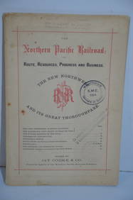
Northern Pacific RR Routes Resources Progress and Business Book-February 1871JM Hobby Supply and Railroad Artifact Auctions4.4(126)See Sold PriceFeb 24, 2024
Northern Pacific RR Washington and Northern Idaho Map Folder-1941JM Hobby Supply and Railroad Artifact Auctions4.4(126)See Sold PriceFeb 24, 2024
EARLY 18TH C. MAP OF ITALY, FRAMEDThomaston Place Auction Galleries4.4(386)See Sold PriceFeb 24, 2024
MAP - PIETER SCHENK / VALK / JANSSEN Hand Colored superb Map Central Italy c1702Luis Porretta Fine Arts4.3(10)See Sold PriceMar 02, 2024
Illustrated Sabbath Cloth - Holy Sites of Eretz IsraelLevy Auction House4.3(11)See Sold PriceFeb 27, 2024
Bassano Italy Mid 20th C. Pottery Soup TureenEpic Auctions and Estate Sales4.6(204)See Sold PriceMar 02, 2024
Putnam - First Map of the State of Ohio by Rufus PutnamTrillium Antique Prints & Rare Books4.5(30)See Sold PriceFeb 24, 2024
Carey, pub. 1796 - A Chart of the West IndiesTrillium Antique Prints & Rare Books4.5(30)See Sold PriceFeb 24, 2024
Carey, pub. 1796 - Map of GeorgiaTrillium Antique Prints & Rare Books4.5(30)See Sold PriceFeb 24, 2024
Carey, pub. 1796 - Map of The State of South CarolinaTrillium Antique Prints & Rare Books4.5(30)See Sold PriceFeb 24, 2024
Carey, pub. 1796 - Map of KentuckyTrillium Antique Prints & Rare Books4.5(30)See Sold PriceFeb 24, 2024
Carey, pub. 1796 - Map of the Tennassee State formerly part of North Carolina (Tennessee)Trillium Antique Prints & Rare Books4.5(30)See Sold PriceFeb 24, 2024
De Jode, Rare, pub. 1593 - Map of Italy (Italiae Totius Orbis olim Domatricis Nova ExactissTrillium Antique Prints & Rare Books4.5(30)See Sold PriceFeb 24, 2024
1822 MAP of LEEWARD ISLANDS GEOGRAPHICAL STATISTICAL HISTORICAL antique 17.5x22"Jasper524.5(9.8k)See Sold PriceFeb 27, 2024
1822 MAP of SOUTH AMERICA GEOGRAPHICAL STATISTICAL HISTORICAL antique 17.5x 22"Jasper524.5(9.8k)See Sold PriceFeb 27, 2024
1816 MAP NORTHERN PART OF RUSSIA or MUSCOVY in EUROPE copper engraving ANTIQUEJasper524.5(9.8k)See Sold PriceFeb 27, 2024
1822 MAP of NORTH & SOUTH AMERICA GEOGRAPHICAL STATISTICAL HISTORICAL antiqueJasper524.5(9.8k)See Sold PriceFeb 27, 2024
1822 MAP of CHILI GEOGRAPHICAL STATISTICAL HISTORICAL antique 17.5x 22" CHILEJasper524.5(9.8k)See Sold PriceFeb 27, 2024