Sold1835 Pocket map and traveller's guide by MitchellHeading: Author: Mitchell, S. Augustus Title: Mitchell's Compendium of the Internal Improvements of the United States Place Published: Philadelphia Publisher:Mitchell & Hinman Date Published: </See Sold Price
Fine pocket map by Mitchell showing the United StatesMitchell's Travellers Guide Through The United States. Samuel Augustus Mitchell (1790-1860) and James H. Young (fl.1817-50). Engraved map with original hand-color in outline. Philadelphia: Mitchell, 1See Sold Price
SoldMitchell, Samuel AugustusMitchell, Samuel Augustus, "Mitchell's Travellers Guide through the United States", Philadelphia, 1832, first edition, hand-colored, tissue backed, originally a pocket map that covered the United StatSee Sold Price
SoldMitchell's Travellers Guide with map 1835Heading: Author: Mitchell, Samuel Augustus Title: Mitchell's Compendium of the Internal Improvements of the United States: Comprising general notices of all the most important Canals and Rail=Roads,See Sold Price
Sold1835 guide and map of U.S.Heading: (United States) Author: Mitchell, S[amuel] Augustus Title: Mitchell's Travellers Guide through the United States. A Map of Roads, Distances, Steam Boat & Canal Routes &c. By J.H. Young PlaceSee Sold Price
SoldMitchell's Travellers' Guide Map The United StatesThis 1835 Mitchell's map measures approx 17 3/4" x 22"In overall nice condition, it has has fold marks and some stains on the lower middle center of border.See Sold Price
SoldBook, "Mitchell's Traveller's GuideThrough the United States." Philadelphia, S. Augustus Mitchell, 1835. Two separate sheets (18" x 22 1/4") tipped in covers. One is a copper-engraved folding map, colored in outline, of the eastern UniSee Sold Price
SoldMexico and Guatimala [sic.],J. H. Young / Samuel Augustus Mitchell, Mexico and Guatimala [sic.], lithograph (hand colored), probably from Travellers Guide through the U.S. (Philadelphia, 1835) , 10 x 8 10 x 8See Sold Price
SoldTwo folding maps of Alaska c.1915Title: Two folding maps of Alaska Author: ** Description: Includes: Anderson Map Co.'s Map of Alaska and Yukon. In paper wrappers titled Kroll's Pocket Map and Traveller's Guide of Alaska and Yukon...See Sold Price
Sold1835 Mitchell Pocket Map of PA, Morocco case.1835 Mitchell Pocket Map of PA, Morocco case.-- Dimensions: ---See Sold Price
SoldRARE PRE-CIVIL WAR "WESTERN" U.S. POCKET MAP - "Ensign,RARE PRE-CIVIL WAR "WESTERN" U.S. POCKET MAP - "Ensign, Bridgman & Fanning's Traveller's Guide Through the Western States", published 156 William St. at Ann St, New York, 1856. In brown leather with gSee Sold Price
RARE PRE-CIVIL WAR "WESTERN" U.S. POCKET MAP - "Ensign,RARE PRE-CIVIL WAR "WESTERN" U.S. POCKET MAP - "Ensign, Bridgman & Fanning's Traveller's Guide Through the Western States", published 156 William St. at Ann St, New York, 1856. In brown leather with gSee Sold Price
Mitchell's Traveller's Guide Through the United StatesTitle/Content of Map: Mitchell's Traveller's Guide Through the United States a Map of the Roads, Distances, Steamboat & Canal Routes &C Cartographer: YOUNG, J.H. Date: 1836 Publisher: MITCHELL, S.A. SSee Sold Price
Mitchell's Traveller's Guide Through the United StatesTitle/Content of Map: Mitchell's Traveller's Guide Through the United States a Map of the Roads, Distances, Steamboat & Canal Routes &C Date: 1836 Cartographer: YOUNG, J.H. Publisher: MITCHELL, S.A. SSee Sold Price
SoldMAP: MITCHELL'S TRAVEL GUIDE, ENGRAVING, C.1836Title: Map: Mitchell's Travellers Guide Through the United States, Printmaker: J.H. Young and D. Haines, Pub: S. Augustus Mitchell, Date: (1832) 1836, Medium: HC Engraving, Paper size: 18 x 22 1/2, InSee Sold Price
Sold2pc Mitchell's Travellers Guide ANTIQUE HAND-COLOREDDetails: This lot consists of the antique folding maps shown in the corresponding image(s).This lot consists of two copies of a hand-colored engraved map entitled "Mitchell's Travellers Guide ThroughSee Sold Price
Mitchell's New Traveller's Guide Through the UnitedTitle/Content of Map: Mitchell's New Traveller's Guide Through the United States, Cartographer: MITCHELL, SAMUEL AUGUSTUS | IRA S. DRAKE Date: 1855 Publisher: CHARLES DESILVER Size: 21.3Height - 28WidSee Sold Price
Mitchell's New Traveller's Guide Through the UnitedTitle/Content of Map: Mitchell's New Traveller's Guide Through the United States, Cartographer: MITCHELL, SAMUEL AUGUSTUS | IRA S. DRAKE Date: 1855 Publisher: CHARLES DESILVER Size: 21.3Height - 28WidSee Sold Price
SoldRARE PRE-CIVIL WAR "WESTERN" U.S. POCKET MAP"Ensign, Bridgman & Fanning's Traveller's Guide Through the Western States", published 156 William St. at Ann St, New York, 1856. In brown leather with gilt blindstamped title and decoration, having aSee Sold Price
Sold1857 Phelps pocket map of United StatesPhelps National Map of the United States, A Travellers Guide, Embracing the Principal Railroads, Canals, Steamboat & Stage Routes Throughout the Union, published by Ensign, Bridgman, Fanning, 1857. FoSee Sold Price
Sold2 Travel Maps of US: Atwood Pocket Map 1851 & Williams Framed, 18541st item: PHELPS'S NATIONAL MAP OF THE UNITED STATES, TRAVELLERS GUIDE. EMBRACING THE PRINCIPAL RAIL ROADS, CANALS, STEAM BOAT & STAGE ROUTES THROUGHOUT THE UNION, by J. M. Atwood, published by ThayerSee Sold Price
Pocket Map of Western Rivers-1846Pocket Map of Western Rivers—1846 346. [MAP]. MUNSON, Sam[ue]l B[ishop]. A New Map of the Western Rivers. Or TraveSee Sold Price
Pocket Map of U.S. With Surround of PresidentsAtwood, J. M. (1818-c. 1880). Phelps's National Map of the United States, a Travellers Guide... Engraved map. New York: Phelps, Ensign & Thayer, 1847. 21" x 25 ½" sheet. "...Embracing the principalSee Sold Price
Sold3 pieces. Folding 19th-Century American Maps: Mit3 pieces. Folding 19th-Century American Maps: Mitchell, S. Augustus, pub. Mitchell's Traveller's Guide to the United States." Philadelphia, 1832. Fold. hand-colored map; tears along folds, a few celloSee Sold Price
Crams Colored Railway Map and Shippers Guide of South Dakota 1908-1909JM Hobby Supply and Railroad Artifact Auctions4.4(127)See Sold PriceFeb 24, 2024
Kenyons Pocket Map and Shippers Guide of Wisconsin-1914JM Hobby Supply and Railroad Artifact Auctions4.4(127)See Sold PriceFeb 24, 2024
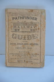
Pathfinder Railway Guide for the New England States-January 1851JM Hobby Supply and Railroad Artifact Auctions4.4(127)See Sold PriceFeb 24, 2024
Archaeological Books - Hilprecht - The Excavations in Assyria and BabyloniaTimeLine Auctions Ltd.4.6(183)See Sold PriceMar 06, 2024
1937 Holland, Michigan, Tulip Time Map Guide, FramedLakeshore Event Center4.6(106)See Sold PriceMar 02, 2024
1849 Mitchell School ATLAS 24 MAPS America Holy Land France Africa Egypt AsiaSchilb Antiquarian Rare Books4.8(428)See Sold PriceMar 31, 2024
Thirty Pieces of Lackawanna Railroad Ephemera - Chief Engineer Timebook, Map, Public Timetables,Rail & Road Auctions4.6(165)See Sold PriceMar 07, 2024
1876 The Centennial Exhibition Pennsylvania Railroad Worlds Fair Guide with Map and Trade CardRail & Road Auctions4.6(165)See Sold PriceMar 07, 2024
Early Pennsylvania Railroad Literature - 1881 New York and Chicago Limited Timetable Brochure andRail & Road Auctions4.6(165)See Sold PriceMar 07, 2024
Group of Ten Railroad Photographs, Maps, and Prints - New Jersey, Long Island, and New YorkRail & Road Auctions4.6(165)See Sold PriceMar 07, 2024
[BUSINESS]. Travel Guide of Negro Hotels and Guest Houses. Published by Afro-American Newspapers ofFreeman's | Hindman4.4(1.6k)See Sold PriceFeb 27, 2024
Group of 75+ Pocket Seed Guides and MoreMatthew Bullock Auctioneers4.7(1.8k)See Sold PriceFeb 24, 2024
VARIOUS ARTISTS [BRITISH TRAVEL GUIDES]. Group of 6 map booklets and flyers. 1930s.Swann Auction Galleries4.4(70)See Sold PriceFeb 29, 2024
Kent & Sussex.- Moss (W.G.) The History and Antiquities of the Town and Port of Hastings, 1824; andForum Auctions4.3(53)See Sold PriceFeb 29, 2024
Hudson River Map & North American Postcards, 45Auctions at Showplace4.6(740)See Sold PriceFeb 13, 2025


![Mexico and Guatimala [sic.], (1 of 1)](https://p1.liveauctioneers.com/457/2714/1174422_1_x.jpg?height=282&quality=70)


![[BUSINESS]. Travel Guide of Negro Hotels and Guest Houses. Published by Afro-American Newspapers of (1 of 4)](https://p1.liveauctioneers.com/197/319238/171467937_1_x.jpg?height=282&quality=70&version=1707520367)


![VARIOUS ARTISTS [BRITISH TRAVEL GUIDES]. Group of 6 map booklets and flyers. 1930s. (1 of 2)](https://p1.liveauctioneers.com/199/319703/171640571_1_x.jpg?height=282&quality=70&version=1707943705)


