SoldTwo folding maps of Alaska c.1915Title: Two folding maps of Alaska Author: ** Description: Includes: Anderson Map Co.'s Map of Alaska and Yukon. In paper wrappers titled Kroll's Pocket Map and Traveller's Guide of Alaska and Yukon...See Sold Price
General Chart of AlaskaU.S. C. & G.S., U.S. COAST AND GEODETIC SURVEY, 1895, Wall – 27.25 H x 50.25 W Inches, Two-sheet folding map at the time of the Gold Rush. Size: Wall – 27.25 H x 50.25 W Inches Please note: Item wSee Sold Price
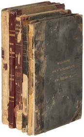
SoldShores and Alps of AlaskaAuthor: Seton-Karr, H. W. Description: xiv, [2], 248 pp. Plates and illustrations from photographs, drawings, etc.; 3 maps, two of them folding. 8¾x5½, gray pictorial cloth, lettering in gilt. FirstSee Sold Price
SoldHarriman Alaska Expedition, Volume I II 1901 1stHarriman Alaska Expedition, Volumes I and II. 1901 First Editions, excellent condition. Includes 45 Edward Curtis photogravure plates, five maps, including four in color and two folding. Provenance: PSee Sold Price
SoldTwo Women in the Klondike - The StoryTwo Women in the Klondike - The Story of a Journey to the Gold Fields of Alaska, Hitchcock, Mary E. 1st; NY, G.P. Putnam, 1899; Hardback; 105 black & white Illustrations. A folding map in pocket at reSee Sold Price
SoldTo Far Western Alaska for Big Game 1929Title: To Far Western Alaska for Big Game: Being an Account of Two Journeys to Alaska in Search of Adventure Author: Hubback, Theodore R. Description: Photograph plates, large color folding map in reaSee Sold Price
Sold1756 Two Folding Maps Naples and SicilyTwo folding maps, one Naples and the other of Sicily, from a German history of Spain. Each approx 15 x 10". The Naples map with some wear to bottom margin, the Sicily map Fine. Reserve: $40.00 ShippinSee Sold Price
1756 Two Folding Maps Naples and SicilyTwo folding maps, one Naples and the other of Sicily, from a German history of Spain. Each approx 15 x 10". The Naples map with some wear to bottom margin, the Sicily map Fine. Reserve: $40.00 ShippinSee Sold Price
1756 Two Folding Maps Naples and SicilyTwo folding maps, one Naples and the other of Sicily, from a German history of Spain. Each approx 15 x 10". The Naples map with some wear to bottom margin, the Sicily map Fine. Reserve: $40.00 ShippinSee Sold Price
SoldTwo folding maps applied on canvas "Mantova e suoiTwo folding maps applied on canvas "Mantova e suoi dintorni colle nuove fortificazioni dal 1859-66" and "Verona e suoi dintorni colle nuove fortificazioni eseguite fino al 1866", published by Borri eSee Sold Price
1756 Two Folding Maps Naples and SicilyTwo folding maps, one Naples and the other of Sicily, from a German history of Spain. Each approx 15 x 10". The Naples map with some wear to bottom margin, the Sicily map Fine. Reserve: $40.00 ShippinSee Sold Price
1756 History of Spain w/ Two Folding MapsAlegmeine Historie von Spanien..., by Johann von Ferreras, printed at Halle by Johann Gebauren, 1756. Contains two folding maps: "Konigsreichs Napoli", and the other of Napoli and Sicily with an insetSee Sold Price
SoldEaton's Life of Andrew Jackson 1817John Henry Eaton. The Life of Andrew Jackson. Phila.: M. Carey, 1817. 8vo. 425 p. Dampstained, browning. Two folding maps, one torn where attached. Full leather, front board loose.See Sold Price
SoldTwo Books: John Henry Eaton. Andrew Jackson.Two Books: John Henry Eaton. The Life of Andrew Jackson. Phila.: M. Carey, 1817. 8vo. 425 p. Full leather. Condition: One Dampstained with browning. Two folding maps, one torn where attached. One withSee Sold Price
SoldGroup of (2) books on IndiaGroup of (2) books on India, to include: ''An Historical Disquistion of India,'' by William Robertson, 1822, London: Printed for J. Richardson & Co, etc, includes two folding maps, (tanning, some foxiSee Sold Price
SoldSmall collection of Conchology prints, etc.Conchology Prints. A collection of prints, some hand-colored; two folding maps and a copy of a photograph. (a lot). (RIJO-A125/LOT)(AL) Property From the Estate of Richard I Johnson (1925-2020), ChestSee Sold Price
Sold1811 Political Essay on Kindom New SpainPolitical Essay on the Kingdom of New Spain…, by Alexander De Humboldt, translated by John Black. Printed for Longman, Hurst, Rees, Orme and Brown, 1811. FOUR volume set. Two folding maps present (MSee Sold Price
SoldCarver, Jonathan (1732-1780), Travels through theCarver, Jonathan (1732-1780), Travels through the Interior Parts of North America..., London, 1779, second edition, with four plates and two folding maps, 8vo, (front cover off, rear cover lacking, owSee Sold Price
SoldHoly Bible, Philadelphia 1813"The Holy Bible: Containing the Old and New Testaments: Together with the Apocrypha" (Philadelphia, M. Carey 1813); contemporary calf; With two folding maps, an early Bible imprint to contain the ApocSee Sold Price
Sold[Louisiana History Book][Louisiana History Book], Antoine Le Page du Pratz, Histoire de la Louisiane..., 1758, Chez de Bure, Paris, 3 vols., 16mo (6 1/2 in. x 3 3/4 in.), full calf, with 40 plates including two folding mapsSee Sold Price
SoldMitchell's National Map of the American Republic, 1843MITCHELL, Samuel Augustus (1792-1868). Mitchell's National Map of the American Republic. Philadelphia, 1843. Two folding maps, each 25 x 35 in. in dark green embossed folder, 4.75 x 5.5 in., gilt titlSee Sold Price
Sold'The History of Polybius,'' trans. by Sir H.S., 1698,''The History of Polybius,'' trans. by Sir H.S., 1698, London: Printed for Sam Briscoe, Volume I-III bound in two books (complete), contains two folding maps, each front end board stamped ''Geo. R. BrSee Sold Price
SoldThe Ornithology of the Straits of Gibraltar.[Birds] Irby, Howard L. The Ornithology of the Straits of Gibraltar. London, 1875. First edition. Publisher's gilt-lettered cloth stamped in black, re-backed with new endpapers. Two folding maps. 8vo.See Sold Price
Sold19th C English Hunting MapsTWO folding maps from the early 19th century showing the places of meeting for two hunts. On conducted by Lord Gifford and the other by the Marquis of Hasting. Fine, each 8 x 11". Please note that thiSee Sold Price
General Books - Boyle - London: A Cartographic History 1746-1950, 200 Years of Folding MapsTimeLine Auctions Ltd.4.6(183)See Sold PriceMar 08, 2024
Jerusalem Map for British Soldiers in Palestine - WW2Levy Auction House4.3(11)See Sold PriceFeb 27, 2024
1704 DESCRIPTION OF ALL THE SEATS OF THE PRESENT WARS OF EUROPE antique w/ MAPSJasper524.5(9.9k)See Sold PriceFeb 27, 2024
Bible, English.- Bible (The): that is, the Holy Scriptures contained in the Olde and Newe Testament,Forum Auctions4.3(53)See Sold PriceFeb 29, 2024
NORTH AFRICA. Morocco Algeria Tunis Tunisia Egypt. Cairo. BARTHOLOMEW 1901 mapJasper524.5(9.9k)See Sold PriceFeb 28, 2024
A LOVELY VICTORIAN MAHOGANY APOTHECARY CHEST with two folding doors revealing a fully fitted interioHannam's Auctioneers Ltd4.3(396)See Sold PriceFeb 27, 2024
OLD ILLUSTRATED 1902 CROSS-COVERED LANDS JOURNEY TO CALCUTTA, INDIA, 2 VOLUMESNY Elizabeth 4.2(86)See Sold PriceMar 03, 2024
THE WHOLE CHRONICLE OF POLYBIUS ANCIENT IN ENGLISH, 1756NY Elizabeth 4.2(86)See Sold PriceMar 03, 2024
1675: ANTIQUE ILLUSTRATED JULIUS CAESAR MAPS OF ROMAN HISTORYNY Elizabeth 4.2(86)See Sold PriceMar 03, 2024
[Constructivism]. The general plan of reconstruction of Moscow. - Moscow: Moscow Worker, 1936. -ARTMAXIMUM4.3(4)See Sold PriceMar 14, 2024


![[Louisiana History Book] (1 of 3)](https://p1.liveauctioneers.com/268/47490/21776818_1_x.jpg?height=282&quality=70&version=1383760681)


![[Constructivism]. The general plan of reconstruction of Moscow. - Moscow: Moscow Worker, 1936. - (1 of 6)](https://p1.liveauctioneers.com/6171/320219/172084257_1_x.jpg?height=282&quality=70&version=1708525949)

