ATLAS of ANTIENT GEOGRAPHY by SAMUEL BUTLER 1843John McInnis Auctioneers,LLC4.6(504)See Sold PriceFeb 24, 2024
18TH C. ANTIQUE MAP: FRENCH & INDIAN WAR, FRAMEDThomaston Place Auction Galleries4.4(389)See Sold PriceFeb 24, 2024
Rand McNally Railroad Map Cabinet w/ 21 Railroad MapsRail & Road Auctions4.6(165)See Sold PriceMar 08, 2024
Keith Haring - Ink on New York Map, Best Buddies, Inscribed, Signed, and DatedSapphire Auction Gallery4.1(67)See Sold PriceMar 02, 2024
LATE 17TH C. FRENCH MAP OF THE NEW WORLD BY ALEXIS-HUBERT JAILLOT (1632-1712)Thomaston Place Auction Galleries4.4(389)See Sold PriceFeb 24, 2024
Central Railroad of New Jersey Map of Sandy Hook Route-ca. 1903JM Hobby Supply and Railroad Artifact Auctions4.4(126)See Sold PriceFeb 24, 2024
Lot of Six Mixed Atlas Box Cars-HO Scale-New in BoxJM Hobby Supply and Railroad Artifact Auctions4.4(126)See Sold PriceFeb 25, 2024
Rand McNally/Santa Fe Railroad Map of Iowa-1912JM Hobby Supply and Railroad Artifact Auctions4.4(126)See Sold PriceFeb 24, 2024
NICOLAES VISSCHER (NETHERLANDS, 1618-1709) MAP OF THE NEW WORLDThomaston Place Auction Galleries4.4(389)See Sold PriceFeb 24, 2024
17TH C. WORLD MAP BY NICOLAES VISSCHER (NETHERLANDS, 1618-1709)Thomaston Place Auction Galleries4.4(389)See Sold PriceFeb 24, 2024
Lot of Six Mixed Atlas Cabooses-HO Scale-New in BoxJM Hobby Supply and Railroad Artifact Auctions4.4(126)See Sold PriceFeb 25, 2024
Sold1833 Royal Geo. Society Map of Canadian Explorations --Title/Content of Map: 1833 Royal Geo. Society Map of Canadian Explorations -- Sketch of North America Shewing the Proposed Route of Capt. Back Date: 1833, London Cartographer: Royal Geographical SocieSee Sold Price
SoldThe Royal Geo. Society Silver Map Limited EditionLOW BUYERS PREMIUM (10%) NO RESERVE AUCTION! BIDDING STARTS AT $10! This is a Royal Geographical Society Silver Map. It is a Limited Edition issue by the Franklin Mint copyrighted FM 1976. The frame mSee Sold Price
SoldThe Royal Geo. Society Silver Map Limited EditioLOW BUYERS PREMIUM (10%) NO RESERVE AUCTION! BIDDING STARTS AT $10! This is a gorgeous Royal Geographical Society Silver Map. It is a Limited Edition issue by the Franklin Mint copyrighted FM 1976. ThSee Sold Price
SoldShufeldt (R.) ship-canal between the Atlantic andShufeldt (R.) Reports of Explorations and Surveys...Ship-Canal between the Atlantic and Pacific oceans, tinted views, folding maps, original cloth, the Royal Society of Edinburgh copy with a fSee Sold Price
SoldSolid silver Royal Topographical Society map withSolid silver Royal Topographical Society map with chased decoration, London hallmark, in a velvet lined mahogany frame, 38cm x 56cmSee Sold Price
The Royal Geographical Society Map by John Pinches,The Royal Geographical Society Map by John Pinches, London 1976 of the Atlantic and Indian Ocean, 15" x 22", in a mahogany finished frameSee Sold Price
SoldBORCHGREVINK, C.E. MAGNETIC AND METEOROLOGICAL OBSBORCHGREVINK, C.E. Magnetic and Meteorological Observations made by the ''Southern Cross'' Antarctic Expedition 1898-1900 London: Royal Society, 1902, map as frontispiece and tables,cloth with gilt leSee Sold Price
SoldThe Royal Geographical Society Silver MapThe Royal Geographical Society Silver Map, Franklin Mint, limited edition, 1976, walnut frame, sight 22 1/2" x 15", frame 27 1/2" x 20". CONDITION: No issues identified.See Sold Price
SoldTHE ROYAL GEOGRAPHICAL SOCIETY SILVER MAP, LIMITEThe Royal Geographical Society Silver Map, Limited Edition, By The Franklin Mint, Framed 27-1/2X20 Wood FrameSee Sold Price
SoldRoyal Geographic Society silver mapRoyal Geographic Society silver map by Franklin Mint decorated with 24K gold, a Limited Edition measuring 20.5" x 27.5" overall,See Sold Price
SoldA John Pinches The Royal Geographic Society silver map,A John Pinches The Royal Geographic Society silver map, London 1977, 37 x 56 cm, with documentation (2)See Sold Price
Royal Geographical Society silver map decorated withRoyal Geographical Society silver map decorated with 24ct gold, with certificate, London 1977, framed, overall 70.5cm x 51.5cmSee Sold Price
The Royal Geographical Society Sterling Silver Map 1976Item/Description: Limited edition framed silver map of the world by Franklin Mint, 1976. The Royal Geographical Society Silver Map, a map of the world, etched in sterling silver and decorated with 24-See Sold Price
Sold1976 Silver Map by Franklin Mint1976 The Royal Geographical Society Silver Map of the World. Issued by The Franklin Mint. Framed measures 20" x 27". This piece comes from the Dickenson Estate of Knoxville, Tennessee. See Photos forSee Sold Price
Sold5pc 19th Century British Maps of China5pc 19th Century British Maps of China. Includes F.S. Weller Royal Geographic Society 'Sketch Map of China' 1898 (20x15.75''), Letts & Son 'Popular Atlas China' 1882 (16.5x14'' and laid down to backinSee Sold Price
Franklin Mint - MapFranklin Mint Carte Carte argentée de la Royal Geographical Society Dimension: 14.5" x 22.25" 37 x 57 cm ------------- Franklin Mint Map Royal Geographical Society Silver Map DimensionSee Sold Price
SoldModern silver 'The Royal Geographical Society SilverModern silver 'The Royal Geographical Society Silver Map', by John Pinches Ltd., London, 1978,See Sold Price
Sold(MALAYSIA / SINGAPORE.) Royal Asiatic Society, Straits(MALAYSIA / SINGAPORE.) Royal Asiatic Society, Straits Branch. Map of the Malay Peninsula. Massive chromolithographed case map of the Malay Peninsula with a detailed inset of "Singapore Town". Two secSee Sold Price
Herbert, Map of Sonora, 1884"Contains details not to be found in other maps of this same country" (Royal Geographic Society, 1885) 99. [MAP]. HERBERT, Charles E. 1884 Mapa oficial del estado de Sonora RepúbSee Sold Price
Sold2014 CANADA $15 FINE SILVER COIN EXPLORING CANADA''THE WEST COAST EXPLORATION", ORIGINAL ROYAL CANADIAN MINT PACKAGINGSee Sold Price
Sold2014 CANADA $15 FINE SILVER COIN EXPLORING CANADATHE WEST COAST EXPLORATION, ORIGINAL ROYAL CANADIAN MINT PACKAGINGSee Sold Price
Sold2014 CANADA $15 FINE SILVER COIN EXPLORING CANADATHE WEST COAST EXPLORATION, ORIGINAL ROYAL CANADIAN MINT PACKAGINGSee Sold Price
Sold2014 CANADA $15 FINE SILVER COIN EXPLORING CANADATHE WEST COAST EXPLORATION, ORIGINAL ROYAL CANADIAN MINT PACKAGINGSee Sold Price
Sold2014 CANADA $15 FINE SILVER COIN EXPLORING CANADATHE WEST COAST EXPLORATION, ORIGINAL ROYAL CANADIAN MINT PACKAGINGSee Sold Price
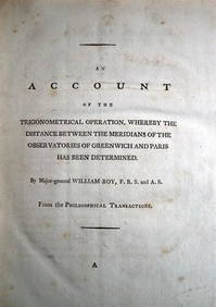
WILLIAM ROY Rare Navigation Book c1797 Trigonometry Between Paris & GreenwichLuis Porretta Fine Arts4.3(10)See Sold PriceMar 02, 2024
Sweet Caporal Cigarettes WWII-Era PosterMiller & Miller Auctions Ltd.4.7(316)See Sold PriceMar 02, 2024
American Goldfinch, Audubon, Royal Octavo hand-colored lithographPBA Galleries4.7(383)See Sold PriceMar 07, 2024
American White Pelican plate from Audubon's Royal OctavoPBA Galleries4.7(383)See Sold PriceMar 07, 2024
Baltimore Oriole, Audubon, Royal Octavo hand-colored lithographPBA Galleries4.7(383)See Sold PriceMar 07, 2024
Blue Heron, Audubon Royal Octavo hand-colored lithographPBA Galleries4.7(383)See Sold PriceMar 07, 2024
Blue Jay, Audubon, Royal Octavo hand-colored lithographPBA Galleries4.7(383)See Sold PriceMar 07, 2024
Great Blue Heron, Audubon Royal Octavo hand-colored lithographPBA Galleries4.7(383)See Sold PriceMar 07, 2024
Great Horned Owl, Audubon, Royal Octavo hand-colored lithographPBA Galleries4.7(383)See Sold PriceMar 07, 2024
Louisiana Heron, Audubon, Royal Octavo hand-colored lithographPBA Galleries4.7(383)See Sold PriceMar 07, 2024
Mallard, Audubon, Royal Octavo hand-colored lithographPBA Galleries4.7(383)See Sold PriceMar 07, 2024
Pileated Woodpecker, Audubon, Royal Octavo hand-colored lithographPBA Galleries4.7(383)See Sold PriceMar 07, 2024
Roseate Spoonbill, Audubon, Royal Octavo hand-colored lithographPBA Galleries4.7(383)See Sold PriceMar 07, 2024
Blue Heron, Audubon Royal Octavo hand-colored lithographPBA Galleries4.7(383)See Sold PriceMar 07, 2024
The Snowy Owl, Audubon, Royal Octavo hand-colored lithographPBA Galleries4.7(383)See Sold PriceMar 07, 2024
Africa inc. discoveries of Livingstone Barth Vogel Chadda Exp. SWANSTON 1860 mapJasper524.5(9.8k)See Sold PriceFeb 28, 2024
Jacques Nicolas Bellin - Antique Map - Vue de la Rade de Tiniam, double antique coast view of theProverde Auctions4.3(3)See Sold PriceFeb 28, 2024
Jacques Nicolas Bellin - View of the entrance to Zihuatanejo Bay - View of the entrance to the portProverde Auctions4.3(3)See Sold PriceFeb 28, 2024
2015 $15 Canada Fifteen Dollars Exploring Canada - Building the Canadian Pacific Railway ElizabethAndrew's Coin & Jewelry4.5(209)See Sold PriceMar 07, 2024
NERVOUS SYSTEM. A group of 19th-century works on the physiology of the nervous system.Bonhams4.1(315)See Sold PriceJun 18, 2024