ATLAS of ANTIENT GEOGRAPHY by SAMUEL BUTLER 1843John McInnis Auctioneers,LLC4.6(502)See Sold PriceFeb 24, 2024
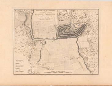
18TH C. ANTIQUE MAP: FRENCH & INDIAN WAR, FRAMEDThomaston Place Auction Galleries4.4(386)See Sold PriceFeb 24, 2024
Rand McNally Railroad Map Cabinet w/ 21 Railroad MapsRail & Road Auctions4.6(165)See Sold PriceMar 08, 2024
Keith Haring - Ink on New York Map, Best Buddies, Inscribed, Signed, and DatedSapphire Auction Gallery4(67)See Sold PriceMar 02, 2024
LATE 17TH C. FRENCH MAP OF THE NEW WORLD BY ALEXIS-HUBERT JAILLOT (1632-1712)Thomaston Place Auction Galleries4.4(386)See Sold PriceFeb 24, 2024
Central Railroad of New Jersey Map of Sandy Hook Route-ca. 1903JM Hobby Supply and Railroad Artifact Auctions4.4(126)See Sold PriceFeb 24, 2024
Lot of Six Mixed Atlas Box Cars-HO Scale-New in BoxJM Hobby Supply and Railroad Artifact Auctions4.4(126)See Sold PriceFeb 25, 2024
Rand McNally/Santa Fe Railroad Map of Iowa-1912JM Hobby Supply and Railroad Artifact Auctions4.4(126)See Sold PriceFeb 24, 2024
NICOLAES VISSCHER (NETHERLANDS, 1618-1709) MAP OF THE NEW WORLDThomaston Place Auction Galleries4.4(386)See Sold PriceFeb 24, 2024
17TH C. WORLD MAP BY NICOLAES VISSCHER (NETHERLANDS, 1618-1709)Thomaston Place Auction Galleries4.4(386)See Sold PriceFeb 24, 2024
Lot of Six Mixed Atlas Cabooses-HO Scale-New in BoxJM Hobby Supply and Railroad Artifact Auctions4.4(126)See Sold PriceFeb 25, 2024
Sold1832 Hinton Map of Maine, NH, & Vermont1832 Hinton bookplate map of Maine, New Hampshire, & Vermont, creased as issued, framed & matted, image size 15" x 10"See Sold Price
SoldEARLY MAP OF MAINE, NEW HAMPSHIRE AND VERMONTEarly monochrome map, 10 1/2' x 16', depicting the states of Maine, New Hampshire and Massachusetts at 1: 2,200,000 scale, engraved by Fenner Sears & Co. and published in 1832 by I.T. Hinton, SimpkinSee Sold Price
Sold4 Maps: Bradford, (1838). Maine, NH, Vermont, RI.[United States/New England] 4 Maps. ++ MAINE. ++ NEW HAMPSHIRE. ++ VERMONT. ++ RHODE ISLAND. ++ Maps 7, 8, 9, and 12 from T. G. Bradford, “An Illustrated Atlas, Geographical, Statistical, And HistorSee Sold Price
SoldGeorge Colton RAILROAD & TOWNSHIP MAP OF MASSACHUSETTSDetails: COLTON, George W. (1827-1901) & Charles B. (1832-1916). Colton's Railroad & Township Map of Massachusetts, Rhode Island, Connecticut with parts of Maine, New Hampshire, Vermont & New York. NSee Sold Price
SoldSDUK New England 1832“North America/ Sheet VI/ New-York, Vermont, Maine, New-Hampshire, Massachusetts, Connecticut, Rhode-Island, and New-Jersey.” London: Society for the Diffusion of Useful Knowledge, 1832. 13 5/8 xSee Sold Price
SDUK Lower Canada 1832“North America/ Sheet II/Lower-Canada and New Brunswick with Part of New-York, Vermont and Maine.” London: Baldwin & Gradock, 1832. 15 1/2 x 12. Engraving by J.&C. Walker. Original outline color.See Sold Price
Sold19th Century Colored Map of Maine, NH & VT19TH CENTURY ATLAS BOOK PLATE OF NH AND VT FRONT MAINE ON REVERSE- GRAYS ATLAS 17 1/4" X 14 1/2"- TONING, SPOTTING, STAIN ON EDGE, AND IMPERFECTIONSSee Sold Price
Gray's Atlas Map of Maine / Vermont New HampshireTitle: Gray's Atlas Map of Maine / Vermont New Hampshire Date: 1873 Cartographer: GRAY, ORMANDO W. Publisher: O.W. GRAY & SON Description: Two maps on either side of the sheet. Margin slightly damped.See Sold Price
Sold8 Railroad Book Lot: Forty Years of the Rail,The8 Railroad Book Lot: Forty Years of the Rail,The Run of the Twentieth Century,RR Laws and Charteirs Maine, NH and VermontSee Sold Price
1852 - No. 8 New England, MitchellNo. 8 Map of the New England or Eastern States engraved to illustrate Mitchell’s School and Family Geography. Two-page map includes Maine, Vermont, New Hampshire, Massachusetts, Connecticut, Rhode ISee Sold Price
1852 - No. 8 New England, MitchellNo. 8 Map of the New England or Eastern States engraved to illustrate Mitchell’s School and Family Geography. Two-page map includes Maine, Vermont, New Hampshire, Massachusetts, Connecticut, Rhode ISee Sold Price
SoldVermont, N.H. & Maine StereoviewsLot of 12, all albumen and all but one are circa 3.75 x 7 inches. Most with inked manuscript titles on rear. Includes 4 with imprint of Frank M. Taft, from his Saxton’s river & Vicinity seriesSee Sold Price
Map of New England States - 1850'sMap Maine, New Hampshire, Vermont, Massachusetts, Rhode Island and Connecticut Cartographer: George Woolworth Colton Dated: C 1850's Type: Engraved Hand ColoredSee Sold Price
SoldSmith: Map of Maine New Hampshire Vermont, 1853Title: Map No. 1 United States- Maine, New Hampshire, Vermont Date: 1853 Size: 9.5 x 11.5 inches From Smith's "Quarto Geography Atlas. Revised Edition, with New Census" Please note that this lot has aSee Sold Price
Antique Map of North America - Maine - Vermont - New Hampshire - J. StuartTitle: Antique Map of North America - Maine - Vermont - New Hampshire - J. Stuart Date/Period: 1871 Dimension: 24 cm x 30 cm Material: Paper Additional Information: Original antique map of Maine, VermSee Sold Price
SoldTravel Map Of Maine New Hampshire Vermont C1833Rare framed traveler's map of Maine, New Hampshire, and Vermont. Frame measures 24.75 inches wide by 20.25 inches high. Published by S. Augustus Mitchell, Philadelphia, 1833See Sold Price
SoldLarge estate collection of ephemera to includemaps of Maine, New Hampshire, Vermont, Michelin manual, "Reddy Fox's Sudden Engagement" by Thornton W. Burgess, Account of furniture and household goods descriptions from Premier Furniture Co of NewbuSee Sold Price
SoldBrown & Parsons MAP OF MAINE NEW HAMPSHIRE AND VERMONTDetails: BROWN & PARSONS. Map of Maine, New Hampshire and Vermont from the most authentic sources. Hartford: 1838. Engraved folding pocket map, full period hand colouring. Inset of the North Part ofSee Sold Price
Map of Maine New Hampshire and Vermont 1853Map of Maine New Hampshire and Vermont Hand colored. Map No 1 United States Cartographer: Jules Sherman Smith Publisher Daniel Burgess Dated: 1853 Type: Hand Colored LiSee Sold Price
SoldMAP, New England - US, FinleyNew England - United States. Anthony Finley, Map of Maine New Hampshire and Vermont, Compiled from the Latest Authorities, 1826 (dated). Hand Color. This folding version of Finley's atlas map delineatSee Sold Price
SoldFour VT MapsLate20th c Stoddard map of Lake Champlain, Map of Grand Isle; Map of Colchester, Map of Maine, New Hampshire and VermontSee Sold Price
Sold1861 Colton's Railroad Map No. 21861 Colton's Railroad Series of Railroad Maps No. 2, Maine, New Hampshire, Vermont, Massachusetts, Rhode Island, Connecticut, Lower Canada, etc. 35 1/2" x 26 1/2"See Sold Price
SoldMITCHELL, SAMUEL AUGUSTUS. Maps of Maine, NewMITCHELL, SAMUEL AUGUSTUS. Maps of Maine, New Hampshire and Vermont, Massachusetts & Rhode Island, Connecticut, New York, and New York City [cover title]. 6 lithographed maps, principally printed in oSee Sold Price
Rare Mitchell atlas of New EnglandTitle: Maps of Maine, New Hampshire and Vermont, Massachusetts & Rhode Island, Connecticut, New York, and New York City (wrapper title) Author:Mitchell, Samuel Augustus Description:6 color lithographeSee Sold Price
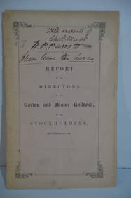
Boston and Maine RR Annual Report-September 12, 1849JM Hobby Supply and Railroad Artifact Auctions4.4(126)See Sold PriceFeb 24, 2024
Troy and Greenfield RR Hoosac Tunnel Cost and Plans Book-1862JM Hobby Supply and Railroad Artifact Auctions4.4(126)See Sold PriceFeb 24, 2024
Eastern RR Summer Book of Tours-1884JM Hobby Supply and Railroad Artifact Auctions4.4(126)See Sold PriceFeb 24, 2024
Grand Trunk Railroad Across the Continent Through Canada Book-1917JM Hobby Supply and Railroad Artifact Auctions4.4(126)See Sold PriceFeb 24, 2024
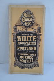
Maine Central RR Through the White Mtns-Portland to the St Lawrence River Book-1901JM Hobby Supply and Railroad Artifact Auctions4.4(126)See Sold PriceFeb 24, 2024
ROBERT BROWNING Rare 1902 LE "Pippa Passes" Calf Binding 1st EdLuis Porretta Fine Arts4.3(10)See Sold PriceMar 02, 2024
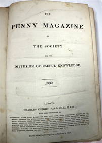
PENNY MAGAZINE 1832 & 1833 Full Bound Volumes Calf Binding THE PENNY MAGAZINELuis Porretta Fine Arts4.3(10)See Sold PriceMar 02, 2024
VENET / DEBUCOURT (1755-1832) Set 3 x Aquatint Engraved Hunting Scenes 23" x 16"Luis Porretta Fine Arts4.3(10)See Sold PriceMar 02, 2024
JOHN BRADLEY HUDSON, JR. (Maine/Massachusetts, 1832-1903), Portrait of the barque Sincerite., Oil onEldred's4.7(409)See Sold PriceFeb 27, 2024
1849 THE NEW-ENGLAND MERCANTILE UNIONNorth American Artifact Auctions4.6(182)See Sold PriceApr 20, 2024
Karl Bodmer - A Young Mandan Indian. 24Trillium Antique Prints & Rare Books4.5(30)See Sold PriceFeb 24, 2024
Karl Bodmer - Assinboin Indians. 32Trillium Antique Prints & Rare Books4.5(30)See Sold PriceFeb 24, 2024
Karl Bodmer - Scalp Dance of the Minatarres. 27Trillium Antique Prints & Rare Books4.5(30)See Sold PriceFeb 24, 2024
Lot of 12 Vintage 1953 & 1954 General Mills Promotional Tin License PlatesBodnar's Auction Sales4.6(609)See Sold PriceMar 28, 2024
Henry Seebohm (1832 - 1895) - Set of 2 British Bird Egg Prints - Pink Footed Goose - Brent Goose -Proverde Auctions4.3(3)See Sold PriceFeb 28, 2024