ATLAS of ANTIENT GEOGRAPHY by SAMUEL BUTLER 1843John McInnis Auctioneers,LLC4.5(505)See Sold PriceFeb 24, 2024
18TH C. ANTIQUE MAP: FRENCH & INDIAN WAR, FRAMEDThomaston Place Auction Galleries4.4(393)See Sold PriceFeb 24, 2024
Rand McNally Railroad Map Cabinet w/ 21 Railroad MapsRail & Road Auctions4.6(165)See Sold PriceMar 08, 2024
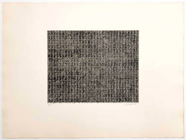
Keith Haring - Ink on New York Map, Best Buddies, Inscribed, Signed, and DatedSapphire Auction Gallery4.1(67)See Sold PriceMar 02, 2024
LATE 17TH C. FRENCH MAP OF THE NEW WORLD BY ALEXIS-HUBERT JAILLOT (1632-1712)Thomaston Place Auction Galleries4.4(393)See Sold PriceFeb 24, 2024
Central Railroad of New Jersey Map of Sandy Hook Route-ca. 1903JM Hobby Supply and Railroad Artifact Auctions4.4(127)See Sold PriceFeb 24, 2024
Lot of Six Mixed Atlas Box Cars-HO Scale-New in BoxJM Hobby Supply and Railroad Artifact Auctions4.4(127)See Sold PriceFeb 25, 2024
Rand McNally/Santa Fe Railroad Map of Iowa-1912JM Hobby Supply and Railroad Artifact Auctions4.4(127)See Sold PriceFeb 24, 2024
NICOLAES VISSCHER (NETHERLANDS, 1618-1709) MAP OF THE NEW WORLDThomaston Place Auction Galleries4.4(393)See Sold PriceFeb 24, 2024
17TH C. WORLD MAP BY NICOLAES VISSCHER (NETHERLANDS, 1618-1709)Thomaston Place Auction Galleries4.4(393)See Sold PriceFeb 24, 2024
Lot of Six Mixed Atlas Cabooses-HO Scale-New in BoxJM Hobby Supply and Railroad Artifact Auctions4.4(127)See Sold PriceFeb 25, 2024
1799 Cary Map of Central and West Germany-- A New Map of the Circles of the Upper and Lower RhineTitle: 1799 Cary Map of Central and West Germany-- A New Map of the Circles of the Upper and Lower Rhine from the Latest Authorities Cartographer: J Cary Year / Place: 1799, London Map Dimension (in.)See Sold Price
1794 Wilkinson Map of Central Germany, Rhine, Moselle and Main River Area s-- A Map of the CirclesTitle: 1794 Wilkinson Map of Central Germany, Rhine, Moselle and Main River Area s-- A Map of the Circles of The Upper Rhine, Lower Rhine & Franconia, Drawn from the Best Authorities Cartographer: R WSee Sold Price
1794 Wilkinson Map of Central Germany, Rhine, MoselleTitle: 1794 Wilkinson Map of Central Germany, Rhine, Moselle and Main River Area s-- A Map of the Circles of The Upper Rhine, Lower Rhine & Franconia, Drawn from the Best Authorities Cartographer: R WSee Sold Price
1794 Wilkinson Map of Central Germany, Rhine, MoselleTitle: 1794 Wilkinson Map of Central Germany, Rhine, Moselle and Main River Area s-- A Map of the Circles of The Upper Rhine, Lower Rhine & Franconia, Drawn from the Best Authorities Cartographer: R WSee Sold Price
Li Circoli dell' Alto, e Basso Reno Western Germany. Rheinland. ZATTA 1783 mapTITLE/CONTENT OF MAP: 'Li Circoli dell' Alto, e Basso Reno di nuova projezione' "The Upper and Lower Rhenish Circles", or Circles of the Upper and Lower Rhine. Western Germany, roughly corresponding tSee Sold Price
Kitchin Map of GermanyKITCHIN, Thomas (1718-1784). The circles of Lower Rhine, Franconia, Swabia, and Bavaria, with the southern parts, of the circles of upper Rhine and Saxony, the western parts of Bohemia and of the circSee Sold Price
SoldJohn Cary: Lower Saxony Germany 1808Map: A New Map of the Circle of Lower Saxony (Germany) Maker: John Cary From Cary's New Universal Atlas Origin: London Date: 1808 (Map dated 1801) Medium: Engraving hand-colored at publication Sheet SSee Sold Price
SoldJohn Cary: Westphalia GermanyMap: A New Map of the Circle of Westphalia (Germany) Maker: John Cary From Cary's New Universal Atlas Origin: London Date: 1808 (Map dated 1799) Medium: Engraving hand-colored at publication Sheet SizSee Sold Price
SoldCanada.- Cary (John) A New Map of Upper & Lower Canada;NO RESERVE Canada.- Cary (John) A New Map of Upper & Lower Canada; A New Map of Nova Scotia, Newfoundland &c., two maps of Canada from Cary's 'New Universal Atlas', engravings with hand-colouring, eacSee Sold Price
SoldCARY, JOHN. A New Map of Upper & Lower Canada.CARY, JOHN. A New Map of Upper & Lower Canada. Double-page engraved map, 470x525 mm, lower margin trimmed to platemark but ample; hand-colored; slightly but evenly toned overall. London, 1807 Shows aSee Sold Price
Sold(CANADA.) Cary, John. A New Map of Upper & Low(CANADA.) Cary, John. A New Map of Upper & Lower Canada. Double-page engraved map, 520x605 mm, wide margins; lakes and topographical elements hand-colored; scattered minor browning. London, 1807 AllSee Sold Price
Sold[GREAT LAKES REGION]. CARY, John (1754–1835). A[GREAT LAKES REGION]. CARY, John (1754–1835). A New Map of Upper & Lower Canada. London: J. Cary, 1807. Hand–colored engraving of this detailed map of Canada, centered on the Great Lakes hSee Sold Price
SoldCary: Antique Map of Upper & Lower Canada, 1807Map: A New Map of Upper & Lower Canada Cartographer: John Cary Place & Date: London / 1807 Size: 20 1/4" x 18" Condition: original color; light overall age toning; a repaired nick in the edge of the uSee Sold Price
SoldNew Map of Upper & Lower Canada, from the LatestTitle: New Map of Upper & Lower Canada, from the Latest Authorities Publication Date: 1807-12-01 Publisher: J. CAREY Size: 18 x 20.3 From Cary's Universal atlas, 1808. Well drawn map with notes such aSee Sold Price
New Map of Upper & Lower Canada, from the LatestReserve Reduced! Title: New Map of Upper & Lower Canada, from the Latest Authorities Publication Date: 1807-12-01 Cartographer: CARY, JOHN Publisher: J. CAREY Size (inches): 18 x 20.3 From Cary's UnivSee Sold Price
Carey Map of CanadaCarey, John (c. 1754 – 1835). New Map of Upper & Lower Canada, from the Latest Authorities. Engraved Map. Carey, 1807. 18" x 20¼" sheet. From Cary's Universal atlas, 1808. Well drawn map witSee Sold Price
Map, The Map of the Circles of the Upper Rhine andBritish School (18th century), "The Map of the Circles of the Upper Rhine and Lower Rhine," copper engraved map with hand coloring, published by R. Wilkinson February 1794, London (possibly later prinSee Sold Price
SoldMap, The Map of the Circles of the Upper Rhine andBritish School (18th century), "The Map of the Circles of the Upper Rhine and Lower Rhine," copper engraved map with hand coloring, published by R. Wilkinson February 1794, London (possibly later prinSee Sold Price
John Cary: A New Map of the Circle of Bavaria, 1799By: John Cary Date: 1799 (Dated) London Dimensions: 18 x 20 inches (45.7 cm x 50.8 cm) Description: This is an authentic hand-colored antique map by the prominent cartographer John Cary, which depictsSee Sold Price
New Map of Scotland from the Latest Authorities, byTitle/Content of Map: New Map of Scotland from the Latest Authorities, by John Cary Date: c1811 Cartographer: CARY, JOHN Publisher: J. CARY Size: 21.3Height - 42Width Upper and lower sheets publishedSee Sold Price
New Map of Scotland from the Latest Authorities, byTitle/Content of Map: New Map of Scotland from the Latest Authorities, by John Cary Cartographer: CARY, JOHN Date: c1811 Publisher: J. CARY Size: 21.3Height - 42Width Upper and lower sheets publishedSee Sold Price
New Map of Scotland from the Latest Authorities, byTitle/Content of Map: New Map of Scotland from the Latest Authorities, by John Cary Date: c1811 Cartographer: CARY, JOHN Publisher: J. CARY Size: 21.3Height - 42Width Upper and lower sheets publishedSee Sold Price
SoldJohn Cary (British, 1754-1835) Framed Map AssortmentJohn Cary (British, 1754-1835) Framed Map Assortment c.1875, (3) maps including a 1799 'New Map of Germany,' 1804 'New Map of Europe' and 1805 'New Map of Africa' Height: 18.50 inches, Width: 21.75 inSee Sold Price
New Map of Scotland from the Latest Authorities, byPublication Date: c1811 Title: New Map of Scotland from the Latest Authorities, by John Cary Cartographer: CARY, JOHN Publisher: J. CARY Height: 21.3 Width: 42 Upper and lower sheets published ten yeaSee Sold Price
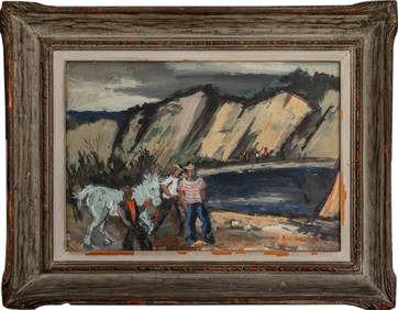
Evelyn Metzger (NY,Brazil,1911-2007) oil paintingBroward Auction Gallery4.7(292)See Sold PriceMar 10, 2024
Central Railroad of New Jersey Map of Sandy Hook Route-ca. 1903JM Hobby Supply and Railroad Artifact Auctions4.4(127)See Sold PriceFeb 24, 2024
Evelyn Metzger (NY,Brazil,1911-2007) oil paintingBroward Auction Gallery4.7(292)See Sold PriceMar 17, 2024
LATE 17TH C. FRENCH MAP OF THE NEW WORLD BY ALEXIS-HUBERT JAILLOT (1632-1712)Thomaston Place Auction Galleries4.4(393)See Sold PriceFeb 24, 2024
Malcolm Hughes "Anne's Hollyhocks" Oil on CanvasAuctions at Showplace4.6(740)See Sold PriceMar 03, 2024
Malcolm Hughes "Bluebonnet Lake" Oil on CanvasAuctions at Showplace4.6(740)See Sold PriceMar 03, 2024
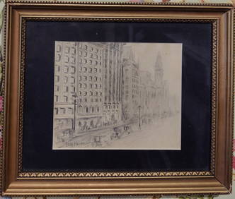
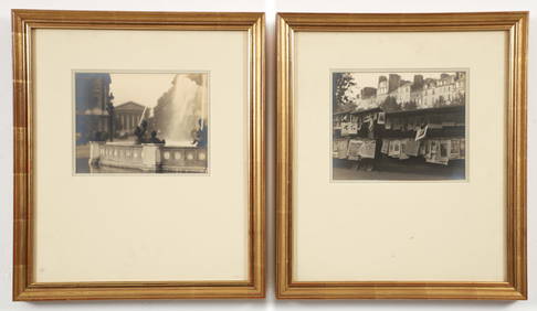
Attributed Childe Hassam Pencil Drawing of New York CityHeritage Gallery Auctions4.4(60)See Sold PriceMar 10, 2024
Keith Haring - Ink on New York Map, Best Buddies, Inscribed, Signed, and DatedSapphire Auction Gallery4.1(67)See Sold PriceMar 02, 2024
18th Century Hess Germany Hand colored Engraved MapGlobal Auctions Company4.3(36)See Sold PriceMar 03, 2024
Willem Blaeu, Etc. 17th C. Antiquarian Maps, 2Auctions at Showplace4.6(740)See Sold PriceMar 17, 2024
1800 MUNGO PARK TRAVELS to AFRICA 2 VOLS w/ MAP antique in ENGLISHJasper524.5(9.9k)See Sold PriceFeb 27, 2024
2 William C. Odiorne Silver Prints Paris Scenes 1920sConcept Art Gallery4.7(510)See Sold PriceMar 06, 2024
Joseph Pennell Watercolor Hudson River Biplane Statue Liberty NYC Airplane Wilbur Wright DiscussionHess Fine Auctions4.5(210)See Sold PriceMar 02, 2024
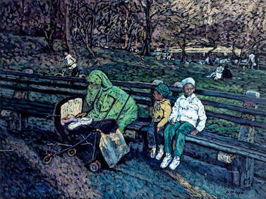
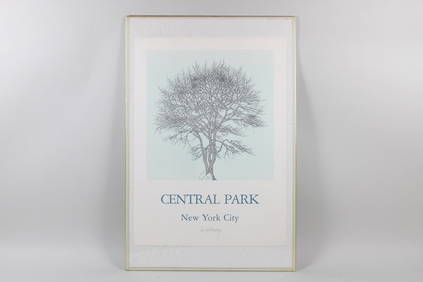
Jacques Hnizdovsky Pencil Signed Poster, Sour Gum Central Park 1982PUBLIC SALE4.7(226)See Sold PriceMar 02, 2024


![[GREAT LAKES REGION]. CARY, John (1754–1835). A (1 of 1)](https://p1.liveauctioneers.com/928/212515/108628835_1_x.jpg?height=282&quality=70&version=1627420959)