ATLAS of ANTIENT GEOGRAPHY by SAMUEL BUTLER 1843John McInnis Auctioneers,LLC4.5(505)See Sold PriceFeb 24, 2024
18TH C. ANTIQUE MAP: FRENCH & INDIAN WAR, FRAMEDThomaston Place Auction Galleries4.4(394)See Sold PriceFeb 24, 2024
Rand McNally Railroad Map Cabinet w/ 21 Railroad MapsRail & Road Auctions4.6(165)See Sold PriceMar 08, 2024
Keith Haring - Ink on New York Map, Best Buddies, Inscribed, Signed, and DatedSapphire Auction Gallery4.1(67)See Sold PriceMar 02, 2024
LATE 17TH C. FRENCH MAP OF THE NEW WORLD BY ALEXIS-HUBERT JAILLOT (1632-1712)Thomaston Place Auction Galleries4.4(394)See Sold PriceFeb 24, 2024
Central Railroad of New Jersey Map of Sandy Hook Route-ca. 1903JM Hobby Supply and Railroad Artifact Auctions4.4(127)See Sold PriceFeb 24, 2024
Lot of Six Mixed Atlas Box Cars-HO Scale-New in BoxJM Hobby Supply and Railroad Artifact Auctions4.4(127)See Sold PriceFeb 25, 2024
Rand McNally/Santa Fe Railroad Map of Iowa-1912JM Hobby Supply and Railroad Artifact Auctions4.4(127)See Sold PriceFeb 24, 2024
NICOLAES VISSCHER (NETHERLANDS, 1618-1709) MAP OF THE NEW WORLDThomaston Place Auction Galleries4.4(394)See Sold PriceFeb 24, 2024
17TH C. WORLD MAP BY NICOLAES VISSCHER (NETHERLANDS, 1618-1709)Thomaston Place Auction Galleries4.4(394)See Sold PriceFeb 24, 2024
Lot of Six Mixed Atlas Cabooses-HO Scale-New in BoxJM Hobby Supply and Railroad Artifact Auctions4.4(127)See Sold PriceFeb 25, 2024
1794 Wilkinson Map of Central Germany, Rhine, Moselle and Main River Area s-- A Map of the CirclesTitle: 1794 Wilkinson Map of Central Germany, Rhine, Moselle and Main River Area s-- A Map of the Circles of The Upper Rhine, Lower Rhine & Franconia, Drawn from the Best Authorities Cartographer: R WSee Sold Price
1794 Wilkinson Map of Central Germany, Rhine, Moselle and Main River Area s-- A Map of the CirclesTitle: 1794 Wilkinson Map of Central Germany, Rhine, Moselle and Main River Area s-- A Map of the Circles of The Upper Rhine, Lower Rhine & Franconia, Drawn from the Best Authorities Cartographer: R WSee Sold Price
1794 Wilkinson Map of Central Germany, Rhine, MoselleTitle: 1794 Wilkinson Map of Central Germany, Rhine, Moselle and Main River Area s-- A Map of the Circles of The Upper Rhine, Lower Rhine & Franconia, Drawn from the Best Authorities Cartographer: R WSee Sold Price
1794 Wilkinson Map of Central Germany, Rhine, MoselleTitle: 1794 Wilkinson Map of Central Germany, Rhine, Moselle and Main River Area s-- A Map of the Circles of The Upper Rhine, Lower Rhine & Franconia, Drawn from the Best Authorities Cartographer: R WSee Sold Price
SoldFramed map of the Rhine river area in Germany.Framed map of the Rhine river area in Germany. 38 1/2" x 15 1/2" .See Sold Price
Ancient map of the Rhineland, Jansson/Mercator 1628Nearly 400-year-old map of the geographical area between the rivers Rhine, Main and Ruhr. Leodiensis Diocesis, Cleve et Muers from an edition of Mercator’s Atlas Minor. Jocodus Hondius created tSee Sold Price
1799 Cary Map of Central and West Germany-- A New Map of the Circles of the Upper and Lower RhineTitle: 1799 Cary Map of Central and West Germany-- A New Map of the Circles of the Upper and Lower Rhine from the Latest Authorities Cartographer: J Cary Year / Place: 1799, London Map Dimension (in.)See Sold Price
Map, The Map of the Circles of the Upper Rhine andBritish School (18th century), "The Map of the Circles of the Upper Rhine and Lower Rhine," copper engraved map with hand coloring, published by R. Wilkinson February 1794, London (possibly later prinSee Sold Price
SoldMap, The Map of the Circles of the Upper Rhine andBritish School (18th century), "The Map of the Circles of the Upper Rhine and Lower Rhine," copper engraved map with hand coloring, published by R. Wilkinson February 1794, London (possibly later prinSee Sold Price
SoldTwo colorful maps of "The Circle of Bavaria" DrawTwo colorful maps of "The Circle of Bavaria" Drawn from the Best Authorities published in London circa Jan 1 1794 R Wilkinson No. 53 Cornhill along with map of City of Saco and Biddeford Circa 1890See Sold Price
Sanson (N) Partie Orientale de TrevesSanson (Nicolas) Partie Orientale du Temporel de l'Archevesché et Eslectorat de Treves; Partie Occidentale... de Treves,central-west Germany, lower Rhine region, junction with the river MosellSee Sold Price
SoldSanson (N) La Basse Partie du Haut RheinSanson (Nicolas) La Basse Partie du Cercle du Haut Rhein,west-central Germany showing the river Rhine from Cologne to Koblenz, large ornamental title cartouche (uncoloured), engraved map on 2See Sold Price
Sanson (N) Cercle du Haut RheinSanson (Nicolas) La Basse Partie du Cercle du Haut Rhein,west-central Germany showing the river Rhine from Cologne to Koblenz, large ornamental title cartouche (uncoloured), engraved map on 2See Sold Price
SoldPropaganda Poster Map Occupation Areas Germany USSR USAOriginal vintage propaganda poster of the Allied occupation areas after World War 2. This colourful and detailed map depicts areas of Germany and central Europe occupied by the Allied nations followinSee Sold Price
SoldHistorical river map, Germany, '''HydrographiaHistorical river map, Germany, '''Hydrographia Germaniae'', copperplate engraving at Homannin Nuremberg, circa 1720, colored according to the catchment areas of the most important streams, with two fiSee Sold Price
Sold1740 Maiestas Austriaca MapUnframed c. 1740 steel engraved & colored 20 1/4" x 24 1/2" double folio map, "Maiestas Austriaca" by Matthias Seutter, Germany, depicting central Europe showing the Archduchy of Austria & areas adjacSee Sold Price
Congo Free State & river valley. Central Africa. HENRYTITLE/CONTENT OF MAP: 'Karta öfver Kongos Flod-Dal och angränsande omraden visande utsträtckningen af Kongo Fristaten af Henry M. Stanley [Map of the Congo river valley and adjacent areas showing tSee Sold Price
Congo Free State & river valley. Central Africa. HENRYTITLE/CONTENT OF MAP: 'Karta öfver Kongos Flod-Dal och angränsande omraden visande utsträtckningen af Kongo Fristaten af Henry M. Stanley [Map of the Congo river valley and adjacent areas showing tSee Sold Price
Congo Free State & river valley. Central Africa. HENRYTITLE/CONTENT OF MAP: 'Karta öfver Kongos Flod-Dal och angränsande omraden visande utsträtckningen af Kongo Fristaten af Henry M. Stanley [Map of the Congo river valley and adjacent areas showing tSee Sold Price
Congo Free State & river valley. Central Africa. HENRYTITLE/CONTENT OF MAP: 'Karta öfver Kongos Flod-Dal och angränsande omraden visande utsträtckningen af Kongo Fristaten af Henry M. Stanley [Map of the Congo river valley and adjacent areas showing tSee Sold Price
Congo Free State & river valley. Central Africa. HENRYTITLE/CONTENT OF MAP: 'Karta öfver Kongos Flod-Dal och angränsande omraden visande utsträtckningen af Kongo Fristaten af Henry M. Stanley [Map of the Congo river valley and adjacent areas showing tSee Sold Price
SoldSOUTHERN STATES TRADE ROUTE MAPLarge Framed Trade Route Map showing waterways and towns from the Mississippi River to Charles Town. Geographic Area Covered: Southern States, South Carolina,Santee River Valley, Savannah River ValleySee Sold Price
Sold1734 ATLAS Vaugondy MAPS Geography Asia Africa Europe1734 ATLAS Vaugondy MAPS Geography Asia Africa Europe USA France Germany Collectors, of both maps and atlases, agree that Vaugondy maps are among the best and most accurate maps! The collection of 18tSee Sold Price
Sold1854 Journey to Central Africa EGYPT Sudan Ethiopia MAP1854 Journey to Central Africa EGYPT Sudan Ethiopia MAP Nile Bayard Taylor Bayard Taylor was a 19th-century travel writer whose abundant notes and reports have been referenced for decades since the miSee Sold Price
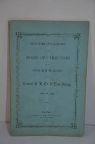
Central Railroad of New Jersey 13th Annual Report-January 1, 1860JM Hobby Supply and Railroad Artifact Auctions4.4(127)See Sold PriceFeb 24, 2024
Central Railroad of New Jersey Map of Sandy Hook Route-ca. 1903JM Hobby Supply and Railroad Artifact Auctions4.4(127)See Sold PriceFeb 24, 2024
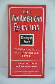
Chicago Burlington and Quincy RR Pan-American Exposition Flyer-1901JM Hobby Supply and Railroad Artifact Auctions4.4(127)See Sold PriceFeb 24, 2024
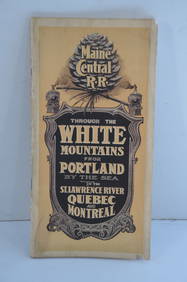
Maine Central RR Through the White Mtns-Portland to the St Lawrence River Book-1901JM Hobby Supply and Railroad Artifact Auctions4.4(127)See Sold PriceFeb 24, 2024
New York Central RR The Adirondacks Brochure 1916-1917JM Hobby Supply and Railroad Artifact Auctions4.4(127)See Sold PriceFeb 24, 2024
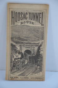
Fitchburg Railroad 1880 Hoosac Tunnel Route Public TimetableJM Hobby Supply and Railroad Artifact Auctions4.4(127)See Sold PriceFeb 24, 2024
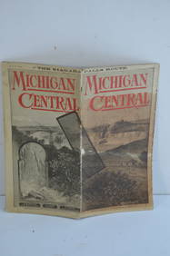
Michigan Central RR May 18, 1884 Public TimetableJM Hobby Supply and Railroad Artifact Auctions4.4(127)See Sold PriceFeb 24, 2024
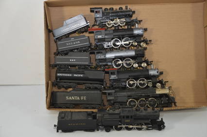
Six Working Varney Steam Locomotives-PRR/NYCHR/BO/SP/ATSF/READ-HO ScaleJM Hobby Supply and Railroad Artifact Auctions4.4(127)See Sold PriceFeb 25, 2024
Anna Fisher Arts and Crafts Movement Still Life Impressionist Oil PaintingHess Fine Auctions4.5(213)See Sold PriceMar 02, 2024
1885 CIVIL WAR 1ed Famous Memoirs US Grant Sheridan Sherman 6v RARE LOT MapsSchilb Antiquarian Rare Books4.8(431)See Sold PriceMar 10, 2024
LATE 17TH C. FRENCH MAP OF THE NEW WORLD BY ALEXIS-HUBERT JAILLOT (1632-1712)Thomaston Place Auction Galleries4.4(394)See Sold PriceFeb 24, 2024
Nova Totius Full Color Geographical World MapThe Benefit Shop Foundation Inc.4.3(3k)See Sold PriceFeb 28, 2024
Large lot of assorted prints. 18th-20th century. To include: North American and other maps, CivilTremont Auctions4.5(298)See Sold PriceFeb 25, 2024
Rand McNally Railroad Map Cabinet w/ 21 Railroad MapsRail & Road Auctions4.6(165)See Sold PriceMar 08, 2024
[BASEBALL]. Group of Four Real Photo Postcards and One Post...Potter & Potter Auctions4.6(550)See Sold PriceMar 07, 2024
19 1/2" Ring Pestle. Ex Dr. Stan Copeland, Dr. Rollin Bunch.Tony Putty Artifacts4.7(407)See Sold PriceMar 09, 2024
SERVANDO CABRERA MORENO (Havana, 1923 – 1981). “Couple of male nudes??, 1974. Pencil on paperSetdart Auction House4(23)See Sold PriceMar 05, 2024


![[BASEBALL]. Group of Four Real Photo Postcards and One Post... (1 of 2)](https://p1.liveauctioneers.com/928/318880/171361343_1_x.jpg?height=282&quality=70&version=1707501302)